Transcription
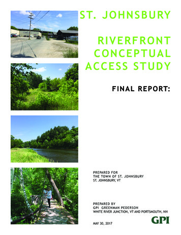
S T. J O H N S B U RYRIVERFRONTCONCEPTUALACCESS STUDYF I N A L R E P O RT:PREPARED FORTHE TOWN OF ST. JOHNSBURYST. JOHNSBURY, VTPREPARED BYGPI GREENMAN PEDERSONWHITE RIVER JUNCTION, VT AND PORTSMOUTH, NHMAY 30, 2017
Designated river corridorarea map:St. Johnsbury, VT
TA B L E O F C O N T E N T S :Chapter: page1. Executive summary: 42. Introduction: 63.Project Goals and Objectives: 84. Property Ownership 105. Public Participation 166 . Coordination with Permitting Agencies 197. Time line of previous work 208. Area Descriptions of the Proposed Improvements:Downtown ConnectionsRiverside Pathway Development and River AccessBay Street Bicycle and Pedestrian Improvementsto the Lamoille Valley Rail TrailDetails for branding, trail design, wayfinding and interpretation.219. Overview of Project Costs 2810. Overview of Project phasing 303
1 . E X E C U T I V E S U M M A RY:A Municipal Planning Grant was awarded to the Townof St. Johnsbury in 2016 by the Vermont Agencyof Commerce and Community Development tocreate a conceptual plan focused on the PassumpsicRiverfront from the Portland Street Bridge south tothe confluence with the Sleepers River. The studyarea is immediately adjacent to the State-designateddowntown. With guidance provided by threeRiverfront Steering Committee meetings, a publicsite walk and local public meeting the plan hasbecome resolved into this conceptual plan report.miles of recreational access and enjoyment.The project’s development is equally oriented tolocal residents as to tourists and visitors. Touriststo support downtown businesses and provide anamenity for St. Johnsbury residents and visitors.This can contribute to improving the physical andeconomic environment of St. Johnsbury’s downtownby linking outdoor water recreation to the downtownexperience. It is expected that this connection willenhance the recreational opportunities availableon the river, will attract visitors who might nototherwise visit the downtown area, and will createa synergy that increases economic activity in thedowntown.Just prior to this report’s completion, the St.Johnsbury selectboard approved a grant applicationthrough the Northern Border Regional Commissionfor as much as 500,000 in funds with local orother grant source matches of 20% for a projectimplementation in excess of 600,000. The optimismof the community for a river path and connectortrail to the highly popular Lamoille Valley Rail Trailand its local manifestation as the Three RiversTransportation Path that has been envisioned by thetown for more than 15 years- is still alive and well.The town has hoped for over a decade that the rivercould also be an impetus for redevelopment forthe former industrial properties along Bay Street,giving those properties value and amenity to allowthe current property owners to either have strongerredevelopoment confidence or to allow them tosell to enthusiastic new development interests andbringing new business and economic opportunity tothe town.This project envisions a river pathway to connect St.Johnsbury’s Designated Downtown to the PassumpsicRiver:Drawing visitors from outside the Town and regionis crucial to the economic health of the downtown.The recent opening of the Lamoille Valley Rail Trailin a single year saw over 12,000 visitors to thearea, bringing in new people in search of excellentrecreation opportunities and looking for goods andservices, of which St. Johnsbury has a lot to offer.New sidewalks, a riverfront path and bicycle routewill allow people to access the river and see it’sbeauty.A trail head facility with parking and renovation ofa derelict Town-owned building into a trail-headcenter with space for boat/bike/fishing gear rentals,and river and trail specific information will welcomepeople and provide economic opportunity in a majormarket sector for VT tourism.Making St. Johnsbury a stronger local downtown isalso a major opportunity, as recent years have seenthe establishment of new and vibrant downtownbusiness with considerable appeal for localresidents and has garnered a devoted following.Connecting to the newly opened and very popularLamoille Valley Rail Trail a river path can connect to4
Residents and many businesses’ have embraced theriver path in part resulting from the experience of asite walk in July 2016, where on a mowed pathwaythe length of the river was created by the fabulousefforts of the public works department. Residentsdescribed the “new” river path as a “game changer”in their perception of downtown and the river as acommunity place and fabulous natural recreationaland economic amenity. This plays well to St.Johnsbury’s desire to have an economically strongerdowntown. If residents and visitors linger on a riverpath - they will soon become hungry and thirsty.Local businesses will have an opportunity to haveadded customers. Visitors may fall in love with thetown and bring other investments.Which makes this study different - to the followingfour major points:1. The path has a stronger and more meaningfulconnection to downtown economic development:A desire to connect the development of community,economic, recreation, natural resource and aestheticrelationship of St. Johnsbury’s downtown to thePassumpsic riverfront is the core proposal, and thevalue of the path is seen as a very clear economicfuture. That may not have been as strong a messagein the past - although that is still anecdotally basedin this study. People really believe in the river now.2. A cooperative spirit with property owners todo realistic improvements for everyones benefit andnot to force unwilling parties to accept a trail ontheir property if they are unready or unwilling. Thethe path route focuses on property with the willinglandowner cooperation of the Green Mountain Powercompany and uses public property and road Rights ofway for the rest.This plan has identified the best location(s) toestablish public access from the downtown businessdistrict to the riverfront. The plan has identifiedcompatible improvements, pedestrian paths,canoe and kayak landing areas, vehicular trail headbike parking and a trail head center,a communitypark, interpretive sites for local heritage andenvironmental stories, supported by a directionaland interpretive signage program.3. A willingness to start small and less expensively- but still achieve meaningful improvements. Thereis a phase of this plan that allows for a smaller scalelocal grass roots effort to define a passable trailroute for the river path.It is important to note that while this topic hasbeen under study in St. Johnsbury in the past - theThree Rivers Bikepath plan suffered from landownerresistance,and planning fatigue. We have usedrelevant background from that past work, but havesimplified the plan as much as possible.4. The plan can grow: Incremental development isas equally viable to get a path up and going at lesscost and with more local “Sweat Equity” of localvolunteers and town staff as opposed to engineeredsolutions that have greater cost and permittingrequirements. The project can be phased.The current grant application represents one way tobuild the path - we have also defined less expensiveand local grass root efforts to get a path in place.Welcome to the St. Johnsbury riverfrontexperiencing as we walk you from the downtown tothe Lamoille Valley Rail trail - and you can join thethousands that have already come to St. Johnsburyto walk, bike and enjoy the community.5
2 . I N T R O D U C T I O N :This project report has the following sections:1. Executive summary:2. Introduction:3.Project Goals and Objectives: to give broaddirection for the project’s priorities.4. An overview of the Property Ownership of thearea and guidance provided by property owners andtheir willingness to be a part of a river path vision.5. Public Participation6. A summary of the local, state, regional andfederal agency permitting and other approvals forthe pathway to be built.7. An Overview and time line of previous work andstudies and project developments for the Bay Streetand riverfront area.8. An Area by Area description of the ProposedImprovements in three general districts:Downtown ConnectionsRiverside Pathway Development and RiverAccessBay Street Bicycle and Pedestrian Improvementsto the Lamoille Valley Rail Trail9.Added Details for trail design, wayfinding andinterpretation.10. Overview of Project Costs11. Overview of and Project phasing coordinatedwith funding Sources and strategies.6
STTH AVY STHLRIVER RDRNAVINMASTEY RSTSTL STD STSTPEARLDRTTE STTH 532½¾FAIRBANKSFIFTH AVFEDERAAVMARIO N AVDEPO T SQCTWESTERN AVLAFAYEDA AVCO STDAY5266ALLEN CTRAILROATH 3½¾T½¾5 36TERSTETASTCARROLL BLVD91SU NESETINPINMAINST¾½ADAMSDRBAYSTTHDRTHS TEOR40AV½¾TH 5EREANC05\24\2017BIRCALEDONI A STDEVERNON STND STIN AVCTTPO RTLANTAPESTCOSt Johnsbury, VTProject Location MapCTMOULSANTR ALE SSAVFOREST AVDAVC ENAROSKEEWST M NDDIF FLYFRCOUNDEOTHURPLAV2WWLLRCHLEWASHING TONRO UTEN¾½OREPWRI GHT AV2WAT E 91INTER STKNTES TEHIG2BFRTERDSIM ONDSUDSELM STORO UTERµWOOSGHI½¾HST½¾AITown Boundary½¾½¾½¾½¾Lamoille Valley Rail TrailThree Rivers Recreation TrailMunicipal Sewer LinesMAIN STMunicipal Water LinesInterstateROU TE5US & State HighwaysPaved Town RoadUnpaved Town RoadTHClass 4 Town Road79Private RoadTEDAHLBERG H RD0.5 MilesRSTETA93NLakes, Ponds,IN& RiversStreamsProject LocationDesignated DowntownProject area Map: St. Johnsbury, VT7
3 . P R O J E C T G O A L S A N D O B J E C T I V E S :The riverfront committee and general public wantedthe plan to include the following:1. Connect to and utilize the Connecticut Scenic BywaysVisitors Center and downtown.2. Improve the safety and comfort of the sidewalksthrough the honking tunnel.3. Develop a new town park on the corner of Baystreet at the Portland Street bridge and connect withsidewalks via Bay Street.4. Instead of demolishing the KT rentals building - nowowned by the town - do selective demolition and cleanup - then allow it to be leased to a trail head businessoperator.5. Develop trail head for parking on Bay Street so thatpeople can follow the river path downstream throughGreen Mountain Power parcels from Bay Street to therail trail.5. Engage the Interesting natural and built featuresalong the riverbanks and woods.6. Interpret the historical and archaeological sites.7. Footpath or bikepath for continuous access.8. Walk - in canoe and kayak access with parking.9. Create park areas for recreation and enjoyment ofriver access and open spaces.10. Integrate river access with river related infrastructureimprovements to the storm-sewer outfalls.8
Designated DowntownMap: St. Johnsbury, VT9
4 . P R O P E RT Y O W N E R S H I P :Parcel NumberCama NumberProperty AddressOwner Name023-008-035002023-008-03500225 DEPOTSQUAREC INNOVATIONSLLC023-008-051000023-008-05100051 DEPOTSQUAREST JOHNSBURYTOWN OF024-003-022000024-003-022000PORTLAND STMAINE CENTRALRAILROAD INC024-003-023000024-003-023000BAY ST024-003-024000024-003-024000119 BAY ST024-003-025000024-003-025000145 BAY STWSI STJOHNSBURYTRANSFERSTATIONWSI STJOHNSBURYTRANSFERSTATIONALLEN LUMBERCOMPANY024-003-026000024-003-026000136 BAY STTREMBLAY WILLIAMJ & ELIZABETH -028000202 BAY STIDE E T & H K258 BAY STALLEN LUMBERCOMPANY024-003-029000024-003-029000256 BAY STALLEN LUMBERCOMPANY024-003-031000024-003-031000249 BAY STALLEN LUMBERCOMPANY024-003-033000024-003-033000195 BAY STST JOHNSBURYTOWN 3-05900042 COSTA AVETOWLE TRACY C257 RIVER RDLEE ANGELA026-002-026000026-002-026000492 BAY STBAY STREETPROPERTY LLC026-002-052000026-002-052000RAILROAD STVERMONT STATEOF026-002-061000026-002-061000MAIN STVERMONT 28-000-034000507 BAY ST507 BAY STREETLLCBROWN C NCOMPANY483 BAY STCo Owner NameMap of property ownership:C/O J TIMOTHYIDEAGENCY OFTRANSPORTATIONAGENCY OFTRANSPORTATION10
11
A grant application was made to the VermontHousing and Conservation Trust in the spring of 2016to acquire this property but was not funded.Coordination with property owners:The following meetings took place either in personor via email or telephone with staff from NVDA, theTown and project team with property owners in theproject area:Allen Lumber property:The project coordinator from NVDA and AssistantTown Manager met with the Allen family in regards2-8 Bay Street – Portland St. Park property:The owners of the WSI parcels have been workingwith the Riverfront Committee, the St. JohnsburyDevelopment Fund and the Vermont RiverConservancy to sell the property for the purpose of apublic path.The property is under some constraint becauseof Brownfield contamination and it is under aBrownfield order. A Stone Environmental BayStreet Area Wide Assessment dated December2011 acknowledges the SMAC for this property, butindicates (page 13) that there are several unassessedRECs on these parcels.A SMAC was issued in June2011, with the caveat that “This SMAC designation isnot an endorsement by the SMS that the standard ofAll Appropriate Inquiry has been met for the entireproperty or for all conceivable future uses of thisproperty.”to their property and other properties around theproject area.12Green Mountain PowerRepresentatives from Green Mountain Powerhave been extremely supportive of the projectand reminded us that they have been alwaysin that position even when the project waspreviously owned by the Central Vermont PublicService. It has always been the intention of GMPto cooperate with an easement agreement for apathway to be developed through the property.GMP representatives clarified that the property isnot under any FERC jurisdiction and so they haveno requirements to provide recreational access tothe public in this place, but they do feel it to bea wonderful community project to which they aresupportive.
Green Mountain Power provided permission foraccess through this area on the site walk and thecompany has been a supportive partner in theproject. It made sense to everyone in discussion tomove an easement proposal forward with GMP as acore parcel and cooperative relationship.copied to the town. However, it was noted thatthe GMP part of the project has always been in aposition to proceed because of their cooperation.The challenging part about project agreement forthe path project funded through VTrans was theinability to agree upon a route through the Ralstonproperty.The Town of St. JohnsburyMeetings with St. Johnsbury Town administrativestaff including the Town Manager, Assistant Townmanager and Public Works director have been heldwith the project team and NVDA staff. There isenthusiasm in Town hall for the project but thereare balancing concerns about cost and phasing bothfor the early phases of design and permitting inengineering as well as carrying it through and thecost of construction.Other considerations of the properties owned by thetown include the following:There is definitely planning fatigue from the VTransThree Rivers Bike Path project that while intenselyactive for well over 15 years, had not gone anywherein terms of VTrans and property owner approvalsand most of the project files had been discontinuedto inactivity. Cad files retrieved from the VTransengaged engineering firm by the project team andThe town has acquireded the KC Rental propertyon the corner of Bay Street. The previous intentionof the town was to remove the building with itsasbestos and lead paint contamination, and itsimpediment to the completion of the Three RiversPath project as a contaminated site. The townreceived an engineer’s opinions of proper probablecost ranging from 106 - 132,000 to remove thestructure and stabilize the site. The town has notauthorized local funds to do this at this time, andgrants were being considered.13The riverfront commitee and NVDA and project teammembers talked about opportunities to approachthat building differently and that the building
partially could be removed at less cost - thenredeveloped to be an economic value for the townas a trail head oriented business. This would not beredundant with the present function of the visitorcenter but could be specifically oriented towards aneconomic activity such as bicycle rental for peoplewanting to bicycle along the river trail and connectto the rail trail and also to reinforce a downtownconnection.Follow up discussions about making the tunnelone - way were discussed with no resolution. It isthe project team’s recommendation that a camerasystem be included in sidewalk plans with signalsoriented in each direction so that cars maybestopped for other traveling vehicles. The details ofthat system are a detailed topic for future study.The town has provided an estimate for whatthey thought locally built sidewalk, curbing andcrosswalk improvements might cost, and they arecommensurate with the project teams estimate.Likewise the town is supportive of a striped bicyclelane along Bay Street to connect over to theLamoille Valley Rail Trail. Traffic volumes and speedson Bay Street are relatively low and a safely definedpainted bike lane seems adequate at this time tomake the connection. Plans in the future could lookat a widened pathway buffered from the road.Everyone in town wants the visitor center to be wellconnected to the River trail, and so a crosswalkacross the parking lot at the base of Eastern Avenuein Depot Square is an important part of the project.The town officials expressed interest to completethe improvements to sidewalks to and through thehonking tunnel as well as some kind of safety systemfor traffic through the tunnel.14
The Ralston propertyThis large property and the immense Ralston Millbuilding have been searching for a redevelopmentfuture for over 20 years. Present uses for offices andstorage occupy the lower floors, but the upper floorsare unused.The owner, Bruce Ralston communicated to theproject team that he really does not want to enterinto any formal agreements for a trail to precedeacross his property. With that in mind, the projectmust basically exit from the Green Mountain Powerproperty out to Bay Street for the completion of thepath connection to the Lamoille Valley Rail Trail.Perhaps in the future, either Mr. Ralston or a futureowner or developer of the property will reconsiderthe combined value of the trail or the economicvalue of the property as a mutually beneficialcombination, but that time is not now.15
5 . P U B L I C PA RT I C I PAT I O N :Public Participation in the planningprocessCommunity River Walk:In July 2016, the project team, the town, and NVDAhosted a community site walk along the River Trailarea, with the consent of the property owners alongthe possible route of a river trail.Several opportunities for the community to inputtheir dreams and aspirations for a Riverside trail andpark for St. Johnsbury have been afforded in thisproject:With the consent of Mr. Ralston and the assistanceof the town public works department, PWD staff ona tractor brush hogged a path through the area fromthe Ralston mill south to the town sewage treatmentplant. The area was previously impenetrable with6 feet grasses and knot weed was opened up in a6 foot swath of accessibility that brought peoplealong the river bank with excellent views up anddownstream.There was an overall introduction and questionsand answers before the walk began, and the groupproceeded in a north - to - south direction from thevisitor center, through the honking tunnel to the parksite near Portland Street and then along the river.16The areas viewed included: The proposed Park site on property on thenortheast corner of Bay Street as it meetsPortland Street. This land is been considered as apotential acquisition for a Riverside Park. Walking along Bay Street, the need for sidewalksfor safety and comfort of pedestrians wasdiscussed and noted. The town owned parcel of the building on thecorner of Bay Street – KC rental was viewed, aswell as the open space adjacent that is ownedby Green Mountain Power Company (GMP) thatprovides access to the riverfront. We walked through the GMP property onrelatively level ground on the terrace above theriver proceeding southbound parallel to the riveralong a town sewer line easement. Side trips were made on fishing paths out to the
waters edge for people to view the river and theriverbank vegetation.What emerged quite quickly was that access tothe river and enjoyment of it as an amenity - wassomething that most people in town had neverexperienced and it was a revelation to many.We proceeded in a southerly direction parallelingthe river below the GMP power substation.For a short section of a few hundred feet,the topography became steeper and morechallenging and we discussed the need to definea trail corridor through there involving regradingthe steep slope. Refuse was also noted with someconcern about contamination. We scrambled upthe hill to the open meadow areas where thepower lines cross the river.An expansive open area of meadows on anelevated terrace with views of the river extendsfor the next several hundred feet south. All thisis on property owned by GMP.Additional side trips were taken to the riversedge through the floodplain forests and to viewcombined storm sewer outfalls along this area.What were noted were the areas where stormsewer pipes came out of the hillside, therewere eroded channels out to the river from 17the storm water erosive impacts. We discussedopportunities that restoration of those areasfor water quality could also be combined withstabilization for recreational boat access also because they created an inlet that could providecanoe landing and informal trail access. Weliked the idea that those improvements could becombined to have multiple functions for a singleinvestment.Proceeding south we arrived at the foundationof the archaeological remains of an old sawmillor factory. This is a dramatic feature in the site,with concrete walls that elevate almost 20 feetabove the topography below. We decided thatit would be a great interpretive and experienceopportunity for people along the River trail,but the safety improvements for a handrail andaccessible path would be necessary parts of theproject if undertaken there.Proceeding from the foundation south wecrossed a broad meadow and then went into thewoods going along the islands that are definedby channels parallel to the river. This area isall a floodplain forest and is highly constrainedin terms of alterations for trail development.State and federal agencies are reluctant to allow
Community Forum:permanent construction in here because it willbe flooded and there could be hazardous resultsor the replacement impact and cost. We meandered through the woods and thenreturned back out to the Meadows lands as weapproached the Ralston properties, which are byfar the largest single ownership in the Area underconsideration for the study.“A unique and special experience”“A game - changer in perception of the river and itsbeauty”That evening after the site walk, a public workshopwas held in the visitor center lobby with about 25people present:These were the major points of this discussion: Access to the river is an experience that is notwidespread to residents of St. Johnsbury and noone coming to visit the area really notices theriver. Making access possible could be a profoundchange of paradigm for the whole downtownarea connected to a beautiful natural amenity. Itcould be new, different, and very good. There were questions about cost and designand maintenance that would be involved onthe town’s part in the event of a trail beingestablished. One thing that was discussed was the challengeof the park property on the north not necessarilybeing in the flow of people movement throughthe honking tunnel out to the river in that itis off to the side - so it would need to be wellconnected Challenges of making the area more pedestriandesirable in the industrial traffic uses of the roadwere considerations of some concern. Some concern about safety with campsites andunwelcoming people. Some concern about it being a natural enclaveand not being overrun with people. The project team agreed to have contact with allthe property owners that might be affected. Receive detailed surveys from the past bike pathproject.Were among comments made. We emerged from the Ralston property to thesewage treatment plant and walked along theaccess road from the sewage treatment plantback to Bay Street. At that point we were outof time, but the extension of Bay Street to theterminus of the Lamoille Valley Rail Trail wasnoted, with the expectation that the trail headparking improvements would be completed in theuse of the rail trail could grow considerably withits completion. A strong desire to have a river trail connect tothe rail trail as a single unified corridor wasexpressed by many.18
6 . C O O R D I N AT I O N W I T H P E R M I T T I N GAGENCIES:Agency River Walk:Agency regulated resources in the project area:The Passumpsic River waterway:In July 2016, the project team, the town, and NVDAhosted a state agency staff site walk along theproject area. Agencies included:ACT 250 District Commission.Vt Agency of Natural ResourcesIn addition to state agency representatives, arepresentative from the Vermont River Conservancyalso attended.Floodway and floodplain areas mapped by FEMA withnatural riverbank areas of the floodplain forests thatare both vulnerable and protective.The project team and NVDA gave an overallintroduction to the project. Many resource agencystaff were familiar with the site from the pastVTrans bike path project in years prior. There wasrecollection of past debates about trail location onvarious private properties along the river.Generally it was thought that if the trail design justkept simple and straightforward and not looking tobuild a paved roadway - that the permitting level ofdetail would be more appropriate to a trail projectassessed at a lower permitting threshold. The sitewalk with agency staff stopped at the NorthernRalston area terminus due to time limitations.Stormwater and sewer outfalls from towninfrastructure:Agency staff from the Vt Division for HistoricPreservation was not included in the site walk butwill be consulted as the project proceeds. Priorbike path locations along the riveres edge hadarcheaological issues but this alignment of the pathis all on disturbed areas.Sites with history and archeology:The entire project area has a legacy of brownfieldissues. A review of the area with NVDA has identifiedareas where brownfields have been re-mediated butthere do not appear at this time to be brownfieldissues that would preclude this vision to proceedwith due diligence.19
7. A TIME LINE OF PREVIOUS WORKEVENTS and DATES - 2001 - PresentSt. Johnsbury Charrette 2001: A Community Planning Town takes title to former “KC Rentals” propertyand Design Workshop (VT Chapter of American Society Oct-12of Landscape Architects, et al)26-Apr-01Phase II Environmental Assessment completed forVT CDBG Awarded to Town of St. Johnsbury forformer “KC Rentals” property29-Aug-13Riverfront/Bay Street Corridor Study7-Apr-03Contract Documents & Specifications prepared forTony Pomerleau Donates Former Railroad Station toDemolition of former KNTT Building (“KC Rentals”)the Town of St. JohnsburySpring 03 July 28 -14Bay Street Redevelopment Project Plan(ORW, et al)St. Johnsbury “Community Visit” facilitated by VCRD.St. Johnsbury Riverfront Committee formed.Apr-15Oct-04Proposal for Renovating the Bay Street Area (St.Johnsbury Academy Student Katherine Tolman)Mt. Vernon Street Bridge Completed, connecting the23-May-05 Three Rivers Bike Path to the Lamoille Valley Rail TrailFall -15VTrans Comments on Bay Street DevelopmentRoute 5/South Main Street Intersection Scoping StudyConceptual Plan 8-Jun-05Completed (Dubois & King)Dec-15Renovation of St. Johnsbury Welcome Center begins1-Jan-06Town of St. Johnsbury is awarded an 8,000 MunicipalPlanning Grant (FY2016) from ACCD to commission aRiverfront Access Concept PlanDec-15Renovated St. Johnsbury Welcome Center Opens11-Aug-08 VHCB Funds Appraisal of two Bay Street Parcels atPortland St. Bridge (owned by ADI) targeted for futureArea Wide Assessment of Bay Street, prepared bywaterfront park Mar-16Stone Environmental for the VT Dept. of EnvironmentalConservation 31-Dec-11 St. Johnsbury Development Fund, with Town of St.Johnsbury support, applies to VHCB for ConservationSt. Johnsbury Three Rivers Bike Path completed, with Grant to acquire ADI parcels for riverfront park (granttrail end on South Main St.15-Aug-12 denied)Apr-16Phase I Environmental Assessment completed for KNTT Riverfront Access Concept Plan Complete (GPI)Investments (“KC Rentals”)19-Oct-12 May-1720
8. AREA DESCRIPTIONS OF THEPROPOSED IMPROVEMENTS:Connection from Downtown to Bay Street:1. An anchor to downtown at Depot Square with thevisitor center serving for public information.2. A crosswalk and sidewalk improvementsimprovement across the base of Eastern Avenueas it meets Depot Square and proceeds throughthe honking tunnel.3. Approximately 550 feet of sidewalk replacingthe existing deteriorated sidewalk would benecessary including granite curbing, concretesidewalk and a repaved road.4. A safety camera controlled traffic light systemfor vehicles approaching from each direction ofthe honking tunnel would make for better trafficmanagement in light of increased pedestrian useof the sidewalk.5. The sidewalk underneath the honking tunnelshould have additional lighting, and the stoneand concrete walls of the tunnel could becleaned to be more attractive.6. Curbing and sidewalk across the intersectionfrom the tunnel to Bay Street southboundthrough Allen
THE TOWN OF ST. JOHNSBURY ST. JOHNSBURY, VT PREPARED BY GPI GREENMAN PEDERSON WHITE RIVER JUNCTION, VT AND PORTSMOUTH, NH MAY 30, 2017 . Designated river corridor area map: St. Johnsbury, VT. 3 Chapter: page 1. Executive summary:4 2. Introduction:6 .