Transcription
National Trails SystemNational Park ServiceU.S. Department of the InteriorNational Historic TrailsAuto Tour Route Interpretive GuideAcross Nevada
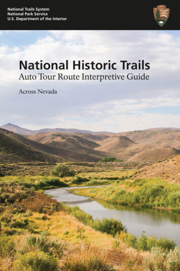
NATIONAL HISTORIC TRAILSAUTO TOUR ROUTEINTERPRETIVE GUIDEAcross Nevada on the Humboldt Route andThe Central Route of the Pony ExpressPrepared byNational Park ServiceNational Trails Intermountain Regionwww.nps.gov/caliwww.nps.gov/poexNATIONAL PARK SERVICEU. S. DEPARTMENT OF THE INTERIORApril 2012Third printing June 2018
By the time they reached the Humboldt Sink many emigrant pioneers hadlittle food, exhausted livestock, and broken wagons.[Cover photo] Humboldt River flowing through Carlin Canyon
CONTENTSIntroduction . . . . . . . . . . . . . . . . . . . . . . . . . . . . . . . . . . . . . . . . 1"Most Cordially I Hate You" The Humboldt River. . . . . . . . . . . 2The Great Basin. . . . . . . . . . . . . . . . . . . . . . . . . . . . . . . . . . . . . . 4Seeking Mary's River . . . . . . . . . . . . . . . . . . . . . . . . . . . . . . . . . 5Approaching the Humboldt . . . . . . . . . . . . . . . . . . . . . . . . . . 11Prelude to Murder . . . . . . . . . . . . . . . . . . . . . . . . . . . . . . . . . . 14The Humboldt Experience . . . . . . . . . . . . . . . . . . . . . . . . . . . . 17West to Stony Point . . . . . . . . . . . . . . . . . . . . . . . . . . . . . . . . . 20The Politics of Hunger . . . . . . . . . . . . . . . . . . . . . . . . . . . . . . . 23A Flash of the Blade. . . . . . . . . . . . . . . . . . . . . . . . . . . . . . . . . 26‘Heartily Tired of The Journey’. . . . . . . . . . . . . . . . . . . . . . . . . 28The Humboldt Sink. . . . . . . . . . . . . . . . . . . . . . . . . . . . . . . . . . 32The Forty Mile Desert: How to Kill an Ox . . . . . . . . . . . . . . . . 34Into the Sierra Nevada. . . . . . . . . . . . . . . . . . . . . . . . . . . . . . . 41The Pony Boys. . . . . . . . . . . . . . . . . . . . . . . . . . . . . . . . . . . . . . 43Change In The Great Basin. . . . . . . . . . . . . . . . . . . . . . . . . . . . 49Sites and Points of Interest: Setting Out. . . . . . . . . . . . . . . . . 51Navigating the California Trail Across Nevada . . . . . . . . . . . . 52Tips for Trailing Across Nevada . . . . . . . . . . . . . . . . . . . . . . . . 54Auto Tour Segment A: West Wendover andJackpot to California . . . . . . . . . . . . . . . . . . . . . . . . . . . . 56Auto Tour Segment B: Black Rock Desert, Rye PatchReservoir to Gerlach. . . . . . . . . . . . . . . . . . . . . . . . . . . . . 74Auto Tour Segment C: West Wendover to California Border . . . . . 82For More Information/Credits:. . . . . . . . . . . . . . . . . . . . . . . . . 98Regional Map. . . . . . . . . . . . . . . . . . . . . . . . . . Inside Back Cover
Auto Tour Route Interpretive GuideNevadaINTRODUCTIONMany of the pioneer trails and other historicroutes that are important in our nation’s pasthave been designated by Congress as national historictrails. While most of those old roads and routes arenot open to motorized traffic, people can drive alongmodern highways that lie close to the original trails.Those modern roads are designated as Auto TourRoutes, and are marked with highway signs and trail logos to helptoday’s travelers follow the trails used by the pioneers who helped toopen a new nation.This interpretive publication guides visitors along the Auto TourRoutes for the California and Pony Express national historic trails asthey cross the state of Nevada from east to west. Site-by-site drivingdirections are included, and an overview map is located insidethe back cover. To make the tour more meaningful, this guide alsoprovides a historical overview of the two trails, shares the thoughtsand experiences of emigrants who trekked to California, anddescribes how westward expansion impacted native peoples of whatis now Nevada.National Park Service interpretive brochures for the Oregon,California, Mormon Pioneer, and Pony Express national historic trailsare available at many trail-related venues, or can be requested viaemail to ntir information@nps.gov. Additional information on eachtrail also can be found on individual trail websites. Links are listed onthe title page of this guide.
Auto Tour Route Interpretive GuideNevada"MOST CORDIALLY I HATE YOU":THE HUMBOLDT RIVERThe four great rivers that led covered wagon pioneers into the farWest each had a personality all its own.There was the gritty prairie Platte, cantankerous but dependable;the brooding, basalt-shrouded Snake, menacing as a stranger with ahostile stare; and the broad-shouldered Columbia, the Big River ofthe West, confident and athletic, striding purposefully toward thePacific Ocean.But the Humboldt.The Humboldt was sullen and spiteful, a mocking mean joker thatlured emigrants deep into the desert, swindled them of all theypossessed, and left them abandoned at last on a dead lake floor ofsilt and salt. Along its twisting course across today’s Nevada, the foulHumboldt River drove many California-bound travelers to despairand at least two to bitter poetry.Meanest and muddiest, filthiestStream, most cordially I hate you—Dr. Horace Belknap, 1850Farewell to thee! Thou Stinking turbid streamAmid whose waters frogs and Serpents gleamThou putred mass of filth farewell foreverFor here again I’ll tempt my fortunes never—Adison Crain, 1852The Humboldt was, as Western historian Dale Morgan wrote, “themost necessary river of America, and the most hated.”Hated for its deep, reedy sloughs, which trapped and drowned thirstcrazed livestock. Hated for the stinking broth of mud and decay thatdawdled down its meandering channels. Hated for the buzzing, bitinginsects and raucous coyotes that mobbed its banks. Hated for itswillow thickets that concealed archers with poison-tipped arrows.2
Auto Tour Route Interpretive GuideNevadaYet necessary, because the Humboldt River ambled in a curvingdiagonal from northeastern Nevada toward the gold fields ofnorthern California. Necessary because it was a long, reliable (ifrepulsive) drink of water across some 300 miles of desert. Necessarybecause it enabled thousands of Americans to go west and help builda nation stretching from coast to coast.Necessary, too, for the survival and independence of the nativepeoples who lived, hunted, and harvested along its length. TheHumboldt and its marshes, meadows, and lake were beautiful, notbaleful, to the Shoshones and Paiutes. These waters provided themdrink, a bounty of waterfowl, fish, and food plants to feed theirfamilies, and willows to make baskets and dwellings.For gold-seekers and emigrating settlers, the Humboldt River was anecessary evil. For the native people of the Great Basin, it was lifegiver and home.Oxbows along the Humboldt River.3
Auto Tour Route Interpretive GuideNevadaTHE GREAT BASINMountain men who probed the country between the RockyMountains and the Sierra Nevada recognized the region tobe a vast, bowl-like depression—a basin. Within that Great Basinrise hundreds of north/south-trending mountain ranges separatedby broad valleys of sagebrush, greasewood, and saltbush. “A barrencountry,” observed the mountain men, “a Country of Starvation.”Explorers had more bad news for pioneers seeking a wagon route toCalifornia: the legendary Buenaventura River was just that—a legend.Early mapmakers had conjectured that the unknown interior wouldbe drained by a great river, the “Buenaventura,” flowing west out ofthe Rocky Mountains and emptying into San Francisco Bay. But infact the streams of the Great Basin are landlocked. Not one has anoutlet to the sea. Instead, they all drain to the basin floor and poolinto lakes and marshes or gradually dwindle and finally expire inmudflats known as sinks.Then too, most of the Basin’s streams run north or south, parallel tothe mountain ranges and not in the direction emigrants wished to go.The only river to thread its way west among the ramparts of Nevada isthe maligned Humboldt, also known to 19th-century trappers andemigrants as the Unknown, the Swampy, the Barren, Paul’s, andOgden’s River. It was best known as Mary’s River until 1845, whenexplorer John C. Fremont renamed it after the distinguished Germangeographer Alexander von Humboldt. Whatever its name, thiswatercourse is not the lustyBuenaventura of mapmakers’imaginations, for it is basinbound and dies a desert deathmiles short of the Sierra Nevada.But it is wet and it is westerly,and so in 1841 the firstCalifornia-bound overlandemigrants followed theHumboldt River across theGreat Basin.4Humboldt River Valley, by Daniel Jenks,ca. 1859. Courtesy Library of Congress.
Auto Tour Route Interpretive GuideNevadaSEEKING MARY’S RIVERBarely beyond the Great Salt Lake Desert, about two-thirds of theway from Missouri to California, the emigrants of the BidwellBartleson Party found themselves undeniably, agonizingly, belly deepin trouble. These 32 men, one woman, and a child were lost in thedesert near today’s Utah/Nevada border. It was mid-September 1841.Their provisions were gone, their draft animals failing, their summerspinning alarmingly toward autumn, and some 500 miles yet laybetween them and their destination.As the first coveredwagon pioneers tostrike out overlandfor California, theyhad no wagon trailto follow and nouseful map of theroute. Mountain manThomas Fitzpatrickhad guided themsafely from the“Emigrant Party On The Road ToMissouri River to Soda Springs inCalifornia.” Courtesy Library ofpresent-day Idaho, but he was not goingCongress.on to California. The emigrants wouldhave to continue west on their own, and best of luck to them, for fewwhite men had yet explored the country between the Great Salt Lakeand the Sierra Nevada.Fitzpatrick and the trappers from nearby Fort Hall could offer onlyhearsay about the region. They knew nothing of any BuenaventuraRiver, which the emigrants had hoped to float from the Great SaltLake to California. The mountaineers had heard of Mary’s River,and they offered some vague and ominous advice on how to find itsheadwaters: first go south, then turn west, and turning in the wrongplace would mean extreme peril and likely death in the wilderness.One month and 200 miles after bidding farewell to Fitzpatrick at SodaSprings, the Bidwell-Bartleson Party was in desperate straits. Ben and5
Auto Tour Route Interpretive GuideNevadaNancy Kelsey, parents of a baby daughter, left their two wagons onthe desert near present-day Lucin, Utah, on September 12 becausetheir oxen were too weak to pull. They continued on with packmules, driving their cattle along as beef-on-the-hoof. Four days later,near today’s I-80 at Oasis, Nevada, the other emigrants prepared toabandon their wagons, as well.As the men crafted packsaddles for their mules, horses, and oxen, ajoyful old Indian man, likely Goshute, walked into camp and told bygestures that he had dreamt of their coming. Charmed, the emigrantsmade him gifts of items they could not pack, and Nicholas Dawsonlater recounted that the men “helped” the laughing stranger to puton unfamiliar articles of clothing “hind-part fore [and] upside downuntil they could get no more on.” Taking no offense in the horseplay,the elderly man accepted each precious gift with a broad smile and alengthy prayer of thanks. It was a happy meeting of mutual goodwillthat, sadly, would not set the tone for intercultural relations in theyears to come.We signed to our aged host that the wagons and everythingabandoned were his, all his, and left him circumscribing theheavens—the happiest, richest, most religious man I ever saw.—Nicholas “Cheyenne” Dawson, 1841Now the emigrants urgently needed to maketheir way to the mysterious Mary’s River andover the Sierra to California. The first task athand was to load necessities onto the livestock.John Bidwell claimed that none of the men hadso much as witnessed a horse being packed,and experienced packers know that balancingand securing an awkward bundle onto the backof an animal is harder than it looks. CinchingJohn Bidwell became onea pack to an ox is especially difficult because,of California’s leadingunlike horses and mules, oxen lack wellcitizens. Courtesy Utahdefined withers, the high, bony prominenceState Historical Society.between the shoulder blades that keeps asaddle from slipping to one side. Predictably,the men’s first efforts resulted in a bucking, bawling, braying brawl.6
Auto Tour Route Interpretive GuideNevadaIt was but a few minutes before the packs began to turn; horsesbecame scared, mules kicked, oxen jumped and bellowed, andarticles were scattered in all directions. —John Bidwell, 1841But, Dawson notedgrimly: “There wasone thing we had notrouble to pack—ourprovisions.” That isbecause they had none.The party had finishedoff the last of theirsupplies before reachingthe Great Salt Lakeseveral weeks earlier.Emigrant road through the dry uplands betweenSince game was scarcethe Humboldt Range and the Ruby Mountainsin this country, theemigrants had begunbutchering their weakest oxen. Now about 20 cattle remained. Whenthose were gone, they would have to eat the mules and horses.As the group resumed their westward march, those emigrants whopacked their belongings on the backs of plodding oxen fell to therear of the caravan while those with horses and mules rode milesahead, too fast for the cattle to keep up. This inequity soon wouldfuel resentments and eventually split the party, but for now they allfocused on moving west, deeper into the Great Basin, toward theelusive Mary’s River.Range after range of mountains forced the migrating band to stairstep anxiously south, west, and south again, until the emigrants foundthemselves in a dry camp at the foot of the Ruby Mountains in today’seastern Nevada. They gazed worriedly into the wasteland. Trappersfrom Fort Hall had warned of a dangerous desert to the south. Couldthis be it? Had they gone too far? In desperation, the party turnedabruptly west, pushed over the Rubys at Harrison Pass, and thenfollowed a creek northward to regain their course. On September 24,eight days after abandoning their wagons in the desert, the emigrantsstruck a larger stream. Although they did not know it, this was the7
Auto Tour Route Interpretive GuideNevadasouth fork of Mary’s River, of the soon-to-be Humboldt. A weeklater the party emerged from the mouth of a twisting canyon abouteight miles west of present-day Elko, where their stream emptied intoa west-flowing channel. It was, at last, their necessary river and thefuture route of the California Trail.Day by day the river led the travelers deeper into the barrens. Grassand game were in short supply. The worn-out oxen, those walkingcommissaries, were growing too weak to carry their packs and tooskinny to make a good meal. It was early October, the Sierra lay ahead,the emigrants were hungry, and Mary’s River itself appeared to bedrying up.The country on both sides appeared a desert. The river seemed tobe dwindling instead of receiving big tributaries to swell its floodand guide us onto the plains of California and on to the Pacific,where our suffering and troubles would end, and where we couldeat, eat, eat—and something that had some fat in it.—Nicholas “Cheyenne” Dawson, 1841The Humboldt River drains into the desert south ofLovelock, Nevada.8
Auto Tour Route Interpretive GuideNevadaThose of the party who rode horses and mules grew increasinglyfrustrated with the doddering ox-drovers. They wanted, needed, tomove quickly and reach California before starvation or winter put anend to them, but the famished, lumbering oxen had only two speeds:slow and stop. Neither love nor loyalty bound the band together; itwas a simple matter of economics. The ox-drovers owned the food.Their oxen were the food. In desperation, eight men of the party, ledby wagon master John Bartleson himself, commandeered the lion’sshare of a fresh-butchered ox, mounted up, and made tracks for themountains, leaving their comrades standing aghast in the desert dust.The 26 emigrants left behind gathered up their remaining cattle andplodded onward. Helpful Paiute Indian guides piloted the groupon down Mary’s River, through the marshy Big Meadows at today’sLovelock, and past the Humboldt Sink, where the stream surrendersat last to the sun. The travelers next made passage across the brutalForty Mile Desert and then turned south toward the west fork of theWalker River.On October 15, ten days after splitting up with Bartleson’s riders,the ox-party made camp at the foot of the Sierra in the vicinity ofpresent-day Wellington, Nevada. Their Paiute guides, unable orunwilling to lead them into the Sierra, slipped into the night, leavingthe emigrants to determine their own fate. Several of the emigrantmen were preparing to scale nearby heights, hoping to spot a likelypassage through the mountains, when Captain Bartleson rode up andsheepishly asked for beef. His outriders had not found a way throughthe Sierra Nevada and had been living for days on pine nuts barteredfrom local Indians. Meat was given. Three oxen remained.The next morning the reunited company began climbing into themountains, not knowing what lay ahead. On October 18th theemigrants—down to their last two oxen and carrying most of theirremaining belongings on their own backs—stood deep among thepeaks of the Sierra Nevada. Despite the odds against them, theBidwell-Bartleson Party had reached California. They had yet toreach safety.9
Auto Tour Route Interpretive GuideNevadaA frightful prospect opened before us—naked mountains whosesummits still retained the snows perhaps of a thousand years.—John Bidwell, 1841Ahead lay the steepest, most dangerous terrain of the trip. TheBidwell-Bartleson Party would spend two desperate weeks picking away down the rugged west slope of the Sierra before staggering, halfstarved, into bountiful San Joaquin Valley.These emigrants had packed a third of the way to California, arrivingon horseback and on foot. Over the next few years, other pioneerswould muscle their desiccated, rattling wagons all the way downMary’s River and over Truckee Pass into California’s Central Valley. Acomplete wagon trail stretched from Missouri to California by 1844,three years after the first wagon party set off for California.“Summit of the Sierras,” byThomas MoranCourtesy Library of Congress10
Auto Tour Route Interpretive GuideNevadaAPPROACHING THE HUMBOLDTThe Bidwell-Bartleson Party’s meandering route from SodaSprings to the Humboldt River was not one that later emigrantscared to follow. Two other approaches to the river soon developed.Most California-bound traffic approached the Humboldt River usinga wagon trail blazed in 1843 by mountain man Joseph RutherfordWalker. Walker’s route went directly southwest from Fort Hall, Idaho,to the City of Rocks, near today’s Idaho/Utah border. Later cutoffsacross Idaho and up from Salt Lake City merged with Walker’s trailnear City of Rocks. Wagon traffic passed among the fantastic granitemonoliths of the “silent city” of stone, then crested Granite Pass.There, travelers paused to take in an expansive view of the GreatBasin ahead.A prospect bounded only by the power of vision, now burstupon the sight a vast amphitheater, of mountains, rising insuccessive chains behind each other, the most distant, overlookingthe whole, and appearing like the faint glimpse of a cloud, withpointed summits stretching along the horizon.—Franklin Langworthy at Granite Pass, 1850City of Rocks National Reserve11
Auto Tour Route Interpretive GuideNevadaStill, California called. Emigrants locked their wagon wheels withchains, took a deep breath, and plunged over the divide toward theGreat Basin. The surviving wagons skidded to a halt at Goose Creek,two miles and some 2,000 vertical feet below the pass. Sometimes thedescent destroyed not only wagons but also bonds of companionshipand love that were already frayed from the friction of the journey.Although breakups happened all along the trail, they became routineas wagon parties struggled across the Great Basin.Sutton and his wife drove two yoke of oxen. They quarreled, cutthe wagon box in two and made two carts. Each took one yokeof oxen and had a divorce right there without judge or jury, oreven a lawyer.—George J. Kellog at the descent to Goose Creek, 1849From there, the main California Trail enters the northeastern cornerof Nevada, crosses wind-lashed Thousand Springs Valley, andcontinues down rugged Bishop Creek Canyon. Walker’s originalroute meets the Humboldt River west of Wells, Nevada. A popularalternate, developed in 1845, bypasses Bishop Creek and goes directlyto Humboldt Wells.Humboldt Wells, at today’s town of Wells, was a milestone on theemigrant road to California and is widely regarded as the headwatersof the Humboldt River. The “wells” were bell-shaped springs,about six feet in diameter at the mouth and widening toward thebottom. Most were 10 to 20 feet deep, although one curious travelerplumbed a well with 120 feet of rope and chain and claimed that henever struck bottom. These waterholes, now altered by agriculturalactivities, once dimpled the valley floor. Humboldt Wells wasa pleasant spot where emigrants (and generations of WesternShoshones) liked to camp.Sometimes a thirsty ox would slip headfirst into a well and drown likea bug in a jug. Welcome, pilgrims, to the Humboldt River.From Wells the trail continues along the north side of the river,south of modern-day I-80, past present-day Elko to Carlin Canyon.Approaching the canyon, wagons crossed to the south side of the12
Auto Tour Route Interpretive GuideNevadaHumboldt and joined incoming traffic from the Hastings Cutoff.The Hastings Cutoff, established in 1846, was the second approachto the Humboldt River corridor. The cutoff splits away from themain trail at Fort Bridger, Wyoming, weaves through the WasatchMountains, and crosses the throat of Utah south of the Great SaltLake. West of Nevada’s Ruby Mountains it merges with the oldBidwell-Bartleson pack trail to the Humboldt River.The Hastings Cutoff avoided the main trail’s northerly sweeptoward Fort Hall and after 1847 had the added advantage of passingthrough Salt Lake City, where travelers could buy provisions. This“shortcut” across the Great Salt Lake Desert, though, proved to bemore harrowing than Walker’s wagon trail to the Humboldt, and inthe end it saved no time. After the initial rush to California in 184950, the Hastings Cutoff was abandoned. The bulk of the Californiaemigration followed Walker’s trail from City of Rocks.Whichever approach they took, by the time emigrants reached theHumboldt River their oxen, horses, and mules were revealing theirarchitecture. Spines protruded like weary ridgelines. Bony hips juttedover hollowed flanks, and ribs pushed up hard beneath dust-dulledhides. After months of drawing heavy wagons along the trail, thebeasts were raw-boned and bone-tired. Those faithful draft animals,the engines of the emigration, would suffer more and perish in greaternumbers in the Great Basin than anywhere else on their overlandjourney west.Here, on the Humboldt, famine sits enthroned, and waves hisscepter over a dominion expressly made for him. —HoraceGreeley, from his 1859 trip west by mail wagon and coachOur cattle are so poor it takes two to make a shadow.—William Swain on the Humboldt River, 184913
Auto Tour Route Interpretive GuideNevadaPRELUDE TO MURDERLife on the trail just wore a man down. It was all too much formuch too long: months of hardship, pain, labor, and loss; ofworry, drudgery, fear, and exhaustion. And there was the forcedintimacy with traveling companions who grew more contrary andcontemptible with each miserable mile, no escaping them day ornight, their opinions, their voices, at last even their mere presence,rubbing, abrading, grinding away like an Arkansas whetstone until afellow’s temper was honed blade-sharp. The Bidwell-Bartleson Partyfelt it in 1841. So did the ill-fated Donner-Reed Party in 1846.Some among that company of 87 souls blamed James Frazier Reed fortheir troubles. Back at South Pass in western Wyoming, Reed hadargued for leaving the proven trail to California to follow instead anewly blazed shortcut around the Great Salt Lake. This, the HastingsCutoff, was supposed to be much faster than the established trailthrough City of Rocks; but once on the route the party, guided byReed, spent weeks grubbing passage through the Wasatch Mountainsof present-day Utah. Next the travelers found themselves facing 80miles of salt flats west of the Great Salt Lake. Reed lost all but two ofhis cattle during that dry crossing. He abandoned two wagons in thedesert and then pressed the other emigrants to lend him a secondyoke of oxen to help draw his family’s remaining large vehicle. All ofthat aside, Reed simply grated on people. He was a well-offbusinessman who spent his money in conspicuous ways, riding aflashy mare, bringing a comfortable camper-style wagon along on thetrail, and hiring others to tend his livestock, drive his wagons, and14
Auto Tour Route Interpretive GuideNevadacook his family’s meals. Reed wassmart and capable, a devotedhusband and father whovolunteered for the party’s mostdifficult jobs. He also wasopinionated, proud, and strongwilled to the point of arrogance.He had grit and he had a temper.James Frazier Reed was awhetstone, but he was a blade,too.James Frazier Reed, Donner-ReedNow here they all were, followingWagon Party. Courtesy Utah StateLansford W. Hastings’s cussedHistorical Society.cutoff on a muddy, six-day detouraround the Ruby Mountains. In fact, these emigrants were on the oldtrack of the Bidwell-Bartleson Party along the alignment of today’sNevada Highway 788, but the Donner-Reed wagons could notfollow the Bidwell pack train over the Ruby Mountains. Instead, theycontinued south and crossed the range at a lower spot, now calledOverland Pass, south of the Ruby Lake wetlands.Worry gnawed the emigrants. It was late September and several timesalready they had encountered snow. Their oxen were nearly playedout and they had yet even to reach the Humboldt River. Worst of all,the emigrants realized they did not have food enough to last them totheir destination. Two of the company’s men were riding ahead toValley of the Humboldt River at Lassen Meadows.Courtesy Beinecke Rare Book and Manuscript Library, Yale University.15
Auto Tour Route Interpretive GuideNevadaCalifornia for provisions, but when would they return? Or would theyreturn at all?Once west of the Rubys, the party followed the combined HastingsCutoff/Bidwell-Bartleson trail north along Huntington Creek(approximated by today’s Nevada Highway 228 and White PineCounty Road 1) and on to the South Fork of the Humboldt River.The river’s canyon is a twisting, narrow gorge that James Reed called“a perfect Snake trail.” After dark on September 26, the DonnerReed Party emerged from the eight-mile canyon west of today’s Elko.The wagons swung west and in five miles more intercepted the mainCalifornia Trail on the Humboldt River. To their immense relief, theemigrants were finished with the Hastings Cutoff.The most recent emigrant wagons had passed here nearly three weeksearlier. The Donner-Reed Party was the last of the year, bringing upthe very tail of the 1846 emigration.And now members of the party began to form factions, coagulatinginto clots of self-interest that pulsed westerly along the artery of theHumboldt River.Map of the various emigrant wagon routes to California: 1840s to 1850s.16
Auto Tour Route Interpretive GuideNevadaTHE HUMBOLDT EXPERIENCEMost emigrants reached the Humboldt River in late August orSeptember, after several hot, dry months had reduced its flow.Expecting a big river like those they knew in the East, travelers foundinstead a channel 30 to 40 feet wide and about three feet deep. Theirsurprise turned to contempt as they followed the stream west, for itsquick, clear flow gradually turned lazy and foul. Along much of itslength, the Humboldt ambled blood warm, turbid and soapy withalkali, down meandering channels. Instead of shady cottonwoods,its banks were plumed with willow thickets; and aside from a fewlarge meadows that were overgrazed during the heaviest emigrationseasons, there was little grass for the draft animals. Where grass didgrow along the river, it often was too salted with alkali for livestock toeat.[The] Humboldt is not good for man nor beast and there isnot timber enough in three hundred miles of its desolate valleyto make a snuff-box, or sufficient vegetation along its banks toshade a rabbit, while its waters contain the alkali to make soapfor a nation. —Reuben Cole Shaw, 1849Hastings Cutoff turns southwest through Ruby Valley.17
Auto Tour Route Interpretive GuideNevadaThe Humboldt twists along countless looping turns or meanderscalled oxbows, so named for their resemblance to the wooden,U-shaped pieces that secure a heavy yoke onto the necks of oxen.Although the river spans about 300 land-miles, a twig driftingdownstream along its myriad meanders between Humboldt Wellsand the Humboldt Sink would easily travel twice that distance. Thefew emigrants who experimented with floating the tortuous streamsoon gave up, finding that they quickly fell miles behind the wagonson the trail.This is the crookedest stream that I ever saw. I believe it runs athousand miles in the distanc
California: the legendary Buenaventura River was just that—a legend. Early mapmakers had conjectured that the unknown interior would be drained by a great river, the "Buenaventura," flowing west out of the Rocky Mountains and emptying into San Francisco Bay. But in fact the streams of the Great Basin are landlocked. Not one has an