Transcription
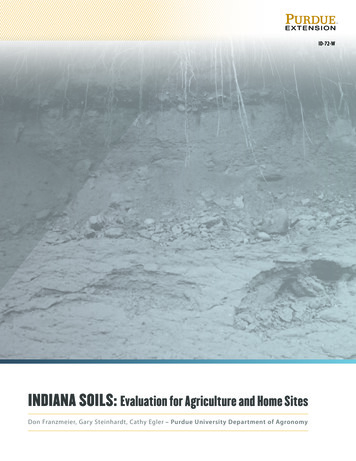
ID-72-WIndiana Soils: Evaluation for Agriculture and Home SitesDon Franzmeier, Gary Steinhardt, Cathy Egler – Purdue University Department of Agronomy
Table of ContentsPrefaceOn the CoverCredits and Acknowledgements346Chapter 1: Soil FormationPreview of Soil, Soil Profiles, Horizons, Factors and ProcessesSoil Profiles, Horizons, and SeriesSoil Formation FactorsSoil Forming ProcessesDefinition of SoilSoil Horizons in IndianaFactors of Soil Formation in IndianaSoil-forming Processes in IndianaFurther InformationSoil Landscapes and Profiles8991010111113212424Chapter 2: Soil PropertiesOverview of Soil Evaluation and JudgingSoil-Landscape-Water RelationsSoil PropertiesKinds of Parent Material3233353737Chapter 3: Agriculture PracticesLand Use OverviewErosion and Compaction PotentialsBuffers and Cover CropsCropping SystemsTillage PracticesWater ManagementPlant Nutrient Application6667687074757984Chapter 4: Home Site PracticesSite Selection and Construction PracticesLandscape and Lawn PracticesOn-site Sewage Disposal — Technical BackgroundOn-Site Sewage Disposal — PracticesActual Practice and Innovative SystemsSoil Water CyclePractical Tips for Homeowners9697104106121126126127Chapter 5: Planning and Arranging Soil ContestsEarly PlanningActivities Immediately Before and During a ContestQuestions and Resources128129130133Chapter 6: Glossary134Resources1462 Indiana Soils: Evaluation for Agriculture and Home Sites
PREFACEThe goal of this publication is to teach students howto apply soil science principles to managing soils foragriculture and home sites. To achieve this goal, weidentify nine key soil properties, explain how studentscan determine each property, and summarize thisprocess in evaluation rules.Then, we review the principles of restoration, forestmanagement, soil conservation, crop management,soil tillage, soil fertility, manure management,landscaping, lawn care, on-site sewage disposal andother specialties. We explain the essence of theseprinciples and summarize them in judging rules.The challenge is to boil the work of experts down toexplanations that students can use to determine keysoil properties and to recommend the same practicesthat experts would recommend. Students have about15 minutes to do all of this. In the process, the naturaltendency is for experts to believe that some detailsare omitted, and for teachers, and especially students,to believe that there is too much material to learn.Compromises must be made and experts, teachers,and students understand this. The process is a work inprogress, so we expect that changes will be made tothis publication.Value to StudentsThis publication will help you learn about soilresources and how to take care of soil. Thispublication is intended to be used mainly by highschool students.These students should learn about soils because: StewardsA steward is a person who takes care of certainresources. Individuals act as stewards at the ballotbox — when they elect people to office and whenthey vote on specific polices through referenda.Some examples follow: Two PublicationsTwo publications support teaching soil science inhigh schools and conducting soil contests. This isthe basic publication that replaces Indiana Soils:Evaluation and Conservation, (published in 2001as Purdue Extension publication ID-72) the basicprevious publication. Indiana Soil Evaluation FieldBook (Purdue Extension publication AY-362-W)is a new companion publication. The Field Booksummarizes the rules in this guide and providescondensed explanations of them. We anticipate thatthis guide will be used mainly for classroom teachingthat students will take the Field Book outdoors anduse it in soil pits. Both publications are available fromthe Purdue Extension Education Store, edustore.purdue.edu.They will be stewards of an important worldresourceIt will benefit them directly Every Indiana county has a Soil and WaterConservation District that helps landowners carefor their soil and water resources.State laws regulate (among other things) hownutrients in manure are applied to soils.Federal laws establish policies for preservingwetlands and controlling soil erosion.One of the main goals of The Food and AgricultureOrganization of the United Nations is to reducesoil degradation.Individual benefitsIn a few years, most high school students will beresponsible for taking care of yards on propertiesthey own or rent. Many of those properties will haveon-site sewage disposal systems that must be caredfor. Other students will go on to manage farms. Stillothers must decide where to build a new house.PREFACE 3
This publication deals with allthese issues. This publication willdiscuss how to apply nutrientsto lawns and home landscapingplants. It will explain how to carefor septic systems. It will suggestfarm practices that are suitable forspecific soils. And it will explain whyit is very dangerous to build houseson certain soils.If you do not follow the guidelinesoutlined in this publication, it canbe very costly to you and couldharm the environment.On the CoverOverviewThe photo on the cover of thispublication illustrates severalfeatures we will discuss in thisbook. Many years ago, a stream cutinto the base of a hill and the soilmaterial fell into the stream leavinga vertical cut. The site is alongFigure 1. This figure shows the parent materials on the cover photo. Photo provided by RyanMud Pine Creek in Warren County,Schroeder.Indiana. The photo was taken byRyan Schroeder, a Purdue studentThe material at the bottom of Figure 1 was depositedstudying Natural Resources and Environmentalfirst. Most of the material in the cut was transportedSciences, in January 2016. He dug into the materialsand deposited by a glacier, a large body of ice thatin the cut to identify their origin. The cut is about 15originated in Canada and flowed to Indiana. Thefeet deep. For now, notice the many different layersglacier, probably a few thousand feet thick, groundand deep tree roots. After you have read more of thisup the bedrock material over which the ice moved,book, read the details about soil parent materials andand deposited the ground-up material (called till) atsoil horizons.the site of the photo. When it was deposited, all thetill was grayish, like the lowest material in the photo.DetailsIt is called unoxidized calcareous till. UnoxidizedWe will explain the photo using Figures 1 and 2.means that much of the iron in the till is ferrous iron(Fe2 ) instead of ferric iron (Fe3 ), which gives till aFigure 1. Parent Materialsbrownish color. The glacier also ground up limestoneParent materials are the materials from which soilsbedrock, so the till contains carbonate minerals (isform. They were deposited thousands of years ago,calcareous). Unoxidized calcareous till appears aboveand it took a few thousand years to deposit all them,and below the debris that covers the cut in the parentbut they were all in place by about 15,000 yearsmaterial sketch. This till was compacted by the weightago. Then soil formation began. The kinds of parentof the glacier, so it is very dense.materials when soil formation began are identifiedin Figure 1.4 PREFACE
bare area and picked up silt andfine sand material creating duststorms. As the wind subsided, sandsettled out first as eolian sand, andthen silt settled out as loess. At thissite, eolian sand was deposited, butnot loess.FIGURE 2. SOIL PROCESSESAND HORIZONSWhen all the parent materialswere deposited, plants started togrow on them, and soil formingprocesses began. Then, all thetill was unoxidized (grayish) andcalcareous (with carbonates), likethe 4Cd2 soil horizon shown inFigure 2.OxidationOver the years, some of the ferrousiron (Fe2 ) in the till was dissolved,oxidized to ferric iron (Fe3 ), andprecipitated as brownish ironoxide minerals. These minerals areresponsible for the brownish colorin the oxidized calcareous till (3Cd1Figure 2. This figure shows the soil processes and horizons on the cover photo. Photo provided byhorizon). It comprises much of theRyan Schroeder.cut surface in the photo. The tillwas oxidized to a depth of about 8There are stones in the till and that were roundedfeet, which is the boundary between the 3C1 and 4C2during transport by ice. There are even more roundedhorizons. Because till is oxidized so deeply in the soil,stones in the outwash that were further rounded byunoxidized material is seldom, if ever, seen in a soil pit.transport by water. Close examination shows thatmany of the stones are igneous and metamorphicCarbonate Leachingrocks. The bedrock below Indiana consists ofThe original till also contained many carbonatesedimentary rocks, so the igneous and metamorphicminerals, such as calcium carbonate (CaCO3, orstones are “strangers” in Indiana, and are called arelime). The acid in rain water and the acids producedcalled erratics. They were carried here from Canada byby plants dissolve carbonates, and the dissolvedthe glacier.materials are lost to the air (as carbon dioxide, CO2),Above the till is a thin layer of outwash, materialor flushed out (leached) with drainage water. Thisdeposited from running water generated when theprocess, called carbonate leaching, extends to theglacial ice melted (meltwater). It contains mainly sandbottom boundary of the 2Bt2 and 3Cd1 horizons,and gravel because the finer material was washed outabout 4 feet in the photo. The depth of carbonateby running water when the outwash was deposited.leaching is often seen in soil pits. Official soil judgesoften post this depth (Calcareous below a certainAbove the outwash is a layer of eolian sand. Followingdepth) on site cards (see page 147).the retreat of the glacier and the deposition ofoutwash materials, strong winds blew across thePREFACE 5
Other soil forming practices include formation ofsoil structure, accumulation of organic matter,weathering of soil minerals and formation of clay, andmovement of clay down the profile. The results ofthese processes are enhanced by soil organisms. Oneof these is the plants that grow on the soil. Note howdeep the tree roots grew in this soil.mapping soils during the summer while attendingMichigan State University. He has been involved insoil judging for 4-H/FFA and at the collegiate level.He has coached the Purdue Soils Team for 30 years.He presently serves on the Board of the IndianaRegistry of Soil Science. He was one of the authorsof the previous edition of this manual.The horizon designations in Figure 2 consist of fourmain parts, illustrated here by the 2Bt2 designation:Cathy Egler is a Teaching Assistant in the PurdueDepartment of Agronomy. She has a bachelor ofscience in natural resources from Ball State Universityand a master of science in agronomy from PurdueUniversity. She has had professional positions in soilconservation and has been the assistant coach of thePurdue Soils Team for 15 years. A leading number (2) that indicates the kind ofparent material. If there is no leading number,(such as in the A, and Bt1 horizons) the numberis assumed to be 1. For this soil, the parentmaterials are:1. Eolian (wind-blown) sand2. Outwash3. Oxidized calcareous till4. Unoxidized calcareous till An uppercase letter that indicates major kinds ofhorizons (“B” in the example).A lowercase letter that indicates major processesof soil formation. The “t” in the example indicatesaccumulation of clay; “d” means dense.Subdivisions of similar horizons (the final ”2” in2Bt2).Credits andAcknowledgementsAuthorsDon Franzmeier was a professor in the PurdueDepartment of Agronomy from 1967 to his retirementin 2004. His appointment was mainly research andteaching, but he also worked with soil evaluation andjudging, an extension activity. He was the lead authorof the previous edition of this manual, which waspublished in 2001. The photos in Figure 3 show that itis, indeed, time to update the manual.Gary Steinhardt has been s a professor and extensionspecialist in the Purdue Department of Agronomyfrom 1976 to present. His work has focused onextension and teaching. He began his career by6 PREFACEThe authors thank Tony Carrell, (Purdue ExtensionSpecialist) for devising the scorecard numberingsystem to make scoring and tabulating large contestresults faster.PhotosThe photos in this publication will help studentsunderstand what the practices they select on contestscorecards. Some of the photos appeared in the lastedition of this manual. Several new ones came fromthe USDA-Natural Resources Conservation Service(NRCS) Photo Gallery. After assembling the photosfrom those sources, we still had gaps, so we askedpeople for help. As a response to this request, wereceived photos from: Eileen Kladivko and Tony Vyn,Purdue Agronomy; Gary Struben (credited to hisemployer, USDA-NRCS, Indiana); Tom Bechman, editorof Indiana Prairie Farmer magazine and a volunteersoil judging coach; Joey Schlatter, GPS specialist withSchlatter’s Inc., in Francesville, Indiana, a companyspecializing in drainage equipment and relatedtechnology; and Mike from the Tiny Farm Blog.Photo sources are provided in the captions. When nosource is provided, the photos and illustrations wereprovided by the authors or Purdue Extension.Volunteer ReviewersAt various stages of developing the publications,teachers, official judges, the experts listed in thepreface, and others reviewed parts the publicationsor all of the Field Book. We thank all these people fortheir interest in caring for our soil resources.
Figure 3. These photos show author Don Franzmeier and his grandson, Chip Herendeen, when the manual was first published in 2001 and morerecently. Photos provided by Gail Herendeen.Figure 4. Cathy Egler (left) and Gary Steinhardt.PREFACE 7
CHAPTER 1 – Soil Formation
Preview of Soil, Soil Profiles,Horizons, Factors andProcessesFirst, we should explain that by soil we generally referto the upper 3 or 4 feet of the land surface. We willprovide a more specific definition later.Soils are outdoors, so you must go outdoors toobserve and study them. Much of what we havewritten here will not make sense unless you gooutside and apply it when you observe an individualsoil and notice how soils differ from place to place.Teachers, official judges, and soil scientist volunteerswill help you with this hands-on study. Soils trainingis similar to medical training. If you need an operationyou surely hope that your surgeon has receivedhands-on training in addition to reading about thesurgery in books and manuals. And if you ever needto install an on-site septic system, you surely willhope that your professional has had the appropriatehands-on training.Instructors have made studying soils more interestingto students by making it competitive. Athletes canshoot baskets individually, but they work harder ifthey are part of a team that competes with otherteams. Similarly, you will evaluate soils in soilevaluation and judging contests. This publication willpresent the process of describing soils and decidinghow best to use them for agriculture and for homesite soils in a competitive format.This chapter previews soil profiles and horizons —what you see in the field. This chapter also providesan overview of the factors that determine soilproperties, and then discusses some of the processesthat form different horizons in soils.Soil Profiles, Horizons,and SeriesIn the field, you will see many soil profiles. Soilprofiles are vertical exposures that are about 4 feetdeep, usually in a pit or road cut. You will notice thata soil profile has different layers (or horizons) thatare parallel to the soil surface. These horizons differfrom each other in texture, color, structure, andother properties.There are three general kinds of soil horizons: Surface soil (A and E Horizons) includes the upperhorizons that are most affected by plant roots.They usually contain more organic matter thanother horizons. Less technically, surface soil iscalled topsoil.Subsoil (B Horizons) includes the horizonsbetween the surface soil and the substratum.Substratum (C and R Horizons) are deep horizonsthat have been little affected by soil formingprocesses. In other words, these materials areusually about the same as they were whenthey were deposited.Later in the chapter, we discuss the horizonsby the letter designations (A, E, B, C, and R) asdesignated above.A soil series is a group of soils with similar profilecharacteristics. Their names represent the area inwhich they were first identified. For example, theBrookston series was named for the Indiana town bythat name. Later in this chapter (in Soil Landscapesand Profiles, pages 24-31) we will use many soil seriesnames, such as Chelsea, Hosmer, and others.CHAPTER 1 – Soil Formation 9
Soil Formation FactorsA factor is something that helps produce a result.Let’s assume the result is a certain soil. Then thereare five factors that determine what the soil is like.Soil scientists list soil formation factors inthree groups:1. Soil formation factors based on the originalcondition of the soil:Parent material Relief2. Active soil formation factors: Climate Organisms, especially vegetation3. Another soil formation factor: TimeWe will illustrate the factors with a typical soil innorthern Indiana. A long time ago, a glacier (largeice sheet) retreated from northern Indiana, and it leftbehind a mixture of sand, silt, and clay (this materialis called parent material), in irregular hills. The shapeof the hills is the relief. After the parent material wasdeposited, it rained on these materials, and the sunwarmed them (climate). Plants and other organismsstarted to grow on the site to begin various processesof soil formation. The glacier retreated about 20,000years ago (time) and the soil has been developingever since. Topography and landscape are terms thatare similar to relief.In Indiana, most soils formed under forest vegetation,but some (mostly in west-central Indiana) formedunder prairie. These prairie soils have thick, darksurface horizons.Indiana’s climate varies a bit, but to see the trueresults of climate, you need to travel. For theextremes, you might compare the soils in the rainforest of Hawaii with soils in the desert of Nevada.If you have a background in math, it might be ofinterest that there is an equation that summarizes therelationship of soil properties to soil properties to soilformation factors:S f (cl,o,r,p,t)The equation states that any soil property (S) dependson climate (cl), organisms (o), relief (r), parent material(p), and time (t). There is a mnemonic device forremembering these factors: clorpt. You can see the effects of individual factors over areasof different sizes. You can often see the effects of therelief factor within a field. Soils at the top of a hill aremuch different from soils in a depression (basin) atthe bottom of a hill.Within a county, there are usually several differentparent materials. Soils near a river were probablydeposited by water. Soils far from a river wereprobably never transported or were deposited by ice,and are much different than those near the river.The different materials might have been depositedat different times. Soils far from the river are probablythousands of years old; those near the river might beonly as old as the last flood.10 CHAPTER 1 – Soil FormationSoil Forming ProcessesNotice that the soil formation factors are nouns. Theyeach describe a thing.In contrast, a process describes some kind of action,so the words that explain processes are verbs. Manyprocess take place in soils.Physical processes break larger particles break downinto smaller ones, move tiny particles downward ina soil, and water moves soil particles down a slope.Chemical process dissolve some minerals completely,transform other minerals from unavailable formsto plant-available forms, and cause soluble iron toprecipitate as reddish brown iron oxide. Biologicalprocesses decay plant materials and transform theproducts to humus (dark organic material), mix thesoil (with worms), and transform nitrogen in the air toforms of nitrogen that are available to plants.Of the many soil forming processes, we mentioneight processes (or groups of processes) here,because they have noticeable effects on soil horizons.We will illustrate these soil forming processes withphotos after we discuss soil horizons.
The eight soil forming processes we will discuss inthis publication are: Carbonate minerals (ground limestoneor “lime”) dissolve.Other minerals weather. Weathering is thebreaking down of rocks and minerals.Some materials (such as ions) are releasedduring the weathering process and leach fromthe soil — that is, they are removed by waterflowing down through the soil.Clay moves down the profile.Organic matter accumulates in surface horizons.Iron oxide minerals form.Soil particles become weakly cemented to eachother. This is responsible for the Bx horizon ofthe Hosmer soil (Figure 1.25).Soil structure forms.Definition of SoilIn this publication, we define soil as the material nearthe Earth’s surface that has horizons that were createdby soil-forming processes.Main HorizonsDistinctive FeaturesO – Organic matter. Surface leaf litterin a forest; peat or muck in a bogi – slightly decomposede – moderately decomposeda – highly decomposedA – Mineral matter darkened byorganic matter and/or cultivatedp — plowedE – Horizon from which clay, iron,etc. has been lostUsually lighter in colorthan A horizonAB, EB, BE – Transition horizonbetween two major horizonsHorizon is more like the firstlisted (EB is more like E than BB – Major subsoil horizong – gleyed (dominantlygray color)t – gain in clayw – weak developmentx – fragipan (brittle)BC, CB –Transition horizonbetween two major horizonsd – denser – weathered bedrockR - BedrockTable 1.1. Common horizon designations for Indiana soils. Soil horizonsand their designations are illustrated in the photos in Soil Landscapes andProfiles (pages 24-31). For example, the Btg horizon of the Brookston soil(Figure 1.17) has a subsoil horizon (B) that contains more clay (t) thanthe horizons above it and is dominantly gray (g).Soil Horizons in IndianaThe soil horizon designation system that wediscussed earlier is used in most countries of theworld. Here we discuss the kinds of horizons inIndiana soils and illustrate them with photos.When describing a soil profile, we use the capitalletters O, A, E, B, C, and R to indicate the major kindsof horizons. Often, these capital letters are followedby a lowercase letter that gives more informationabout the horizon. For example, a B horizondesignates a subsoil horizon in which something hasaccumulated. A Bt horizon is a soil horizon in whichclay has accumulated. Table 1.1 explains what all ofthese letters mean. We also describe the major lettersin more detail below.In addition to the letters, some horizon designationsinclude a number that appears before the uppercaseletter. This number represents changes in parentmaterials. For example, the horizons in a profile(from the top down) may be Ap, E, 2Bt, and 2C. Thesedesignations tell us that the first two horizons (Apand E) formed in one kind of parent material (suchas loess), and the lower two horizons (2Bt and 2C)formed in a different parent material (such as till). A Note About FiguresThe Soil Landscapes and Profiles section(pages 24-31) includes many figures we willrefer to throughout this manual. Figure 1.2(pages 14 and 25) is a soil map of Indiana.Figures 1.14-1.27 (pages 26-29), show 14soil profiles. The explanations for Figures1.14 -1.27 (including the scale on the tapethat shows depth) appear on pages 30-31.In soil evaluation, you are not required to name thehorizons. However, knowing the characteristics of theA, E, and B horizons will help you determine erosionclasses, recognize fragipans, identify alluvium, andrecognize other soil properties.CHAPTER 1 – Soil Formation 11
O HorizonsB HorizonsSoil horizons that are composed of organic materialson the surface of mineral soil are called O horizons.An example of an O horizon is the Trappist soil(Figure 1.27). In the Trappist soil, the organicmaterials are predominantly decomposing leavesfrom hardwood trees.The mineral horizons below the A and E horizonsare called B horizons. B horizons are also referredto as subsoil.In bogs and marshes, the whole soil will haveformed in organic matter, so the entire profileconsists of O horizons.A HorizonsMineral horizons (those with little organic matter)that are near the surface are called A horizons.Living organisms are most active in this horizon,so an A horizon is characterized by a dark-coloredhumus mixed with the mineral materialUnder forest vegetation, the A horizon is only a fewinches thick (Miami soil, Figure 1.15). But under prairiegrasses (Parr soil, Figure 1.14) or in swales (Brookstonsoil, Figure 1.17), the A horizon may be 25 or moreinches thick. A horizons are usually the darkest of anyhorizon in the soil.Within the A horizon category is the designation Ap,which is given to soil that has been mixed by plowingor cultivation.Ap horizons consist mostly of the: A horizonA and E horizonsRemaining A (and usually E) and part of the upperB horizons (in eroded soils)E HorizonsA soil that develops under forests commonly has anE horizon a few inches below the surface. E horizonsoils are lighter in color, lower in organic matter, andless fertile than A horizon soils. Clay, aluminum, iron,and some nutrients have been washed out of orleached from the E horizon.The E horizon is apparent in the Miami soil (Figure1.15) and the Hosmer soil (Figure 1.25). In Crosbysoil (Figure 1.16), part of the E horizon remainsundisturbed below the plowed (Ap) horizon,especially on the right side of the profile.12 CHAPTER 1 – Soil FormationB horizon soils have one or more of these distinctivecharacteristics: An accumulation of clay, iron, aluminum, or acombination of theseA prismatic or blocky structureReddish or brownish colors in better drained soilsWeak cementation, which results in brittle materialCollectively, we call the A, E, and B horizons thesolum. If a soil lacks B and E horizons (which maybe the case in recent alluvial materials) the solumcontains only the A horizon.C HorizonsMaterials that cannot be designated as A, E, or Bhorizons because they lack soil development arecalled C horizons, or substratum. C horizons canbe weathered rock material immediately below thesolum that was never transported, or C horizons canbe material that was moved by ice, water, or wind.In most soils, the C horizon is like the material fromwhich the overlying horizons formed. If this is thecase, we can say that the C horizon is the parentmaterial of the A, E, and B horizons. Sometimes, theC horizon material is different from the material inwhich the A, E, and B horizons formed.R HorizonsHorizons composed of consolidated (hard) bedrock(such as limestone, sandstone, or shale) are called Rhorizons. In Indiana, the depth to bedrock varies froma few inches to several hundred feet.
Factors of Soil Formationin IndianaRemember, the five soil formation factors are: parentmaterial, relief (or topography), climate, organisms(especially vegetation), and time. Here, we providesome examples of these factors as they relate toIndiana soils.Parent MaterialsParent material is the starting point of soil formation.Parent material largely determines a soil’s range oftextures (that is, how much sand, silt, and clay thesoil will have). The parent material’s chemical andmineral properties also affect the natural fertility ofthe soil it forms.Indiana soils have many kinds of parent materials.Indiana soils include parent materials such as bedrockthat was weathered and mainly remained in place,and they include parent materials that were carriedsome distance by ice, water, or wind. Glaciers (largeice sheets) transported the parent materials of manyIndiana soils. The glaciers that covered Indiana werecontinental glaciers that covered much of the UnitedStates. Smaller valley glaciers illustrate glaciation(Figure 1.1). The map of Indiana soil regions (Figure1.2) is based mainly on soil parent material. Chapter 2:Soil and Landscape Properties presents guidelines foridentifying rocks and parent materials.A.B.Figure 1.1. These photos show a glacier (large ice sheet) in Canadaand related features. A. The Athabasca glacier is a valley glacier andis much smaller than the continental glaciers that covered much ofthe northern United States. B. This meltwater stream flows fast anddeposits very coarse material, mainly gravel. C. This photo showsstriations (small grooves) on the bedrock over which a glacier haspassed. Stones in the glacier scratched the surface of the bedrock.In this case, one set of striations is oriented at right angles to theother set. Apparently, the glacier advanced in one direction,retreated, and then advanced again from a different direction.C.CHAPTER 1 – Soil Formation 13
Figure 1.2.This map showsthe various soilregions of Indiana.This figure will berepeated in theSoil Landscapesand Profiles sectionat the end ofthis chapter(pages 24-31).14 CHAPTER 1 – Soil Formation
Before the glacial period, Indiana’s topography wasrather rough and rolling — similar to what you nowfind in southern Indiana (Soil Regions 11, 12, and 13in Figure 1.2). That’s because ice never covered thatpart of southern Indiana. The glaciers were hundredsof miles long and hundreds to thousands of feetthick. These massive ice sheets covered most of thestate during at least three different ice ages: the (1)Pre-Illinoian, (2) Illinoian, and (3) Wisconsinan Ages.As the ice moved south, it destroyed old hills andmade new ones. The ice carried material with it andburied old valleys. When the ice melted and receded,it left a layer of rock, sand, silt, and clay. Collectively,this left-behind material is call glacial drift.For soil evaluation in Indiana, we recognize eightparent materials: Weathered bedro
Book (Purdue Extension publication AY-362-W) is a new companion publication. The Field Book summarizes the rules in this guide and provides . materials when soil formation began are identified in Figure 1. The material at the bottom of Figure 1 was deposit
