Transcription
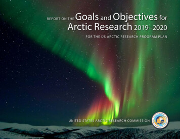
Goals and Objectives forArctic Research 2019–2020REPOR T ON THEFOR THE US ARC TIC RESEARCH PROGR AM PLANUNITED STATES ARC TIC RESEARCH COMMISSIONa
CONTENTSA Message from USARC Chair Fran Ulmer. 1Goal 1. Advance Arctic Infrastructure. 2Goal 2. Assess Arctic Natural Resources. 6Goal 3. Observe, Understand, and Forecast ArcticEnvironmental Change. 8Goal 4. Improve Community Health and Well-Being. 12Goal 5. Enhance International Scientific Cooperationin the Arctic. 16Emerging Topics in Arctic Research. 18Working with the Interagency Arctic ResearchPolicy Committee. 19USARC CommissionersFRAN ULMER, CHAIRFormer ChancellorUniversity of Alaska AnchorageAnchorage, AKJAMES J. McCARTHY, PhDAlexander Agassiz Professor ofBiological OceanographyHarvard UniversityCambridge, MADAVID BENTONFormer ChairNorth Pacific Fisheries ManagementCouncilPoint Retreat, AKMARY C. PETE (deceased)DirectorKuskokwim CampusUniversity of Alaska FairbanksBethel, AKKASAŊNAALUK MARIE N. GREENEFormer President and CEONANA Regional CorporationKotzebue, AKJACQUELINE RICHTER-MENGEResearch FacultyInstitute of Northern EngineeringUniversity of Alaska FairbanksFairbanks, AKLARRY A. MAYER, PhDDirectorCenter for Coastal and Ocean MappingUniversity of New HampshireDurham, NHFRANCE A. CÓRDOVA, PhDDirectorNational Science FoundationArlington, VAAddressing Federal and State Priorities. 20Duties of the Commission Develop and recommend a national Arctic research policyand Arctic research goals and objectives Assist the Interagency Arctic Research Policy Committeein establishing a national Arctic research program plan toimplement the policy Facilitate cooperation in Arctic research among federal, state,and local governments and with international partners Review federal Arctic research programs and recommendimprovements for coordination Recommend advances in Arctic research logistics Recommend improved methods for data sharing amongresearch entitiesPrinciples for Conducting Researchin the ArcticThe Interagency Arctic Research Policy Committee releasedan updated version of the principles,1 which encouragesresearchers to: Be Accountable Establish Effective Communication Respect Indigenous Knowledge and Cultures Build and Sustain Relationships Pursue Responsible Environmental StewardshipUSARC StaffJOHN FARRELL, PhDExecutive DirectorArlington, VACHERYL ROSA, DVM, PhDDeputy DirectorAnchorage, AK1 cuments/principles for conducting research in the arctic final 2018.pdfKATHY FARROWCommunications SpecialistArlington, VA
A MESSAGE FROMUSARC CHAIR FRAN ULMERWhy is the world paying moreattention to the Arctic?Fran Ulmer, Tim Gallaudet, and France Córdovaat the 2nd Arctic Science Ministerial.Many nations, beyond the eight Arctic countries, are increasing their attention to, andinvestment in, Arctic research and engagement to better understand and prepare for theconsequences of these dramatic changes. It’s critically important for the United States, aworld leader in scientific research and development, to intensify its focus on this region,which for many Americans previously seemed too frozen and remote to be of seriousconcern. Now that warmer Arctic conditions and rapidly decreasing ice on land and seahave been linked to mid-latitude weather extremes, intensified storms, longer droughts,wildfires, floods, and rising sea levels, the North has attracted more interest and concern. Similarly, potential oil and mineral development, new shipping patterns, alteredfisheries, and increased tourism all require countries, companies, and communitiesto focus on adjusting and preparing for these new opportunities and challenges. Foreconomic, cultural, environmental, geopolitical, and security reasons, the commitmentto science-informed and evidence-based decisions and investments is essential to thefuture of the entire region as well as to our nation. This report identifies important topics for Arctic research related to these changes and their consequences that can advanceknowledge and enable better decisions. Informed and wise management of the valuableand vulnerable Arctic matters greatly to people in and beyond the Arctic.We dedicate this report to Commissioner Mary Ciuniq Pete, anenthusiastic and thoughtful administrator, researcher, mother,and friend who tirelessly championed education, health, andsubsistence. Mary passed away on November 17, 2018, fromovarian cancer. In 2005, Mary became Director of the Universityof Alaska Fairbanks Kuskokwim Campus in Bethel, Alaska, aftera decade serving as Director of the Subsistence Division forthe Alaska Department of Fish and Game. In 2010, PresidentObama first appointed Mary to USARC, and reappointed her in2013. Born and raised in Stebbins, Alaska, Mary, a fluent speakerof the Central Yup’ik language, was devoted to her family andto the communities, causes, and campus she served. She lovedengaging in a subsistence lifestyle, carrying on traditions,helping in culturally relevant ways, and generously sharing herinsights. Mary was a significant asset to the Commission, and agreat friend. She is dearly missed.1Photo credit: Jimmie LincolnFour reasons stand out: The environment of the Arctic is changing faster than in any other region on the planet. Changes taking place in the Arctic have global impacts. Diminished physical and geopolitical barriers to resource access and extraction arepresenting economic and strategic possibilities. Arctic residents are faced with rapidly changing conditions that challenge health,safety, and cultural practices.
GOAL 1. Advance Arctic InfrastructureMOTIVATIONRECOMMENDATIONSArctic infrastructure for transportation, buildings, communication, utilities, andenergy delivery, both civilian and military, is an essential prerequisite for humanactivity in the North. Climate warming continues to cause damage to infrastructure, making it especially costly to maintain, repair, or replace, especially in remoteAlaska. For instance, 70% of all Arctic infrastructure lies atop near-surface permafrost that will thaw in the next 30 years, and this is likely to occur even if the climatechange targets of the Paris Agreement are reached.2 Timely preventative measures,based on a well-informed understanding of environmental conditions, and theirprojected changes over time, can reduce infrastructure damage and costs.» Fund demonstration projects to address engineering design of Arctic infrastructure. Engineers and planners need decision-support tools, with regularly updatedinformation, to plan, design, and construct infrastructure in a rapidly changingArctic environment. Such tools will supersede outdated planning tools3 and guidance documents,4,5 will increase value engineering via cost reduction, and mayserve as the archetype for tools designed for non-Arctic regions.» Transfer knowledge from engineering research projects to design guidance documents. Specifically, rewrite the out-of-date Department of Defense UnifiedFacilities Criteria 3-130 (Arctic and Sub-Arctic Construction).» Support, through federal public-private partnerships, and by working cooperatively with the State of Alaska, and with local and tribal authorities, the Arcticmarine infrastructure needs identified through congressional hearings6 and theinteragency US Committee on the Marine Transportation System (CMTS).7Areas of emphasis include ports, navigable waterways, physical and information infrastructure, response services (e.g., search and rescue, and environmentalresponse), and vessels.» Fund construction of the icebreakers identified in the US Coast Guard’s polar security cutter program that are critical to meeting national needs, including research.ba2c345672Hjort, J., et al. 2018. Degrading permafrost puts Arctic infrastructure at risk by mid-century. NatureCommunications. https://doi.org/10.1038/s41467-018-07557-4Alaska Engineering Design Information System. http://citeseerx.ist.psu.edu/viewdoc/download?doi 10.1.1.119.7647&rep rep1&type pdfHartman, C.W., and R.R. Johnson. 1984. Environmental Atlas of Alaska. University of Washington PressSmith, D.W., ed. 1996. Cold Regions Utilities Monography. https://doi.org/10.1061/9780784401927For example, the June 7, 2018, hearing of the House Subcommittee on Coast Guard and MaritimeTransportation, “Maritime Transportation in the Arctic: The U.S. Role,” https://republicans- transportation. house.gov/calendar/eventsingle.aspx?EventID 402555, and the December 6, 2018, hearing of theSenate Subcommittee on Oceans, Atmosphere, Fisheries and Coast Guard, “Preparing for MaritimeTransportation in a Changing Arctic,” rctic-transportation-issues.US Committee on the Marine Transportation System. 2018. Revisiting Near-Term Recommendationsto Prioritize Infrastructure Needs In The U.S. Arctic. Washington, DC., 43 pp., https://www.cmts.gov/ downloads/ NearTermRecommendationsArctic2018.pdf(a) Thule Air Base, Greenland. (b) Kivalina, Alaska.(c) Canadian Forces Station Alert, Ellesmere Island.
aEXAMPLESbc(a) Geodesic dome at Thule Air Base,Greenland. (b) Red Dog Mine portfacility, Alaska. (c) Thermosiphons,Kotzebue, Alaska.» Consider dual-use opportunities for research when planning Arctic communication infrastructure. For example, submarine fiber optic cables traditionally usedfor telecommunication could also be used to collect ocean observations8 and todetect earthquakes.9» Better understand how oil and gas production and transportation infrastructuremust evolve to adapt to changing Arctic environments. Examples include evaluation of gas-to-liquids transport through the Trans-Alaska Pipeline and methods totransport energy from the North Slope (as liquid natural gas and via high-voltagedirect current transmission).8910Adaptive Engineering. Engineers, scientists, planners, regulators, and educators need up-to-date data and projections to appropriately design the “builtenvironment”—the human-made surroundings and infrastructure that provide thesetting for human activity, ranging in scale from villages to cities, and including supporting systems for water, sewer, energy, communications, and transportation.These data may include environmental variables, such as sea level, the frequencyof extreme storms and their surges, the warming and thawing of near-surfacepermafrost, freeze-thaw cycles, sea ice cover, rates of coastal and riverine erosion,inland flooding, and the frequency and extent of forest and tundra wildfires.Many guidance documents, reference materials, building codes, and criteria fordesigning Arctic infrastructure are outdated because the environmental conditionsupon which they were based have evolved significantly over the past 30 to 40 years,in response to a changing Arctic.Infrastructure is often expected to function for decades, yet the Arctic will continue to warm and environmental conditions will change. As such, static planning documents and guidelines, even if updated, are of limited value. Instead, an“evergreen” approach is needed to regularly assemble, validate, coordinate, anddeliver quality-controlled information for planning and design.A computer-based system of data and applications, with an easily accessible,user-friendly, and web-based interface, should be developed as a support tool fortimely and effective decision making. Such a system could be used, and supported,on a subscription basis. Ideally, such a system could downscale data to regional andlocal scales; calculate means, trends, and other statistics; and provide projectionsthat accurately represent current and future conditions. Scenario planning and riskassessment would be possible, as would integration of climate and environmentalvariables into engineering design parameters.Consistent with the needs described above, the Department of Defense’s (DoD)Environmental Security Technology Certification Program (ESTCP) releaseda solicitation10 in January 2019 to support research on an environmental technology demonstration and validation effort on Arctic infrastructure titled, “DoDInfrastructure Resiliency Arctic Engineering Design Tool.”Ocean Networks Canada, http://www.oceannetworks.ca/ and specifically http://www.oceannetworks.ca/ observatories/arcticMarra, G., et al. 2018. Ultrastable laser interferometry for earthquake detection with terrestrial and submarine cables. Science. itations3
Preparing for Arctic Maritime Activity. The federal government is anticipatingand planning for greater and more varied vessel traffic in the US maritime Arctic.As suggested by the CMTS’s interagency Arctic Marine Transportation IntegratedAction Team, to make the waterways safe and secure for vessels and to minimizeenvironmental damage, several types of infrastructure will be needed such as infrastructure associated with making waterways navigable (e.g., ports of refuge), physical infrastructure (e.g., ports, harbors, and geospatial infrastructure), and marinetransportation system (MTS) information infrastructure (e.g., hydrographic surveys, shoreline mapping, aids to navigation, communications, marine weather, andsea ice forecasts; real-time oceanographic information; and Automatic IdentificationSystem). Also needed are MTS response services (e.g., for icebreaking, emergencies, environmental management, and search and rescue) and vessel-related efforts(e.g., International Maritime Organization Polar Code implementation, crew standards, and training).Research continues to assist in several of these efforts. The GovernmentAccountability Office11 recently summarized federal efforts associated with offshoreoil spill prevention and response, including some in the Arctic, conducted by nineagencies, involving over 100 projects per year for a total cost of about 200M fromfiscal years 2011 through 2017.In 2017, the US Coast Guard’s (USCG) Research and Development Center fieldtested a number of technologies and systems associated with oil spills in ice-infestedArctic waters, including an oil skimmer referred to informally as the “Roomba.”12In 2018, the USCG tested unmanned technologies, such as a communication network composed of aircraft, surface vessels, and an aerostat balloon.The Arctic Domain Awareness Center (ADAC13) supports research projects onArctic maritime activity. ADAC tested an oil-spill-mapping Long Range AutonomousUnderwater Vehicle (LRAUV) that can operate under solid ice pack at 1 to 3 milesper hour for 15 days on a single battery charge and can produce 3-D maps of crudeoil and petroleum products.14 ADAC also supports the “Polar Scout” research program, which explores ways to enhance Arctic communications and domain awareness using small cube satellites successfully launched in December 2018.15Arctic marine charts are suboptimal; only 4.1% of the US maritime Arctic ischarted to modern international standards,16 raising safety concerns for marineoperations. The charts are based on sparse data collected long ago, and for shallow coastal regions, where typical charting vessels cannot operate, seasonalchanges in bathymetry due to storm effects and ice scour compound the problem.4a(a) Testing the Long RangeAutonomous Underwater Vehicle.Photo credit: ADAC, Woods HoleOceanographic Institution, andMonterey Bay Aquarium ResearchInstitute. (b) University ofNew Hampshire’s autonomoussurface vessel deployed fromNOAA Ship Fairweather. Photocredit: Christina Belton, NOAA Officeof Coast SurveybExperts17 recently demonstrated the feasibility and efficiency of deploying a small,12-foot-long autonomous surface vessel (ASV) from the National Oceanographicand Atmospheric Administration (NOAA) hydrographic survey vessel Fairweather.The ASV was equipped with a multibeam echosounder for mapping the seaflooradjacent to Alaska’s Point Hope. Future use of the ASV, possibly off Utqiagvik, and inclose coordination with local authorities, is planned for 2020.The Army’s Cold Regions Research and Engineering Laboratory initiated a “SeaIce Dynamics Experiment,” sponsored by the Office of Naval Research (ONR), tounderstand processes governing sea ice fracture and 700/696318.pdfEwing, T. 2017. “Roomba” in the Arctic. Marine Technology News. pp. 40–45, October ws/2018/12/04/snapshot-more-tests-arctic-oil-spill time-Arctic28feb2018.pdfUniversity of New Hampshire’s Center for Coastal and Ocean Mapping/Joint Hydrographic Center,https://ccom.unh.edu
Anticipating Arctic Road Systems. The minimal road system in Alaska increases the cost and time for transportation to and among communities and locationsrich in natural resources. Using public and private funds, Alaskans are consideringtwo major initiatives to address this issue, the Arctic Strategic Transportation andResource (ASTAR) Project, and the Ambler Mining District Access Project.Scientific research and Indigenous Knowledge18 can help inform consideration ofthese projects. For example, how might roads impact caribou herds, which are a valuable natural resource? What is the condition of the soils and near-surface permafrost,and how will road construction and operation impact the environment (consideringhydrogeology, dust control, and spills from vehicles)? What does research suggestfrom independent, economic-based cost-benefit analysis of road construction?Several State entities, including the Alaska Industrial Development and ExportAuthority, and the Departments of Natural Resources, Health and Social Services,Commerce, Community and Economic Development, and Transportation andPublic Facilities, are conducting research associated with the projects. If theyadvance, both road systems would cross federal lands, and the Department of theInterior, among other agencies, would become more involved, beyond just writingmandated environmental documents.18One Arctic indigenous group, the Inuit Circumpolar Council, defines Indigenous Knowledge as “asystematic way of thinking applied to phenomena across biological, physical, cultural, and spiritualsystems. It includes insights based on evidence acquired through direct and long-term experience andextensive multigenerational observations, lessons, and skills. It has developed over millennia and is stilldeveloping in a living process, including knowledge acquired today and in the future, and it is passed onfrom generation to generation.”b(a) Dalton Highway, Alaska. (b) GaswellRoad, Utqiagvik, Alaska. Photo credit:UMIAQ Design & Municipal Services, LLCa5
GOAL 2. Assess Arctic Natural ResourcesMOTIVATIONResearch informs management of the Arctic’s plentiful and rich natural resources,such as oil and gas, minerals, and wildlife, as well as those less frequently considered,such as plants, land, water, and air, and their contributions to society (i.e., “ecosystemservices”). Responsible stewardship of these resources for the benefit of both present and future generations is a national value. Information gleaned from scientificresearch and Indigenous Knowledge is necessary to understand the Arctic’s living andnon-living resources, how they support life, how they evolve, and how to thoughtfullybalance current use against future demand. As the Arctic becomes increasingly accessible, and as global demand for resources grows, decision-makers will need information that will allow them to make informed choices on resource use.19baRECOMMENDATIONS» Support US Geological Survey (USGS) efforts to better understand the oil andgas potential of Alaska’s North Slope, with specific foci on petroleum systems thatexist beyond the outer continental shelf area and under the continental slope, and,in cooperation with Department of Energy (DOE), identify the resource potentialof gas hydrates via production testing field experiments.20» Encourage DOE to fully implement its 10-year Arctic renewable energy plan,21follow-on initiatives to the “Remote Alaska Communities Energy Efficiency”effort,22 and the applicable recommendations in the Renewable EnergyAtlas of Alaska.23» Enable the USGS to conduct detailed geologic mapping to better understand thedistribution and resource potential of minerals and to develop new databases formineral resource analysis.» Support NOAA to conduct additional trawl surveys in the Bering Sea and north ofthe Bering Strait to assess fish stocks in light of shifting population localities andcontinue to develop camera survey techniques for untrawlable habitats.» Encourage agencies responsible for surveying and conducting census countsof marine and terrestrial mammals to consider advanced technologies, such asunmanned aircraft systems, to improve assessments.19c202122236Auad, G., et al. 2018. A dynamic management framework for socio- ecological system stewardship: A case study for the United States Bureauof Ocean Energy Management. Journal of Environmental Management.https://doi.org/ SARDraftPlan leenergy-atlas/(a) Gas flare stack at Northstar Island, Alaska.(b) Trans-Alaska Pipeline. (c) Unisea fishprocessing plant, Unalaska, Alaska.
(a) Sampling oil to assessweathering properties.Photo credit: SINTEF. (b) RedDog mine, Alaska. (c ) Beaverpond and dam, DenaliNational Park, Alaska.bcaEXAMPLESOil Seeps. The Department of Interior’s (DOI) Bureau of Ocean Energy Managementis supporting a new study of natural petroleum seeps in Alaskan coastal and marineenvironments to identify the location and extent of these resources, to learn moreabout associated chemosynthetic communities, to help determine the fair marketvalue of leased outer continental shelf blocks, and to assist in environmental analysesrequired by law. Future work, involving NOAA and the Bureau of Land Management,could expand this effort by chemically “fingerprinting” the natural seeps to helpdifferentiate them from human-caused spills.Critical Minerals. Alaska has deposits of at least 15 “critical minerals” that areessential to national security and the economy and are subject to supply chaindisruption. To decrease US dependence on foreign sources of minerals such asgraphite, tin, platinum, and cobalt, the DOI has listed 35 as critical nationwide,and is preparing a report to the President that includes efforts to identify newUS mineral sources through improved maps. Geospatial analysis by the USGS hasalready identified areas in Alaska with critical mineral-resource potential to helpguide future exploration activities and scientific research. The USGS is conductinga petrologic investigation of rare earth elements on the Seward Peninsula, butmore work is needed. The United States could consider replicating the effort of theCanadian government, which invested about 75M (US), in a geo-mapping programto identify new energy and mineral resources.Invasive Species and Range Expansion. Species not typically associated withthe Arctic are being introduced through human activities or are moving northwardbecause of a warming climate, impacting human health, the environment, and nativespecies valued for food and subsistence culture.24 New technologies and techniquescan detect invasive species or ones that are expanding their range. For example,satellite imagery shows beavers moving into the tundra25 as shrub vegetation andwoody growth are on the rise. Although valued for their fur, these dam buildersare reshaping the landscape and hydrological systems, and, by influencing thedistribution of permafrost, further exacerbating the effects of climate , K., et al. 2018. Tundra be dammed: Beaver colonization of the Arctic. Global ChangeBiology. https://doi.org/10.1111/gcb.143327
GOAL 3. Observe, Understand, and ForecastArctic Environmental ChangeMOTIVATIONThe Arctic is warming twice as fast as the rest of the world. This dramatic, humancaused heating is impacting Arctic snow, ice, permafrost, ecosystems, and humanpopulations. Arctic weather in 2018 was a year of extremes.26 Above-normal airtemperatures in autumn and early winter, warm water in the Bering Sea, and one ofthe stormiest winters of the past 70 years resulted in near-record low winter maximum ice extent across the entire Arctic. For the first time since 1850, the BeringStrait remained virtually ice-free. Similar conditions occurred in early 2019.27 Thereis growing realization that rapid and extensive changes in the Arctic are redefining ecosystems, landscapes, and communities, as well as economic and geopoliticalinterests. Greater knowledge and understanding of the causes and consequences ofArctic environmental change are needed to inform decisions and actions.RECOMMENDATIONS» Better understand the production and fluxes of carbon dioxide and methane fromArctic wetlands to improve climate projections.» Improve species management through co-production of knowledge by scientists and Indigenous Knowledge holders. Recognize the important roleco-management plays in informing and supporting research goals and projects.» Document the use and vulnerability of critical migratory bird stopover areas.» Develop a simplified framework to assess Arctic species status, based on population size, range, behavior, and health, as a means to inform conservation andmanagement efforts.28» Support the adoption of EarthScope Transportable Array (TA) seismic stations(a network of over 200 seismic stations, with power and communication, distributed across Alaska).29 The standard TA stations include atmospheric sensors thattransmit weather observations and natural hazards information.» Support basic research on climate geoengineering (e.g., carbon dioxide removalfrom the atmosphere and solar radiation management to cool the planet) and further consider ethical and governance issues, and geoengineering policies.» Advance “attribution science”—efforts to scientifically distinguish the role ofhuman-caused global warming from the role of natural climate fluctuations incausing individual extreme weather events, to help planners understand whichextreme events are likely to increase with additional warming.» Expand the general concept of a sustained Arctic observing network into an integrated, fully operational system that provides increased and timely access to data,critical information, and derived products for scientific research, as well as operational intelligence and decision support.» Collect additional data on the ecology of commercial fish species to better understand growth and movements in response to warming seas.262728298Photo credit: Bob WaldropNOAA, e S.E., and R.R. Reeves. 2018. Trackingarctic marine mammal resilience in an eraof rapid ecosystem alteration. PLoS Biology.https://doi.org/ bs/2019/nsf19048/nsf19048.jsp
STORM SURGEEXAMPLESWhen Change is Constant. The 4th National Climate Assessment, released by theWhite House in 2018, warns of “substantial damages” in Alaska and across the restof the United States from increasing wildfires in the West, flooding in the East, andrising temperatures in the Midwest. Globally, the likelihood of years that are bothextremely warm and dry has doubled since 1931.30 Research attributes this changealmost entirely to human activity.» WILDFIRES. The recent shift in jet stream flow, possibly linked to Arctic warmingand sea ice loss, has further increased temperatures across the western UnitedStates. Sluggish weather patterns allow hot, dry weather to linger, resulting inlonger wildfire seasons.31 Water loss from soil and plants has increased, and snowmelt and river levels are low, exacerbating the wildfires.» LICHEN DECLINE. Lichens, which are ecologically important to the nutrient cycleand serve as a key food for animals, are slow to recover to pre-fire abundanceand diversity following wildfires, which are increasing in number, temperature, and severity.32» STORM SURGE. Climate change boosts storm surge—the temporary, weather- induced increase in sea level at a given location. Hurricane storm surge now rideshigher on seas because melting polar ice sheets and a warmer, expanding oceanare causing sea level to rise. Much of the densely populated Atlantic and Gulfcoasts lie less than 9 feet above mean sea level, placing half of the nation’s economic productivity at risk.CRATERSCraters surrounded by what appears to be ejectahave been discovered in the Arctic. Researchersspeculate that warming air may have causedpermafrost thaw and melting of subsurface iceto form a large underground cavity. But unliketypical sinkholes, the grou
of Alaska Fairbanks Kuskokwim Campus in Bethel, Alaska, after a decade serving as Director of the Subsistence Division for the Alaska Department of Fish and Game. In 2010, President Obama first appointed Mary to USARC, and reappointed her in .