Transcription
Geospatial AnalysisA Comprehensive Guide to PrinciplesTechniques and Software Tools6th edition, 2018Dr Michael J de Smith, Prof Michael F GoodchildProf Paul A Longley & Associates
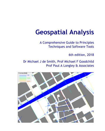
Copyright 2007-2018 All Rights reserved. Sixth Edition. Issue version: 2018-2No part of this publication may be reproduced, stored in a retrieval system or transmitted in any formor by any means, electronic, mechanical, photocopying, recording, scanning or otherwise, exceptunder the terms of the UK Copyright Designs and Patents Act 1998 or with the written permission ofthe authors. The moral right of the authors has been asserted. Copies of this edition are available inprint, electronic book and web-accessible formats. Users of mono print vesions should refer to theweb or special PDF versions for color images.Disclaimer: This publication is designed to offer accurate and authoritative information in regard tothe subject matter. It is provided on the understanding that it is not supplied as a form of professionalor advisory service. References to software products, datasets or publications are purely made forinformation purposes and the inclusion or exclusion of any such item does not imply recommendationor otherwise of the product or material in question.For more details please refer to the Guide’s website: 3-8 Hardback978-1-912556-04-5 Paperback978-1-912556-05-2 ebookThe cover image is OpenStreetMap contributors and shows the area around University CollegeLondon with the public GPS trace data for the location date and time viewed.
3D visualization of modeled road-related noise levels inan urbanized areaVisualization using CadnaA software, courtesy of Accon GmbH & DataKustik GmbH
Optimized service center location and allocated demandTripolis, in Arcadia, GreeceCoverage or p center location optimization problem. See Section 7.4.2 for more details. Mapproduced using S-Distance software (2006), courtesy of S A Sirigos
AcknowledgementsThe authors would like to express their particular thanks to the following individuals andorganizations: Accon GmbH, Greifenberg, Germany for permission to use the noise mapping images onthe inside cover of this Guide and in Figure 3-4; Prof D Martin for permission to use Figure 4-19 andFigure 4-20; Prof D Dorling and colleagues for permission to use Figure 4-50 and Figure 4-52; Dr KMcGarigal for permission to use the Fragstats summary in Section 5.3.4; Prof Wei Li and colleagues,China National Laboratory for High Speed Railway Construction for permission to use figures 4-69A and4-69B; Dr H Kristinsson, Faculty of Engineering, University of Iceland for permission to use Figure 4-70;Dr S Rana, formerly of the Center for Transport Studies, University College London for permission touse Figure 6-24; Prof B Jiang, Department of Technology and Built Environment of University of Gävle,Sweden for permission to use the Axwoman software and sample data in Section 6.3.3.2 and the insidecover page; Dr G Dubois, European Commission (EC), Joint Research Center Directorate (DG JRC) forcomments on parts of Chapter 6 and permission to use material from the original AI-Geostats website;Geovariances (France) for provision of an evaluation copy of their Isatis geostatistical software;F O’Sullivan for use of Figure 6-41; Profs A Okabe, K Okunuki and S Shiode (Center for SpatialInformation Science, Tokyo University, Japan) for use of their SANET software and sample data; and SA Sirigos, University of Thesally, Greece for permission to use his Tripolis dataset, the provision of hisS-Distance software, and comments on part of Chapter 7.Sections 8.1 and 8.2 of Chapter 8 are substantially derived from material researched and written byChristian Castle and Andrew Crooks (updated for the latest editions by Andrew) with the financialsupport of the Economic and Social Research Council (ESRC), Camden Primary Care Trust (PCT), andthe Greater London Authority (GLA) Economics Unit. Chapter 9 has been substantially written by GuyLansley of the UCL Consumer Data Research Centre. We would also like to express our thanks to themany users of the book and website for their comments, suggestions and occasionally, corrections.Particular thanks for corrections go to Bryan Thrall, Juanita Francis-Begay, Paul Johnson and Prof LiemTran.A number of the maps displayed in this Guide, notably those in Chapter 6, have been created using GBOrdnance Survey data provided via the EDINA Digimap/JISC service. These datasets and other GB OSdata illustrated are Crown Copyright. Every effort has been made to acknowledge and establishcopyright of materials used in this publication. The cover image is OpenStreetMap contributors andshows the area around University College London with the latest public GPS trace data for the locationdate and time viewed. Anyone with a query regarding any such item should contact the authors via theGuide’s website, www.spatialanalysisonline.comde Smith, Goodchild, Longley and Associateswww.spatialanalysisonline.com
7Table of Contents1 Introduction and terminology171.1 Spatial analysis, GIS and software tools201.2 Intended audience and scope251.3 Software tools and Companion Materials251.3.1GIS and related software tools261.3.2Suggested reading281.4 Terminology and Abbreviations1.4.1Definitions1.5 Common Measures and Notation3030381.5.1Notation381.5.2Statistical measures and related formulas402 Conceptual Frameworks for Spatial Analysis2.1 Basic jects592.1.4Maps602.1.5Multiple properties of places612.1.6Fields622.1.7Networks632.1.8Density estimation632.1.9Detail, resolution, and scale64Topology652.1.102.2 Spatial Relationships662.2.1Co-location662.2.2Distance, direction and spatial weights matrices662.2.3Multidimensional scaling682.2.4Spatial context682.2.5Neighborhood692.2.6Spatial heterogeneity69de Smith, Goodchild, Longley and Associateswww.spatialanalysisonline.com
82.2.7Spatial dependence702.2.8Spatial sampling702.2.9Spatial interpolation712.2.10Smoothing and sharpening722.2.11First- and second-order processes722.3 Spatial Statistics732.3.1Spatial probability732.3.2Probability density742.3.3Uncertainty742.3.4Statistical inference742.4 Spatial Data 4.3Interoperability772.4.4Conclusion773 Methodological Context793.1 Analytical methodologies813.2 Spatial analysis as a process853.3 Spatial analysis and the PPDAC model863.3.1Problem: Framing the question883.3.2Plan: Formulating the approach903.3.3Data: Data acquisition913.3.4Analysis: Analytical methods and tools933.3.5Conclusions: Delivering the results943.4 Geospatial analysis and model building953.5 The changing context of GIScience4 Building Blocks of Spatial Analysis1001034.1 Spatial and Spatio-temporal Data Models and Methods1054.2 Geometric and Related Operations1104.2.1Length and area for vector data1104.2.2Length and area for raster datasets1134.2.3Surface area114de Smith, Goodchild, Longley and Associateswww.spatialanalysisonline.com
94.2.4Line Smoothing and point-weeding1194.2.5Centroids and centers1214.2.6Point (object) in polygon (PIP)1284.2.7Polygon decomposition1294.2.8Shape1304.2.9Overlay and combination operations1324.2.10Areal interpolation1364.2.11Districting and re-districting1384.2.12Classification and clustering1434.2.13Boundaries and zone membership1584.2.14Tessellations and triangulations1674.3 Queries, Computations and Density1724.3.1Spatial selection and spatial queries1724.3.2Simple calculations1734.3.3Ratios, indices, normalization, standardization and rate smoothing1764.3.4Density, kernels and occupancy1804.4 Distance Operations1954.4.1Metrics1974.4.2Cost distance2024.4.3Distance Transforms2094.4.4Network distance2174.4.5Buffering2184.4.6Distance decay models2214.5 Directional Operations2254.5.1Directional analysis of linear datasets2264.5.2Directional analysis of point datasets2314.5.3Directional analysis of surfaces2334.6 Grid Operations and Map Algebra2354.6.1Operations on single and multiple grids2354.6.2Linear spatial filtering2364.6.3Non-linear spatial filtering2394.6.4Erosion and dilation2405 Data Exploration and Spatial Statistics5.1 Statistical Methods and Spatial Datade Smith, Goodchild, Longley and Associates243245www.spatialanalysisonline.com
105.1.1Descriptive statistics2485.1.2Spatial sampling2485.2 Exploratory Spatial Data Analysis2555.2.1EDA, ESDA and ESTDA2555.2.2Outlier detection2585.2.3Cross tabulations and conditional choropleth plots2615.2.4ESDA and mapped point data2645.2.5Trend analysis of continuous data2655.2.6Cluster hunting and scan statistics2655.3 Grid-based Statistics and Metrics2675.3.1Overview of grid-based statistics2675.3.2Crosstabulated grid data, the Kappa Index and Cramer’s V statistic2685.3.3Quadrat analysis of grid datasets2715.3.4Landscape Metrics2735.4 Point Sets and Distance Statistics2795.4.1Basic distance-derived statistics2805.4.2Nearest neighbor methods2805.4.3Pairwise distances2845.4.4Hot spot and cluster analysis2895.4.5Proximity matrix comparisons2945.5 Spatial Autocorrelation2955.5.1Autocorrelation, time series and spatial analysis2955.5.2Global spatial autocorrelation2985.5.3Local indicators of spatial association (LISA)3125.5.4Significance tests for autocorrelation indices3155.6 Spatial Regression3175.6.1Regression overview3175.6.2Simple regression and trend surface modeling3225.6.3Geographically Weighted Regression (GWR)3255.6.4Spatial autoregressive and Bayesian modeling3295.6.5Spatial filtering models3376 Surface and Field Analysis6.1 Modeling Surfaces6.1.1Test datasetsde Smith, Goodchild, Longley and Associates339341341www.spatialanalysisonline.com
116.1.2Surfaces and fields3426.1.3Raster models3446.1.4Vector models3476.1.5Mathematical models3486.1.6Statistical and fractal models3496.2 Surface Geometry3516.2.1Gradient, slope and aspect3516.2.2Profiles and curvature3576.2.3Directional derivatives3626.2.4Paths on surfaces3626.2.5Surface smoothing3646.2.6Pit filling3656.2.7Volumetric analysis3666.3 Visibility3676.3.1Viewsheds and RF propagation3676.3.2Line of sight3706.3.3Isovist analysis and space syntax3716.4 Watersheds and Drainage3736.4.1Drainage modeling3746.4.2D-infinity model3756.4.3Drainage modeling case study3766.5 Gridding, Interpolation and Contouring3776.5.1Overview of gridding and interpolation3786.5.2Gridding and interpolation methods3796.5.3Contouring3856.6 Deterministic Interpolation Methods3876.6.1Inverse distance weighting (IDW)3886.6.2Natural neighbor3916.6.3Nearest-neighbor3936.6.4Radial basis and spline functions3936.6.5Modified Shepard3956.6.6Triangulation with linear interpolation3966.6.7Triangulation with spline-like interpolation3966.6.8Rectangular or bi-linear interpolation3976.6.9Profiling397de Smith, Goodchild, Longley and Associateswww.spatialanalysisonline.com
126.6.10Polynomial regression3986.6.11Minimum curvature3986.6.12Moving average3996.6.13Local polynomial3996.6.14Topogrid/Topo to raster3996.7 Geostatistical Interpolation Methods4006.7.1Core concepts in Geostatistics4026.7.2Kriging interpolation4147 Network and Location Analysis7.1 Introduction to Network and Location Analysis4254277.1.1Terminology4277.1.2Source data4297.1.3Algorithms and computational complexity theory4307.2 Key Problems in Network and Location Analysis4317.2.1Overview - network and locational analysis4327.2.2Heuristic and meta-heuristic algorithms4397.3 Network Construction, Optimal Routes and Optimal Tours4497.3.1Minimum spanning tree4497.3.2Gabriel network4507.3.3Steiner trees4527.3.4Shortest (network) path problems4537.3.5Tours, travelling salesman problems and vehicle routing4587.4 Location and Service Area Problems4637.4.1Location problems4647.4.2Larger p-median and p-center problems4667.4.3Service areas4727.5 Arc Routing7.5.1Network traversal problems8 Geocomputational methods and modeling8.1 Introduction to Geocomputation8.1.1Modeling dynamic processes within GIS8.2 Geosimulation8.2.1Cellular automata (CA)de Smith, Goodchild, Longley and online.com
138.2.2Agents and agent-based models4898.2.3Applications of agent-based models4928.2.4Advantages of agent-based models4978.2.5Limitations of agent-based models4998.2.6Explanation or prediction?5008.2.7Developing an agent-based model5018.2.8Types of simulation/modeling (s/m) systems for agent-based modeling5038.2.9Guidelines for choosing a simulation/modeling (s/m) system5048.2.10Simulation/modeling (s/m) systems for agent-based modeling5068.2.11Verification and calibration of agent-based models5178.2.12Validation and analysis of agent-based model outputs5188.3 Artificial Neural Networks (ANN)5208.3.1Introduction to artificial neural networks5208.3.2Radial basis function networks5348.3.3Self organizing networks5368.4 Genetic Algorithms and Evolutionary Computing5438.4.1Genetic algorithms - introduction5438.4.2Genetic algorithm components5448.4.3Example GA applications5498.4.4Evolutionary computing and genetic programming5529 Big Data and Geospatial Analysis5559.1 Big Data and Research5589.2 Types of Big Data5619.2.1Human-sourced data5619.2.2Process-Mediated data5629.2.3Machine-Generated data5649.3 Challenges of Big Data5669.3.1Access5669.3.2Ethics5679.3.3Data Quality5689.3.4Repurposing Data5689.3.5Demographic Bias5699.3.6Spatial and temporal Coverage5719.3.7Unstructured Data572de Smith, Goodchild, Longley and Associateswww.spatialanalysisonline.com
149.3.8Data Linkage5739.3.9Tools and Skills57410 Resources57710.1 References57910.2 Appendices59910.2.1CATMOG Guides59910.2.2R-Project spatial statistics software packages60110.2.3Fragstats landscape metrics60410.2.4Web links608de Smith, Goodchild, Longley and Associateswww.spatialanalysisonline.com
ForewordThis 6th edition includes the following principal changes from the 2015 edition: weblinks and associatedinformation have been updated and/or added or removed as appropriate; errata identified in the 5th edition havebeen corrected; new material in Chapter 4.4 has been added with thanks to China National Railways; and thefinal Chapter has been substantially expanded, with a focus on Big Data and the issues such data raise forgeospatial research and analysis. Note that new versions of software tools referenced in the text have not beenre-run and re-tested so readers should refer to the latest versions of these software tools and theirdocumentation where appropriate.Geospatial Analysis: A Comprehensive Guide to Principles, Techniques and Software Tools originated as materialto accompany the spatial analysis module of MSc programmes at University College London delivered by theprincipal author, Dr Mike de Smith. The project was discussed with Professors Longley and Goodchild. They kindlyagreed to contribute to the contents of the Guide itself. As such, this Guide may be seen as a companion to thepioneering book on Geographic Information Systems and Science (now changed to Science and Systems) byLongley, Goodchild, Maguire and Rhind, particularly the chapters that deal with spatial analysis and modeling.Their participation has also facilitated links with broader “spatial literacy” and spatial analysis programmes.Notable amongst these are the GIS&T Body of Knowledge materials provided by the Association of AmericanGeographers together with the spatial educational programmes provided through UCL and UCSB. The formats inwhich this Guide has been published have proved to be extremely popular, encouraging us to seek to improve andextend the material and associated resources further. Many academics and industry professionals have providedhelpful comments on previous editions, and universities in several parts of the world have now developed courseswhich make use of the Guide and the accompanying resources. Workshops based on these materials have beenrun in Ireland, the USA, East Africa, Italy and Japan, and a Chinese version of the Guide (2nd ed.) has beenpublished by the Publishing House of Electronics Industry, Beijing, PRC, www.phei.com.cn in 2009.A unique, ongoing, feature of this Guide is its independent evaluation of software, in particular the set of readilyavailable tools and packages for conducting various forms of geospatial analysis. To our knowledge, there is nosimilarly extensive resource that is available in printed or electronic form. We remain convinced that there is aneed for guidance on where to find and how to apply selected tools. Inevitably, some topics have been omitted,primarily where there is little or no readily available commercial or open source software to support particularanalytical operations. Other topics, whilst included, have been covered relatively briefly and/or with limitedexamples, reflecting the inevitable constraints of time and the authors’ limited access to some of the availablesoftware resources. Every effort has been made to ensure the information provided is up-to-date, accurate,compact, comprehensive and representative - we do not claim it to be exhaustive. However, with fast-movingchanges in the software industry and in the development of new techniques and data sources it would beimpractical and uneconomic to publish the material in a conventional manner. Accordingly the Guide has beenprepared without intermediary typesetting. We would like to thank all those users of the book, for theircomments and suggestions which have assisted us in producing this latest edition.Mike de Smith, UK, Mike Goodchild, USA, Paul Longley, UK, 2018 (6th edition)de Smith, Goodchild, Longley and Associateswww.spatialanalysisonline.com
Chapter1
Introduction and terminology119Introduction and terminologyIn this Guide we address the full spectrum of spatial analysis and associated modeling techniques that areprovided within currently available and widely used geographic information systems (GIS) and associated software.Collectively such techniques and tools are often now described as geospatial analysis, although we use the morecommon form, spatial analysis, in most of our discussions.The term ‘GIS’ is widely attributed to Roger Tomlinson and colleagues, who used it in 1963 to describe theiractivities in building a digital natural resource inventory system for Canada (Tomlinson 1967, 1970). The history ofthe field has been charted in an edited volume by Foresman (1998) containing contributions by many of its earlyprotagonists. A timeline of many of the formative influences upon the field is provided in Longley et al. (2015,p20). The research makes the unassailable point that the success of GIS as an area of activity has been driven bythe success of its applications in solving real world problems.In order to cover such a wide range of topics, this Guide has been divided into a number of main sections orchapters. These are then further subdivided, in part to identify distinct topics as closely as possible, facilitatingthe creation of a web site from the text of the Guide. Hyperlinks embedded within the document enable users ofthe web and PDF versions of this document to navigate around the Guide and to external sources of information,data, software, maps, and reading materials.Chapter 2 provides an introduction to spatial thinking, described by some as “spatial literacy”, and addresses thecentral issues and problems associated with spatial data that need to be considered in any analytical exercise. Inpractice, real-world applications are likely to be governed by the organizational practices and procedures thatprevail with respect to particular places. Not only are there wide differences in the volume and remit of data thatthe public sector collects about population characteristics in different parts of the world, but there aredifferences in the ways in which data are collected, assembled and disseminated (e.g. general purpose censusesversus statistical modeling of social surveys, property registers and tax payments). Data collected by the privatesector, often as a result of the use of services that automatically gather information on events, locations andindividuals, present a further challenge (see Chapter 9 for an extended discussion of this issue).There are also differences in the ways in which different data holdings can legally be merged and the purposes forwhich data may be used — particularly with regard to health and law enforcement data. Finally, there aregeographical differences in the cost of geographically referenced data. Some organizations, such as the USGeological Survey, are bound by statute to limit charges for data to sundry costs such as media used for deliveringdata while others, such as most national mapping organizations in Europe, are required to exact much heaviercharges in order to recoup much or all of the cost of data creation. Analysts may already be aware of thesecontextual considerations through local knowledge, and other considerations may become apparent throughbrowsing metadata catalogs. GIS applications must by definition be sensitive to context, since they representunique locations on the Earth’s surface.This initial discussion is followed in Chapter 3 by an examination of the methodological background to GISanalysis. Initially we examine a number of formal methodologies and then apply ideas drawn from these to thespecific case of spatial analysis. A process known by its initials, PPDAC (Problem, Plan, Data, Analysis,Conclusions) is described as a methodological framework that may be applied to a very wide range of spatialanalysis problems and projects. We conclude Chapter 3 with a brief discussion on model-building, with particularreference to the various types of model that can be constructed to address geospatial problems.Subsequent Chapters present the various analytical methods supported within widely available software tools. Themajority of the methods described in Chapter 4 (Building blocks of spatial analysis) and many of those in Chapter6 (Surface and field analysis) are implemented as standard facilities in modern commercial GIS packages such asArcGIS, MapInfo, Manifold, TNTMips and Intergraph. Many are also provided in more specialized GIS products suchde Smith, Goodchild, Longley and Associateswww.spatialanalysisonline.com
20as Idrisi, GRASS, QGIS and ENVI. Note that GRASS and QGIS (which includes GRASS in its download kit) areOpenSource.In addition we discuss a number of more specialized tools, designed to address the needs of specific sectors ortechnical problems that are otherwise not well-supported within the core GIS packages at present. Chapter 5,which focuses on statistical methods, and Chapter 7 and Chapter 8 which address Network and Location Analysis,and Geocomputation, are much less commonly supported in GIS packages, but may provide loose- or closecoupling with such systems, depending upon the application area. In all instances we provide detailed examplesand commentary on software tools that are readily available. The final Chapter (Chapter 9) addresses issuesassociated with so-called Big Data.As noted above, throughout this Guide examples are drawn from and refer to specific products — these have beenselected purely as examples and are not intended as recommendations. Extensive use has also been made oftabulated information, providing abbreviated summaries of techniques and formulas for reasons of bothcompactness and coverage. These tables are designed to provide a quick reference to the various topics coveredand are, therefore, not intended as a substitute for fuller details on the various items covered. We providelimited discussion of novel 2D and 3D mapping facilities, and the support for digital globe formats (e.g. KML andKMZ), which is increasingly being embedded into general-purpose and specialized data analysis toolsets. Thesedevelopments confirm the trend towards integration of geospatial data and presentation layers into mainstreamsoftware systems and services, both terrestrial and planetary (see, for example, the KML images of Mars DEMsdeveloped by Google as part of the Google Earth project).Just as all datasets and software packages contain errors, known and unknown, so too do all books and websites,and the authors of this Guide expect that there will be errors despite our best efforts to remove these! Some maybe genuine errors or misprints, whilst others may reflect our use of specific versions of software packages andtheir documentation. Inevitably with respect to the latter, new versions of the packages that we have used toillustrate this Guide will have appeared even before publication, so specific examples, illustrations and commentson scope or restrictions may have been superseded. In all cases the user should review the documentationprovided with the software version they plan to use, check release notes for changes and known bugs, and look atany relevant online services (e.g. user/developer forums and blogs on the web) for additional materials andinsights.The web version of this Guide may be accessed via the associated Internet site: www.spatialanalysisonline.com.The contents and sample sections of the PDF version may also be accessed from this site. In both cases theinformation is regularly updated. The Internet is now well established as society’s principal mode of informationexchange and most GIS users are accustomed to searching for material that can easily be customized to specificneeds. Our objective for such users is to provide an independent, reliable and authoritative first port of call forconceptual, technical, software and applications material that addresses the panoply of new user requirements.1.1 Spatial analysis, GIS and software toolsOur objective in producing this Guide is to be comprehensive in terms of concepts and techniques (but notnecessarily exhaustive), representative and independent in terms of software tools, and above all practical interms of application and implementation. However, we believe that it is no longer appropriate to think of astandard, discipline-specific textbook as capable of satisfying every kind of new user need. Accordingly, aninnovative feature of our approach here is the range of formats and channels through which we disseminate thematerial.Given the vast range of spatial analysis techniques that have been developed over the past half century manytopics can only be covered to a limited depth, whilst others have been omitted because they are not implementedin current mainstream GIS products. This is a rapidly changing field and increasingly GIS packages are includingde Smith, Goodchild, Longley and Associateswww.spatialanalysisonline.com
Introduction and terminology21analytical tools as standard built-in facilities or as optional toolsets, add-ins or analysts. In many instances suchfacilities are provided by the original software suppliers (commercial vendors or collaborative non-commercialdevelopment teams) whilst in other cases facilities have been developed and are provided by third parties. Manyproducts offer software development kits (SDKs), programming languages and language support, scripting facilitiesand/or special interfaces for developing one’s own analytical tools or variants.In addition, a wide variety of web-based or web-deployed tools have become available, enabling datasets to beanalyzed and mapped, including dynamic interaction and drill-down capabilities, without the need for local GISsoftware installation. These tools include the widespread use of web-based Java, Javascript, AJAX and HTML5applications, and interactive Virtual Globe explorers, some of which are described in this Guide. They provide anillustration of the direction that many toolset and service providers are taking.Throughout this Guide there are numerous examples of the use of software tools that facilitate geospatialanalysis. In addition, some subsections of the Guide and the software section of the accompanying website,provide summary information about such tools and links to their suppliers. Commercial software products rarelyprovide access to source code or full details of the algorithms employed. Typically they provide references tobooks and articles on which procedures are based, coupled with online help and “white papers” describing theirparameters and applications. This means that results produced using one package on a given dataset can rarely beexactly matched to those produced using any other package or through hand-crafted coding. There are manyreasons for these inconsistencies including: differences in the software architectures of the various packages andthe algorithms used to implement individual methods; errors in the source materials or their interpretation;coding errors; inconsistencies arising out of the ways in which different GIS packages model, store and manipulateinformation; and differing treatments of special cases (e.g. missing values, boundaries, adjacency, obstacles,distance computations etc.).Non-commercial packages sometimes provide source code and test data for some or all of the analytical functionsprovided, although it is important to understand that “non-commercial” often does not mean that users candownload the full source code. Source code greatly aids understanding, reproducibility and further development.Such software will often also provide details of known bugs and restrictions associated with functions — althoughthis information may also be provided with commercial products it is generally less transparent. In this respectnon-commercial software may meet the requirements of scientific rigor more fully than many commercialofferings, but is often provided with limited documentation, training tools, cross-platform testing and/ortechnical support, and thus is generally more demanding on the users and system administrators. In manyinstances open source and similar not-for-profit GIS software may also be less generic, focusing on a particularform of spatial representation (e.g
5.2 Exploratory Spatial Data Analysis 255 5.2.1 EDA, ESDA and ESTDA 255 5.2.2 Outlier detection 258 5.2.3 Cross tabulations and conditional choropleth plots 261 5.2.4 ESDA and mapped point data 264 5.2.5 Trend analysis of continuous data 265 5.2.6 Cluster hunting and scan
