Transcription
RockToposOntinyentRockTopo climbing guides are intended to provide documented information, directions androutes descriptions for the rock climbing at the cliff or area covered by the guide.The guides are intended to supplement the local published guides to these climbing areas.These guides will be updated to reflect new routes and to provide current access details.RockTopo guides may be obtained by free download from the Internet.RockTopo guides may be distributed free of charge.A free climbing guide provided by lished 2006Page 48Copyright RockTopos 2006RockTopos ClimbingGuideCosta Blanca OntinyentA free climbing guide provided by lished 2005
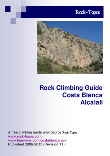
RockToposOntinyentOntinyentRockToposThere are many different climbing areas close to the town of Ontinyent in the ravines called the Barrancode L’Avern, the Barranco D’els Tarongers and the Barranco de Bocairent. The road follows the Barrancode Bocairent which makes the crags here a little noisy.Typically the limestone rock is excellent and characterized by tufas, overhangs and hanging stalactites.GENERAL APPROACHAll the crags are in an area south of Ontinyent (Onteniente), next to the major highways of the A-330,the A430 and the N-340. The climbing is easiest approached from the town by going towards the townsof Bocairent and Villena. From Ontinyent take the C3316 and immediately you can see Finestres on theright below the level of the road. On a hot day this area is poplular and the river is a cooling respite fromthe sun.Detailed approaches and where to park are included at the start of each sector.Page 2Copyright RockTopos 2006Copyright RockTopos 2006Page 47
RockToposOntinyentOntinyentRockToposThe SectorsNumber ofroutesTypicalgrades57a – 7c2. La Monja14V – 6c 3. El Pont96a – 7a23V – 6a 5. El Gegant196b – 7a 6.Cagallo delGegant36V – 7a 7. El Cami16V – 6b 1.Finestres4. La CequiaUnusual climbing past square holes in the rockVertical wall high above the road.8. El DepositA short slightly overhanging wall.226a – 7b9. La ViseraSteep climbing on mostly goods holds – good166b - 7b 10. PathsideAbove the path – newly developed – poor3?11. PatirasThe most extensive cliff35 6a – 7a 12. PylonOnly for those climbing 7c and above107c – 8b13. Tufa WallBlack wall covered in tufas – can be prone to badseepage96c - 7c14. La Via2615. Heavy26c - 7b16. Fragel37c - 8a17. Fragel46c – 7b18. La Cantera16bINFORMATIONEvery effort has been made to make this topo as accurate as possible however the information providedis on an as-is basis. The publication of this topo does not imply any right of access to the area.New information and updates to this guide are available athttp://d.1asphost.com/costablancarock/If you have any comments, additional routes or corrections please e-mail these torocktopos@hotmail.comPage 46Copyright RockTopos 2006Copyright RockTopos 2006Page 3
RockToposOntinyentOntinyentRockToposWHERE TO STAYIt is prohibited to camp anywhere in the sierra. There are hotels and hostels in the town of Ontinyent.WATERThere is water at Pou Clar and at the parking for El Camí. Also at the entrance to the ravine Bocairent,at the cross of Alfafara.ORIENTATIONThe different orientation of the sectors allow climbing throughout the year by choosing the right time ofthe day. It is possible to climb in the very hot summer by choosing a crag in the shade, but breeze isuseful. If it’s too hot you have the option to swim in the river.North facing: La Monja, El Pont and Pou Clar.South facing: La Cequia and Patirás.West facing: La Via and El Gegant.EQUIPMENT & HEIGHTAll the major areas are equipped with expansion bolts with occasionally resin bolts. All the routes can beclimbed with a 60 meter rope as the belays are less than 30 meters except "les mil y una nit" on the cliffLa Via, where there is an belay station halfway up.Page 4Copyright RockTopos 2006Copyright RockTopos 2006Page 45
RockToposOntinyentOntinyentRockToposSector 1: Finestres (Barranc de l Avern - Pou Clar)Finestres and La Monja are visble from the parking close to Pou Clar, 2km from Ontinyent. This wall ischaracterised by the square holes which are the openings to small rooms inside the rock. The sectorfaces east and receives the sun in the earlier morning.Approach5 minutesThe routes are described from left to right.Page 44Copyright RockTopos 20061.- Per a Calfar .18m. Climb the left edge of the wall.7a?2.- Putos Hijos de Pou Clar .16m. Through the bulge past the square hole.?3.- Entre Morsas .16m.7c4.- KK Lorsai .16m.7b5.- El Maromo de las Raiban . 16m. Clima direct to the righthand hole in the wall.7aCopyright RockTopos 2006Page 5
RockToposOntinyentSector 2: La Monja (Barranc de l Avern, Pou Clar)La Monja is almost north facing so avoiding the sun for most of the day. It is also in the bottom of thegorge so it is sheltered from the winds. See the approach and parking for Finestres.OntinyentRockToposGraded List9a8c 8c8b 8b8a 8a7c Approach5 minutes7c7b 7b7a 7aThis section is described from left to right.1. Escalullo .m.V 2. El jete dels escolars .m.6c 3. Diedre flequillo .m.V 4. Placa flequillo .m.V5. Salva .m.V 6. Iternauta .m.7a7. Dos germans .m.6b Page 66c 6c6b Copyright RockTopos 20066b6a 6aCopyright RockTopos 2006Page 43
RockToposOntinyentSector 18: La Cantera (Barranc de Bocairent)Approach8 minutes1. La dona del Martin .m. Page 42Copyright RockTopos 2006OntinyentRockTopos8. Xapa Xina . .m.6c/6c 9. Marilo . .m.6c10. Queimada .m.7b11. Monja .m.A112. Pilotaris . .m.6b13. Burila alco ana .m.A114. El daurat .m.A1/6c6bCopyright RockTopos 2006Page 7
RockToposOntinyentSector 3: El Pont (Barranc de l Avern, Pou Clar)El Pont is really the continuation of La Monja further up the ravine. Approach via the C3316 andafter crossing the river there is a sharp right bend. Just a round this there is a track leading off to theright. There is parking here for a few cars. Walk back down the ravine to the climbing.OntinyentRockToposSector 17: Fraguel Rock II (Barranc de Bocairent)Heavy Pescador and Fragel Rock I and II: After the end of the two-lane road, leave the car on theright of the road. Go on foot along the road to where you can identify the sectors.Approach8 minutesApproach5 minutesThe routes are described from left to right.1. Catarata de merda .m. 6b2. Hector verdu .m.6a3. Vicente Morales .m.6b 4. Quarre pa 2 vias .m.6a-5. Pepe soplillo y sus moquillos .m.6a6. Disetu .m.6c7. El corsari .m.7aPage 8Copyright RockTopos 20061.- Abanico de cristal .m. 7a2.- ? .m. ?3.-? .m. 6c4.-? .m. 7b?Copyright RockTopos 2006Page 41
RockToposOntinyentSector 16: Fraguel Rock I (Barranc de Bocairent)OntinyentRockTopos8. Balido bolilla . .m.6b 9. Sangul .m.6c Approach8 minutes1. La cachima del moro .m.2. La banana de la mora .m. 6c 7c3. Akbara .m. 8aPage 40Copyright RockTopos 2006Copyright RockTopos 2006Page 9
RockToposOntinyentSector 4: La Cequia (Barranc de l Avern)OntinyentRockToposSector 15: Heavy Pescador (Barranc de Bocairent)Take the C3316 and park as for El Pont. For La Cequia, El Gegant and El Cagalló del Gegant godown under the bridge along a well marked path. When the path disappears there is a smaller paththrough the reeds to a small ditch at the base of the wall. La Cequia is the cliff running up thehillside. It is south-west facing and will catch the wind.Approach10 minutesThe routes are described from left to right.1. Espero lunchinin .m.2. Ricmos . .m.V Approach8 minutes1. Alcoiana . .m. 7b2. Heavy Pescador . .m. 6c 3. Ekus .m.V V4. Trogolitro .m. V5. Petxina . .m. 6a6. El senor de los anillos .m. 6a7. Manduca . .m. 6a 8. Comic’s . .m. 6b Page 10Copyright RockTopos 2006Copyright RockTopos 2006Page 39
RockToposOntinyentOntinyentRockTopos9. Cuentos chicos .m. 10. Joli .m. 6a V 11. Flipat perdut per un canut .m.6a 12. Avi-cola .m. 13. Garbancito .m. 14. Avi-guai . .m.V 15. Mongolo .m.V 16. Magachi .m.V 17. Loca la bosina .m.6a 18. Carmaic .m.V 19. Torta .m.V 20. Piruli .m.21. Nyanyes .m.6aV V 22. Caballo molames .m.V23. Pistoles .m.Page 38Copyright RockTopos 2006Copyright RockTopos 2006 VVPage 11
RockToposOntinyentSector 5: El Gegant (Barranc de l Avern)Ontinyent10. No talies el telix .30m.RockToposThis impressive sheet of rock sits high above the valley floor and offers some superb face routes.Some of the climbs are ready for a re-bolting, though the gear is at least adequate. This faces south–west and receives the afternoon sun. From the parking go under the bridge, cross the river bed andscramble up to the water conduit. Go left along this and cross over it and scramble up the ravineside, going left of the pinnacle to reach two trees on the ridge. Behind these take the rocky band viaa chimney to the second pylon on the ridge. Just past this take the ramp line down to reach theupper part of the wall. This takes 10 minutes from the parking. 6b11. El cerdo volador .30m. 6c12. Baixca 41 .30m. 6c13. Mocador blau.30m. 6b13a Unknown .34m. ?14. Calla .30m. 6b15. Les mil I una nit . 7b16. Orgulio blanco.30m. 6b17. La taca roja .30m. 6c18. Sit e dicen que cal .30m. 7b19. Luz artificial .28m. 6c20. Mollerunga .28m. 6a 21. Que palissa .20m. 6a6a22. Cinc-zero .20m. 6a V *23. Si, que .20m. 6a24. Pioilo .20m. 6a25. Cap arnut .20m. V26. Que facil .20m. V35m. Note there is a belay half-way up the climb.Approach10 minutesThe routes are described from left to right.1. Bamcalina .15m. Poor line up the left edge of the wall. 2. Satiro . 30m. Climb the rib past old bolts and threads. Some traditional gear is requied.3. Milotxo . V *28m.The edge of the face. Traverse left along the ledge and take the line of new bolts, then older oneshigher up.4. Bordi .28m.Trend lightly left up the rib and the obvious thin crack. 6a **5. En un moment . 6b **28m.As for Bordi but follow the line of new bolts to the right. Sustained climbing.6. Pinoxo .28m.The line of older bolts up the black streak. 6a *Page 12Copyright RockTopos 2006Copyright RockTopos 2006Page 37
RockToposOntinyentSector 14: La Vía (Barranc de l Avern)Ontinyent7. J.M.Tempranmillo .28m.The yellow streak with old bolts.RockToposPared de la Via: Continue along the main road, up the valley for 1.4km and leave the car on theleft where you leave the river. In front of you is the cliff above you rising above the railwayembankment. It is the highest cliff with an extensive number of routes. 6b *8. Sangunsa . 28m. The pillar of grey rock to the right. Protected by old bolts and threads.6c **9. Botamons .6c **28m. Climb 10m to the wriggling crack and black drainage streak and continue in a direct line above.10. Sandalio . 7a ***28m. A tricky lower wall leads to a grassy ledge. Climb scoops and bulges in the upper wall.11. Sanson s escora . 7b **28m. Up to the right side of the ledge and climb to a hard finís. The lower off is left of the bush.12. Man kane .28m. Excellent line of new bolts. 7a **13. Hector .28m. The blue bolts mark this line. Tricky upper rib. 7a ***14. Morir d’amor .20m. The left-hand line up the wall. 7b **15. Tot ras .20m. Pass left of the deep hole. 7a **6a 16. Sesion de noche .20m. Gain the deep hole from the right. 6c **6b 17. Te de tot .20m. The direct line to the right. 6b *7a The final two routes are a further 50m to the right.18. Anillo de cuero .15m. The left line. 6b *6c 19. Puntmort .14m. The right line. 7a *Approach8 minutesThe routes are described from left to right.1. Capol .12m. The awkward leaning crack. 2. Brimonster .12m. The overhanging crack.3. El principle .18m. The white rib and thin crack line.4. Alex .18m. The grey steak and the yellow streak above. 5. Orelles curtes . 7a26m. The wall passing left of the flake, the bulge (crux) then trend right to the lower off.6. Orelles llargues .26m. Yellow wall—right of the flake and finishing up the leaning wall.7. Johny Mendieta .28m.8. La ley del agarre .28m. The next route is 20m to the right of the orange wall.6c 6a 6c 9. Caxipolla .30m. 6cPage 36Copyright RockTopos 2006Copyright RockTopos 2006Page 13
RockToposOntinyentOntinyentRockToposSector 6: El Cagalló del Gegant (Barranc de l Avern)This sector is opposite the road from the parking and just above the water channel - the approachtaking about 3 minutes. From the parking place, take the track under the bridge and cross the riverbed. Scramble to the water conduit and go right until it’s possible to cross over using a plank whichbrings you to the base of the wall.Facing south-west it is sheltered and gets a lot of sun.Approach3 minutes8. ? .m. Start below the platform and climb the smoother wall on tufas. 7b *9. ? . .m. Project10. ? .m. At the very right side of the crag climb the large tufas.6c *The routes are described from left to right.1.- S has golo .18m. 4m left of the bridge, fierce pocket pulling through the initial bulge.7a 2.- Barrufets . 6c *18m. Use pocket through the right edge of the smooth bulge. Easier up the rib to an old belay.3.- Pitufos . 6a *18m. Take the rib immediately right of the bulges. Sustained climbing with fingery moves to reach thethin crack.4.- Pelawaudios . 6a *18m. Aim for the yellow scar at 6m, go through the bulge and steep wall above.5.- Esperó boxerini . 6a *18m. The wall below the prominent arete high up the buttress. The arete is very pleasant. Lower off tothe left.7.- Dolores .18m. The line of new bolts. 6a *8.- Tirali Calceti . 6a 18m. From the cave at the base of the wall climb take the narrowing slab, organge groove and finalleaning wall.9.- Cap de caixo .14m. Climb left of the yellow flake. 6a10.- Dolores con piano .14m. New bolts through the overlap and up the orange wall. 6aPage 14Copyright RockTopos 2006Copyright RockTopos 2006Page 35
RockToposOntinyentSector 13: Tufa Wall - Barranc dels TarongersFrom the parking follow the path, passing Patirás and Pylon until you reach the old ruined mill house. Find apath leading from behind the mill house next to a water trough and follow this along the right bank eventuallytraversing slabby rock to reach the tufa laden crag. The approach takes 20-25 minutes from the parking place.OntinyentRockTopos11.- Flamingo .14m. The grey rock and the shallow groove. 6a12.- Tortugo .12m. Climb the overhangs and broken flake left of the easy groove. 6a13.- L oratge .10m. The left-hand flake. IV14.- Obri llaunes .10m. The shallow chimney. IVTo the right is slanting ramp and then next buttress.15.- Sopa de ganso .20m.The left facing orange crack. 6a 16.- Va que es per avui . . 6a *20m. Start right of the large flake cross the overhang to reach the thin crack. Good sustained climbing.17.- Rocabola . 6a *20m.The red flake provides a steep start. Continue up the left side of the bulging rib.Approach25 minutesThe routes are described from left to right.1. ? . 6c **25m. At the left side of the crag. Climb the slab to a steep wall and pull into the cave. Climb through the roof of this andmake a long reach to gain better holds.2. ? . 6c ** 7a ***18.- Panxa verda .20m. The green bolts mark this horrendously hard route. 7b **19.- Mitja via .20m. Direct through the smooth scoop starting as for Panxa Verda. 7a *20.- M han fotut .18m. The right side of the scoop is a fierce fingery route. 7b *21.- Bon tacte .20m. The right-hand finish to M’han Fotut. 7a To the right the buttress is capped by a narrow roof. The rock is good after the loose ledges at the base.22.- Si hay sirocco no te comas el coco .18m. The tilted grey rock—trend left to the belay. 6c 25m. Very obvious line up the large tufas. Pull slightly rightwards where it steepens, crux, and then more easily to abelay.23.- Ara no bailo .18m. Through the lower bulges via the hanging ramp/niche. 6c4. ? .7a *24.- Marti tirali . .18m. Pull over the rightside of the bulge and goleft up the fine grey wall. 6b *Project25.- La penga dels botifarres .18m. The direct line above the start of the last line.25m. Slightly easier line 3 metres to the right.3. ? . 25m. Line to the right joining route 3 at the bulge.5. ? .m. 6a *6. ? . 7c **m. From the platform starting just left of the tree climb the tufa’s up the overhanging wall.7. ? .7c **m. From behind the tree climb the pocket and tufa cover wall to reach a large hole. Pull through the roof aboveto the belay.Page 34Copyright RockTopos 2006Copyright RockTopos 2006Page 15
RockToposOntinyentSector 6: El Cagalló del Gegant (Barranc de l Avern)26.- Pablito clavó un clavito .18m.27.- De repent en parapent18m.28.- Secció homos .18m.29.- Desastre pe un sastre .18m.30.- Xe quin bolet .18m. 6b OntinyentRockTopos9. ? . 18m. As for route 8 to the roof. Pull past the hole and up the stepped wall above.8a ***10. ? . 20m. Climb tufa’s up the wall and cross the wide roof following the crack line.8b ***6c 6c 6b 6aTo the right is a rock tower above the dam.31.- Que content que estic .18m.32.- Relajació i recreo .12m.33.- Opa ostil .12m.34.- Cap finet .10m.35.- Mano guarra .10m.36.- La trampa .10m.Page 16 6c V 7a 6b 7a 6aCopyright RockTopos 2006Copyright RockTopos 2006Page 33
RockToposOntinyentOntinyentRockToposSector 12: Pylon (Barranc dels Tarongers)From the parking area follow the footpath next to the river passing Patirás and shortly alter crossing thestream bed find a foot path taking a steeper line up the hillside. Aim for the cliff close to the electricitypylon. The approach takes about 15 minutes from the parking place.Approach15 minutesThe routes are described from left to right.1. ? .18m. 2. ? .18m.3. ? .18m. Large tufa leading to the roof. Finish at the lip.4. ? .18m. Tufa line to the right and final roof. Project8b 8a *** Project5. Soul Taker .18m. Excellent looking overhanging shallow scoop line running up the wall. 8a ***6. ? .18m. Very steep line up the bulging arête. 8b ***7. ? .18m.
RockTopo climbing guides are intended to provide documented information, directions and routes descriptions for the rock climbing at the cliff or area covered by the guide. The guides are intended to supplement the local published guides to these climbing areas. These guides will be update
