Transcription
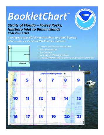
BookletChart Straits of Florida – Fowey Rocks,Hillsboro Inlet to Bimini IslandsNOAA Chart 11469A reduced-scale NOAA nautical chart for small boatersWhen possible, use the full-size NOAA chart for navigation.
Published by theNational Oceanic and Atmospheric AdministrationNational Ocean ServiceOffice of Coast Surveywww.NauticalCharts.NOAA.gov888-990-NOAAWhat are Nautical Charts?Nautical charts are a fundamental tool of marine navigation. They showwater depths, obstructions, buoys, other aids to navigation, and muchmore. The information is shown in a way that promotes safe andefficient navigation. Chart carriage is mandatory on the commercialships that carry America’s commerce. They are also used on every Navyand Coast Guard ship, fishing and passenger vessels, and are widelycarried by recreational boaters.What is a BookletChart ?This BookletChart is made to help recreational boaters locatethemselves on the water. It has been reduced in scale for convenience,but otherwise contains all the information of the full-scale nauticalchart. The bar scales have also been reduced, and are accurate whenused to measure distances in this BookletChart. See the Note at thebottom of page 5 for the reduction in scale applied to this chart.Whenever possible, use the official, full scale NOAA nautical chart fornavigation. Nautical chart sales agents are listed on the Internet athttp://www.NauticalCharts.NOAA.gov.This BookletChart does NOT fulfill chart carriage requirements forregulated commercial vessels under Titles 33 and 44 of the Code ofFederal Regulations.Notice to Mariners Correction StatusThis BookletChart has been updated for chart corrections published inthe U.S. Coast Guard Local Notice to Mariners, the National GeospatialIntelligence Agency Weekly Notice to Mariners, and, where applicable,the Canadian Coast Guard Notice to Mariners. Additional chartcorrections have been made by NOAA in advance of their publication ina Notice to Mariners. The last Notices to Mariners applied to this chartare listed in the Note at the bottom of page 7. Coast Pilot excerpts arenot being corrected.For latest Coast Pilot excerpt visit the Office of Coast Survey website t w.php?book 4.(Selected Excerpts from Coast Pilot)Between Jupiter Inlet and Lake WorthInlet, a distance of about 10.5 miles, thecoast is clear of shoals with the 10-fathomcurve about 1 mile offshore. A fishing pierextends about 340 yards seaward fromabout 26 53'37"N., 80 03'24"W.Lake Worth Inlet is a dredged cut throughthe barrier beach 11 miles south of JupiterInlet Light and 31 miles north of HillsboroInlet Entrance Light. The entrance isprotected by two jetties and the cut byrevetments.Port of Palm Beach is a deepwater port development 1.1 miles west ofthe entrance to Lake Worth Inlet. The port borders the communities ofRiviera Beach on the north and West Palm Beach on the south. It is 259miles south of Jacksonville and 68 miles north of Miami. There is extensive barge traffic. An extensive roll-on/roll-off operation is conducted inthe Bahama Island trade. All of the wharves and warehouses are ownedby the Port of Palm Beach District.Coast Guard Station.–Lake Worth Inlet Coast Guard Station is inside theentrance about 0.7 mile north of Peanut Island on the west side of theIntracoastal Waterway.Anchorages.–Two offshore anchorage grounds are close north andsouth of the channel entrance. (See 110.1 and 110.185, chapter 2, forlimits and regulations.) There is no deepwater anchorage in the harbor.Anchorage for craft drawing up to 8 feet is available in the vicinity ofPalm Beach.Dangers.–A reef in the form of a ridge with scattered boulders extendsfor about 300 yards eastward of Peanut Island about 25 feet north ofthe improved channel. The reef, with a least depth of about 4 feet overit, is extremely dangerous. On the ebb, the current sets across the reefin a northeasterly direction. Two fish havens are 0.7 and 1.5 miles offthe north side of the entrance and another is 1.5 miles off the southentrance.Pilotage, Port of Palm Beach.–Pilotage is compulsory for foreign vesselsand for U.S. vessels under register in the foreign trade and drawingmore than 7 feet of water. Pilotage is optional for U.S. coastwise vesselswhich have a pilot aboard licensed by the Federal Government.The Port of Palm Beach is served by Palm Beach Pilots Association, atRiviera Beach Marina, 200 E. 13th Street, Suite B, Riviera Beach, FL33404; telephone 561-845-2628, fax 561-845-2644. The office/stationmonitors VHF-FM radiotelephone channel 16 and works on channel 14.Harbor regulations.–Copies of the Port Tariff may be obtained at theoffices of the Port of Palm Beach District at the Maritime Office Buildingin Riviera Beach. The Port Operations Manager assigns berths andenforces the harbor regulations. The Port of Palm Beach is a publiccorporation created by the State Legislature. Port regulations state itshall be unlawful for any vessel, boat, barge, or other watercraft of anykind to anchor in the channel or turning basin, except in cases of actualemergency.The coast between Lake Worth Inlet and Port Everglades is fairly bold.The 20-fathom curve runs parallel to the beach and for a greater part ofthe distance is less than 2 miles from it. Several wrecks and obstructionsare within 0.5 mile of the shore.Palm Beach, a resort on the narrow island between Lake Worth and thesea, is connected to West Palm Beach by highway bridges. The oceanpier here is used only for amusement purposes. Several other towns andcities are along the shores of Lake Worth.Bakers Haulover Inlet has been dredged through the barrier beach atthe north end of Biscayne Bay, 11.6 miles south of Port Everglades, toprovide circulation of water in the bay. The channel leads westwardthrough the inlet, thence northward to a boat basin on the east side ofthe channel and connects with the Intracoastal Waterway north of thebasin and through a cut opposite the basin. In 2008, the controllingdepth was 10.9 feet through the inlet to the highway bridge, thence 10feet in the basin and 8 feet in the channels leading to the IntracoastalWaterway. Route A1A highway bridge over the inlet has a fixed spanwith a clearance of 32 feet; an overhead power cable just east of thebridge has a clearance of 53 feet.The Florida Department of Natural Resources has established a slow-nowake speed zone in the Intracoastal Waterway where the channelsconverge in the vicinity of Bakers Haulover Inlet.U.S. Coast Guard Rescue Coordination Center24 hour Regional Contact for EmergenciesRCC Miami2Commander7th CG DistrictMiami, FL(305) 415-6800
Lateral System As Seen Entering From Seawardon navigable waters except Western RiversPORT SIDEODD NUMBERED AIDSGREEN LIGHT ONLYFLASHING (2)FLASHINGOCCULTINGQUICK FLASHINGISOPREFERRED CHANNELNO NUMBERS – MAY BE LETTEREDPREFERRED CHANNELNO NUMBERS – MAY BE LETTEREDPREFERRED CHANNEL TOSTARBOARDTOPMOST BAND GREENPREFERRED CHANNELTO PORTTOPMOST BAND REDGREEN LIGHT ONLYRED LIGHT ONLYFLASHING (2)FLASHINGOCCULTINGQUICK FLASHINGISORED LIGHT ONLYCOMPOSITE GROUP FLASHING (2 1)COMPOSITE GROUP FLASHING (2 1)812"1"Fl G 6sLIGHTGR "A"Fl (2 1) G 6sG "9"Fl G 4s5DAYBEACON"2"Fl R 6sRG "B"Fl (2 1) R 6sG"5"UCGR"U"RGN "C"GRC "S"CANG6RG"G"NUNFor more information on aids to navigation, including those on Western Rivers, please consult the latest USCG Light List for your area.These volumes are available online at http://www.navcen.uscg.govRN "6"NUNR "8"Fl R 4sLIGHTED BUOYLIGHTLIGHTED BUOYGC "1"CANSTARBOARD SIDEEVEN NUMBERED AIDS2DAYBEACONR"2"
VHF Marine Radio channels for use on thewaterways:Channel 6 – Inter-ship safety communications.Channel 9 – Communications between boats andship-to-coast.Channel 13 – Navigation purposes at bridges, locks, andharbors.EMERGENCY INFORMATIONChannel 16 – Emergency, distress and safety calls toCoast Guard and others, and to initiate calls to othervessels. Contact the other vessel, agree to another channel, and then switch.Channel 22A – Calls between the Coast Guard and the public. Severe weatherwarnings, hazards to navigation and safety warnings are broadcast here.Channels 68, 69, 71, 72 and 78A – Recreational boat channels.Distress Call Procedures Make sure radio is on. Select Channel 16. Press/Hold the transmit button. Clearly say: “MAYDAY, MAYDAY, MAYDAY.” Also give: Vessel Name and/or Description;Position and/or Location; Nature ofEmergency; Number of People on Board. Release transmit button. Wait for 10 seconds — If no responseRepeat MAYDAY call.Getting and Giving Help — Signal other boaters using visual distress signals (flares,orange flag, lights, arm signals); whistles; horns; and on your VHF radio. You arerequired by law to help boaters in trouble. Respond to distress signals, but do notendanger yourself.HAVE ALL PERSONS PUT ON LIFE JACKETS!NOAA Weather Radio All Hazards (NWR) is a nationwide network of radio stations broadcasting continuousweather information directly from the nearest National Weather Service office. NWR broadcasts official WeatherService warnings, watches, forecasts and other hazard information 24 hours a day, 7 days a week.http://www.nws.noaa.gov/nwr/Quick ReferencesNautical chart related products and information - http://www.nauticalcharts.noaa.govQRInteractive chart catalog - .shtmlReport a chart discrepancy - hart and chart related inquiries and comments - page ContactUsChart updates (LNM and NM corrections) - http://www.nauticalcharts.noaa.gov/mcd/updates/LNM NM.htmlCoast Pilot online - htmTides and Currents - http://tidesandcurrents.noaa.govMarine Forecasts - http://www.nws.noaa.gov/om/marine/home.htmNational Data Buoy Center - http://www.ndbc.noaa.gov/NowCoast web portal for coastal conditions - http://www.nowcoast.noaa.gov/National Weather Service - http://www.weather.gov/National Hurrican Center - http://www.nhc.noaa.gov/Pacific Tsunami Warning Center - http://ptwc.weather.gov/Contact Us - tmFor the latest news from Coast Survey, follow @NOAAchartsThis Booklet chart has been designed for duplex printing (printed on front and back of one sheet). If a duplex optionis not available on your printer, you may print each sheet and arrange them back-to-back to allow for the properlayout when viewing.NOAA’s Office of Coast SurveyThe Nation’s Chartmaker
Bakers Haulover Inlet has been dredged through the barrier beach at the north end of Biscayne Bay, 11.6 miles south of Port Everglades, to provide circulation of water in the bay. The channel leads westward through the inlet, thence northward to a boat basin on the east side of the channel and connects with the Intracoastal Waterway north of the