Transcription
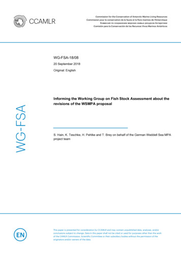
Commission for the Conservation of Antarctic Marine Living ResourcesCommission pour la conservation de la faune et la flore marines de l’AntarctiqueКомиссия по cохранению морских живых pесурсов АнтарктикиComisión para la Conservación de los Recursos Vivos Marinos AntárticosWG-FSA-18/0820 September 2018WG-FSAOriginal: EnglishInforming the Working Group on Fish Stock Assessment about therevisions of the WSMPA proposalS. Hain, K. Teschke, H. Pehlke and T. Brey on behalf of the German Weddell Sea MPAproject teamThis paper is presented for consideration by CCAMLR and may contain unpublished data, analyses, and/orconclusions subject to change. Data in this paper shall not be cited or used for purposes other than the workof the CAMLR Commission, Scientific Committee or their subsidiary bodies without the permission of theoriginators and/or owners of the data.
Informing the Working Group on Fish Stock Assessment about the revisions of the WSMPAproposalIn 2016, the EU submitted document CCAMLR-XXXV/18 containing a draft Conservation Measure forestablishing a MPA in the Weddell Sea (WSMPA) to CCAMLR 2016 (see map in Annex 1).A revised draft WSMPA Conservation Measure has been submitted by the EU to CCAMLR 2018. TheAnnexes to this document contain the following extracts of this revised draft WSMPA ConservationMeasure:Annex 2:Map of the revised WSMPA proposal to be presented to CCAMLR 2018;Annex 3:Detailed map (Statistical Subarea 48.6) of the revised WSMPA to be presented toCCAMLR 2018 with a draft table to be used in investigating the establishment ofreference areas in Subarea 48.6 to enable comparisons between fished andunfished areas;Annex 4:Extract from the revised WSMPA Conservation Measure to be submitted toCCAMLR 2018: Weddell Sea Marine Protected Area – Management Plan;Annex 5:Extract from the revised WSMPA Conservation Measure to be submitted toCCAMLR 2018: Weddell Sea Marine Protected Area – Research and MonitoringPlan.This document informs FSA about the main differences between the 2016 and the 2018 version of thedraft WSMPA proposal.1.Closing the gap on the eastern coast of the Antarctic PeninsulaThe 2016 WSMPA proposal consisted of two distinct geographical parts, which were separated by agap on the eastern side of the Antarctic Peninsula (see Annex 1, Fig.1).The 2018 WSMPA proposal now includes this area, thereby unifying the previously two separate partsinto one coherent WSMPA. The reasons for doing so are:a.one of the main comments raised with respect to the 2016 WSMPA proposal was thatthere was only very limited flexibility as regards potential fisheries operations outside ofthe fisheries research blocks 48.6-3, 48.6-4 and 48.6- 5 agreed under CCAMLR CM 41-04.In order to achieve the agreed conservation targets also for adult Antarctic toothfish, thegap on the eastern side of the Antarctic Peninsula was closed, protecting additionalhabitat of adult Antarctic toothfish in Statistical Subarea 48.5.b.Under CCAMLR Conservation Measure 24-04, the area, where on 12 July 2017 a 5,800 km2section broke off the Larsen C Ice Shelf, has been designated for a period of 10 years as aStage 2 Special Area for Scientific Study. By closing the gap, this Special Area for ScientificStudy will be included in the WSMPA and will become part of the WSMPA GeneralProtection Zone after the expiry of the 10 years. This ensures that this area will be subjectto a more longer-lasting conservation, management and research and monitoringapproach under CCAMLR.1
2.Adjustment of the habitat of adult Antarctic toothfish in Statistical Subareas 48.6 and 48.5In the 2016 WSMPA proposal, the habitat of adult Antarctic toothfish was indicated as between 550mand 2300m.However, subsequent analyses and modelling, as presented to SAM 2017 (Teschke et al. 2017) showedthat the habitat of adult Antarctic toothfish in Statistical Subareas 48.6 and 48.5 was better expressedto range from 550m to 2100m. This depth range comprises the habitat of 90% of adult Antarctictoothfish in these areas.3.Establishment of scientific reference areas in Statistical Subarea 48.6In accordance with paragraph 2 (iii) of CCAMLR Conservation Measure 91-04, one of the objectives ofthe WSMPA is the establishment of scientific reference areas for monitoring the effects of harvestingon Antarctic marine living resources.In order to study the ecosystem effects of D. mawsoni fishing activities, Germany had considered thatsuch reference areas would have to be established in the potential habitat of adult toothfish (waterdepths between 550 - 2100m) in Statistical Subarea 48.6. The reference areas should also contributeto the achievement of the Special Objectives of the WSMPA. In these reference areas, the GeneralProtection Zone (GPZ) management requirements would apply.Germany outlined these considerations at WG SAM 2018 and the CCAMLR Workshop on SpatialManagement (WS-SM-18) with a view to seeking advice from both meetings as regards the design,selection, location, size and number of reference areas. The groups responded as follows:WG-SAM-18 (see preliminary report §§ 8.3 - 8.4) "The Working Group recognised the need for reference areas (i.e. fished and unfished areas)as a tool for studying the effects of fishery on biodiversity. The Working Group noted that whileit was unlikely to find a fished and an unfished area that are otherwise ecologically identical,this may not be necessary if there are gradients of the levels of historical fishing acrossotherwise comparable areas with which to examine potential impacts. It also noted thatmethods existed for estimating the historical fishing footprint in the Convention Area and thatthese could be updated to inform this process (WG-FSA-15/62 Rev. 1). The Working Group agreed that there was a range of criteria that could be used to identifyappropriate reference areas and that these would depend on the specific objective of thecomparisons. The Working Group recommended that the approach used in Figure 1 tocategorise the information available relative to the selection of research areas in Division58.4.1 could be a useful way to approach selection of reference areas."WS-SM-18 (see preliminary report § 3.63) "the location and size of reference areas would depend on the scientific question/hypothesisand may involve areas inside or outside MPAs; investigations of the potential impact of longline fishing on benthic ecosystems (i.e. whetherlonglines cause physical disturbances on the benthic fauna) could be carried out within theexisting research blocks in Subarea 48.6 by comparing fished areas (i.e. known longline tracks)with unfished areas between these tracks; large-scale unfished reference areas outside the existing fisheries research blocks might beused to answer other scientific questions, for example whether longline fishing for D. mawsoni2
has wider trophic impacts. This could be accompanied by a statistical power analysis todetermine that the sampling design would be able to detect such impacts; the most appropriate location and size of such reference areas should be determined basedon a set of parameters specific to the question to be answered. These parameters could becompiled in form of a table (see example in Table 2) as a transparent decision-support tool toaid the establishment of the reference area by indicating the occurrence of theseparameters/attributes (e.g. in terms of high, medium or low) within the investigated area."Taking into account this very helpful and most welcome expert advice, Germany has further developedTable 2 attached to the WS-SM-18 report. The results of this work are at Annex 3 of this paper andwere posted on 20 September 2018 on the WSMPA e-group on the CCAMLR website to enablecomments from the e-group members.4.Changes to the WSMPA Management Plan and the WSMPA Research and Monitoring PlanThe revised draft WSMPA Management Plan and the revised draft WSMPA Research and MonitoringPlan are attached in Annex 4 and 5, respectively. The main changes compared to the 2016 versions ofthese plans are:a.in the Management Plan, a new paragraph 12 was inserted to harmonise the WSMPAproposal with CCAMLR Conservation Measure 24-04;b.the text of the individual paragraphs in both plans was, to the extent possible, harmonisedwith the text agreed by CCAMLR in Conservation Measure 91-05 (Ross Sea region marineprotected area);c.slight textual changes and additions were made to both plans in order to reflect theoutcome of the Workshop for the Development of a D. mawsoni Population Hypothesisfor Area 48 held in Berlin (19 - 21 February 2018).3
ReferencesAnonymous (2016a) CCAMLR Report of the Working Group on Statistics, Assessments and Modelling,Genoa, Italy, 27 June to 1 July 2016, 147 pp.Anonymous (2016b) CCAMLR Conservation Measure 21-02. -XXXV/18 - European Union (2016) Proposal on a conservation measure establishing theWeddell Sea Marine Protected Area (WSMPA), 34 pages.CCAMLR Conservation Measure 91-04 (2011) General framework for the establishment of CCAMLRMarine Protected Areas, 4 pp.CCAMLR Conservation Measure 91-05 (2016) Ross Sea region marine protected area, 17 pages.CCAMLR Conservation Measure 24-04 (2017) Establishing time-limited Special Areas for ScientificStudy in newly exposed marine areas following ice-shelf retreat or collapse in Statistical Subareas 48.1,48.5 and 88.3, 6 pp.CCAMLR Conservation Measure 41-04 (2017) Limits on the exploratory fishery for Dissostichusmawsoni in Statistical Subarea 48.6 in the 2017/18 season, 3 pp.Douglass LL, Turner J, Grantham HS, Kaiser S, Constable A, et al. (2014) A Hierarchical Classification ofBenthic Biodiversity and Assessment of Protected Areas in the Southern Ocean. PLoS ONE, 9(7),e100551, doi:10.1371/journal.pone.0100551.Kaleschke L, Lupkes C, Vihma T, Haarpaintner J, Bochert A, Hartmann J, Heygster G (2001) SSM/I seaice remote sensing for mesoscale ocean-atmosphere interaction analysis. Canadian Journal of RemoteSensing, 27, 526-537.Parker SJ, Hoyle SD, Fenaughty JM & Kohout A (2014) Methodology for automated spatial sea icesummaries in the Southern Ocean. CCAMLR WG-FSA-14/54, 20 pp.Pehlke H, Teschke K & Brey T (2018) Predicting fishing ground accessibility in the Antarctic WeddellSea. CCAMLR WG-SAM-18/01, 15 pp.SC-CAMLR-XXXV/BG/13 (2016) Scientific background document in support of the development of aCCAMLR MPA in the Weddell Sea (Antarctica) - Version 2016; Part C: Data analysis and MPA scenariodevelopment. Delegation of Germany, 82 pp.SC-CAMLR-XXXV/BG/28 (2017) Scientific background document in support of the development of aCCAMLR MPA in the Weddell Sea (Antarctica) - Version 2017 – Reflection of the recommendations byWG-EMM-16 and SC-CAMLR-XXXV, Delegation of Germany, 65 pp.Spreen G, Kaleschke L, Heygster G (2008) Sea ice remote sensing using AMSR-E 89-GHz channels.Journal of Geophysical Research-Oceans, 113: C02S03, doi:10.1029/ 2005JC003384.Teschke K, Pehlke H, Brey T (2017) Scientific background document in support of the development ofa CCAMLR MPA in the Weddell Sea (Antarctica) - Version 2017 - Reflection of the recommendations byWG-EMM-16 and SC-CAMLR XXXV. CCAMLR WG-SAM-17/30, 60 pp.Teschke K, Pehlke H, Brey T (2018) Scientific background document in support of the development ofa CCAMLR MPA in the Weddell Sea (Antarctica) - Version 2018 - Reflection on the recommendationsby WG-EMM-17 and SC-CAMLR XXXVI. CCAMLR WS-SM-18/13, 34 pp.WG-SAM-18 (2018): Preliminary Report of the Meeting of the Working Group on Statistics,Assessments and Modelling, 37 pp.WS-SM-18 (2018): Report of the Meeting of the Workshop on Spatial Management, 43 pp.4
Annex 1Fig 1:Map of the draft WSMPA proposed to CCAMLR 2016(source: document CCAMLR-XXXV/18)5
Annex 2FRZ - furtherthoughtsadult toothfishhabitat from550m - 2100 mFig. 2:Map of the revised WSMPA proposal to be presented to CCAMLR 2018.The main changes compared to the 2016 version (see Fig. 1) are indicated in red.6
Annex 3A list of parameters has been developed - according to the advice of WG-SAM-18 (see preliminary report§ 8.4) and WS-SM-18 (see preliminary report § 3.63) - to enable an evaluation of geographic areas andtheir suitability as reference area in Subarea 48.6. The reference areas outside the existing fisheriesresearch blocks enable comparisons between fished and unfished areas in terms of potential effectslongline fishing for Dissostichus mawsoni has e.g., on the food web and its different trophic levels.Here, we present the different parameters that related to the suitability of reference areas to meetresearch objectives, and shortly describe for each parameter, which data and analyses we used in orderto develop possible thresholds for each parameter. Finally, the suitability as reference area of five-degreelongitude sections from 20 W to 20 E (see Figure 3) was indicated by three ranks, i.e. high, medium orlow (see Table A3-2). The areas per five-degree-longitude section that were actually included in theanalyses were situated within the potential toothfish habitat (depth range: from 550 m to 2100 m)outside the existing fisheries research blocks.Repeated accessibilityWe used daily sea ice concentration maps from AMSR-E (2002 - 2011) and AMSR2 (since 2012) (Kaleschkeet al. 2001, Spreen et al. 2008) to calculate mean repeated accessibility (RA) for the potential toothfishhabitat per five-degree-longitude section. I.e. the probability that a respective area is navigable by vesselsat a given time and again at least once within a defined time span (here the subsequent two years). Arepeated investigation within two years after the first research activity is stipulated by the Working GroupSAM (Anonymous 2016a, paragraph 3.26) for exploratory fishery as defined under Conservation Measure21-02 (Anonymous 2016b) and logically requires a navigability respectively an accessibility within this timespan.Our analyses were applied to the data of the austral summer (Dec -
depths between 550 - 2100m) in Statistical Subarea 48.6. The reference areas should also contribute to the achievement of the Special Objectives of the WSMPA. In these reference areas, the General Protection Zone (GPZ) management requirements would apply . Germany outlined these considerations at WG SAM 2018 and the CCAMLR Workshop on Spatial Management (WS-SM-18) with a view to