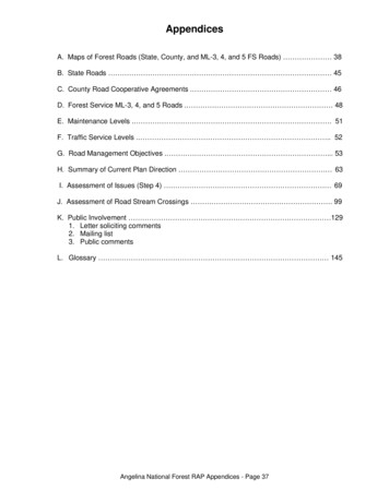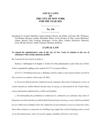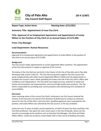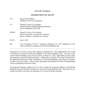
Transcription
Council LocalPlanning PolicyManualAs at 29 September 2014PLAN-003686
Preamble1.2.Generala)When Council adopts a policy it is exercising its legislative function. It doesso when required by the Local Government Act or to provide guidance tostaff and the public about the way its discretionary powers will be exercised.b)Even though a Council has adopted a policy it may be amended or waivedat any time if Council determines to do so.c)When policies are implemented or applied by members of staff, theAdministration is exercising its executive function.d)Each policy identified the purpose for which the policy was adopted and astatement of Policy.Changing PoliciesOnly Council may amend or revoke a policy.Policies may be amended or revoked at any time but each Council policy mustbe reviewed at least once every three years.2
Table of ContentsPreamble .26.2 Cash In Lieu Of Car Parking (LPP) .46.5 Swanbourne Design Guidelines A (Precincts 1 To 5 And 9) .66.6 Swanbourne Design Guidelines B (Precincts 6, 7 & 8).76.8 Subdivision Policy (LPP).86.9 Two Grouped Dwellings In Dual Coded Areas .116.10 Allen Park Residential Estate Design Standard For Lots 11 To 17Clement Street And Lots 18 To 25 North Streets, Swanbourne (LPP) .126.11 Road Widening (Stirling Highway) (LPP) .146.12 Cash In Lieu Of Car Parking - Government Road .166.16 Listed Heritage Places - Demolition Policy .176.17 Intensification of Residential Density .186.18 Reduction of Front Setbacks (LPP) .196.20 St Peters Square Design Guidelines (LPP).216.23 Carports And Minor Structures Forward Of The Primary StreetSetback (LPP) .246.25 Hollywood Design Guidelines (LPP) .296.27 Old Swanbourne Hospital Precinct (LPP) .30New Adopted Local Planning Policies .43Local Planning Policy: Sea Containers .43Ancillary Accommodation Local Planning Policy .463
6.2 Cash In Lieu Of Car Parking (LPP)IntroductionPurposePolicyTown Planning Scheme No. 2 has provisions for an applicantto provide on-site parking. Council may use its discretion andallow an applicant to make a cash payment in lieu of on-siteparking. Note- a separate policy provides for parking inGovernment Road.To ensure that proper provision is made for the parking ofcars when a development application is considered.To guide the way in which Council should use its discretionto receive cash in lieu payments for parking.1.The general policy considerations which shall applyare :1.A cash payment in lieu of car parking is a means bywhich Council can exercise flexibility. It provides theability to accept a cash payment where a developercannot, or does not wish to, meeting the car parkingrequirement set down in Town Planning Scheme No.2.2.The taking of a cash in lieu payment is purelydiscretionary and Council may decide to require fullprovision of car parking in accordance with Schemestandards if in its opinion the amenity of the areas mayin any way be adversely affected.2.It is normal only to take cash in lieu payment whereCouncil has:-1.Developed or has plans to develop a Council carparking reserve in close proximity to the developmentpaying the cash in lieu.2.Exceptionally good reasons exist for wanting thedevelopment to proceed, such as the development :-3.i.Will provide a much needed facility or service tothe locality.ii.May act as a catalyst for other new developmentto occur in the locality thereby encouragingredevelopment and upgrading the area.Cash in lieu payments collected by Council are to bepaid into the City Development Welfare and ServicesReserve Fund.4
3.The following shall be used to determine the amountof any proposed cash in lieu payment.a.A construction component cost assessed at the timeof development being charged.b.A land value component charged, based on thefollowing:29 m2 x land value per m2 x number of parking baysrequired.c.The per square metre value of land is to bedetermined from a valuation conducted by a swornvaluer appointed by the Council and all costs incurredin obtaining the valuation will be borne by thedeveloper proposing a cash in lieu contribution of carparking.Adopted/Amended 18 August 1987 (Item 1 of Standing Orders Committee)Review12 March 2002 (Report E31.02)History10 December 2002 (Report E166.02)25 November 2003 (Report E109.03)26 October 2004 (Report E130.04)22 November 2005 (Report CP35.05)5
6.5 Swanbourne Design Guidelines A (Precincts 1 To 5 And 9)PurposeTo provide design guidelines for development within theproposed Precincts 1 to 5 and 9 on the Lot previously knownas Swanbourne High School, No. 392 (Lot 28634) AlfredRoad, Swanbourne.PolicyThis is a local planning policy – the full version of thisdocument, dated 27 March 2007 Revision N3, can beobtained from either Council’s website or via RecordsManagement Document TRIM Ref. D07/17574.Related Procedure NilRelatedLocal Town Planning Scheme No. 2Law/LegislationProcedureCouncilAmendmentAuthority LevelRelatedDelegationAdopted/Amended 11 September 2007 (Report D52.07)Review History6
6.6 Swanbourne Design Guidelines B (Precincts 6, 7 & 8)PurposeTo provide design guidelines for development withinproposed Precincts 6, 7 & 8 on the Lot previously known asSwanbourne High School, No. 392 (Lot 28634) Alfred Road,Swanbourne.PolicyThis is a local planning policy – the full version of thisdocument, dated 20 September 2007 Revision H, can beobtained from either Council’s website or via RecordsManagement Document TRIM Ref. D07/17573.Related Procedure Nil.ProcedureCouncilAmendmentAuthority LevelRelatedLocal Town Planning Scheme No. 2Law/LegislationRelatedDelegationAdopted/Amended 11 September 2007 (Report D52.07)Review History7
6.8 Subdivision Policy (LPP)IntroductionPurposePolicyWhen applications for sub-division or rezoning areconsidered there is an opportunity to consider a number ofissues which impact upon amenity and sustainability such asbut not restricted to, the provision of public open space,adequate road widths, solar orientation, fencing, landscapingand underground power. Council has determined thestandards it will require before it recommends to the WesternAustralian Planning Commission that a sub-division beapproved or an amendment to the Town Planning Schemeinitiated.To ensure increased sustainability and preservation of theamenity of the City with future land subdivision.Council is not prepared to initiate rezoning or to recommendsubdivision approval unless the following requirements aresatisfied:Public Open Space (POS)Where subdivision is five or more lots, local POS shall beprovided at the rate of 10% of the gross subdivisible areawhere the residential density is R10, increasing at the rate of1% for each 2.5 in residential density eg. 11% for a densityof R12.5 and 14% for a density of R20. Provision of POSshall be in accordance with the Western Australian PlanningCommission’s Policy DC 2.3 Public Open Space inResidential Areas and may include cash-in-lieu.Where subdivision is less than five lots, a local POSprovision at the rate of 10% of the gross subdivisible area orcash-in-lieu equivalent, in accordance with the WesternAustralian Planning Commission’s Policy DC 2.3 PublicOpen Space in Residential Areas, may be requested.In considering the most appropriate location for local POS,the Council shall give consideration to the retention of anybushland or mature trees on the site, the need for sportinggrounds, access by the local community and the aestheticsof the landform.DrainageAll stormwater shall be retained on-site, in accordance withCouncil’s Policy 6.2 Drainage of Private Properties and theWater & Rivers Commission’s “Manual for Managing UrbanStormwater Quality in Western Australia”, August 1998, asamended. Provided drainage works are located, designedand landscaped for public use and amenity is not impaired,full credit will be given for drainage works satisfying the POSrequirement, in excess of 8%.Road Reserve Widths8
To retain the spacious character of the City, the averageprimary road reserve width shall be 18m, with a minimumwidth of 16m.Rights of Way Reserve WidthsAny rights of way provided in new subdivisions shall have aminimum reserve width of 6 metres in accordance withCouncil’s Policy 4.8 Rights of Way.Where a right of way is to be used for rubbish pick-up:(i)the design of the right of way shall not require thepick-up vehicle to travel in reverse gear; and(ii)the minimum reserve width shall be 8 metres forpick-up on both sides.Corner TruncationsTruncations shall be provided in accordance with the W.A.Planning Commission’s Policy DC 1.7 ‘General RoadPlanning’ and Planning Bulletin No. 33 ‘Rights-Of-Way thstanding minimum corner truncations of 6m x 6mshall be provided at all road intersections and junctions.Minimum corner truncations of 2m x 2m are required forrights of way with a width of 10m or less.Lot FrontageLot frontage shall be in accordance with the R Codes to aminimum effective width of 8 metres and shall exclude battleaxe configuration. All lots shall front a road at least 16 metresin width.Underground PowerUnderground power shall be provided in all newsubdivisions, in accordance with Council’s Policy 10.13Undergrounding of Power.Solar OrientationAll new residential subdivisions shall be designed withoptimum northern orientation of lots (east-west or preferably,north-south) and minimum likelihood of buildingsovershadowing their neighbours.Fencing9
Subdivisional boundary fences shall be designed andconstructed to ensure surveillance of adjoining publicspaces, in accordance with Council’s Fencing Local Laws.Verge LandscapingVerge landscaping shall be undertaken by the developer,with due consideration of water use, maintenance andCouncil’s Policy 6.13 Alternative Verge Development, to thesatisfaction of the Council.Construction StandardsDesign and construction of all subdivision works shall beconsistent with the W.A. Planning Commission’s Policy DC2.6 ‘Residential Road Planning’ and in accordance with theInstitute of Municipal Engineering Australia, W.A. DivisionInc publications “Guidelines for Development andSubdivision of Land”, June 1998 (AUS-SPEC #1), asamended, and “Local Government Guidelines forSubdivisional Development”, October 1998, as amended.Related Procedure NilProcedureNot ApplicableAmendmentAuthority LevelAdopted/Amended 25 January 2000 (Report E28.00)ReviewHistory12 February 2002 (Report E14.02)10 December 2002 (Report E166.02)25 November 2003 (Report E109.03)26 October 2004 (Report E130.04)22 November 2005 (Report CP35.05)10 October 2006 (Report D77.06)10
6.9 Two Grouped Dwellings In Dual Coded AreasPurposePolicyTo ensure that when Council approves the developmentof two grouped dwellings in areas where there is a ously.a.Any planning approval for the development of twogrouped dwellings in areas with a dual residentialcode will be valid for a period of twelve monthsonly.b.The following conditions will be imposed on anyplanning approval for two grouped dwellings in adual coded area:a.Related ProcedureProcedureAmendmentAuthority LevelRelatedLocalLaw/LegislationRelated DelegationAdopted/AmendedReview History“A building licence must be applied forwithin 6 months and the building beconstructed to at least plate height prior tothe expiry of the 12 month planningapproval period.”b.“Vacant lot strata is not permitted.”NilNot ApplicableTown Planning and Development Act17 September 1992 (Item 2 Standing Orders Committee)21st February 1993 (Item 16 F&CS Committee –Council4th March 1993)12 February 2002 (Report E14.02)10 December 2002 (Report E166.02)25 November 2003 (Report E109.03)26 October 2004 (Report E130.04)11
6.10 Allen Park Residential Estate Design Standard For Lots 11 To 17Clement Street And Lots 18 To 25 North Streets, Swanbourne (LPP)IntroductionPurposePolicyIn recognition that the area in which the Allen ParkResidential Estate is Located is re-coded from R60 to R35,the vendor and purchaser of the land have agreed withCouncil upon standards that will allow sub-division anddevelopment to proceed in a way consistent with orderly andproper planning.To provide for the orderly and proper planning of the AllenPark Residential Estate in a way that enhances amenity andpromotes sustainability.Allen Park Residential Estate Design Standard.Land in the Allen Park Residential Estate (“the Estate”) hasbeen re-coded from R60 to R35. The vendor and purchaseragree that development of land is not to exceed the R Codedensity of R35, and the following further developmentstandards shall apply:Front Setback6.0 metres minimum.Carport/Garage4.5 metres minimum from the PrimaryStreet frontage.1.5 metres minimum from any SecondaryStreet frontage.Side Setback As per the –Codes.Parapet wall(s) is permitted on any side boundary as per cl.1.5.8 (f) of the R-Codes without the need for consultation withneighbours.Rear Setback4.0 metres minimum.Building HeightCl.5.11 of the City’s Town PlanningScheme No. 2 shall apply as to the building height, providedthat the purchaser agrees that no dwelling shall be erectedwith more than 2 storeys or with height more than 10 metresfrom the highest portion of the building to the benchedground level as set out in the attached Schedule (seeAttachment R1).Open Space As per the R-Codes for R35 that is a minimumof 50% of the site area.Where a maximum or minimum standard is stipulated above,the maximum shall not be exceeded and the minimum shallnot be reduced.12
Related Procedure NilProcedureNot ApplicableAmendmentAuthority LevelAdopted/Amended 9 May 2000 (Report E103.00)13 June 2000 (Report E135.00)Review History10 December 2002 (Report E166.02)25 November 2003 (Report E109.03)26 October 2004 (Report E130.04)22 November 2005 (Report CP35.05)10 October 2006 (Report D77.06)13
6.11 Road Widening (Stirling Highway) (LPP)IntroductionPurposePolicyStirling Highway is classified as a ‘Controlled AccessHighway’ under the provisions of the Metropolitan RegionScheme. Main Roads of WA have a 5 metre wideningrequirement along both dies of Stirling Highway. The roadwidening area, once resumed, will allow Main Roads of WAto construct a highway standard dual carriageway withappropriate turning pockets, median islands andlandscaping.To describe setback and site requirements relating tocommercial land affected by road widening along StirlingHighway.Policy Requirementsa.This Policy shall apply to commercial land abuttingStirling Highway which is proposed to be widened.b.Council requires that any development on landaffected by the road widening shall comply with therequirements of the City of Nedlands Town PlanningScheme No. 2. as if the land had been resumed forthe road widening purposec.All proposed buildings shall be setback a distance of12 metres from the existing front boundary (beingStirling Highway reserve) or 7.0 metres from the futureroad widening boundary (whichever is the greater).d.The Council may require a larger setback to beprovided for the purpose of maintaining a uniformsetback.e.The area of road widening shall be excluded from theaffected lot for the purpose of calculating:a.b.c.d.f.Car parking;Landscaping;Plot Ratio; orany other standard described by the City ofNedlands Town Planning Scheme (with theexception of determining front setback).The area of road widening shall be landscaped to thesatisfaction of Council and not used for any otherpurpose than landscaping unless otherwise approvedby Council.Related Procedure Nil14
ProcedureNot ApplicableAmendmentAuthority LevelAdopted/Amended 27 May 1997 (Item ES11.97)Review History12 February 2002 (Report E14.02)10 December 2002 (Report E166.02)25 November 2003 (Report E109.0326 October 2004 (Report E130.04)22 November 2005 (Report CP35.05)10 October 2006 (Report D77.0615
6.12 Cash In Lieu Of Car Parking - Government RoadPurposeTo provide for the payment of cash in lieu for parking inGovernment Road (northern verge)Policy1. Council may accept cash in lieu of on-site car parkingfor the construction of parking bays on the vergedirectly opposite the subject lot.2. The amount of any cash in lieu payment shall becalculated at the time of the Council approval usingthe procedure associated with this policy.Related Procedure 6.12 Cash in lieu of car parking - Government RoadProcedureExecutiveAmendmentAuthority LevelRelatedLocal Town Planning Scheme No. 2Law/LegislationRelatedDelegationAdopted/Amended 17 April 1989 (Standing Orders Committee)24 November 1994 ( 13PC15.11.94)Review History12 March 2002 (Report E31.02)10 December 2002 (Report E166.02)25 November 2003 (Report E109.03)26 October 2004 (Report E130.04)22 November 2005 (Report CP35.05)16
6.16 Listed Heritage Places - Demolition PolicyPurposeTo provide for the proper documentation and recording ofheritage places before the issue of a demolition license.Policya.b.Related ProcedureProcedureAmendmentAuthority dopted/AmendedReview HistoryThe following information is to be provided to theCouncil prior to the issue of a demolition licensefor any place on the List of Heritage Places (asamended) with Council meeting the cost of theinformation:a.photographs of the place, both exterior andinterior where relevant, showing allelevations and with particular attention towindow and door openings, mouldings andother decorative features;b.measured drawings of the place at a scaleof 1:100 unless approved otherwise.For places with a rating of 1 or 2 in the of List ofHeritage Places, as amended, a heritageassessment with a statement of significance is tobe prepared by a qualified professional before ademolition permit may be issued.6.16 Listed heritage places - demolition policyExecutiveTown Planning Scheme No. 225 November 1997 (Report E282.97)28 July 1998 (Report E148.98)25 November 1997 (Report E282.97)28 July 1998 (Report E148.98)10 December 2002 (Report E166.02)25 November 2003 (Report E109.03)26 October 2004 (Report E130.04)22 November 2005 (Report CP35.05)17
6.17 Intensification of Residential DensityPurposePolicyTo support the Local Housing Strategy.Council will only initiate amendments to Town PlanningScheme No. 2 for the purpose of increasing housing densitythat would comply with the Local Housing Strategy.Related Procedure 6.17 Intensification of residential densityProcedureExecutiveAmendmentAuthority LevelRelatedLocal Town Planning Scheme No. 2Law/LegislationRelatedDelegationAdopted/Amended 16 December 1997 (Report E299.97)26 October 2004 (Report E130.04)Review History10 December 2002 (Report E166.02)25 November 2003 (Report E109.03)26 October 2004 (Report E130.04)22 November 2005 (Report CP35.05)18
6.18 Reduction of Front Setbacks (LPP)IntroductionClause 5.3.3 of the Town Planning Scheme No. 2 requires a9m street setback to preserve the spacious landscapedcharacter of the City. Under the scheme the Council mayvary this requirement in the case of new large scalesubdivisions and where more than half the lots on the sameside of the street block have a lesser setback.PurposeTo establish the circumstances when Council may exerciseits discretion under Clause 5.3.3. of Town Planning SchemeNo. 2 to reduce setbacks.1.Large scale subdivisions where the front setbackrequirement has been reduced are as follows:Policy1. St Johns Wood (Area 1)2. St Johns Wood (Area 2)3. (excludesJubaeaGardens)4. Poplar Grove5. Westminster Gardens7.5m absolute6.0m pursuant to R DesignCodes4.0m, 2.0m to carport6.0m, pursuant to R DesignCodes6. MtClaremont 6.0m, pursuant to R DesignRedevelopmentCodes7. Seawood Village6.0m absolute8. Lot 2 Stubbs Terrace As per R Design Codes(Cape Bouvard)2.In Residential R10 areas, the minimum front setbackshall be 7.5m absolute irrespective of whether morethan half the lots on the same side of the street blockhave a lesser setback.3.In all other cases, where an application is received fora reduced setback:1.The application shall be accompanied by a planillustrating the street profile of existing setbacksof the street block within which the developmentproposal is located;2.Where more than half the lots on the same sideof the street block have a setback less than 9m inaccordance with this policy, the Council shallpermit a reduced minimum front setback inaccordance with the provisions of the ResidentialDesign Codes - Acceptable DevelopmentCriteria.19
Note: For the purpose of varying the minimum front setbackin accordance with this Policy, existing buildings on the sameside of the street block shall be measured between the frontwall of the dwelling and the street alignment, excludingverandahs, detached garages and carports.Adopted/Amended 28 July 1998 (Report E129.98)Review History12 March 2002 (Report E31.02)10 December 2002 (Report E166.02)25 November 2003 (Report E109.03)26 October 2004 (Report E130.04)22 November 2005 (Report CP35.05)10 October 2006 (Report D77.06)20
6.20 St Peters Square Design Guidelines (LPP)IntroductionPurposePolicySt Peters Square is a development within which are a range ofresidential densities. The policy rationalises the application ofsetback variations allowed with each residential code in orderto improve the amenity within the small lot sub-division.The design guidelines are in response to clause 5.14 of TownPlanning Scheme No. 2 (Amendment No. 121) and areintended to improve the amenity in the small lot subdivision.1.All development shall be in accordance with therequirements of the Scheme, supporting policies andthe respective R-Codes, as modified by theseguidelines. Setback requirements are outlined in theTable below:DensityFrontSetback R25 3.0m minimumLotsgreater than 6.0m350m2averageRearSetback 3.0mminimum 6.0maverageR25 Lotslessthan2350m 3.0mminimum 6.0maverage 3.0mminimum 6.0maverage R40 Lotslessthan2350m 3.0mminimum 6.0maverage minimum 4.0maverageGarages 4.5mminimumfromprimarystreet 1.0m ifaccess is toa6.0maccesslaneway Side SetbackAs per R-Codes, ornil setback (parapetwall) as per Plan 1attached to Policy10.30, where noadvertisingtoaffected neighboursis required.As per R-Codes, ornil setback (parapetwall) as per Plan 1attached to Policy10.30, where noadvertisingtoaffected neighboursis required.As per R-Codes, ornil setback (parapetwall) as per Plan 1attached to Policy10.30, where noadvertisingtoaffected neighboursis required.As per R-Codes, ornil setback (parapetwall) as per Plan 1attached to Policy10.30, where noadvertisingtoaffected neighboursis required.21
2.Where there is an inconsistency between therequirements of the R Codes and the Scheme or anysupporting policy, those of the R Codes shall prevail.3.Building height shall be limited to 2 storey, generally inaccordance with the conceptual plans submitted insupport of the rezoning application.4.The density bonus provisions for Aged and DependantDwellings under the R Codes shall not apply to the R40and R60 sites.5.In relation to lots approved under WAPC Ref. 107179and 109128:a.b.roofs,c.d.e.f.access,building colours and materials for walls andbin areas,air conditioners, andfencing shall, andbuildings to boundaries maybe constructed in accordance with the report titled St PetersSquare Residential Site Design Guidelines, December 1998and accompanying plan titled Peters Square Residential SiteDesign Guidelines, Revision C, December 1998.6.Where verges are reticulated prior to purchase ofadjoining lots, the design is to ensure maintenance bythe adjoining owner. Where the verge is not reticulatedprior to purchase of adjoining lots, owners shall providereticulation to the verge as part of any landscaping andreticulation of adjoining private property.7.Lighting of rear service lanes to be in accordance withthe Australian Standards, to the satisfaction of theExecutive Manager Technical Services.8.Parapet walls are permitted on lots identified in theattached Plan No. 1 without the need for advertising toaffected landowners and all crossovers shall beconstructed at the designated location; all lots shall bedeveloped in accordance with the maximum buildingfootprint outlined in the attached Plan No. 2.9.Council may approve development with reduced frontsetbacks in accordance with Plan No. 3, being Drawing2D prepared by The Planning Group, dated September1999, received 5 October 1999.22
RelatedProcedureProcedureAmendmentAuthority LevelAdopted/AmendedReviewHistoryNilNot Applicable14 September 1999 E166.9914 December 1999 E271.9912 February 2002 (Report E14.02)10 December 2002 (Report E166.02)25 November 2003 (Report E109.03)26 October 2004 (Report E130.04)22 November 2005 (Report CP35.05)10 October 2006 (Report D77.06)23
6.23 Carports And Minor Structures Forward Of The Primary Street Setback(LPP)IntroductionThe Residential Design Codes provide that Councils maydevelop Local Planning Policies which address streetscapeissues such the structures that may be constructed within thefront setback. Town Planning Scheme No. 2 generallyprovides for a 9 metre setback although Council has thediscretion to vary the provision and has done so via variouspolicies.PurposeTo ensure that the present open character and streetamenity of the City of Nedlands is not compromised by theconstruction of carports and other small structures within theprimary street setback area.PolicyDEFINITIONSCarport means a roof structure designed to accommodate amotor vehicle and shall be open on all sides unlessconstructed adjoining a boundary fence or wall of a building.R-Codes the requirements for the control of residentialdevelopment set out in the Residential Design Codes Acceptable Development Criteria.Primary Street Setback means the required setback fromthe front boundary (which is adjacent to the street) to the wallor columns of the building. If the property is bounded bymore than one street the applicant can nominate which streetfrontage will be the primary one.Pergola an open walled structure that may be constructed ofsteel, timber or the like and can be either attached to ordetached from, the residence. The roof of a pergola must beopen and not clad with an impervious material or product.POLICY STATEMENTCarports(a)Materials and Construction MethodsAny structures located in the primary street setback areashall use similar materials and construction methods as themain building.(b)SetbacksApplications for carports forward to the required setbackmust be in accordance with Clause 5.6.2 of the TownPlanning Scheme No. 2 and the following requirements:(i)New Development24
Notwithstanding any other provision in thispolicy where a carport is to be constructed as part of a siteredevelopment (i.e. new residence) then that carport shouldbe located behind the required front boundary setback line.(ii)Existing DevelopmentCarports will only be approved forward of theprimary street setback under this policy, provided a minimumof five years (5) years has elapsed since the issue of abuilding licence by the City for the existing dwelling on the lotor for significant alterations/additions to the dwelling whichhas resulted in the need for a carport in this location.Carports may be constructed forward of the required primarystreet setback, but the side facing the street must be leftopen. Council will however consider wrought iron or tubesteel gates/fencing along the side facing the street forsecurity purposes.The following setbacks shall be deemed as standard andmeasured to the columns of the carport. All setbacks aremeasured at right angles to the wall and not the boundary.Primary Street Setback3.5 metresSide Boundary1.0 metresSecondary Street Setback InaccordancewiththeResidential Design Codes - Acceptable DevelopmentCriteria.(c)Variations(i)Where an application is received that does not complywith the abovementioned requirements, then an Officer willevaluate the application to determine whether the variationwill have impact on either the relevant adjoining property orthe streetscape.Note : some factors which may influence the evaluation are: existing buildings; existing trees or vegetation; topography of site; lot size and/or shape.(ii)Should it be determined that the variation will have asignificant adverse impact on either the adjoining propertiesor the streetscape, the applicant will be contacted andrequested to locate the carport in compliance with thestandard requirements.25
(iii)Should the applicant refuse to or be unable to, complywith the standard requirements then Council will contact, inwriting, any relevant adjoining property owner and any otherproperty owners which (in the opinion of the Officer) may beaffected, so that they have the opportunity to view theproposal and make comments should they wish.Note: this consultation should be undertaken in accordancewith Council’s Policy 10.8 “Neighbour Consultation” and inconjunction with Council corresponding to adjoining propertyowners on the development in general (eg. two storeydevelopment).(iv)Should the Officer, after the consultation period,conclude that the variation will significantly affect the amenityof other properties and/or the streets
of R12.5 and 14% for a density of R20. Provision of POS shall be in accordance with the Western Australian Planning Commission's Policy DC 2.3 Public Open Space in Residential Areas and may include cash-in-lieu. Where subdivision is less than five lots, a local POS provision at the rate of 10% of the gross subdivisible area or

