Transcription
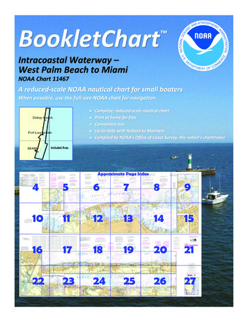
BookletChart Intracoastal Waterway –West Palm Beach to MiamiNOAA Chart 11467A reduced-scale NOAA nautical chart for small boatersWhen possible, use the full-size NOAA chart for navigation.
Published by theNational Oceanic and Atmospheric AdministrationNational Ocean ServiceOffice of Coast Surveywww.NauticalCharts.NOAA.gov888-990-NOAAWhat are Nautical Charts?Nautical charts are a fundamental tool of marine navigation. They showwater depths, obstructions, buoys, other aids to navigation, and muchmore. The information is shown in a way that promotes safe andefficient navigation. Chart carriage is mandatory on the commercialships that carry America’s commerce. They are also used on every Navyand Coast Guard ship, fishing and passenger vessels, and are widelycarried by recreational boaters.What is a BookletChart ?This BookletChart is made to help recreational boaters locatethemselves on the water. It has been reduced in scale for convenience,but otherwise contains all the information of the full-scale nauticalchart. The bar scales have also been reduced, and are accurate whenused to measure distances in this BookletChart. See the Note at thebottom of page 5 for the reduction in scale applied to this chart.Whenever possible, use the official, full scale NOAA nautical chart fornavigation. Nautical chart sales agents are listed on the Internet athttp://www.NauticalCharts.NOAA.gov.This BookletChart does NOT fulfill chart carriage requirements forregulated commercial vessels under Titles 33 and 44 of the Code ofFederal Regulations.Notice to Mariners Correction StatusThis BookletChart has been updated for chart corrections published inthe U.S. Coast Guard Local Notice to Mariners, the National GeospatialIntelligence Agency Weekly Notice to Mariners, and, where applicable,the Canadian Coast Guard Notice to Mariners. Additional chartcorrections have been made by NOAA in advance of their publication ina Notice to Mariners. The last Notices to Mariners applied to this chartare listed in the Note at the bottom of page 7. Coast Pilot excerpts arenot being corrected.For latest Coast Pilot excerpt visit the Office of Coast Survey website hart.php?chart 11467.(Selected Excerpts from Coast Pilot)The Florida Department of NaturalResources has established a slow-no wakespeed zone in the Intracoastal Waterwaywhere the channels converge in the vicinityof Bakers Haulover Inlet.Miami River trends westward thennorthwestward through the heart of thecity of Miami for about 2.8 miles to theconfluence of South Fork Miami Riverand North Fork Miami River. North Forkleads northwest for another 0.6 mile to thejunction with Miami Canal, thence Miami Canal continues northwest forabout 1.8 miles to a dam below the NW 36th Street bridge. Miami Canalis navigable for small boats for about 10 miles above the dam, however,the head of navigation from seaward is at the dam. Tamiami Canal leadswestward from Miami Canal to Sweetwater in the Everglades. A dam isabout 1.2 miles above its junction with Miami Canal.Miami River and Tamiami Canal are Regulated Navigation Areas. (See165.1 through 165.13, and 165.726, chapter 2, for limits/regulations.)The Coast Guard reports that ships may encounter current anomalies atthe mouth of Miami River which have caused occasional groundings.Currents in the river are strong on the ebb and cause swirls at the bends.From West Palm Beach, the waterway continues southward to the southend of Lake Worth at Mile 1034.3, thence through a cut to Lake Wymanat Mile 1045.7.Southern Boulevard Bridge (State Route 80), Mile 1024.7, has a basculespan with clearance of 14 feet at the center. The bridgetender monitorsVHF-FM channel 16, call sign WHW-777. (See 117.1 through 117.59 and117.261, chapter 2, for drawbridge regulations.)West Palm Beach Canal enters the waterway at Mile 1026.8. A fixedhighway bridge with a clearance of 12 feet is about 0.3 mile above themouth. In 1983, the reported controlling depth in the canal was 7 feet.At Lake Worth, Mile 1028.8, State Route 802 highway bridge (locallyknown as Lake Worth Avenue bridge) crossing the waterway has a spanwith a clearance of 38 feet at the center and 35 feet elsewhere. Thebridgetender monitors VHF-FM channel 16 and works channel 13.A repair yard in the yacht basin on the west side of the lake at Mile1030.5 has berths with electricity, gasoline, water, a pump-out station,ice, marine suplies and dry storage. Hull, engine and electronic repairscan be made. In 2007, an approach depth of 7 feet was reported.At Lantana, Mile 1031.0, Lantana Avenue bridge crossing the waterwayhas a bascule span with a clearance of 13 feet at the center. (See 117.1through 117.59 and 117.261, chapter 2, for drawbridge regulations.)The bridgetender monitors VHF-FM 16 and works channel 13. There aresmall-craft facilities at Miles 1032.6 and 1033.1. Berths with electricity,gasoline, diesel fuel, water, ice, marine supplies, pump-out station, wetand dry storage are available. A lift to 85 tons is available for hull andengine repairs.The waterway enters a cut at Mile 1034.3. East Ocean Avenue/StateRoute 804 highway bridge crossing the waterway at Boynton Beach,Mile 1035.0, has a span with a clearance of 21 feet. The bridgetendermonitors VHF-FM channel 16 and works channel 13; call sign WHW-773.Just north of the bridge on the western shore of the lake there are twosmall-craft facilities where berths with electricity, gasoline, diesel fuel, apump-out facility, water and ice are available. In 2007, the reportedapproach depth was 10 feet with 8 feet alongside.At Mile 1035.8, Woolbright Road highway bridge with a bascule spanand clearance of 25 feet crosses the waterway. The bridgetendermonitors VHF-FM channel 16 and works channel 13.The Eighth Street highway bridge over the waterway at Mile 1038.7 hasa bascule span with a clearance of 9 feet at the center. (See 117.1through 117.59 and 117.261, chapter 2, for drawbridge regulations.)The bridgetender monitors VHF-FM channel 16 and works channel 13.A boatyard is on the north shore of Little River, about 0.6 mile above themouth. The yard has a 20-ton marine lift, and a marine railway that canhandle craft up to 50 feet. Gasoline, water, ice, electricity, and marinesupplies are available. There is berthage for about 15 boats with 7 to 10feet reported alongside in 1983. There is a machine shop on thepremises; hull and engine repairs can be made.U.S. Coast Guard Rescue Coordination Center24 hour Regional Contact for EmergenciesRCC New Orleans2Commander8th CG DistrictNew Orleans, LA(504) 589-6225
Lateral System As Seen Entering From Seawardon navigable waters except Western RiversPORT SIDEODD NUMBERED AIDSGREEN LIGHT ONLYFLASHING (2)FLASHINGOCCULTINGQUICK FLASHINGISOPREFERRED CHANNELNO NUMBERS – MAY BE LETTEREDPREFERRED CHANNELNO NUMBERS – MAY BE LETTEREDPREFERRED CHANNEL TOSTARBOARDTOPMOST BAND GREENPREFERRED CHANNELTO PORTTOPMOST BAND REDGREEN LIGHT ONLYRED LIGHT ONLYFLASHING (2)FLASHINGOCCULTINGQUICK FLASHINGISORED LIGHT ONLYCOMPOSITE GROUP FLASHING (2 1)COMPOSITE GROUP FLASHING (2 1)812"1"Fl G 6sLIGHTGR "A"Fl (2 1) G 6sG "9"Fl G 4s5DAYBEACON"2"Fl R 6sRG "B"Fl (2 1) R 6sG"5"UCGR"U"RGN "C"GRC "S"CANG6RG"G"NUNFor more information on aids to navigation, including those on Western Rivers, please consult the latest USCG Light List for your area.These volumes are available online at http://www.navcen.uscg.govRN "6"NUNR "8"Fl R 4sLIGHTED BUOYLIGHTLIGHTED BUOYGC "1"CANSTARBOARD SIDEEVEN NUMBERED AIDS2DAYBEACONR"2"
VHF Marine Radio channels for use on thewaterways:Channel 6 – Inter-ship safety communications.Channel 9 – Communications between boats andship-to-coast.Channel 13 – Navigation purposes at bridges, locks, andharbors.EMERGENCY INFORMATIONChannel 16 – Emergency, distress and safety calls toCoast Guard and others, and to initiate calls to othervessels. Contact the other vessel, agree to another channel, and then switch.Channel 22A – Calls between the Coast Guard and the public. Severe weatherwarnings, hazards to navigation and safety warnings are broadcast here.Channels 68, 69, 71, 72 and 78A – Recreational boat channels.Distress Call Procedures Make sure radio is on. Select Channel 16. Press/Hold the transmit button. Clearly say: “MAYDAY, MAYDAY, MAYDAY.” Also give: Vessel Name and/or Description;Position and/or Location; Nature ofEmergency; Number of People on Board. Release transmit button. Wait for 10 seconds — If no responseRepeat MAYDAY call.Getting and Giving Help — Signal other boaters using visual distress signals (flares,orange flag, lights, arm signals); whistles; horns; and on your VHF radio. You arerequired by law to help boaters in trouble. Respond to distress signals, but do notendanger yourself.HAVE ALL PERSONS PUT ON LIFE JACKETS!NOAA Weather Radio All Hazards (NWR) is a nationwide network of radio stations broadcasting continuousweather information directly from the nearest National Weather Service office. NWR broadcasts official WeatherService warnings, watches, forecasts and other hazard information 24 hours a day, 7 days a week.http://www.nws.noaa.gov/nwr/Quick ReferencesNautical chart related products and information - http://www.nauticalcharts.noaa.govQRInteractive chart catalog - .shtmlReport a chart discrepancy - hart and chart related inquiries and comments - page ContactUsChart updates (LNM and NM corrections) - http://www.nauticalcharts.noaa.gov/mcd/updates/LNM NM.htmlCoast Pilot online - htmTides and Currents - http://tidesandcurrents.noaa.govMarine Forecasts - http://www.nws.noaa.gov/om/marine/home.htmNational Data Buoy Center - http://www.ndbc.noaa.gov/NowCoast web portal for coastal conditions - http://www.nowcoast.noaa.gov/National Weather Service - http://www.weather.gov/National Hurrican Center - http://www.nhc.noaa.gov/Pacific Tsunami Warning Center - http://ptwc.weather.gov/Contact Us - tmFor the latest news from Coast Survey, follow @NOAAchartsThis Booklet chart has been designed for duplex printing (printed on front and back of one sheet). If a duplex optionis not available on your printer, you may print each sheet and arrange them back-to-back to allow for the properlayout when viewing.NOAA’s Office of Coast SurveyThe Nation’s Chartmaker
speed zone in the Intracoastal Waterway where the channels converge in the vicinity of Bakers Haulover Inlet. Miami River trends westward then northwestward through the heart of the city of Miami for about 2.8 miles to the confluence of South Fork Miami River and North Fork Miami River. North Fork leads northwest for another 0.6 mile to the