Transcription
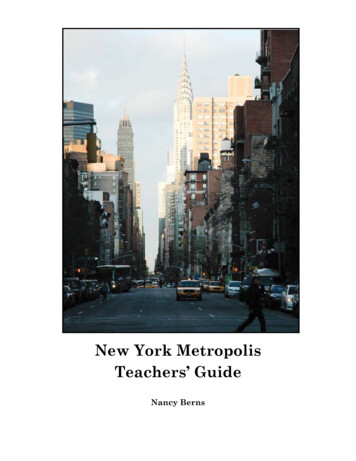
New York MetropolisTeachers’ GuideNancy Berns
IntroductionIn less than four hundred years, people and their technologyhave transformed four hundred square miles into the mostcomplex and culturally diverse city in the world, the City ofNew York.Completed in 1980 and sporting a number of recentadditions, the New York State Museum’s New YorkMetropolis exhibits portray the merger of New York City’sexquisite natural resources with its diverse and dynamichuman populations. This teachers’ guide is designed to walkyou and your students through these exhibits in ways thatwill make your visit scholastically useful and memorablewhile making optimum use of your time.The first part of this guide provides a map of the New YorkMetropolis exhibit stops, a neighborhood and landmarkmap of Manhattan, a subway map and an aerial photographof the city. It is recommended that, for educationalpurposes, you begin your visit at the enlarged version of thisphotograph located at the far end of New York MetropolisHall. This photograph provides a large vista that bestexemplifies the exhibits overriding theme: the interactionof human populations with their natural environment.From here simply follow the directions in the grid table.The “Where to Go” section of the table provides explicitdirections on where to go, how to get there and what to lookfor. Major exhibit section titles, usually appearing in largewhite lettering throughout the exhibits, correspond to thelarge numbered and underlined headings in the guide. Onyour New York Metropolis exhibit map, these major sectionsare numbered the same. Individual exhibit titles within themajor exhibit sections are shown in bolded and quotedtext within the grid table. Subtitles are simply quoted andindented under these. For educational information onexhibits of “The World Trade Center: Rescue Recovery andResponse,” refer to Jason Colavito’s teachers’ guide by thatsame name at .html.In the “What to See and Do” section of the grid table,students are asked to closely examine exhibit componentsand themes via brief activities and discussions. Throughthese they are encouraged to make comparisons andconnections and envision themselves as part of what theysee and hear around them. Supplemental background information is included to facilitate this as needed.Supporting learning standards are listed and numbered incorrespondence with those of the New York State learningstandard booklets.Near the end of the guide, activities are provided thatstudents can work on either before, during or after their visit.The “Create a Timeline” activity is designed to encouragestudents to chronologically examine and piece togetherthe most important accomplishments and advancementsin New York’s complex history. The goal in this is forstudents to discover the interdependency of New York’sachievements and to step away from extraneous detail for amoment to view the city as a dynamic whole. On the otherhand, “The 4 Dollar Question” activity asks older students toanalyze and critique the methods and conclusions of historyand historians.The glossary for the New York Metropolis exhibits and thisteachers’ guide is in the form of a large crossword puzzle atthe end of this guide. The top half of the puzzle comes withrelatively easy clues and answers while the bottom half ofthe puzzle gradually becomes more difficult. The objective,particularly for the youngest students, should not be tofinish the entire puzzle but to see how far they can go bothbefore and then after their visits. The vocabulary-buildingwords can be emphasized during your visit. The answers areprovided near the end of this guide.Exhibit GoalSkyscrapers, subways, suburbs: in the New York region, humanactivities seem to obscure nature. The dynamic interactionbetween human activities and the natural environment hastransformed the wilderness into a metropolis.These exhibits show how New York City grew from thesettlement of New Amsterdam to a World City. As the tempoof growth increased, so did the complexity and diversity of theNew York Metropolis.--- introduction at the entrance to the “New YorkMetropolitan Region” located at numberaccompanying map1 on the
Map of NY HallStart HereOpenSpaces1265FifthAvenue3New YorkMetropolis4ThePortSkyscraperCity7Harlemin the 1920s890Metropolis on the MoveWorld Trade CenterHere isNew York
Neighborhoods of Manhattan Island4
New York City Subway Map
WHERE TO GO1 The Large Photograph ofthe New York MetropolisRegionFind the location of number 1 on theattached map.Enter the Cultural Education Center’sMain Lobby from Madison Avenue. Turnleft in front of the large informationdesk and enter where the overhead signreads, “GALLERIES / MUSEUM SHOP.”Turn right and walk straight back pastthe bright orange 19 9 taxicab and pastthe Algonkian wigwam, “The IndianHouse.” Continue walking under theharbor porpoises above you. Stop whenyou come to a sign on your right thatreads “The Indians and Their Worlds.”Look to your left to find the large colorphotograph of New York City and this iswhere you will begin.This location is also reachable from theopposite direction through Birds ofNew York and Crossroads Gallery: Fromthe Main Lobby, you enter to the rightof the large information desk wherethe overhead sign reads, “GALLERIES/ MUSEUM THEATER.” From there youwill turn left just before and as youare approaching the Museum Theater.From this point proceed to the back ofAdirondack Hall as you bear left andfollow the black wall on your left. Turnleft into “Birds of New York,” then leftagain at the Crossroads Gallery. Thelarge photograph of New York City willbe in front of you to your right.WHAT TO SEE & DONYS STANDARDSFor comparative purposes this is a great placeto begin with your students. It provides notonly a good visual overview of how the citylooks today, but of how its components fit andfunction together. It is the best starting pointfor introducing the region’s special naturalfeatures that, when coupled with repeatedinfluxes of diverse human populations, haveculminated in the megalopolis that thestudents can see pictured before them.Introduce and discuss the natural resourcesnecessary or preferable for the growth andsuccess of a world city:Coastal Location Deep and protected harbor rivaled onlyby the harbors of Hong Kong and SanFranciscoo shipping/commerce/immigration Perfect worldwide geographicpositioning for the import and export ofgoods and labor from other countries andfrom the South and Midwest Marine Life for food, commerce, etc.o whaling; Fulton Fish MarketFreshwater Resources for drinking water,industry Watersheds In Catskills and Adirondackslocated conveniently at higher elevationso building of reservoirs to augment The Hudson and East Riverso inland transportation andcommerce;o the Erie Canal, railroadconnectionsSocial Studies .1—understand thecharacteristics, functionsand applications of aerialphotographs. . —acquire, organize,and analyze geographicinformation; formulatingconclusions from maps,photographs.Mathematics, Science andTechnology4. —describe how livingthings, including humans,depend upon the living andnonliving environment fortheir survival.Bedrock of Manhattan schist and gneisssuitable for maintaining the weight ofnumerous skyscrapersIntroduce and discuss important landmarksas they relate to immigration, populationgrowth, economic growth, city planning,transportation and the city as a City ofNeighborhoods:The Statue of Liberty and Ellis IslandSkyscrapers: Empire State Building, Chrysler BuildingThe Brooklyn and Manhattan BridgesOpen Spaces: Central Park, Coney Island .1—Interconnectedness:recognize how parts ofa system interrelate andcombine to performspecific functions; describethe [interdependencies]between engineeringsystems, natural systems andsocial systems.
WHERE TO GO2 Before the MetropolisWHAT TO SEE & DOImagine yourselves seeing these strange newplants and animals for the first time in yourlives. How would you have reacted as anexplorer? As a merchant? As a settler?Social Studies1.4—explore differentexperiences, beliefs, motives,and traditions of people.Discuss whether or not you believe thedrawings portrayed of plants, animals andIndians were made by people who actually sawthem and how you came to your conclusions.Compare, for example, the real opossums withthe drawing next to them.The Arts4.4—explore art to understandthe social, cultural &environmental dimensions ofhuman society.“The Indians and Their Worlds”(directly across from the photographdiscussed above) and also, “The IndianHouse” (wigwam), “The Algonkians”(“Indian Foods”)Make a list of the plants and animals thatthe coastal Indians depended upon for theirsurvival. Discuss which of these would help anarchaeologist to determine that these peoplewere dependent on at least some marineresources. Which food and cultural itemswould preserve the best or poorest throughtime?Science4. —Humans depend uponthe living and nonlivingenvironment for their survival.“The Algonkians”Discuss the meaning of Algonkian. How manydifferent Algonkian peoples can you find on themap? How do you think the lives of each mighthave been similar or different? What aboutafter contact with non-native populations?English Language Arts1. —developing vocabulary.Find the location of number 2 on theattached map by locating the followingexhibit labels:“The Wonderful Animals and Plants ofthe New and Unknown World” / “TheNew World Beckons”-“The Same for All”Compare how the Indians and Europeans, suchas the Dutch, valued land and possessions. . —Interconnectedness:things belong to the samecategory and yet are different.Social Studies1.4—analyzing differentviewpoints and/or frames ofreference.1.1—evaluate the validityand credibility of historicalinterpretations of importantevents in New York Statehistory.“A Century of Expansion”-“A Heritage of Slavery”-“A Paucity of People”Very unlike later periods in New York City’shistory, New Amsterdam, a city of 18 differentlanguages, experienced an ongoing laborshortage. Discuss what caused this asdescribed under “A Paucity of People.” Discussthe existence of slavery, as an acceptedinstitution at this time, and how, without thecontributions of slaves, the early colony mightnot have survived.1. —learning about theimportant accomplishments ofindividuals and groups.Turn into the hallway at the black arrowand the sign that reads, “New YorkMetropolis Hall.” Find “The Map thatMade Modern Manhattan” andIn 1811 a gridiron system of roadways wasplanned for the replacement of the old narrowand winding colonial streets. Discuss if andhow this would benefit the future growth,economic and transportation needs of the city.What disadvantages might you foresee?Science .1—design solutions to realworld problems of generalsocial interest related to thecommunity via applyingmathematical concepts.-The Gridiron Plan” almostimmediately on your right.8NYS STANDARDS
WHERE TO GO3 Image of the CityOn your map find number 3.Bear to your right as you enter“Skyscraper City.” Look for “Image ofthe City” located up high and ahead ofyou and just past the high steel worker.On the Manhattan gridiron map, pointout the center of the lower left bulge,the Lower East Side, so that the studentswill know what area of Manhattan isbeing discussed.Directly in front of this large overheadmap turn right, walk forward anddirectly on your left locate the variousdrawings at “The First Slums.”WHAT TO SEE & DOAsk your students to see if they can discoveran enlarged version of the gridiron map ofManhattan that was just discussed above.NYS STANDARDSSocial Studies .1—investigate thedistribution and migration ofhuman populations.Locate the Lower East Side, the lower leftarea on that map. In this neighborhood,huge influxes of 19th and early 0th centuryimmigrants resulted in overcrowding thatsometimes rivaled that of Bombay, IndiaEspecially focus on the backlit drawingsnumbers , ,1 and 1 . Closely examinethem for details. Discuss striking details. Forexample, what activities would be illegal today?Discuss your overall impressions of whateveryday life was like and why for this majorityof Manhattan’s population in the mid-to-late1800s. Hypothesize what other conditions andexperiences these people might have facedthough not directly shown.4.1—discover and exploresome ways individuals andgroups attempt to satisfy basicneeds and wants by utilizingscarce resources; understandthe nature of scarcity and howgoverning and city planningdecisions may have economicand social consequences.Continue walking on until you reach“People of the Lower East Side,” alsoon your left. You’ve just jumped aheadin time to the end of the 19th century.With the exception of the dresses onthe two little girls, all the clothing isauthentic from around this time period.The people in this scene were cast fromreal people, a number of who were orare still employed by the New York StateMuseum. The photographer representsJacob Riis and other photojournalistreformers of their day who wereconcerned with improving the livingconditions of New York City’s poor.On average an immigrant would liveabout ten years in the Lower East Sidebefore moving on to better areas andopportunities.Take a moment to observe all that is goingon in this life group and compare this withwhat is going on in the photographs that areaccompanied with text. List all the jobs youcan find.Compare the way people are portrayed inthis diorama to the people in the surroundingforeground and background photographs.Social Studies1.4—explain the significanceof historical evidence.Have the students file by this exhibit ina single-file line so that everyone has achance to see everything. Encouragechildren who cannot see over the exhibittext to take turns standing on the box.Predict what one or more of these people maydo next i.e. where they will go, what they willdo. What led you to your conclusion?English Language Arts . —Speaking and writing forliterary expression involvesproducing imaginative text.Summarize your perceptions of these peoples’daily lives based on their surroundings, theirclothing and the artifacts around them.Discuss what defines an artifact and how amuseum would go about classifying many ofthe objects you are looking at as artifacts? Asnon-artifacts?1.4—explore differentexperiences and traditions ofpeople; weigh the importance,reliability, and validity ofevidence; view historic eventsthrough the eyes of those whowere there, as shown throughartifacts and photography.English Language Arts1. —developing vocabulary.Imagine yourself in this scene. What would youhave liked best? Least?9
WHERE TO GO4 Skyscraper CityReturn to “The Skyscraper Rises” whereyou’ll find a high-steel worker walkingabove you.Interesting Related TidbitsZoning laws did not exist in NYC — or anyUS city — prior to 1916. However, in 1915the Equitable Life Insurance Companyheadquarters sprung straight up from thesidewalk on lower Broadway, shadowingeverything around it and reducingadjacent property values. Zoning lawsresulted.The high-steel worker was cast from PhilTarbell, a Mohawk Indian who worked forThe New York State Museum in the 1980s.A high percentage of Native Peoples aretypically found in this work.“Changing 5th Avenue”Have the students locate the largeWashington Square Park Archphotograph. As you are looking up atthe high steel worker, the arch is locateddirectly behind you. Proceed throughthe arch.“Millionaire’s Row”Walking north up Fifth Avenue, you areheaded in the same direction that manyof NYC’s 19th century wealthy moved asthey continued to contribute to theirfortunes in, for example, the constructionand buyouts of railroad and steamshipcompanies. Others who became richthrough inventions or commoditieselsewhere in the United States, wereattracted to New York City to foster newbusiness partnerships and to 5th Avenue inparticular for its sheer opulence and highsociety.10WHAT TO SEE & DOFind and examine clues that help trace someof the technological, construction and/ormanufacturing advances that enabled sucha large city to accommodate ever-increasinghuman populations and economic growth. Listand discuss technological components andhow they work together to create an entiretechnological system e.g. electricity, steel Ibeams and elevators to build skyscrapers.List and discuss other contributing inventions,advances or methods you may spot or think ofas you proceed through the remaining exhibithalls and discuss their usefulness within thecontext of a metropolis e.g. subway, steamships, standard garment sizing, etc.Compare and discuss the advantages anddisadvantages of each new innovation.NYS STANDARDSScience and Technology . —explore a variety ofmaterials and energy sourcesto design and constructdevices and structuresthat were technologicaladvancements. .4—understand that largertechnological systemsare made up of smallercomponent subsystems;identify examples oftechnological systems that areused to satisfy human needsand wants, and select them onthe basis of safety, cost, andfunction. . —describe how technologycan have positive and negativeeffects on the environmentand on the way people liveand work.Ask the students to locate the sameWashington Square Park Arch in itsGreenwich Village context and as it appearsin a photograph from recent times. Have thestudents also locate a model of what — sincethe terrorist destruction of the World TradeCenter — is NYC’s tallest building, the EmpireState Building. (All are on your left.)Today many of us take going out to eat forgranted. But before World War II eating outwas nearly unheard of for most people in theUnited States. In taverns and restaurants of the1800s there was a set meal such that everyonehad to order the same thing. Discover anddiscuss what Delmonico’s Restaurant did tobreak this tradition. Discuss which class ofpeople was best able to take advantage ofthis new trend. (Notice that, during this timeperiod, all the women in Delmonico’s had tohave male escorts.)Compare the homes, clothing and lifestyleof these wealthy New Yorkers with those youviewed at the tenements of The Lower EastSide. What would have been the advantagesand disadvantages of each lifestyle? Whichlifestyle would you have preferred and why?Social Studies1.1—explain how ideas, values,beliefs and traditions havechanged over time and howthey unite all Americans.4.1—define basic economicconcepts such as scarcity,opportunity, supply anddemand and economicgrowth.1. —compare and contrastthe experiences of differentgroups in the United States.
WHERE TO GO5 Open SpacesProceed left around the corner from“Millionaire’s Row” to enter “OpenSpaces.” Explore the exhibits before andon either side of the boardwalk.The boardwalk you walk across isdesigned to suggest the boardwalk alongthe Lower New York Bay at Coney Island.Located at the foot of Brooklyn, ConeyIsland dates back before the Civil Warwhen it was a secluded retreat. After theturn of the 20th Century, it would becomethe best known and, until Disneylandopened in 1955, the most heavily visitedamusement park in the world.Just beyond the boardwalk and on yourright locate “Life in the Salt Marsh.”WHAT TO SEE & DOList and discuss the needs for preserving andmaintaining open spaces within a metropolis.It is preferable that the students discover thesereasons on their own if time permits. Discussthe need for1) preservation of natural resources such aswater, wetlands, wildlife and unique or rareecological niches ) recreation ) entertainment4) mental and physical relaxation from thestresses of urban life.NYS STANDARDSScience and Technology4. — explain how societalactions can contribute toimproving the environment.Discuss the disadvantages (or advantages) oflarge urban areas lacking open spaces.Despite their desert-like appearances, saltmarshes teem with wildlife, much of which isdependent upon the relatively rare eco-nichesthat these unique habitats provide. See howmany different plants and animals you can find.Name and discuss several important reasons forthe preservation of NYC’s salt marshes, such asthose located in the 9000 acres of the JamaicaBay Wildlife Refuge on Long Island.4. — explain the importanceof preserving diversity ofspecies and habitats.Include shelter, food and breeding territory forwildlife, storm buffers, groundwater reservoirsin your discussions.Walk on to where you will have thestudents investigate “At Work in theSalt Marshes.” (on your right justbefore the whale) and “Market HuntingAround Long Island.” (on your left)Discover and discuss the advantages ofdraining some portions of salt marsh habitats(e.g. mosquito and disease control, reclaimedland for residential and commercial growth). . — Optimization: to arriveat the best solution, it is oftennecessary to make trade-offs.Compare and contrast advantages anddisadvantages of preserving versus thedraining/filling of salt marsh habitats.11
WHERE TO GOWHAT TO SEE & DONYS STANDARDSAs you walk on to “Whales” you can’tmiss the 8- foot skeleton of a RightWhale, so-called because, in the 1 and1800s, these whales were consideredthe best or “right” whales to hunt fortheir blubber and baleen. When killedthey were also said to “right” themselveson account of their tremendous blubbercontent. Because of over hunting, theirnumbers eventually dwindled into thehundreds.Examine this right whale’s mouth and comparewhat is inside with what is inside yourown mouth and the mouths of most othermammals, including other whales, such asdolphins. Discover and discuss what baleenis i.e. keratin, the fingernail-like material thatcomposes the baleen plates that hang likecurtains in this whale’s mouth. Imagine massesof “baleen hair” that would have been attachedto these plates for trapping tiny food particleswhen this whale was alive. Locate and discussitems made from the tough but elastic-likebaleen in past centuries.4.1 — Living things are bothsimilar and different from eachother.Like other baleen whales, such as blueand gray whales, right whales feed bysimply swimming with their mouthsopen through ocean waters rich withtiny fish and small shrimp-like organismscalled krill. When these whales shuttheir mouths water is expelled but theirtiny prey are trapped behind the giantcomb-like baleen and baleen hairs.In the last hundred years millions ofwhales have been killed for fertilizer,margarine, pet food and whale meat.Today right, gray and blue whales, all ofwhich are baleen whales, are protectedfrom hunting.1 4. —describe how livingthings, including humans,depend upon the livingand nonliving environmentfor their survival; humandecisions and activitieshave had a profound impacton the physical and livingenvironment.What manmade resources would eventuallybecome substitutes for flexible baleen? Forwhale oil candles and lamps? Discuss theadvantages and disadvantages of syntheticsubstitutes.On Manhattan gaslights began to replace oillamps in the 1820s. This more reliable lightingallowed shops to stay open late like those inLondon and Paris. The gas light era begins tocome to an end in the 1880s with the introductionof electric lightingAnother baleen whale, the blue whale — theworld’s largest creature ever known — is in lifeabout ten feet longer than twice as long as thisright whale skeleton displayed here. Calculatehow many feet long a blue whale would be.Then using a tape measure or by holding handswith outstretched arms, create a “blue whale”to compare side by side with the right whaleskeleton.Mathematics . & . — multiply withwhole numbers to determinedistances. .4—Use concrete materials tomodel spatial relationships.
WHERE TO GOWHAT TO SEE & DONYS STANDARDSTrace New York City’s history as a port. Create abrief timeline of particularly significant eventsthat influenced the development of NYC asa world port. Include one or two importantevents for each time period. A sample timelinemight look like:v 1 00s and 1 00so The export of fur pelts is New York’smajor source of wealth. Early on theDutch profit by being the “MiddlePersons” in this trade.v 1800so Centrally situated, the port of NYCbecomes a crossroads of worldcommerce” and becomes larger thanany other U.S. port.v 1900so Other U.S. ports develop and NewYork’s dominance as a world portis replaced by its dominance as abusiness headquarters.Social Studies . —develop timelines byplacing important events anddevelopments in world historyin their correct chronologicalorder.Locate “A Culture of Commerce 1625 1700” and note the hilly terrain frontedby Dutch Colonial homes on the largewall drawings as well as the ships in theharbor.Discuss the clues that the drawings provide fordetermining what county was in control of NewYork City’s Port at this time i.e. union jacks arevisible on the ships.The Arts4.4—analyze works of art andplace them within a culturaland historical context.Directly across from the drawings viewthe also giant Greek Revival buildingfronts. These were actual warehousefaçades that stood on Front Street in the1800s i.e. they are real artifacts broughthere from NYC’s South Street Seaportarea. On a cargo box at “The FirstWarehouse District” find a small mapthat shows their location.Compare the real Front Street warehousefaçades — real artifacts brought here from NYC— with how they appear in the photographto the left and below the small map. Pinpointtheir location on the map. Imagine you werea merchant working there in the 1800s. Whichdirection would a sea captain need to walk tofind you if he and his ship were docked at Pier1 along the East River? (NW)4.4—analyze artifacts andplace them within a culturaland historical context.6 PortWalk on from the whale to enter the“Port” exhibits. These exhibits extendfrom “The Fulton Fish Market” and“South Street Seaport” of the 1800sto the 0th century S.S. Satsuma, thesteam-powered ocean liner located at“Challenge and Decline 1900-1955.”As you go along notice that the exhibitsare not in strict chronological order.Ask the students to stay within but todisperse and search throughout these“Port” exhibits to create a brief timelineof significant events. To begin youmay wish to direct them to (or to find)a “Dutch Merchant Ship” model withaccompanying background informationfor those times.Locate Pearl Street on the map. In DutchColonial times Pearl Street abutted the EastRiver.Walk on to the corner of the warehousefaçades to discover a picture of “TheGreat Fire of 1835,” which destroyednot only all of the South Street Seaportbut a quarter of the financial district andall of the remaining old Dutch homes.The glow in the sky could be seen inPhiladelphia, 110 miles away.1.1—imitate variousexperiences through roleplaying.Social Studies/Geography . —analyzing geographicinformation: use maps todiscover how locations arerelated to other people andplaces.Discover and discuss setbacks in New YorkCity’s development as a major port city.1
WHERE TO GOWHAT TO SEE & DONYS STANDARDSProceed right around the corner to find“South Street Seaport, 1840” and “ ACounting room c. 1845”Examine the interior of “A Counting room c.1845.” Hypothesize what the “merchant fromthe South,” i.e. the man with the cane, mightbe shipping here from the South. For one clue,look at what his clothes appear to be made of.Also, read the accompanying text to identifythe ship captain, importing merchant and clerk.English Language Arts1.1—Discovering facts andrelationships requires readingto acquire information andunderstanding.Go to “Making Land fromWater” located beneath “Isle of Ships.Examine and discuss how the colonists createdland to enlarge Manhattan and create much ofthe South Street Seaport district.Science and Technology .1—investigate priortechnological solutions andideas.Locate the ocean liner, “S. S. Satsuma,”at “Challenge and Decline 1900-1955.”Regular steamship service betweenNYC and England began in the 18 0sand cut the time it took to cross theAtlantic from weeks (in good weather)to 10 days. However, steamships do notimmediately replace all the fast Clippers,with bows that cut rather than buttedthe waves. In the 18 0s the East RiverYards were still well known for theirgreat Clippers.In 180 Robert Fulton launched the world’sfirst practical steamboat off the west side ofManhattan. Technological advancementsin steam power inevitably result in thereplacement of the great wind-powered sailingships of the 1 and 1800s with ocean liners.Compare advantages and disadvantagesof coal-fired steam as a new energy source.Discuss another mode of transportation thatalmost simultaneously comes to rely on steampower and becomes important in linkingNew York City with other parts of the country.(railroads; see later Metropolis on the Move) .4—identify familiar examplesof technological systems thatare used to satisfy humanneeds and wants, and selectthem on the basis of safety,cost, and function.Examine the faces of immigrants from daysgone by. Discuss reasons why these peoplewere willing to emigrate from their far-awayhomelands, leaving friends and families behind.Why might they immigrate to the United Statesand not to somewhere else?Social Studies1. —understandinterrelationshipsbetween world events anddevelopments in NYS (e.g.causes for immigration.).7 The ImmigrantsPhotograph of the Statue of Libertysurrounded by immigrant faceslocated above and to the left of the S.S.Satsuma ocean liner. . —describe how theevolution of technology ledto the shift in society froman agricultural base to anindustrial base.4.1—understand how scarcityrequires people to makechoices, which involve costsand future considerations.“Isle of Ships”Turn around to find “Isle of Ships”directly behind you and to the right ofthe S.S. Satsuma.14In the 1 and 1800s great sailing ships similarto those portrayed would each transporthundreds of immigrants to New York City fromports all over the world. An Atlantic crossingmight take a month or more depending on theweather. Discuss how immigrants might havesp
human populations. This teachers' guide is designed to walk you and your students through these exhibits in ways that will make your visit scholastically useful and memorable while making optimum use of your time. The irst part of this guide provides a map of the New York Metropolis exhibit stops, a neighborhood and landmark