Transcription
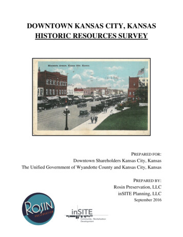
DOWNTOWN KANSAS CITY, KANSASHISTORIC RESOURCES SURVEYPREPARED FOR:Downtown Shareholders Kansas City, KansasThe Unified Government of Wyandotte County and Kansas City, KansasPREPARED BY:Rosin Preservation, LLCinSITE Planning, LLCSeptember 2016
ACKNOWLEDGEMENTSMayor/CEO Mark HollandBoard of CommissionersAnn Brandau-MurguiaBrian McKiernanMelissa BynumJane Winkler PhilbrookHarold L. Johnson, Jr.Gayle TownsendMike KaneHal T. WalkerAngela MarleyJim F. Walters2016 Downtown Shareholders Board of Directors and OfficersAshley AdoranteBill HuttonWil Anderson, PresidentBridgette JobeRoderick BettisLynn KuluvaCindy CashDorota LopezJody FranchettTeresa MataSimeon HendersonMurray RhodesClayton HunterJim Schraeder, Vice PresidentBarbara Jolley, SecretaryHollis Worthen, Treasurer2016 Downtown Shareholders StaffChuck Schlittler, DirectorThis publication has been financed in part with Federal funds from the National Park Service, a division of the United StatesDepartment of the Interior, and administered by the Kansas State Historical Society. The contents and opinions, however, donot necessarily reflect the view or policies of the United States Department of the Interior or the Kansas State HistoricalSociety.This program receives Federal funds from the National Park Service. Regulations of the U. S. Department of the Interiorstrictly prohibit unlawful discrimination in departmental Federally Assisted Programs on the basis of race, color, nationalorigin, age or handicap. Any person who believes he or she has been discriminated against in any program, activity, orfacility operated by a recipient of Federal assistance should write to: Director, Equal Opportunity Program, U. S. Departmentof the Interior, National Park Service, 1201 Eye Street, Washington, DC 20005.Downtown Kansas City, Kansas Historic Resources Survey- i -
Downtown Kansas City, Kansas Historic Resources Survey- ii -
TABLE OF CONTENTSINTRODUCTION.1METHODOLOGY .4FIELD SURVEY .4ARCHIVAL RESEARCH .5COMPILATION OF DATA .5DATA ANALYSIS .6ARCHITECTURAL ANALYSIS . 6ESTABLISHING DATES OF CONSTRUCTION AND PROPERTY HISTORIES . 7EVALUATION OF INTEGRITY . 7STATE OR NATIONAL REGISTER ELIGIBILITY .10EVALUATING STATE OR NATIONAL REGISTER ELIGIBILITY . 10HISTORIC CONTEXT .13EARLY HISTORY .13TWENTIETH CENTURY GROWTH .15URBAN RENEWAL AND DOWNTON REVITALIZATION –GATEWAY PROJECT .18URBAN RENEWAL AND DOWNTOWN REVITALIZATION –CENTER CITY .19AMERICAN CITY PLAN AND END OF URBAN RENEWAL .20RECENT CHANGES .21SURVEY RESULTS .22LOCATION AND SETTING .22FUNCTIONAL PROPERTY TYPE.23COMMERCIAL BUILDINGS . 25NON-COMMERCIAL PROPERTY TYPES . 30ARCHITECTURAL STYLES AND FORMS .34COMMERCIAL BUILDING FORMS . 34ARCHITECTURAL STYLES . 38DATES OF CONSTRUCTION.41ARCHITECTURAL INTEGRITY .42SURVEY RECOMMENDATIONS .44REGISTER-LISTED AND INDIVIDUAL PROPERTIES .44HISTORIC DISTRICTS . 47REGISTER OF HISTORIC KANSAS PLACES INDIVIDUALLYELIGIBLE RESOURCES AND HISTORIC DISTRICTS .52VINTAGE RESOURCES.55BIBLIOGRAPHY .56Downtown Kansas City, Kansas Historic Resources Survey- iii -
FIGURE LOGFigure 1. Survey Area MapFigure 2. Original Function TableFigure 3. 839 Minnesota Avenue. Brad Finch, 2015Figure 4. 932 Minnesota Avenue. Brad Finch, 2015Figure 5. 1101 Minnesota Avenue. Brad Finch, 2015Figure 6. 900 Minnesota Avenue. Brad Finch, 2015Figure 7. 745-755 State Avenue. Brad Finch, 2015Figure 8. 1320 State Avenue. Brad Finch, 2015Figure 9. 901 Minnesota Avenue. Brad Finch, 2015Figure 10. 741 Washington Blvd. Brad Finch, 2015Figure 11. 818 Ann Avenue. Brad Finch, 2015Figure 12. 1711-21 Minnesota Ave. Brad Finch, 2015Figure 13. 700 Minnesota Avenue. Brad Finch, 2015Figure 14. 915 Washington Boulevard. Brad Finch, 2015Figure 15. 900 N. 8th Street. Brad Finch, 2015Figure 16. 1210 N. 10th Street. Brad Finch, 2015Figure 17. 625 Minnesota Avenue. Brad Finch, 2015Figure 18. 1211 N. 8th Street. Brad Finch, 2015Figure 19. 730 State Avenue. Brad Finch, 2015Figure 20. Huron Cemetery (625 Minnesota Avenue). Brad Finch, 2015Figure 21. Building Forms TableFigure 22. Architectural Style TableFigure 23. 838 Minnesota Ave. Brad Finch, 2015Figure 24. 907 N. 18th Street. Brad Finch, 2015Figure 25. 738 Armstrong Ave. Brad Finch, 2015Figure 26. 821-829 N. 7th Street. Brad Finch, 2015Figure 27. 823-827 Minnesota Avenue. Brad Finch, 2015Figure 28. 1111 N. 8th Street. Brad Finch, 2015Figure 29. 751 Minnesota Avenue. Brad Finch, 2015Figure 30. 1009 Minnesota Avenue. Brad Finch, 2015Figure 31. 819 N. 7th Street. Brad Finch, 2015Figure 32. 819 N. 7th Street. Brad Finch, 2015Figure 33. 812 N. 7th Street. Brad Finch, 2015Figure 34. 1109-1231 N. 10th Street. Brad Finch, 2015Figure 35. Dates of Construction TableFigure 36. Dates of Construction MapFigure 37. Map of Potentially Eligible ChurchesDowntown Kansas City, Kansas Historic Resources Survey- iv -
INTRODUCTIONThe Unified Government of Wyandotte County and Kansas City, Kansas (UG), through theDowntown Shareholders Kansas City, Kansas (Downtown Shareholders) contracted with inSITEPlanning, LLC and Rosin Preservation, LLC to conduct an intensive level survey of thecommercial, civic, and institutional resources that comprise Downtown Kansas City, Kansas.Originally developed as the heart of the early town and expanded along major thoroughfares andstate highways, this roughly 268-acre area forms a cohesive commercial core with a wide varietyof building sizes, types, and functions.The Survey Area includes roughly thirty-seven blocks flanking the two primary east-west streetsin downtown Kansas City, Kansas: Minnesota Avenue and State Avenue. The study areaincludes all of the commercial, civic, industrial, and institutional resources along Minnesota,State, Nebraska, and Armstrong avenues from N. 5th Street on the east to N. 18th Street on thewest. It also includes the governmental resources along N. 7th Street Trafficway down to BarnettAvenue. The survey examined a total of 267 resources.The Downtown Kansas City, Kansas Historic Resources Survey encompasses two objectives:1) to identify, record, photograph, and evaluate through architectural/historicsurvey those individual properties and potential districts in the Survey Areathat, on the basis of age, integrity and associations, meet the eligibility criteriafor listing in the National Register of Historic Places or Register of HistoricKansas Places, and2) to substantiate such assessments; and to identify and characterize thoseportions of the Survey Area which, on the basis of insufficient age orintegrity, exclude them from consideration for nomination in the NationalRegister of Historic Places or Register of Historic Kansas Places and tosubstantiate such assessments.Between February and August 2016, Rosin Preservation principal Elizabeth Rosin, associatesRachel Nugent, Alison Dunleavy, Rachel Barnhart, and Katie Greer, and sub-consultant BradFinch performed survey activities. Ms. Dunleavy and Mr. Finch completed field survey andphotography. Ms. Dunleavy entered data into a Microsoft Excel spreadsheet. Daniel Serda,principal of inSITE Planning, provided parcel and some historical data for the survey entries.Ms. Nugent and Mr. Serda prepared preliminary recommendations for future preservation work,including state and or National Register nominations for individual properties or historicdistricts. Ms. Barnhart and Ms. Greer prepared and uploaded site maps and photographs to theDowntown Kansas City, Kansas Historic Resources Survey- 1 -
database. Ms. Dunleavy conducted archival research for the historic context and individualbuilding histories. Finally, Ms. Nugent, Ms. Dunleavy, and Ms. Barnhart analyzed the data,prepared the historic context, developed survey recommendations, and prepared this report offindings.This report, through the historic contexts it presents, connects downtown Kansas City’s builtenvironment to the city’s past. More specifically, it establishes relationships between resourcesthat share historical themes, time frames, and geographic areas. Some resources, however, are atrisk as demolition and significant exterior alterations continue to threaten not only olderbuildings but some of the city’s mid-twentieth century Modern Movement buildings, some ofwhich may be significant works of architecture. Revitalization will be successful if thecommunity embraces and celebrates the architectural past of downtown Kansas City as a recordof the community’s shared history.Downtown Kansas City, Kansas Historic Resources Survey- 2 -
FIGURE 1- SURVEY AREADowntown Kansas City, Kansas Historic Resources Survey-3-
METHODOLOGYRosin Preservation and inSITE Planning completed the Downtown Kansas City, Kansas HistoricResources Survey in conformance with the procedures for historic resources survey outlined inNational Register Bulletin 24: Guidelines for Local Survey: A Basis for Preservation Planningand the Kansas Historical Society HPF Grant-Funded Survey Requirements. Evaluation ofresources for significance was in accordance with National Register Bulletin 15: How to Applythe National Register Criteria for Evaluation.The scope of work included the following: Field survey and photography of individual properties. Archival research sufficient to develop a historic context for the Survey Area and toidentify dates of construction (approximate to within five years) for all buildingssurveyed. Compilation of physical and historical information in a database and preparation of areport that summarizes the findings. Preliminary identification of each resource’s architectural style or property type, periodof construction, and architectural integrity. Preliminary identification of all architecturally significant sites, objects, buildings,structures, and districts within the Survey Area. Evaluation and determination of properties and districts that appear eligible for listing inthe National Register of Historic Places. Recommendations for future preservation of historic resources identified in the SurveyArea.FIELD SURVEYDuring field survey the consultants examined every resource in the Survey Area regardless ofage, whether it had been previously surveyed, or its existing National Register designation. Theteam took high-resolution digital photographs and recorded information about the exteriorphysical appearance of each resource, specifically building materials, architectural style, andDowntown Kansas City, Kansas Historic Resources Survey- 4 -
condition. Primary elevation photographs conform to standards for survey documentation setforth by the Kansas Historical Society (KSHS).ARCHIVAL RESEARCHHistorical research is critical to understanding the evolution of the built environment as well asthe social history of the Survey Areas. Research occurred concurrently with field survey and datareview. This approach allowed the team to merge field and research data to create a strong andunderstandable relationship between the events in Kansas City’s history and its builtenvironment, to develop a historic context for the Survey Area, and to establish dates ofconstruction for individual properties.A variety of primary and secondary resources provided background information about thepeople, buildings, and developments that created the commercial community that exists in 2016.The consultants reviewed the Downtown Kansas City, Kansas Historic Inventory – Phase 5Survey 1 from 1993, existing National Register nominations for individually listed properties inthe Survey Area, and written histories of the City of Kansas City. Primary sources, such as citydirectories and newspaper articles obtained from the Wyandotte County Museum and the KansasCity, Kansas Public Library, were reviewed to understand the development of the Survey Areas.Other sources included the Sanborn Fire Insurance Maps from 1907-1908, 1931, and 1957 andaerial photographs. The Wyandotte County Tax Assessor records provided approximate dates ofconstruction, although these had to be verified through field survey and additional research whenavailable.COMPILATION OF DATARosin Preservation compiled survey information in a Microsoft Excel spreadsheet provided byKSHS, which was then uploaded to the Kansas Historic Resources Inventory (KHRI) database.KHRI contained 173 existing entries for resources in the Survey Area. Additional entries werecreated for resources that were not previously surveyed. Daniel Serda, with inSITE Planning,provided the spreadsheet containing owner information and GIS identifiers for the surveyedproperties. While in the field, the consultant confirmed the addresses provided by the UG.Because each parcel can contain more than one building, additional entries were created in thespreadsheet so that each surveyed resource would have its own entry. 2 The final spreadsheetcontains 267 entries. The database fields record each building’s physical features (e.g., plan,materials, architectural style and/or property type, outbuildings, etc.) as well as historicalinformation (e.g., date of construction, original and current function). When linked with digital1Cydney Millstein, Linda F. Becker, and Kansas City, Kansas Planning and Zoning Division, Downtown KansasCity, Kansas, Grant No. 20-93-80045-002, Historic Inventory – Phase 5 Survey, Kansas City, Kansas, 1993.2The Wyandotte County GIS on-line viewer and Google Earth maps were used to determine separate buildingfootprints.Downtown Kansas City, Kansas Historic Resources Survey- 5 -
records from past and future surveys, this database enhances the understanding of historicresources in downtown Kansas City.The information in the 1731 existing KHRI entries contained varying amounts and types of data.The 1993 survey provided thorough descriptions and histories for commercial propertiesbetween N. 5th Street and N. 12th Street within the current Survey Area. The physicaldescriptions were reviewed to determine accuracy. Most had attached photographs, but severaldid not. The KHRI inventory number and all of the entered data with the exception of ownerinformation was transferred to the main spreadsheet. New information was added to the existingentries, and incorrect or irrelevant information was removed. Twenty-nine resources from the1993 survey have since been demolished. Of the recently demolished resources, fourteen wereconstructed as single-family dwellings and would not have been included in the 2016 survey dueto their historic function. Seven of the twenty-nine demolished resources were located outsidethe boundaries of the 2016 survey. Of the fifteen commercial resources that have beendemolished since 1993, only one lot contains a new building. All of the other lots are vacant.The consultant uploaded the completed spreadsheet to the KHRI website using the batchuploading procedure. KSHS staff then assigned KHRI inventory numbers to the ninety-fourresources not previously surveyed. Once the batch upload was complete, two currentphotographs and site plans for each resource were uploaded and captioned according to KSHSrequirements.DATA ANALYSISThe consultants analyzed three categories of data to identify contiguous historic districts and/orindividual properties that appear potentially eligible for National Register listing. The followingthree categories address issues important in determining the significance of a property and itsNational Register eligibility. Architectural Style/Property TypeDate of ConstructionArchitectural IntegrityThe “Survey Results” section of this report provides a detailed description of this analysis andthe findings for the Survey Area.ARCHITECTURAL ANALYSISAfter compiling and reviewing the results of the field survey, Rosin Preservation analyzedarchitectural styles and vernacular property types by reviewing photographs and databaseinformation. Rosin Preservation assigned each building an architectural style and/or vernacularDowntown Kansas City, Kansas Historic Resources Survey- 6 -
property type. The Buildings of Main Street: A Guide to American Commercial Architecture byRichard Longstreth and A Field Guide to American Houses by Virginia and Lee McAlesterprovided guidance for identifying properties by architectural style, building form, and functionand ensured the use of terminology consistent with National Register nomenclature. The KHRIspreadsheet also includes an approved list of architectural styles accepted by the KSHS that isderived from the categories and subcategories presented in the National Register Bulletin How toComplete the National Register Registration Form. Accordingly, resources with simple buthistoric commercial facades were identified as “Minimal Commercial (Early-Mid TwentiethCentury).” Resources covered entirely in non-historic facades that obscure any stylistic featureswere identified as “Not Applicable/No Style.”ESTABLISHING DATES OF CONSTRUCTION AND PROPERTY HISTORIESExisting survey information, historic maps and atlases, written histories of the area, and countytax assessor records provided starting points for determining dates of construction. When historicaccounts, county tax records, and historic maps did not provide conclusive information,architectural style and comparison to similar buildings in the Survey Area were used to estimateconstruction dates.EVALUATION OF INTEGRITYAll properties eligible for listing in the National Register, whether for individual significance oras contributing elements to a historic district, must retain sufficient architectural integrity toconvey the period of time in which they are significant. 3 The National Park Service uses thefollowing areas to define integrity. A property must retain integrity in a majority of these areas tobe eligible for the register. Location:The place where the historic property was constructed or the placewhere the historic event occurred. Design:The combination of elements that create the form, plan, space,structure, and style of a property. Setting:The physical environment of a historic property. Materials:The physical elements that were combined durin
Department of the Interior, and administered by the Kansas State Historical Society. . The Unified Government of Wyandotte County and Kansas City, Kansas (UG), through the . of building sizes,