Transcription
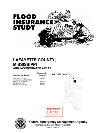
LAFAYETTE COUNTY,MISSISSIPPIAND INCORPORATED AREASCommunity NameLAFAYETTE COUNTY(UNINCORPORATED AREAS)ABBEVILLE, TOWN OFOXFORD, CITY OFTAYLOR, VILLAGE OFCommunityNumberLAFAYETTE COUNTY280093280309280094280248PRELIMINARYAUG 21 2009Federal Emergency Management AgencyFLOOD INSURANCE STUDY NUMBER28071CV000A
NOTICE TOFLOOD INSURANCE STUDY USERSCommunities participating in the National Flood Insurance Program have established repositories of floodhazard data for floodplain management and flood insurance purposes. This Flood Insurance Study may notcontain all data available within the repository. It is advisable to contact the community repository for anyadditional data.Selected Flood Insurance Rate Map panels for the community contain information that was previouslyshown separately on the corresponding Flood Boundary and Floodway Map panels (e.g., floodways, crosssections). In addition, former flood hazard zone designations have been changed as follows:Old ZoneNew ZoneA1 through A30V1 through V30BCAEVEXXThis preliminary revised Flood Insurance Study contains profiles presented at a reduced scale to minimizereproduction costs. All profiles will be included and printed at full scale in the final published report.Part or all of this Flood Insurance Study may be revised and republished at any time. In addition, part ofthis Flood Insurance Study may be revised by the Letter of Map Revision process, which does not involverepublication or redistribution of the Flood Insurance Study. It is, therefore, the responsibility of the user toconsult with community officials and to check the community repository to obtain the most current FloodInsurance Study components.
TABLE OF CONTENTS1.0INTRODUCTION .11.11.21.32.0AREA STUDIED .22.12.22.32.43.0Scope of Study .2Community Description .3Principal Flood Problems .3Flood Protection Measures.3ENGINEERING METHODS .43.13.23.34.0Purpose of Study .1Authority and Acknowledgments.1Coordination .2Hydrologic Analyses .4Hydraulic Analyses .7Vertical Datum .9FLOODPLAIN MANAGEMENT APPLICATIONS .104.14.2Floodplain Boundaries .10Floodways .105.0INSURANCE APPLICATION .246.0FLOOD INSURANCE RATE MAP .247.0OTHER STUDIES .268.0LOCATION OF DATA .269.0BIBLIOGRAPHY AND REFERENCES .26i
TABLE OF CONTENTS - continuedFIGURESFigure 1. Floodway Schematic . 11TABLESTable 1: Letter of Map Change . .3Table 2: Summary of Discharges . 5Table 3: Summary of Stillwater Elevations . . 8Table 4: Floodway Data Table . . .12Table 5: Community Map History . . .25EXHIBITSExhibit 1 – Flood ProfilesBailey BranchBurney BranchClear CreekDavidson CreekDavidson Creek Tributary 1Davidson Creek Tributary 2East Goose Valley CreekEast Goose Valley Creek Tributary 1East Goose Valley Creek Tributary 1AHudson CreekWest Goose Valley CreekExhibit 2 – Flood Insurance Rate Map IndexFlood Insurance Rate elsPanelsPanelsPanels01P – 02P03P – 06P07P – 08P09P – 11P12P13P14P – 15P16P17P18P – 19P20P – 21P
FLOOD INSURANCE STUDYLAFAYETTE COUNTY, MISSISSIPPI AND INCORPORATED AREAS1.0INTRODUCTION1.1Purpose of StudyThis Flood Insurance Study (FIS) revises and updates information on the existence andseverity of flood hazards in the geographic area of Lafayette County, Mississippi, includingthe City of Oxford, the Town of Abbeville, the Village of Taylor, as well as theunincorporated areas of Lafayette County (referred to collectively herein as LafayetteCounty), and aids in the administration of the National Flood Insurance Act of 1968 andthe Flood Disaster Protection Act of 1973. This study has developed flood-risk data forvarious areas of the community that will be used to establish actuarial flood insurance ratesand to assist the community in its efforts to promote sound floodplain management.Minimum floodplain management requirements for participation in the National FloodInsurance Program (NFIP) are set forth in the Code of Federal Regulations at 44 CFR,60.3.In some states or communities, floodplain management criteria or regulations may existthat are more restrictive or comprehensive than the minimum Federal requirements. Insuch cases, the more restrictive criteria take precedence and the State (or otherjurisdictional agency) will be able to explain them.1.2Authority and AcknowledgmentsThe sources of authority for this FIS report are the National Flood Insurance Act of 1968and the Flood Disaster Protection Act of 1973. The sources of hydrologic and hydraulicanalyses that have been performed for each jurisdiction included in this countywide FIShave been compiled from previous FIS reports and are described below.Oxford, City ofThe hydrologic and hydraulic analyses for theMarch 1978 FIS report were prepared by the U.S.Army Corps of Engineers (USACE), VicksburgDistrict, for the Federal Insurance Administration,under Inter-Agency Agreement No. (IAA)-H-16-75,Project Order No. 20, and Interagency Agreement No.(IAA)-H-7-76, Project Order No. 1. This work wascompleted in May 1977 (Reference 1).Lafayette County:(Unincorporated Areas)The hydrologic and hydraulic analyses for theJanuary 17, 1991 FIS report were prepared bySpencer-Engineers, Inc/consultants. for the FederalEmergency Management Agency (FEMA), underContract No. EMW-87-C-2458. This study wascompleted in September 1988 (Reference 2).The hydrologic and hydraulic analyses for this study were performed by the State ofMississippi for FEMA, under Contract No. EMA-2006-CA-5617. This study wascompleted in April 2009. Floodplain boundaries for approximate study streams were1
delineated based on 10 and 30 meter Digital Elevation Models (DEMs) from the UnitedStates Geological Survey (USGS).Base map information shown on this Flood Insurance Rate Map (FIRM) was provided indigital format by Mississippi Department of Environmental Quality (MDEQ) andMississippi Emergency Management Agency (MEMA).The coordinate system used for the production of DFIRM is Mississippi State Plane East(FIPS 2301), reference to the North American Datum of 1983 and the GRS80. Distanceunits were measured in United States (U.S.) feet.1.3CoordinationAn initial Consultation Coordination Officer’s (CCO) meeting is held withrepresentatives of the communities, FEMA, and the study contractors to explain thenature and purpose of the FIS, and to identify the streams to be studied by detailedmethods. A final CCO meeting is held with representatives of the communities, FEMA,and the study contractors to review the results of the study.The dates of the initial and final CCO meetings held for the communities within theboundaries of Lafayette County are shown below.Community NameInitial CCO DateFinal CCO DateCity of OxfordFebruary 11, 1975August 9, 1977Lafayette County(Unincorporated Areas)October 16, 1986February 22, 1990For this countywide FIS, an initial Consultation Coordination Officer (CCO) meetingwas held on January 11, 2007 in the City of Oxford, and attended by representatives ofFEMA, MDEQ, MEMA, Lafayette County, the City of Oxford, the Village of Taylor,the Town of Abbeville, and MGI (Study Contractor). A final meeting, the PreliminaryDFIRM Community Coordination (PDCC), was held on MONTH DD, YEAR to reviewthe results of this study.2.0AREA STUDIED2.1Scope of StudyThis FIS covers the geographic area of Lafayette County, Mississippi, including theincorporated communities listed in Section 1.1. The areas studied by detailed methodswere selected with priority given to all known flood hazards and areas of projecteddevelopment or proposed construction.Two types of analysis were used to develop this FIS report: redelineation of streams thathad been previously studied with detailed methods, and approximate methods analysis.Floodplain boundaries of streams that had been previously studied by detailed methodswere redelineated based on more detailed and up-to-date topographic mapping for this FISreport. Enhanced approximate analyses were used to study those areas having a lowdevelopment potential or minimal flood hazards. The scope and methods of study for eachstream were proposed to, and agreed upon, by FEMA and Lafayette County.2
Table 1 presents Letters of Map Change incorporated into this countywide study.Table 1. Letters of Map ChangeCommunityCITY OF OXFORD,MISSISSIPPI(Unincorporated Areas)2.2Flooding Source(s) andProject IdentifierBurney Branch (02-04-179P)Date IssuedTypeMay 8, 2002LOMRCommunity DescriptionLafayette County is in north-central Mississippi, 85 miles southeast of the City ofMemphis, Tennessee. It is bordered on the north by Tate and Marshall Counties; on theeast by Union and Pontotoc Counties, on the south by Calhoun and Yalobusha Counties,and on the west by Panola County. The county seat is the City of Oxford. LafayetteCounty is served by State Highways 6, 7, 9W, 30, 314, and 334. The 2008 population forLafayette County was estimated to be 43,922 (Reference 3).2.3Principal Flood ProblemsThe history of flooding in Lafayette County indicates that flooding may occur duringany season of the year. The majority of floods occur during the winter and spring. Runoff due to intense rainfall is the principal cause of flooding. Due to the relatively smallsize of the drainage basin, flash floods can occur from local high intensitythunderstorms.Within Oxford, some of the low-lying areas along Burney Branch, Davidson Creek, EastGoose Valley Creek, and Bailey Branch have experienced flooding. One of the worstfloods occurred on May 10, 1970, when 6.6 inches of rain fell in 9 hours, and amaximum of 1.87 inches in 30 minutes was recorded. As a result of this storm, severalstreets and homes were inundated.2.4Flood Protection MeasuresSardis and Enid Lakes are large flood control reservoirs located in the northern andsouthern portions of the county, respectively. They are part of the Yazoo HeadwatersFlood Control Project, authorized in 1936. Sardis Lake is a 32,500 acre flood controlreservoir in Panola and Lafayette Counties. Completed in 1940 by the USACE, the lakewas designed to control the floodwaters of the Little Tallahatchie River to preventflooding in the Mississippi Delta. The lake has a storage capacity of 1.512 million acrefeet. Enid Lake is a 17,000 acre flood control reservoir in Lafayette, Panola, andYalobusha Counties. The lake was completed by the USACE in December 1952. EnidLake was designed to control the floodwaters of the Yocona River to prevent flooding inthe Mississippi Delta. The lake has a storage capacity of 602,400 acre-feet.3
Neither Sardis Lake nor Enid Lake provides meaningful protection from the 1.0-percentannual-chance flood upstream of the flood control structures.3.0ENGINEERING METHODSFor the flooding sources studied by detailed methods in the community, standard hydrologic andhydraulic study methods were used to determine the flood hazard data required for this study.Flood events of a magnitude that are expected to be equaled or exceeded once on the average duringany l0-, 50-, l00-, or 500-year period (recurrence interval) have been selected as having specialsignificance for floodplain management and for flood insurance rates. These events, commonlytermed the l0-, 50-, 100-, and 500-year floods, have a l0-, 2-, 1-, and 0.2-percent-annual-chance,respectively, of being equaled or exceeded during any year. Although the recurrence intervalrepresents the long-term average period between floods of a specific magnitude, rare floods couldoccur at short intervals or even within the same year. The risk of experiencing a rare floodincreases when periods greater than 1 year are considered. For example, the risk of having a floodthat equals or exceeds the 1-percent-annual-chance flood in any 50-year period is approximately 40percent (4 in 10); for any 90 year period, the risk increases to approximately 60 percent (6 in 10).The analyses reported herein reflect flooding potentials based on conditions existing in thecommunity at the time of completion of this study. Maps and flood elevations will be amendedperiodically to reflect future changes.3.1Hydrologic AnalysesHydrologic analyses were carried out to establish the peak discharge-frequencyrelationships for each flooding source studied by detail methods affecting the community.Pre-countywide AnalysesLafayette County (Unincorporated Areas): For the streams studied in detail, the onlygaging station that existed (on Clear Creek at the State Highway 6 crossing) wasdiscontinued in 1974. Published flood frequencies were used for portions of Clear Creek(Reference 4). For East Goose Valley Creek, Davidson Creek, and Burney Branch, inwhich portions of their drainages areas lie within the urban areas of Oxford, the estimatedpeak rural discharges were modified for urban conditions by USGS procedures(Reference 5).Discharges for the 0.2%-annual-chance-flood for all streams were determined by straightline extrapolation of a log-probability graph of flood discharges computed for frequenciesup to 100 years.City of Oxford: Peak discharges were computed from synthetic unit hydrographs andrainfall information contained in the U.S. Weather Bureau Technical Paper No. 40(Reference 6). The synthetic unit hydrograph parameters were developed by a combinationof Snyder’s Method and US Soil Conservation Service criteria (Reference 7). The basedata for Snyder’s Method were obtained from 35 years of gage records from SenatobiaCreek at Senatobia and from 23 years of gage records from Clear Creek at State Highway6, 5 miles west of the Oxford corporate limits (Reference 8). The unit hydrographs wereadjusted for urbanization by procedures developed by the US Army Corps of Engineers(Reference 9).4
Discharges for the 0.2-percent-annual-chance flood on all streams were computed from thesynthetic unit hydrographs and rainfall as determined by the straight-line extrapolation of asingle-log graph of rainfall amounts obtained for frequencies up to 100 years.This Countywide StudyFor this countywide study, discharges for the 1-percent-annual-chance recurrence intervalwere calculated for stream reaches studied by approximate methods using regressionequations for rural areas in Mississippi found in USGS Fact Sheet 008-01 (Reference 10).Discharges for the 0.2%-annual-chance frequency flood for all streams were determined bystraight line extrapolation of a log-probability graph of flood discharges computed forfrequencies up to 1%-annual-chance.Peak discharge-drainage area relationships for the streams studied by detailed methods areshown in Table 2, “Summary of Discharges”.Table 2. Summary of DischargesPEAK DISCHARGES (cfs)FLOODING SOURCE ANDLOCATIONDRAINAGEAREA(Square .2%AnnualChanceBAILEY BRANCHAt MouthAt abandoned roadBURNEY BRANCHAt mouthAt southern corporate limitsAt Mississippi State Highway 7 bypassAt Confluence with Bailey BranchAt Mississippi State Highway 6BypassAt University AvenueAt Jackson AvenueAt Confluence with TributaryAt City Park CulvertAt Cross Section TCLEAR CREEKJust downstream of confluence ofHudson CreekAt State Highway 6Approximately 2,000 feet upstream ofState Highway 6Approximately 2,800 feet upstream ofCounty RoadDAVISON CREEKAbout 7,000 feet upstream ofconfluence of Berry .591,1901,8002,0702,8008.103,4005,5506,5109,1005
PEAK DISCHARGES (cfs)FLOODING SOURCE ANDLOCATIONDRAINAGEAREA(Square miles)DAVISON CREEK (Continued)About 3,800 feet downstream of State3.20Highway 314About 2,000 feet downstream of State2.24Highway 314At College Hill Road1.90At Cross Section D1.61At Cross Section E1.33At Confluence with Tributary0.90At Cross Section I0.70DAVIDSON CREEK TRIBUTARY 1At Mouth0.18At State Highway 60.09DAVIDSON CREEK TRIBUTARY 2At Mouth0.43At Washington Avenue0.17EAST GOOSE VALLEY CREEKJust downstream of the confluence of11.99West Goose Valley CreekJust upstream of the confluence of5.99West Goose Valley CreekApproximately 900 feet downstream of2.12W. Jackson AvenueApproximately 50 feet upstream ofNAState Highway 6EAST GOOSE VALLEY CREEK TRIBUTARY 1At Mouth2.13At Mississippi State Highway 62.00At Confluence of East Goose Valley1.50Creek Tributary 1AEAST GOOSE VALLEY CREEK TRIBUTARY 1AAt Mouth0.55HUDSON CREEKAt Mouth9.44About 5,000 feet upstream of State6.81Highway 6About 800 feet upstream of County3.56Road1.87About 2,600 feet upstream of 07,3006,2001,7102,5902,9303,9009701,4501,6302,200
PEAK DISCHARGES (cfs)FLOODING SOURCE ANDLOCATIONDRAINAGEAREA(Square miles)WEST GOOSE VALLEY CREEKAt mouthAt State Highway 6About 2,000 feet upstream of StateHighway e3,7802,3201,3705,3003,1001,800Hydraulic AnalysesAnalyses of the hydraulic characteristics of flooding from the sources studied were carriedout to provide estimates of the elevations of floods of the selected recurrence intervals.Users should be aware that flood elevations shown on the FIRMs represent rounded wholefoot elevations and may not exactly reflect the elevations shown on the Flood Profiles or inthe Floodway Data Tables in the FIS report. Flood elevations shown on the FIRM areprimarily intended for flood insurance rating purposes. For construction and/or floodplainmanagement purposes, users are cautioned to use the flood elevation data presented in thisFIS in conjunction with the data shown on the FIRM.Pre-Countywide AnalysesCross-section data for the water-surface profile analyses were obtained from field surveys.All bridges and culverts were surveyed to obtain elevation data and structural geometry.Locations of selected cross sections used in the hydraulic analyses are shown on the FloodProfiles and on the Flood Insurance Rate Map.Water-surface elevations of floods of the selected recurrence intervals were computedusing the HEC-2 water-surface profile computer program (Reference 11). Starting watersurface elevations for all streams were determined by the slope-area method. Channel andoverbank roughness coefficients (Manning’s “n”) used in the hydraulic computations werechosen by engineering judgment and were based on field observations of the stream andfloodplain areas. Manning’s “n” values for channels ranged from 0.040 to 0.080 and foroverbank areas ranged from 0.08 to 0.20.This Countywide StudyFor this countywide study, water-surface profiles were computed through the use of theUSACE HEC-RAS version 3.1.2 computer program (Reference 12). Water surfaceprofiles were produced for the 1-percent-annual-chance storms for approximate studies.The approximate study methodology used the computer program WISE as a preprocessorto HEC-RAS. WISE combined geo-referenced data from the terrain model andmiscellaneous shapefiles (such as streams and cross sections). Tools within WISE allowedthe engineer to verify that the cross-section data was acceptable. The WISE program wasused to generate the input data file for HEC-RAS. Then HEC-RAS was used to determinethe flood elevation at each cross section of the modeled stream. No floodway wascalculated for streams studied by approximate methods.7
The 1.0-percent-annual-chance flood elevations for Enid and Sardis Lakes weredetermined by analysis of historical stage records. These elevations are presented in Table3—Summary of Stillwater Elevations.Table 3. Summary of Stillwater Elevations10%AnnualChanceFLOODING SOURCE ANDLOCATIONELEVATION (ft NID LAKEAt DamSARDIS LAKEAt Dam**273.5*283.1*285.6**Data Not AvailableLocations of selected cross sections used in the hydraulic analyses are shown on theFlood Profiles (Exhibit 1). For stream segments for which a floodway was computed(Section 4.2), selected cross-section locations are also shown on the FIRM. Floodprofiles were drawn showing the computed water-surface elevations for floods of theselected recurrence intervals. In cases where the 2%- and 1%-annual chance elevationsare close together, due to limitations of the profile scale, only the 1%-annual chanceprofile has been shown.The hydraulic analyses for this study were based on unobstructed flow. The floodelevations shown on the Flood Profiles (Exhibit 1) are thus considered valid only ifhydraulic structures remain unobstructed, operate properly, and do not fail.All qualifying bench marks within a given jurisdiction that are catalogued by theNational Geodetic Survey (NGS) and entered into the National Spatial ReferenceSystem (NSRS) as First or Second Order Vertical and have a vertical stabilityclassification of A, B, or C are shown and labeled on the FIRM with their 6-characterNSRS Permanent Identifier.Bench marks cataloged by the NGS and entered into the NSRS vary widely invertical stability classification. NSRS vertical stability classifications are as follows: Stability A: Monuments of the most reliable nature, expected to holdposition/elevation well (e.g., mounted in bedrock) Stability B: Monuments which generally hold their position/elevation well(e.g., concrete bridge abutment) Stability C: Monuments which may be affected by surface ground movements(e.g., concrete monument below frost line Stability D: Mark of questionable or unknown vertical stability (e.g., concretemonument above frost line, or steel witness post)8
In addition to NSRS bench marks, the FIRM may also show vertical controlmonuments established by a local jurisdiction; these monuments will be shown onthe FIRM with the approximate designations. Local monuments will only be placedon the FIRM if the community has requested that they be included, and if themonuments meet the aforementioned NSRS inclusion criteria.To obtain current elevation, description, and/or location information for bench marksshown on the FIRM for this jurisdiction, please contact the Information ServicesBranch of the NGS at (301) 713-3242, or visit their Web site at www.ngs.noaa.gov.It is important to note that temporary vertical monuments are often established duringthe preparation of a flood hazard analysis for the purpose of establishing localvertical control. Although these monuments are not shown on the FIRM, they maybe found in the Technical Support Data Notebook associated with this FIS andFIRM. Interested individuals may contact FEMA to access this data.3.3Vertical DatumAll FIS reports and FIRMs are referenced to a specific vertical datum. The vertical datumprovides a starting point against which flood, ground, and structure elevations can bereferenced and compared. Until recently, the standard vertical datum used for newlycreated or revised FIS reports and FIRMs was the National Geodetic Vertical Datum of1929 (NGVD). With the completion of the North American Vertical Datum of 1988(NAVD), many FIS reports and FIRMs are now prepared using NAVD as the referencedvertical datum.Flood elevations shown in this FIS report and on the FIRM are referenced to the NAVD.These flood elevations must be compared to structure and ground elevations referenced tothe same vertical datum. Some of the data used in this revision were taken from the prioreffective FIS reports and FIRMs and adjusted to NAVD88. The datum conversion factorfrom NGVD29 to NAVD88 in Lafayette County is 0.07 feet.For additional information regarding conversion between the NGVD and NAVD, visit theNational Geodetic Survey website at www.ngs.noaa.gov, or contact the National GeodeticSurvey at the following address:NGS Information ServicesNOAA, N/NGS12National Geodetic SurveySSMC-3, #92021315 East-West HighwaySilver Spring, Maryland 20910-3282(301) 713-3242Temporary vertical monuments are often established during the preparation of a floodhazard analysis for the purpose of establishing local vertical control. Although thesemonuments are not shown on the FIRM, they may be found in the Technical Support DataNotebook associated with FIS report and FIRM for this community. Interested individualsmay contact FEMA to access these data.9
To obtain current elevation, description, and/or location information for benchmarks shownon this map, please contact the Information Services Branch of the NGS at (301) 713-3242,or visit their website at www.ngs.noaa.gov.4.0FLOODPLAIN MANAGEMENT APPLICATIONSThe NFIP encourages State and local governments to adopt sound floodplain managementprograms. To assist in this endeavor, each FIS report provides 1-percent-annual-chance floodplaindata, which may include a combination of the following: 10-, 2-, 1-, and 0.2-percent-annual-chanceflood elevations; delineations of 1- and 0.2-percent-annual-chance floodplains; and 1-percentannual-chance floodway. This information is presented on the FIRM and in many components ofthe FIS report, including Flood Profiles, Floodway Data tables, and Summary of StillwaterElevation tables. Users should reference the data presented in the FIS report as well as additionalinformation that may be available at the local community map repository before making floodelevation and/or floodplain boundary determinations.4.1Floodplain BoundariesTo provide a national standard without regional discrimination, the 1-percent-annualchance flood has been adopted by FEMA as the base flood for floodplain managementpurposes. The 0.2-percent-annual-chance flood is employed to indicate additional areas offlood risk in the county. For each stream studied in detail, the 1- and 0.2-percent-annualchance floodplain boundaries have been delineated using the flood elevations determinedat each cross section. Between cross sections, the boundaries were interpolated based ontopographic maps at a scale of 1:24,000 with contour intervals of 10 and 20 feet (Reference13).The 1- and 0.2-percent-annual-chance floodplain boundaries are shown on the FIRM(Exhibit 2). On this map, the 1-percent-annual-chance floodplain boundary corresponds tothe boundary of the areas of special flood hazards (Zones A, AE) and 0.2-percent-annualchance floodplain boundary corresponds to the boundary of areas of moderate floodhazards (Zone X). In cases where the 1- and 0.2-percent-annual-chance floodplainboundaries are close together, only the 1-percent-annual-chance floodplain boundary hasbeen shown. Small areas within the floodplain boundaries may lie above the floodelevations but cannot be shown due to limitations of the map scale and/or lack of detailedtopographic data.For the streams studied by approximate methods, only the 1-percent-annual-chancefloodplain
This Flood Insurance Study (FIS) revises and updates information on the existence and severity of flood hazards in the geographic area of Lafayette County, Mississippi, including the City of Oxford, the Town of Abbeville, the Village of Taylor, as well as the unincorporated areas of Lafayette County (referred to collectively herein as Lafayette