Transcription
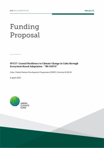
FP157: Coastal Resilience to Climate Change in Cuba throughEcosystem Based Adaptation - "MI COSTA"Cuba United Nations Development Programme (UNDP) Decision B.28/046 April 2021
GREEN CLIMATE FUND FUNDING PROPOSAL V.2.0 PAGE 0 OF 67ContentsSection APROJECT / PROGRAMME SUMMARYSection BPROJECT / PROGRAMME INFORMATIONSection CFINANCING INFORMATIONSection DEXPECTED PERFORMANCE AGAINST INVESTMENT CRITERIASection ELOGICAL FRAMEWORKSection FRISK ASSESSMENT AND MANAGEMENTSection GGCF POLICIES AND STANDARDSSection HANNEXESNote to Accredited Entities on the use of the funding proposal template Accredited Entities should provide summary information in the proposal with crossreference to annexes such as feasibility studies, gender action plan, term sheet, etc.Accredited Entities should ensure that annexes provided are consistent with the detailsprovided in the funding proposal. Updates to the funding proposal and/or annexes must bereflected in all relevant documents.The total number of pages for the funding proposal (excluding annexes) should notexceed 60. Proposals exceeding the prescribed length will not be assessed within the usualservice standard time.The recommended font is Arial, size 11.Under the GCF Information Disclosure Policy, project and programme funding proposalswill be disclosed on the GCF website, simultaneous with the submission to the Board,subject to the redaction of any information that may not be disclosed pursuant to the IDP.Accredited Entities are asked to fill out information on disclosure in section G.4.Please submit the completed proposal to:fundingproposal@gcfund.orgPlease use the following name convention for the file name:“FP-[UNDP]-[Cuba]-[2020/03/20]”
GREEN CLIMATE FUND FUNDING PROPOSAL V.2.0 PAGE 1 OF 67APROJECT/PROGRAMME SUMMARYA.1. Project orprogrammeA.3. Request forProposals (RFP)A.2. Public or privatesectorProjectPublicNot applicableCheck the applicable GCF result area(s) that the overall proposed project/programme targets.For each checked result area(s), indicate the estimated percentage of GCF budget devoted to it.The total of the percentages when summed should be 100%.Mitigation: Reduced emissions from:A.4. Result area(s) GCF contribution:Enter number%Enter number%Enter number%Enter number%Energy access and power generation:Low-emission transport:Buildings, cities, industries and appliances:Forestry and land use:Adaptation: Increased resilience of: Most vulnerable people, communities and regions: Health and well-being, and food and water security:Infrastructure and built environment: Ecosystem and ecosystem services:A.5. Expected mitigationimpactN/AA.7. Total financing (GCF co-finance) 44,299,229 USDA.8. Total GCF fundingrequestedA.10. Financialinstrument(s) requestedfor the GCF fundingA.6. Expected adaptationimpact23,927,294 USDA.9. Project size11%Enter number%Enter number%89%444,793 direct and 879,321indirect11.7% of populationSmall (Upto USD 50million)Mark all that apply and provide total amounts. The sum of all total amounts should be consistentwith A.8. Grant23,927,294 Equity LoanEnter number Results-based GuaranteeEnter numberEnter numberpaymentEnter numberA.11. Implementationperiod8 yearsA.12. Total lifespan30 yearsA.13. Expected date ofAE internal approval7/3/2019A.14. ESS categoryBA.15. Has this FP beensubmitted as a CNbefore?A.17. Is this FP includedin the entity workprogramme?A.19. Complementarityand coherenceA.20. Executing EntityinformationA.16. Has Readiness orPPF support been usedYes No to prepare this FP?A.18. Is this FP includedin the countryYes No Yes No programme?Does the project/programme complement other climate finance funding (e.g. GEF, AF,CIF, etc.)? If yes, please elaborate in section B.1.Yes No The Executing Entity is the Environmental Agency (AMA) of the Ministry of Science,Technology and Environment (CITMA) of Cuba. The Deputy Minister of CITMA isappointed as the National Designated Authority of Cuba to the GCFYes No
GREEN CLIMATE FUND FUNDING PROPOSAL V.2.0 PAGE 2 OF 67A.21. Executive summary (max. 750 words, approximately 1.5 pages)A1. The Project responds to the coastal adaptation needs of Cuba due to slow onset events, including relative sea levelrise and the associated flooding arising from extreme weather events (hurricanes and extra-tropical storms).Impacts from these climate drivers are a matter of national security for a small-island state and pose an existentialthreat to coastal settlements and communities. Projections show that if no intervention is made by 2100, up to 21coastal communities will disappear with a further 98 being severely affected by climate related threats (flooding,coastal erosion and saline intrusion).2. Cuba’s Southern Coast has been selected due its high vulnerability to climate change particularly in the form ofcoastal flooding and saline intrusion. 1,300 km of coastline, 24 communities, and 1,324,114 people will directlybenefit from the project implementation through activities and measures designed to increase resilience to theseidentified climate impacts.3. Cuba s geographical characteristics and its marine and coastal ecosystems conservation status represent an optimalopportunity for wide scale ecosystem-based adaptation (EBA), an approach that has been favoured through Cuba’sState Plan to Manage Climate Change “Tarea Vida”. EBA can adaptively withstand a range of increasing waterlevels and wave heights, which help achieve more cost-effective and flexible adaptation solutions, thus making itparticularly appropriate to Cuba’s southern coastline. Healthy ecosystems can be a natural defence barrier againstsea level rise, and moderate winds and waves by reducing coastal erosion, flooding and salt intrusion risks, as wellas serving a protective role during more extreme events.4. Geomorphological processes in Cuba have led to an interconnected and diverse landscape in which differentecosystems have flourished. The coastline is very irregular and diverse, including steep cliffs, sandy beaches,extensive low lying and swampy coastal plains fringed by mangroves with coastal lagoons and estuaries adjacentto a wide and shallow shelf area with abundant seagrasses and fringed by coral reefs. Connections betweenmountains and marine environments, between fresh and saltwater sources, and between karstic processes anddeep aquifers are well known 1.5. The proposed project will enhance adaptive capacity by holistically rehabilitating coastal land-seascapes, theirinterlinked ecosystems and hydrology. This will be achieved by rehabilitating ecosystem functions and connectionswithin mangroves and swamp forests and reducing anthropic pressures to marine coastal ecosystems, thusenhancing the services supplied by integrated coastal ecosystems (particularly protection from saline flooding anderosion, and channelling freshwater to coastal areas and aquifers). It will also strengthen the adaptive capabilitiesof coastal governments and communities by building their capacity to utilise and understand the benefits of EBA,enhancing information flow between stakeholders and strengthening the regulatory framework for territorialmanagement in coastal areas.6. 11,427 ha of mangroves, 3,088 ha of swamp forest and 928 ha of grass swamp will be restored, which in turn willimprove the health of 9,287 ha of seagrass beds and 134 km coral reefs crests. Together these ecosystems willprovide protection and regulation services along the targeted coastline (See Figure 2). Climate Change Adaptation(CCA) and EBA training of trainers will target national and local decision makers, teachers, economic sector leadersand local communities aiming to provide training to 60% of the population within the targeted municipalities.Environmental information will be provided and integrated into existing information products to provide a fuller pictureof coastal vulnerability and resilience and will be distributed through a knowledge platform, to ensure thestrengthening of regulatory frameworks and continuous feedback to and from the communities to technicalorganizations and government.7. Project interventions will enable a new paradigm by positioning EBA directly into development strategies and actionsas a means for integrated coastal zone management in a changing climate, thereby enabling flexible riskmanagement solutions for coastal populations and reducing their flooding risks. To enable such a paradigm, anintegrated approach to EBA needs to be implemented including a focus on the full coastal marine landscape andensuring that information and capacities are available to communities and the government. This requires i)information to be available and accessible, ii) ecosystems to be rehabilitated and iii) communities and institutions’awareness of ecosystems role in adaptation to be strengthened along with their capacities to sustain it.8. Ecosystem protection and rehabilitation, capacity building (in both governing institutions and communities) andregulation strengthening are the pillars of this project. The former aims to recover the ecosystem’s functionality toprovide protection and regulation services and the latter ensure its sustainability and continuity.9. The project provides direct support to and will provide a baseline for the implementation of the Government of Cuba(GoC)’s “Tarea Vida”; its implementation in targeted areas during the project will provide GoC with practical methodsand approaches which can be implemented elsewhere. Through its interventions, the project proposes directsolutions to national priorities outlined in “Tarea Vida” and in Cuba’s Nationally Determined Contributions (NDCs),enabling a transformation in how the GoC will manage climate change impacts on its coast and generate informationused to implement similar approaches in the Caribbean region.Silvestri, S., Kershaw, F. (eds.). Framing the flow: Innovative Approaches to Understand, Protect and Value Ecosystem Services acrossLinked Habitats. UNEP World Conservation Monitoring Centre, Cambridge, UK1
GREEN CLIMATE FUND FUNDING PROPOSALV.2.0 PAGE 3 OF 67PROJECT/PROGRAMME INFORMATIONBB.1. Climate rationale and context (max. 1000 words, approximately 2 pages)Climate change impacts and threats10. The Cuban archipelago’s location in the Caribbean, places it in the path of frequent tropical storms 2, and the long,narrow configuration of the country is such that no part of the country is very far from the sea (over 57% of thepopulation lives in coastal municipalities).11. Coastal municipalities and their respective settlements are also extremely vulnerable to climate change (CC) dueto increased storms and rising sea levels, resulting in increased coastal flooding caused by extreme meteorologicalphenomena such as tropical cyclones, extratropical lows, and strong winds from sures 3. From 2001 to 2017, thecountry has been affected by 12 hurricanes 10 which have been intense (category 4 or 5, FS Figure 7), the highestrate in a single decade since 1791. In the past 10 years the percentage of intense hurricanes affecting the countryhas risen from a historical average of 26% to 78% with accompanying acute losses (FS Table 6). These intensehurricanes impacting Cuba since 2001 coincide with very high sea surface temperatures (SSTs) in the tropicalAtlantic recorded since 1998.12. The coasts of Cuba in the past three decades have also seen an increase in the occurrence of moderate and strongfloods as a result of tropical cyclones and of extratropical systems; with extratropical cyclones being associatedwith the highest rates of flooding in the country. Furthermore, warm Pacific El Niño events lead to an increase inextra-tropical storms which increase the risks of flooding along the coastline 4 .13. CC induced Sea Level Rise (SLR) will aggravate coastal flooding affecting in particular low lying coastal areas. Itis expected that through SLR, mean sea level will increase by 0.29 m by the year 2050 and between 0.22m and0.95m by the year 2100 5 impacting 119 coastal settlements in Cuba (FS Section Table 2 Figure 35). Combiningincreased storm surge and projected SLR, flooding of up to 19,935 km² (CC Category 5 hurricane) and 2,445km² (CC normal conditions) can be expected by the year 2050 6 (Feasibility Study Section 2.4.2).14. These estimates could be higher when compounded by the impact of surface water warming on the speed ofstorms, and new research that links it to increased wave heights in the Caribbean 7. Under this scenario, stormscould be more frequent and move at a slower pace thus increasing the impact on island states such as Cuba 8,9.15. CMIP5 10 projections indicate that by 2050, mean annual temperature in Cuba will rise by a median estimate of1.6 C; total annual extremely hot days (temperature 35 C) will rise by a median estimate of 20 days (RCP 4.5)and 20.8 days (RCP 8.5). Associated increases in potential evapotranspiration will further lead to more frequentsevere droughts 11, as already observable in eastern Cuba (FS, Figure 34).16. Cuban coastal seascapes and landscapes are a succession of ecosystems that have coevolved under currentclimatic conditions, including current distributions of extreme events. The progression of coral reefs, seagrassmeadows, beaches, coastal mangroves and forest or grassland swamps represents an equilibrium that confersresilience to each ecosystem separately but also to the coast as a whole (Figure 2). The current resilience of Cubancoastal ecosystems to extreme events and SLR, is being undermined by both climate change effects (increasedextreme events) and other anthropogenic pressures, tempering their capacity to provide their protective services.Mangroves have further suffered high levels of degradation affecting their ability to colonize new areas, reducewave impacts, accrete sediments and stabilize shorelines. Additionally, coral reefs have shown signs of bleachingand degradation that have been attributed to mangrove and sea grass degradation (including the alteration ofhydrological natural flows, presence of invasive species, water contamination, and habitat destruction, see Figure2), climate-related increases in surface water temperature and to increased impacts of hurricanes 12.Acosta, Jorge (2016). Catalog of tropical cyclones in the Caribbean regionStrong southerly winds4Cárdenas, P. y M. Pérez (1991): Eventos ENOS y anomalías de lluvia en Cuba. Instituto de Meteorología. 24 pp. And Meulenert, A. R.(1991): Efecto del evento El Niño-Oscilación del Sur sobre el estado del tiempo en Cuba. Instituto de Meteorología.5IPCC-AR5-WGL. Climate Change 2013: The Physical Science Basis. Contribution of Working Group I to the Fifth Assessment report(AR5) of the intergovernmental Panel on Climate Change. 2013. The Cuban tide gauge monitoring system values are closed to the globalmean sea-level rise from the IPCC’s models (AR5, 2013) where four possible trajectories (Representative Concentration Pathways orRCPs) are described on global sea-level rise6Iturralde y Serrano (2015) Macroproyecto. Peligros y vulnerabilidades de la zona marino-costera de Cuba: estado actual y perspectivasante el cambio climático 2100. Editorial Academia, La Habana7Reguero, B.G., et al. (2019). A recent increase in global wave power as a consequence of oceanic warming. Nat Commun 10, 205doi:10.1038/s41467-018-08066-08Planos E., Rivero R., Guevara V (eds), 2012. Impactos del Cambio Climático y medidas de Adaptación en Cuba9Kossin et al. (2018). A global slowdown of tropical-cyclone translation speed, Nature, 10Program for Climate Model Diagnosis & Intercomparison. CMIP5- Coupled Model Intercomparison Project Phase 5- Overview.https://pcmdi.llnl.gov/mips/cmip5/11The World Bank Group. Climate Change Knowledge Portal. Climate data. ble pr12Alcolado et al., 2009. Trend of change of live stony coral cover in Cuban coral reefs. Serie Oceanológica No. 5. La Habana, Cuba.23
GREEN CLIMATE FUND FUNDING PROPOSALV.2.0 PAGE 4 OF 67BSLR will further increase current vulnerabilities and stresses on ecosystems due to increases in water depth and waveenergy which will increase coastal erosion, coastal flooding and saline intrusion risks 13,14.Coastal erosion17. Current coastal erosion rates are attributed to a combination of natural dynamics (waves, currents, extreme events,hurricanes, etc.) and human interventions (natural resources extraction, wetlands filling, coastal infrastructureconstruction excluding natural dynamics, habitat loss, water diversion, etc). An increase in the magnitude ofextreme events and increasing SLR will accelerate erosion related to natural processes, which currently averages1.2 m/year (calculated between 1956-2002) 15. This erosion rate poses a danger to communities, infrastructure andnatural habitats that are not tolerant to saline intrusion and provide services to landward communities.Flooding18. Coastal flooding as a combination of high rainfall, high sea levels and storm surges has been identified as one ofthe primary climate change related threats to Cuba. Trends in the frequency of coastal floods during the period1901-2011 have been observed in Cuba with the past three decades seeing an increase in the occurrence ofmoderate and strong floods, regardless of the meteorological events that generate them (FS Section 1.3.3).Specific impacts and the extent of resulting damages depend on local bathymetry and topography, seabedroughness and coastal vegetation coverage and conditions, with the coastal regions of La Coloma- Surgidero deBatabano and Jucaro-Manzanillo being particularly vulnerable (See FS Figures 38 and 40).19. Hurricanes have also extensively damaged infrastructure. Hurricane Matthew, which crossed the eastern end ofCuba in October 2016, caused USD 97.2 million of damages (approximately 2.66% of GDP), making it the thirdmost devastating hurricane to hit the island in the last decade, only behind Ike (2008) and Sandy (2012), withequivalent costs of USD 293 million (12.05% of GDP) and USD 278 million (9.53 % of GDP) respectively 16.Saline intrusion20. Saline intrusion into aquifers is the most common and extensive cause of freshwater degradation in Cuba’s coastalzones. Most of these aquifers, located near and beneath the northern and southern coasts, are open to the sea,making them very susceptible and exposed to saline intrusion as a result of SLR, and potentially leading to waterthat is too saline for human consumption and increasing the salinization of agricultural fields 17. It is estimated (FSSection 3 and Annex 1) that approximately 544,300 ha in the area of proposed interventions are already affectedby saline intrusion.Drought21. Drought has been identified among the most important climate risks for all Caribbean islands, including Cuba.There has been an increase in drought events in the period 1961-1990 when compared to 1931-1960 18. Severedroughts have been increasing in eastern Cuba and are projected to increase in the future (Figures 33-36, FS).Future projections indicate a general reduction in rainfall by 2070 (particularly along the Eastern Coastline), alongwith an average reduction in relative humidity between 2% and 6% between 2030 and 2070, respectively (FSFigure 20). Reduced rainfall occurring mostly during the summer rainy season, with relatively smaller increases inwinter and dry season rainfall This situation adds an increase pressure on the aquifers, which cannot be filled byjust one tropical storm, or during the rainy season.Vulnerability Southern Coast of Cuba, project target site22. Cuba’s coastal ecosystems have been extensively studied through extensive research led by The Ministry ofScience, Technology and Environment (CITMA), the Environmental Agency (AMA) and the Scientific Institute forthe Sea (ICIMAR). ICIMAR’s research on coastal dynamics and vulnerability is the foundation for Cuba’s NationalEnvironmental Strategy (NES) and its State Plan for Facing Climate Change (“Tarea Vida”, 2017) which outlinedcoastal areas in eminent danger as national priority.23. A research-based CC vulnerability ranking (high, medium, and low) was designed considering a combination offactors: geological, geomorphological and ecosystem degradation (Feasibility study Section 2.2), highlighting thatvulnerability to sea-level rise and associated events is higher in the country’s low-lying coasts 19. Settlements inthese areas are more vulnerable to SLR and more likely to be affected by extreme weather events (hurricanes,NU. CEPAL(Ed), 2018. Efectos del cambio climático en la costa de América Latina y el Caribe. Reconstrucción histórica y proyeccionesdel efecto del cambio climático sobre el oleaje en la costa de Cuba, 63pp.14Reguero, B.G., et al. (2019). A recent increase in global wave power as a consequence of oceanic warming. Nat Commun 10, y, A.C., E. Tristá, M. Guerra, R.T. Capote, M. Martínez, M. Hernández, P.M. Alcolado Menéndez, S. Lorenzo, L. PeñaFuente, M. Esquivel y M. Sosa. 2006. Rehabilitación ecológica del tramo de costa comprendido entre Surgidero de Batabanó yMayabeque, costa sur de la Provincia de La Habana. Informe Final de Proyecto de Programa Ramal de Protección de Medio Ambiente yDesarrollo Sostenible.16As cited in Cuba’s National Determined Contributions, p617Iturralde y Serrano (2015) Macroproyecto. Peligros y vulnerabilidades de la zona marino-costera de Cuba: estado actual y perspectivasante el cambio climático 2100. Editorial Academia, La equía:AnálisisdelPeriodo1931-1990(Informe Técnico). Instituto de Meteorología, La Habana, CUBA.19Iturralde y Serrano (2015) Macroproyecto. Peligros y vulnerabilidades de la zona marino-costera de Cuba: estado actual y perspectivasante el cambio climático 2100. Editorial Academia, La Habana13
GREEN CLIMATE FUND FUNDING PROPOSALV.2.0 PAGE 5 OF 67Btropical storms) because of their low elevation, largely flat topography, extensive coastal plains and the highlypermeable karstic geology that underlies it; hence more exposed and susceptible to flooding and saline intrusion(FS, Section 3). These areas have been targeted as the project’s area of intervention, prioritized within “TareaVida,” with attention being paid to two coastal "stretches" totaling approximately 1,300 km of coastline and 24municipalities covering 27,320 km2 (Figure 1 FS, Section 3).24. Main localities for direct intervention (FS, Annex 1) of EBA include settlements with high vulnerability to coastalflooding, facing saline intrusion and with a contribution to economic life including those with major fishing ports forshrimp and lobster. Settlements with coastal wetlands that represent a protective barrier for important agriculturalproduction areas to reduce the effects of saline intrusion on the underground aquifers and agricultural soils wherealso considered(FS, Figures 56-62, Section 3).Figure 1. Targeted Coastal Stretches. Tramo 1 is Stretch 1 and Tramo 2 is Stretch 2Southern Coastal Ecosystems25. Coastal ecosystems in the targeted coastal stretches are characterized mainly by low, swampy and mangrovelined shores surrounded by an extensive, shallow submarine platform, bordered by numerous keys and coral reefs.In these areas mangroves and marshes could potentially act as protective barriers against storm surges, windsand waves and therefore reduce coastal erosion, flooding and salt intrusion associated risks. Theseecosystems can keep pace with rising seas depending on sediment budgets, frequency of disturbances,colonization space, and ecosystem health 20,21,22.26. There are numerous reported functional relationships between coastal and marine ecosystems, including sedimentbinding and nutrient absorption, which combined with water retention, create equilibrium dynamics and coastalstability. Freshwater infiltration is favored by swamp forests reducing saline intrusion risk and organic matterexchange facilitates favorable conditions for healthy seagrass beds and coral reefs. Restoration of these fluxesand connections is required to increase these ecosystems resilience to a changing climate and strengthening theirprotective role 23 .27. Coastal ecosystems and their complex interconnections provide a variety of services to communities 24 (Figure 2),including coastal protection and disaster risk reduction 25 . These services can be enhanced with healthyecosystems, functional connections and when adequately integrated into land/marine planning policies 26,27.Morris et al. 2002. Responses of coastal wetlands to rising sea level. Ecology 83(10):2869–2877McIvor et al. 2013. The response of mangrove soil surface elevation to sea level rise. Natural Coastal Protection Series: Report 3.Cambridge Coastal Research Unit Working Paper 42. Published by The Nature Conservancy and Wetlands International, pp 5922Van Wesenbeeck et al. 2016. Coastal and riverine ecosystems as adaptive flood defences under a changing climate. Mitigation andAdaptation Strategies for Global Change, 22(7), 1087–1094. DOI: 10.1007/s11027-016-9714-z23Silvestri, S., Kershaw, F. (eds.), 2010. Framing the flow: Innovative Approaches to Understand, Protect and Value Ecosystem Servicesacross Linked Habitats. UNEP World Conservation Monitoring Centre, Cambridge, UK24Silvestri, S., Kershaw, F. (eds.), 2010. Framing the flow: Innovative Approaches to Understand, Protect and Value Ecosystem Servicesacross Linked Habitats. UNEP World Conservation Monitoring Centre, Cambridge, UK25Sudmeir et al 2018. Global literature review on ecosystem-based disaster risk reduction. New Dimensions for natural hazards in Asia.Tagaytay, Philippines Feb 2018.26Spalding M. et al 2014. The role of ecosystems in coastal protection: Adapting to climate change and coastal hazards. Ocean & CoastalManagement 90:50-57Wells S. et al 2006. The role of ecosystems in coastal protection: Adapting to climate change and coastal hazards. UNEP-WCMCBiodiversity Series 24. Cambridge. UK27Lacambra et al. 2019. Ecosystem Based Disasters Risk Reduction and Climate Change Adaptation. Eco-DRR & EbA Regional WorkshopReport. UN Environment Bogota.2021
GREEN CLIMATE FUND FUNDING PROPOSALV.2.0 PAGE 6 OF 67BFigure 2. Integrated Coastal Ecosystems (Functional Coastal Landscape) Source UNEP-WCMC, 201028. Figure 3 summarizes the climate change rationale for the project, demonstrating how both observed historical andprojected changes in climate lead to impacts on erosion, flooding and freshwater flows, which increase the risks ofsaline intrusion and losses and damages to infrastructure and livelihoods. It further demonstrates how the proposedEbA solutions (mangrove regeneration and improved freshwater flows) will lead to outcomes (coastal stability,protection and reduced saline intrusion) which reduce environmental and social vulnerabilities to climate changeimpacts.Figure 3 – Climate impacts, vulnerabilities, risks and reduction through EbA solutions and project outcomes29. The project will focus on actions along Cuba’s Southern Coast that has been selected due its high vulnerability toclimate change (open aquifers, low lying coastal plain, degraded ecosystems and concentration of settlements),particularly to storms, drought and sea level rise, which result in coastal flooding and saline intrusion.30. Targeted shores cover approximately 89,520 hectares of mangroves (representing 16.81% of the country'smangroves) followed by 60,101 hectares of swamp grasslands and 28,146 hectares of swamp forests 28. These inturn will contribute to improving 9,287 ha of seagrass and 134 km of coral reefs and their respective protectiveservices.Menéndez, L. y A. Priego (1994): Los manglares de Cuba: Ecología. En: El ecosistema de manglar en América Latinay la cuenca delCaribe: su manejo y conservación. (D. O. Suman, ed.), Rosenstiel School of Marine and Atmospheric Science, Universidad de Miami.28
GREEN CLIMATE FUND FUNDING PROPOSALV.2.0 PAGE 7 OF 67B31. There is evidence of reef crests degradation 29, 30 which in turn could cause significant wave damage in bothmangroves and sea grasses reducing further their ability to offer protection against the effects of CC on the coastof Cuba 31.32. Restoration of degraded red mangrove (Rhizophora mangle) strips along the coastal edges, in stretches 1 and 2,is crucial. During wind, storms and hurricane seasons, the sea has penetrated more than 150 meters inland inthese areas, exposing areas dominated by black or white mangroves, which are less tolerant to hyper-salineconditions, potentially becoming more degraded. During stakeholder consultations, communities highlighted theconsequent loss of infrastructure and reduced livelihood opportunities (both fisheries and agriculture).Coastal Stretch 1: La Coloma – Surgidero de Batabanó (271 km – 13,220 km2)33. This stretch is made up of 3 provinces (Pinar del Rio, Artemisa and MAyabeque) and 13 municipalities (San Juany Martinez, San Luis, Pinar del Rio, Consolacion del Sur, Los Palacios, San Cristobal, Candelaria, Artemisa,Alquizar, Guira de Melena, Batabano, Melena del Sur and Guines). The main localities along this stretch are: (1)La Coloma in Pinar del Rio Province; (2) Beach Cajío in Artemisa province; and, (3) Surgidero Batabanó inMayabeque Province (Figure 1).34. The vulnerability assessment concluded that, by 2100, 5 communities in this stretch could disappeared due to SLR.Extreme events, waves’ strength and salinity have also been identified in this area; hence appropriate adaptationmeasures need to be in place to reduce the impact.35. These risks are being exacerbated by the impacts of ecosystem degradation related to changes in land use,pollution past logging, grey infrastructure and inappropriate measures of coastal pr
A . GREEN CLIMATE FUND FUNDING PROPOSAL V.2.0 PAGE 2 OF 67. A.21. Executive summary (max. 750 words, approximately 1.5 pages) 1. The Project responds to the coastal adaptation needs of Cuba due to slow onset events, including relative sea level