Transcription
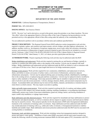
DEPARTMENT OF THE ARMYSAN FRANCISCO DISTRICT, U.S. ARMY CORPS OF ENGINEERS450 GOLDEN GATE AVENUESAN FRANCISCO, CALIFORNIA 94102DEPARTMENT OF THE ARMY PERMITPERMITTEE: California Department of Transportation, District 4PERMIT NO.: SPN-2020-00219ISSUING OFFICE: San Francisco DistrictNOTE: The term "you" and its derivatives, as used in this permit, means the permittee or any future transferee. The term"this office" refers to the appropriate District or Division office of the Corps of Engineers having jurisdiction over thepermitted activity or the appropriate official of that office acting under the authority of the commanding officer.You are authorized to perform work in accordance with the terms and conditions specified below:PROJECT DESCRIPTION: This Regional General Permit (RGP) authorizes routine transportation work activitiesrequired to maintain, replace, and construct road improvements, culverts, bridges, and other highway infrastructure. Inaddition, ancillary work (e.g., development of temporary staging areas, access roads, utility line relocation, dewateringsystems, and restoration or enhancement of aquatic resources) required as part of the activity are included as a coveredactivity. Enclosure 1 titled “USACE File ID SPN-2020-00219 (EA 04-3J790), Caltrans District 4, Regional GeneralPermit 33 (EA 04-3J790),” dated January 11, 2021, in 9 sheets, provides typical plans and drawings.AUTHORIZED WORK: Projects requiring the following work activities may be authorized under this RGP:Bridge rehabilitation and replacement: Work activities required to prolong the use and function of bridges, typically inresponse to a problem that affect public safety or the integrity of the structure. Culverts may be replaced with smallbridges. Bridge rehabilitation and replacement activities authorized under the RGP are limited to work on structures witha total span of 250 feet or less. There is no span length limit however for bridge maintenance projects.Drainage system projects: Work activities required for new construction, rehabilitation, and replacement of culverts,drains, and ditches to ensure conveyance of surface waters, avoid erosion of infrastructure, and protect adjacentinfrastructure and property. Culverts may be replaced utilizing open-cut trenching methods, rehabilitated by installing aliner in the existing culvert, or replaced using jack-and-bore construction. Culverts may be replaced in-kind or modified toimprove safety standards or fish passage. Rock slope protection (RSP) may be installed or replaced at the downstreamends of culverts to provide erosion protection. Culverts, drainage channels, ditches, and associated components may becleaned. Accumulated debris and sediment may be removed from ditches, channels, and detention or retention basins toreturn them to as-built contours. This may require excavation or grading.Safety and traffic improvement projects: Work activities required to prolong the life of a roadway and enhance publicsafety. Projects in this category may include shoulder widening, installing roundabouts, or reconfiguring interchanges.Additionally, projects may consist of pavement rehabilitation; guard rail, railings, barrier, and fencing installation orrepair; rumble strip installation; or signage improvements.Bank stabilization and slide abatement projects: Work activities required for streambank and slope stabilizations to protectinfrastructure and adjacent property, as well as to minimize adverse impacts to aquatic resources and listed species habitatthat may be caused by erosion. These projects typically involve the placement of RSP and/or bioengineered stabilizationtreatments or the construction of retaining walls or revetments. Slope stabilization activities authorized under the RGPmay include placement of retaining walls (e.g., soldier pile walls), revetments, or bioengineered treatments to stabilizelandslide and unstable slopes. Bank stabilization and erosion protection authorized under this RGP must be associated withexisting facilities or installations.Stormwater, trash, and debris management: Work activities including various best management practices designed toprotect and improve water quality. Installation of trash control BMPs associated with the trash control measures mayinclude the following: retrofit of existing stormwater treatment BMPs for full trash capture (FTC), bioretention with FTC,
gross solids removal devices such as trash nets, gross solids removal devices with biofiltration swale, biofiltrationswales/strips, design pollution prevention infiltration area, infiltration device, media filters and chemical separators, androck mulch swale.Stormwater management activities may include construction and maintenance of stormwater treatment systems. Newsystems may include construction of biofiltration swales/strips, and bioretention basins. Existing waters of the U.S. maynot be used to treat stormwater, but construction of stormwater treatment systems may impact waters of the U.S. Retentionor detention basins may also be maintained to preserve the line, grade, depth, and cross section to which they wereoriginally designed.Scientific investigation: Work activities may include geotechnical surveys, soil and sediment sampling, and culturalresource, biological, and hydrologic studies.FILL LIMITS: Projects qualify for authorization under the RGP only if they require placement of temporary fill withinno more than 1.5 acres or 500 linear feet, require permanent placement of fill within no more than 0.5 acre or 500 linearfeet, and result in the loss of no more than 0.25 acre or 300 linear feet of waters of the U.S.Overall, cumulative placement of a maximum of 5 acres of permanent fill over a 5-year period may occur under thisauthorization. Cumulatively, the loss of more than 1 acre of water of the U.S. over a 5-year period may not be authorized.There is no cumulative limit on temporary fill authorization. Impacts to culverted waters (e.g., culvert replacement) do notcount toward fill limits. When a culvert is upgraded, only impacts to the open water portions of the feature count towardthe fill limits. Fills required for ditch relocation associated with a roadway or bridge widening or relocation do not counttoward fill limits.Per projectTotal program limitsTemporary fillPermanent fillLoss of waters of the U.S.1.5 acres or500 linear feetnone0.5 acre or500 linear feet5 acres over5 years0.25 acre or300 linear feet1 acre over5 yearsNote: Impacts to culverted waters and ditch relocation/reestablishment are not counted toward project and program limitson aquatic resource impacts.PROJECT LOCATION: The program area would encompass 6,272 square miles and would include the entirety of theoverlapping areas in which Caltrans District 4 implements projects and the Corps of Engineers San Francisco District hasregulatory authority (Enclosure 1, Sheet 1). The program area includes the entireties of Marin, Napa, San Francisco, SanMateo, Santa Clara, and Sonoma Counties and the western portions of Alameda, Contra Costa, and Solano Counties thatdrain to the San Francisco Bay watershed.PERMIT CONDITIONS:GENERAL CONDITIONS:1.The time limit for completing the work authorized ends on December 31, 2025. If you find that you need moretime to complete the authorized activity, submit your request for a time extension to this office for considerationat least one month before the above date is reached.2.You must maintain the activity authorized by this permit in good condition and in conformance with the termsand conditions of this permit. You are not relieved of this requirement if you abandon the permitted activity,although you may make a good faith transfer to a third party in compliance with General Condition 4 below.ENG FORM 1721, Nov 862(33 CFR pt. 325 (Appendix A))
Should you wish to cease to maintain the authorized activity or should you desire to abandon it without a goodfaith transfer, you must obtain a modification of this permit from this office, which may require restoration of thearea.3.If you discover any previously unknown historic or archeological remains while accomplishing the activityauthorized by this permit, you must immediately notify this office of what you have found. We will initiate theFederal and State coordination required to determine if the remains warrant a recovery effort or if the site iseligible for listing in the National Register of Historic Places.4.If you sell the property associated with this permit, you must obtain the signature of the new owner in the spaceprovided and forward a copy of the permit to this office to validate the transfer of this authorization.5.A copy of the CWA 401 Water Quality Certification for projects authorized under the RGP will be provided toCorps of Engineers prior to impacting jurisdictional waters of the U.S.(see Special Condition 1(i)) You mustcomply with the conditions specified in the certification as special conditions to project authorization under theRGP.6.You must allow representatives from this office to inspect the authorized activity at any time deemed necessaryto ensure that it is being or has been accomplished in accordance with the terms and conditions of your permit.7.You understand and agree that, if future operations by the United States require the removal, relocation or otheralteration of the structure or work authorized herein, or if, in the opinion of the Secretary of the Army or hisauthorized representative, said structure or work shall cause unreasonable obstruction to the free navigation ofthe navigable waters, you will be required, upon due notice from the Corps of Engineers, to remove, relocate, oralter the structural work or obstructions caused thereby, without expense to the United States. No claim shall bemade against the United States on account of any such removal or alteration.SPECIAL CONDITIONS:1.Individual Project Authorization Requests must be submitted for authorization for each project under theRGP. Within 15 calendar days of receiving the Project Authorization Requests, the Corps of Engineerswould notify Caltrans District 4 if additional information is necessary to determine whether the project canbe authorized under this RGP. Caltrans District 4 should respond to additional information requests within15 calendar days. Once the Project Authorization Request is deemed complete, the Corps of Engineerswould provide concurrence with the terms and conditions of this RGP within 30 calendar days.Projects proposed for authorization under this RGP should be submitted to the Corps of Engineers with thefollowing information:a.A signed Project Authorization Request that documents materials are complete and accurate;b.A description of the proposed activity, including a discussion of which of the six general categoriesthe project falls under;c.A description of the project location, including latitude, longitude, and a project location map thatcomplies with the South Pacific Division’s Map and Drawing Standards;d.Project plans clearly depicting the location, size, and dimensions of the proposed activity, as wellas the location of delineated waters of the U.S. All drawings/plans shall comply with the mostrecent South Pacific Division Map and Drawing Standards;ENG FORM 1721, Nov 863(33 CFR pt. 325 (Appendix A))
2.3.e.An ORM Aquatic Resources and Consolidated Upload Spreadsheet listing all of the aquaticresources within the project area and all associated impacts;f.Documentation supporting Caltrans’ determination of impacts to federally listed species andcritical habitat, along with any applicable letters of concurrence or biological opinions from theU.S. Fish and Wildlife Service and/or the National Marine Fisheries Service (letters of concurrenceand biological opinions can be submitted as a PDF or as a web link to a publicly accessiblewebsite);g.Documentation supporting Caltrans’ determination of impacts to historic properties, along withany applicable letters of concurrence or memorandums of agreement signed by the State HistoricPreservation Officer;h.Documentation of Caltrans’ outreach to local Native American tribes, along with any responsesfrom the tribes if required;i.Documentation of your compliance with the current 401 certification process;j.Documentation of compliance with the Coastal Zone Management Act, along with any applicableconsistency certification; andk.A conceptual mitigation plan that complies with the 2008 Mitigation Rule for any projectproposing permanent impacts to greater than 0.1-acre waters of the U.S. (Temporary impactslasting more than one growing season are considered permanent for the purposes of complyingwith the 2008 Mitigation Rule.)Caltrans District 4 shall submit an annual report by February 1 of each year documenting impacts to watersof the U.S. authorized under the Program for the prior year. The annual report shall include a summary ofthe area and volume of temporary and permanent fills and any permanent loss of aquatic resourcesauthorized under the RGP. The annual report shall also track the overall Program-level impact limits. Assome projects authorized under the RGP require construction over more than one season, a summary ofprojects completed and still in construction shall be included with the report. The annual report shallinclude:a.A list of projects that have been completed and projects that are in progress.b.For applicable projects, documentation of any changes to the work compared to the ProjectAuthorization Request.c.The final quantity of permanent and temporary fill (in acres and cubic yards) and loss of waters ofthe U.S. (if applicable) for complete projects in table format.d.Lessons learned/opportunities for improved avoidance and minimization.e.Annual mitigation reporting; for each of the pre-identified mitigation sites the annual report shallinclude annual mitigation reporting compliant with the approved permittee-responsible mitigationplan.All project authorized under this RGP shall be implemented utilizing Caltrans program-wide avoidance andminimization measures. These minimization measures include:ENG FORM 1721, Nov 864(33 CFR pt. 325 (Appendix A))
a.Seasonal Work Windows: June 1-October 31 in perennial and tidal waters, April 1-October 31 innon-perennial waters.b.Environmental Awareness training: environmental awareness training for all work personnelconducted by a biologist prior to any work.c.Protect Environmentally Sensitive Areas: limiting work in environmentally sensitive areas (ESA’s)and fencing ESA's outside of the work area.d.Suitable Material: construction material must be free from toxic pollutants in toxic amounts.e.Implement Stormwater Best Management Practices.f.Implement Project Site Best Management Practices.g.Vegetation Removal: vegetation clearance only where necessary.h.Restore Disturbed Area: restoration of disturbed areas to preconstruction condition.i.Control Invasive Weed: compliance with Executive Order 13112 to reduce to spread of invasive,non-native species.j.Work from Uplands: construction equipment to be operated from upland areas to the maximumextent practicable to reduce adverse effects to aquatic resources.k.Management of Water Flows: maintaining or restoring pre-construction water flows and conditionto the maximum extent practicable.l.Removal of Temporary Fills: removal of temporary fills and restoration of area to pre-constructionelevation and re-vegetation.FURTHER INFORMATION:1.Congressional Authorities: You have been authorized to undertake the activity described above pursuant to:(X) Section 10 of the Rivers and Harbors Act of 1899 (33 U.S.C. Section 403).(X) Section 404 of the Clean Water Act (33 U.S.C. Section 1344).( ) Section 103 of the Marine Protection, Research and Sanctuaries Act of 1972 (33 U.S.C. Section 1413).2.3.Limits of this authorization:a.This permit does not obviate the need to obtain other Federal, State, or local authorizations required by law.b.This permit does not grant any property rights or exclusive privileges.c.This permit does not authorize any injury to the property or rights of others.d.This permit does not authorize interference with any existing or proposed Federal project.Limits of Federal Liability: In issuing this permit, the Federal Government does not assume any liability for thefollowing:a.Damages to the permitted project or uses thereof as a result of other permitted or unpermitted activities orENG FORM 1721, Nov 865(33 CFR pt. 325 (Appendix A))
from natural causes.b.Damages to the permitted project or uses thereof as a result of current or future activities undertaken by oron behalf of the United States in the public interest.c.Damages to persons, property, or to other permitted or unpermitted activities or structures caused by theactivity authorized by this permit.d.Design or construction deficiencies associated with the permitted work.e.Damage claims associated with any future modification, suspension, or revocation of this permit.4.Reliance on Applicant's Data: The determination of this office that issuance of this permit is not contrary to thepublic interest was made in reliance on the information you provided.5.Reevaluation of Permit Decision: This office may reevaluate its decision on this permit at any time thecircumstances warrant. Circumstances that could require a reevaluation include, but are not limited to, thefollowing:a.You fail to comply with the terms and conditions of this permit.b.The information provided by you in support of your permit application proves to have been false,incomplete, or inaccurate. (See Item 4 above.)c.Significant new information surfaces which this office did not consider in reaching the original publicinterest decision.Such a reevaluation may result in a determination that it is appropriate to use the suspension, modification, andrevocation procedures contained in 33 C.F.R. § 325.7 or enforcement procedures such as those contained in 33C.F.R. §§ 326.4 and 326.5. The referenced enforcement procedures provide for the issuance of an administrativeorder requiring you to comply with the terms and conditions of your permit and for the initiation of legal actionwhere appropriate. You will be required to pay for any corrective measures ordered by this office, and if you failto comply with such directive, this office may in certain situations (such as those specified in 33 C.F.R. §209.170) accomplish the corrective measures by contract or otherwise and bill you for the cost.6.Extensions: General Condition 1 establishes a time limit for the completion of the activity authorized by thispermit. Unless there are circumstances requiring either a prompt completion of the authorized activity or areevaluation of the public interest decision, the Corps of Engineers will normally give favorable consideration toa request for an extension of this time limit.Your signature below, as permittee, indicates that you accept and agree to comply with the terms and conditions of thispermit.1/13/21(PERMITTEE)(DATE)ENG FORM 1721, Nov 866(33 CFR pt. 325 (Appendix A))
This permit becomes effective when the Federal official, designated to act for the Secretary of the Army, has signedbelow.for1/15/2021John D. CunninghamLieutenant Colonel, US ArmyDistrict Engineer(DATE)When the structures or work authorized by this permit are still in existence at the time the property is transferred, the termsand conditions of this permit will continue to be binding on the new owner(s) of the property. To validate the transfer ofthis permit and the associated liabilities associated with compliance with its terms and conditions, have the transferee signand date below.(TRANSFEREE)(DATE)ENG FORM 1721, Nov 867(33 CFR pt. 325 (Appendix A))
SAN FRANCISCO DISTRICT, U.S. ARMY CORPS OF ENGINEERS 450 GOLDEN GATE AVENUE SAN FRANCISCO, CALIFORNIA 94102 . DEPARTMENT OF THE ARMY PERMIT . (Enclosure 1, Sheet 1). The program area includes the entireties of Marin, Napa, San Francisco, San Mateo, Santa Clara, and Sonoma Counties and the western portions of Alameda, Contra Costa, and Solano .


