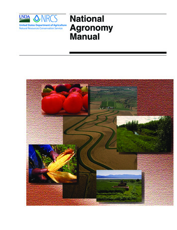
Transcription
NationalAgronomyManual
NationalAgronomyManualIssued February 2011The U.S. Department of Agriculture (USDA) prohibits discrimination in allits programs and activities on the basis of race, color, national origin, age,disability, and where applicable, sex, marital status, familial status, parentalstatus, religion, sexual orientation, genetic information, political beliefs,reprisal, or because all or a part of an individual’s income is derived fromany public assistance program. (Not all prohibited bases apply to all programs.) Persons with disabilities who require alternative means for communication of program information (Braille, large print, audiotape, etc.) shouldcontact USDA’s TARGET Center at (202) 720-2600 (voice and TDD). To file acomplaint of discrimination, write to USDA, Director, Office of Civil Rights,1400 Independence Avenue, SW., Washington, DC 20250–9410, or call (800)795-3272 (voice) or (202) 720-6382 (TDD). USDA is an equal opportunityprovider and employer.(190–V–NAM, 4th Ed., February 2011)
NationalAgronomyManualContentsPart 500Authorities, Policies, and Responsibilities500–1Part 501Water Erosion501–1Part 502Wind Erosion502–1Part 503Crop Production503–1Part 504Water Management504–1Part 506Plant Attributes506–1Part 507Cropland Conservation Management Systems507–1Part 508Soils508–1Part 509Data Management509–1Glossary(190–V–NAM, 4th Ed., February 2011)G–1i
NationalAgronomyManualii(190–V–NAM, 4th Ed., February 2011)
Part 500ContentsAuthorities, Policies, andResponsibilitiesSubpart 500A Authority500–1500.00 Description of authorities.500–1500.01 Purpose of the National Agronomy Manual.500–1Subpart 500B Agronomic policies500–1500.10 Location of policy.500–1500.11 Amendments to NAM.500–1Subpart 500C Responsibilities of agronomists500–2500.20 Responsibilities of national, State, area, and field agronomists.500–2500.21 Technical information—preparing, transferring, and training.500–2500.22 Certification.500–3500.23 Affiliation with professional organizations.500–3(190–V–NAM, 4th Ed, February 2011)500–i
Part 500500–iiAuthorities, Policies, andResponsibilities(190–V–NAM, 4th Ed, February 2011)NationalAgronomyManual
Part 500Authorities, Policies, andResponsibilitiesSubpart 500A Authority500.00Subpart 500B AgronomicpoliciesDescription of authoritiesThe U.S. Department of Conservation (USDA) SoilConservation Service (SCS) was renamed the NaturalResources Conservation Service (NRCS) by Secretary’s Memorandum 101–1 of November 20, 1994. Thisaction was authorized by the Federal Crop InsuranceReform and Department of Agriculture ReorganizationAct of 1994 (Public Law 103–354). The SCS had beencreated in USDA by the Soil Conservation and Domestic Allotment Act of 1935 (Public Law 74–46).Public Law 74–46 authorized a broad program of soiland water conservation, and it is still the basic authority for the Agency’s work with farmers and conservation districts.500.10Location of policyAgronomic policies are contained in specific parts andsubparts of the NAM as appropriate.500.11Amendments to NAMThe NAM will be amended as additional research iscompleted, existing methods or procedures are updated, or new technology is developed and approved foruse in the NRCS. The national agronomist is responsible for updating this manual.500.01 Purpose of the NationalAgronomy ManualThe National Agronomy Manual (NAM) containspolicy for agronomy activities and provides technicalprocedures for uniform implementation of agronomytools and applications. This manual is meant to complement all established USDA and NRCS policies andguidelines.(190–V–NAM, 4th Ed, February 2011)500–1
Part 500Authorities, Policies, andResponsibilitiesSubpart 500C Responsibilitiesof agronomists500.20 Responsibilities of national,State, area, and field agronomistsThe national agronomist, nutrient management specialists, and pest management specialists at the national level and agronomists on the center staffs andthe National Technical Support Centers provide staffassistance in all NRCS programs and provide nationalleadership on NRCS agronomy-related activities. Theyare responsible for: assisting upper management in formulating andrecommending national policies, procedures,and standards technical leadership and guidance; quality control national coordination of agronomy with otherNRCS technical fields promoting and maintaining relations withgroups and agencies that have common interestin agronomy technology transfer and direct technical support to States and State staffState agronomists provide staff assistance to the Stateconservationist for all agronomy and related functions.They are responsible for: assisting in developing State policies, procedures, and instructions, and coordinating themwith other States within the region providing technical leadership and guidance toother agronomists and appropriate personnelwithin the State collaborating with other State staff membersto ensure interdisciplinary action in all NRCSprograms training field personnel participating in agronomy components of appraisals and reviews500–2NationalAgronomyManual maintaining working relations with researchcenters and other cooperating agencies developing and revising of all aspects of FieldOffice Technical Guides related to agronomy providing assistance in interdisciplinary technical reviews of project plans, environmentalimpact statements, and other technical materials coordinating agronomy functions with otherStates in the region and across regional boundaries as appropriateArea, zone, or field level agronomists provide staffassistance in all NRCS programs. They are responsiblefor carrying out the requirements of conservationagronomy consistent with technical proficiency, training, interdisciplinary action, and quality control withintheir administrative area. In some cases, these agronomists may carry out some of the responsibilities of theState agronomists, if so delegated.Agronomists in the mentioned positions may providespecific functions through team or ad hoc assignmentsat a National, regional, or State level. Each agronomist has the responsibility to develop a training needsinventory and to work with their supervisor to obtaintechnical training to improve the overall agronomicexpertise.500.21 Technical information—preparing, transferring, and trainingAgronomists at all levels use technical informationthat has been developed by researchers, universities,institutes, and private sources to maintain technical materials for the administrative area they serve.Agronomists at all administrative levels develop andreview field office technical guide materials and ensure materials are technically correct, comprehensive,and useful to the end user.NRCS policy on preparing and maintaining technicalguides is in General Manual (GM) Title 450, Part 401.In addition, State agronomists are responsible for technical notes and other agronomy technical materialsthat are applicable to the State.(190–V–NAM, 4th Ed, February 2011)
Part 500Authorities, Policies, andResponsibilitiesAgronomists issue technical information at the area,State, or national level. This may include original information, research notes, papers, or excerpts of suchmaterial. All agronomists are encouraged to submitarticles for publication or presentation at professionalmeetings. Technical information presented or prepared for publication shall have an appropriate technical and or administrative review and include creditingof appropriate references per GM450 Part 410, SubpartB, Scientific and Technical Publications Review Program.Agronomists receive and provide training necessaryto maintain technical competency at all administrativelevels. Training includes, but is not limited to, NationalEmployee Development Center courses, workshops,conferences, university courses, and on-the-job Agronomists at all levels of the Agency are encouragedto obtain professional certification(s). Examples of certification programs include the Certified Crop Adviser(CCA), Certified Professional Agronomists (CPAg)under ARCPACS of the American Society of Agronomy,and Certified Professional in Erosion and SedimentControl (CPESC) of the Soil and Water ConservationSociety. Continuing educational requirements of mostcertification programs provide excellent opportunitiesto stay abreast of advances in technology.500.23 Affiliation with professionalorganizationsAgronomists at all levels are encouraged to be activemembers of professional scientific societies, such asthe American Society of Agronomy, Soil Science Society of America, Crop Science Society of America, theSoil and Water Conservation Society. These organizations provide opportunities to interact with researchers at the national and State level and to stay currenton the latest technology.(190–V–NAM, 4th Ed, February 2011)500–3
Part 501ContentsWater ErosionSubpart 501A Introduction501–1501.00 Overview of water erosion . .501–1Subpart 501B Water Erosion501–1501.10 Forms of water erosion .501–1501.11 The water erosion process . .501–1Subpart 501C Estimating sheet and rill erosion501–2501.20 How, why, and by whom water erosion is estimated .501–2501.21 Methods of estimating sheet and rill erosion .501–2501.22 The Revised Universal Soil Loss Equation version 2 (RUSLE2).501–3501.23 Limitations of the equation .501–3501.25 Data needed to support RUSLE2 .501–4501.26 Tools for using RUSLE2 .501–4Subpart 501D Principles of water erosion control501–4501.30 Overview of principles .501–4501.31 Relation of soil loss values to RUSLE2 factors .501–4Subpart 501E References(190–V–NAM, 4th Ed, February 2011)501–5501–i
Part 501501–iiWater Erosion(190–V–NAM, 4th Ed, February 2011)NationalAgronomyManual
Part 501Water ErosionSubpart 501A IntroductionSubpart 501B Water Erosion501.00501.10Overview of water erosionThis part presents United States Department of Agriculture (USDA) Natural Resources ConservationService (NRCS) policy and procedures for estimatingsoil erosion by water. It explains the types, the methodused to estimate, and the management of soil erosionby water. NRCS technical guidance related to watererosion shall conform to policy and procedures setforth in this part.The Agricultural Research Service (ARS) has primaryresponsibility for erosion prediction research withinthe USDA. ARS is the lead agency for developingerosion prediction technology, including the RevisedUniversal Soil Loss Equation version 2 (RUSLE2). Themajority of the technology in RUSLE2 is documentedin the publication Predicting Soil Erosion by Water: AGuide to Conservation Planning With the Revised Universal Soil Loss Equation (RUSLE), USDA Handbook703, hereafter referred to as the Agriculture Handbook703. The reader is referred to the Agriculture Handbook 703 for a detailed description of RUSLE2 technology and parameter effects on soil loss,Forms of water erosionForms of soil erosion by water include sheet andrill, ephemeral gully, classical gully, and streambank.Each succeeding type is associated with the progressive concentration of runoff water into channels as itmoves downslope. Sheet erosion, sometimes referredto as interrill erosion, is the detachment of soil particles by raindrop impact and the removal of thin layersof soil from the land surface by the action of rainfalland runoff. Rill erosion is the formation of small, generally parallel channels formed by runoff water. Rillsusually do not re-occur in the same place. Ephemeralgullies are concentrated flow channels formed whenrills converge to form shallow channels. They can easily be filled with soil by typical tillage operations andre-formed in the same general location by subsequentrunoff events. Classical gullies are also concentratedflow channels formed when rills converge. These arewell defined, permanent incised drainageways thatcannot be crossed by ordinary farming operations.Other forms of erosion that are related to soil erosionby water include stream channel and geologic. Streamchannel erosion refers to the degradation of channelsand waterways. Geologic erosion refers to long-termerosion effects, as opposed to accelerated erosionevents described in this subpart.No reliable methods exist for predicting the rate ofephemeral gully, classical gully, stream channel, orgeologic erosion. However, the science is under development to add ephemeral gully erosion estimatesto water erosion prediction models. The remainderof this part deals only with prediction and control ofsheet and rill erosion.501.11The water erosion processDetachment, transport, and deposition of soil particlescaused by raindrop impact and surface runoff areknown as the processes of sheet and rill erosion.(190–V–NAM, 4th Ed, February 2011)501–1
Part 501Water ErosionDetachment is the removal of particles from the soilmass and is expressed in units, such as tons per acreand is referred to as sediment.The movement of sediment downslope is sedimenttransport. A measure of sediment transport is sediment load. Sediment load on a slope increases withdistance downslope as long as detachment is occurring. That is, detachment adds to the sediment load.Where runoff is slowed along the slope, at the baseof a slope, or by dense vegetation, deposition occurs.Deposition is the transfer of sediment from the sediment load to the soil mass. That is, deposition removessediment from the sediment load, and accumulates onthe soil surface.Two types of deposition, remote and local, occur. Remote deposition occurs some distance away from theorigin of the sediment. Depositions at the toe of a concave slope, on the uphill side of vegetative strips, andin terrace channels are examples of remote deposition.Local deposition is where sediment is deposited near,within several inches, of where it is detached. Deposition in microdepressions and low gradient furrows arealso examples of local deposition.NationalAgronomyManualSubpart 501C Estimating sheetand rill erosion501.20 How, why, and by whom watererosion is estimatedNRCS estimates soil erosion by water as part of itstechnical assistance to land users. In conservationplanning, erosion estimates are made for an existingmanagement system and compared with alternativesystems and with soil loss tolerance (T) values.In addition, soil loss estimates are used to inventorynatural resources, evaluate the effectiveness of conservation programs and land treatment, and estimatesediment production from fields that might becomesediment yield in watersheds.Title 450 National Instruction Part 300 issued in July2002 required that RUSLE2 be fully implemented in allNRCS field offices where water erosion is a resourceissue by the end of calendar year 2002. In 2002, NRCSadopted RUSLE2 as the official tool for predicting soilerosion by water. NRCS continues to use some USLEcomponents for certain provisions of Farm Bill programs, most notably it uses USLE soil factors in determining if fields are Highly Erodible Land.501.21 Methods of estimating sheet andrill erosionEfforts to predict soil erosion by water started in the1930s. Cook (1936) identified the major variables thataffect erosion by water. Zingg (1940) published thefirst equation for calculating field soil loss. Smith andWhitt (1947) presented an erosion-estimating equationthat included most of the factors present in modernsoil loss equations. The Musgrave equation (Musgrave1947) was a soil loss equation developed for farmplanning. Finally, an effort was initiated to develop anational equation from the various state and regionalequations that existed in the 1950s. In 1954, the ARSestablished the National Runoff and Soil Loss DataCenter at Purdue University in West Lafayette, Indiana,to consolidate all available erosion data. Using thedata assembled at the Data Center, Wischmeier and501–2(190–V–NAM, 4th Ed, February 2011)
Part 501Water ErosionNationalAgronomyManualSmith (1965) developed the Universal Soil Loss Equation (USLE).R The USLE was a consolidation of several regional soilloss equations, and was based on summarizing andstatistical analyses of more than 10,000 plot-years ofbasic runoff and soil loss data from 49 United Stateslocations (Agriculture Handbook 703, 1997; Wischmeier and Smith 1965, 1978).K L S C P The USLE was designed to provide a convenient working tool for conservationists. It quantifies soil erosionas a product of six factors representing rainfall andrunoff erosiveness, soil erodibility, slope length, slopesteepness, cover-management practices, and supporting practices.ARS released RUSLE in 1992 as a computer programin the DOS environment. The model calculates soilloss from a field slope using values for each factorand using data elements from climate, plant, and fieldoperation databases.501.22 The Revised Universal Soil LossEquation version 2 (RUSLE2)Since implementation during 2002, RUSLE2 has beenused by NRCS to estimate soil loss by water. RUSLE2predicts long-term average annual soil loss from sheetand rill erosion. RUSLE2 is an update of the RevisedUniversal Soil Loss Equation (RUSLE) as describedin Agriculture Handbook 703. RUSLE2 utilizes a computer program to facilitate the calculations. RUSLE2technology reflects the analysis of research data thatwere unavailable when Agricultural Handbook 282(Wischmeier and Smith 1965), Agriculture Handbook537, and Agriculture Handbook 703 were completed,including subsequent technology development.The average annual soil loss from sheet and rill erosion is computed based on the following equation:A R K L S C PwhereA the computed spatial average soil loss andtemporal average soil loss per unit of area(usually expressed in units of T/a/yr)501.23the rainfall-runoff erosivity factor (therainfall erosion index value plus a factor forany significant snowmelt runoff)the soil erodibility factor (the soil loss rateper erosion index unit for a specified soilas measured on a standard plot that is 22.1meters long with a uniform 9 percent slopein continuous clean-tilled fallow)the slope length factor (the ratio of soil lossfrom the field slope length and soil lossfrom standard plot length under otherwiseidentical conditions)the slope steepness factor (the ratio ofsoil loss from the field slope gradient andsoil loss from standard plot gradient underotherwise identical conditions)the cover-management factor (the ratio ofsoil loss from an area with specified cover/management and soil loss from an otherwise identical area in continuous cleantilled fallow)the support practice factor (the ratio of soilloss with a support practice like contouring,strip cropping or terracing and soil loss withstraight-row farming up and down the slope)Limitations of the equationThe term Universal distinguishes the USLE, RUSLEand RUSLE2 from State and regionally based modelsthat preceded them. However, the use of these equations is limited to situations where factors can beaccurately evaluated and to conditions for which theycan be reliably applied (Wischmeier 1978; AgricultureHandbook 703, 1997).RUSLE2 predicts long-term average annual soil losscarried by runoff from specific field slopes underspecified cover and management systems. It is notappropriate to use RUSLE2 to predict specific erosionevents associated with single storms or short-termrandom fluctuations. RUSLE2 also estimates sedimentyield for the amount of eroded soil leaving the endof a slope with certain support practices. It does notpredict sediment yield for the amount of sediment thatis delivered to a point in a watershed, such as the edgeof a field that is remote from the origin of the detachedsoil particles. Nor does RUSLE2 predict erosion thatoccurs in concentrated flow channels.(190–V–NAM, 4th Ed, February 2011)501–3
Part 501501.25Water ErosionData needed to support RUSLE2RUSLE2 uses soil erodibility, K, values from the NASISSoils Database. The RUSLE2 user inputs the appropriate soil type/component for the defined slope beingevaluated. Climatic data (R) is obtained from NationalWeather Service weather stations with reliable longterm data. State and area agronomists have developedmanagement records for the different crops in theirareas from which RUSLE2 calculates cover and management factors (C).The crop database in RUSLE2 contains plant growthand residue production parameters. Values for many ofthese parameters are available in a database for a widevariety of plants.The operations database in RUSLE2 contains thesoil and residue disturbance parameters. Values areavailable for a very large number of field operationsranging from a spade to numerous types of harvestingequipment.Development and maintenance of databases used byNRCS in erosion prediction models are the responsibility of NRCS agronomists at the State and nationallevels. Refer to part 509 in this manual for moredetailed information on database management and instructions. The national database manager maintains adatabase management plan that identifies the processof developing and maintaining databases needed tosupport RUSLE2. Databases for all States are availablein electronic format from the official RUSLE2 website (http://fargo.nserl.purdue.edu/rusle2 dataweb/RUSLE2 Index.htm). Length of slope (L) and steepness of slope (S) are entered by the user based on theslope and length being evaluated.501.26Tools for using RUSLE2Most States and basin areas have developed countybased climatic maps for their areas. These containthe detail that is desired when applying RUSLE2 tospecific field situations, and are available in NRCSState offices and, in many cases, from the Field OfficeTechnical Guide.501–4NationalAgronomyManualSubpart 501D Principles ofwater erosion control501.30Overview of principlesThe principle factors that influence soil erosion by water are climate, soil properties, topography, vegetativecover, and conservation practices. Climate and soilproperties are conditions of the site and are not modified by ordinary management measures. Conservationtreatment primarily involves manipulation of vegetative cover, modification of topography, and manipulation of soil conditions in the tillage zone.The greatest deterrent to soil erosion by water is vegetative cover, living or dead, on the soil surface. Coverand cultural practices influence both the detachmentof soil particles and their transport. Growing plantsand plant residue absorb the energy of raindrops,decrease the velocity of runoff water, and help createsoil conditions that resist erosion. Cultural practicesthat affect vegetative cover include crop rotations,cover crops, management of crop residue, and tillagepractices.501.31 Relation of soil loss values toRUSLE2 factorsIn conservation planning, cover and management(Cfactor) and practice implementation (P factor) can bemodified or selected in RUSLE2 to develop alternatives for erosion reduction. In addition, where slopelength is reduced by installing terrace or diversionsystems, the slope length and steepness factor (LS)will be reduced. Using RUSLE2 technology, estimatesof erosion reduction are illustrated in the C subfactors.Benefits to erosion control are achieved in the: prior land use subfactor by increasing the massof roots and buried residue and increasing periods since soil disturbance canopy cover subfactor by increasing thecanopy cover of the field area and low raindropfall height from the canopy(190–V–NAM, 4th Ed, February 2011)
Part 501Water ErosionNationalAgronomyManual surface cover subfactor by increasing theground cover of plant residue, and by permanent cover such as rock fragmentsSubpart 501E References surface roughness subfactor by increasing therandom surface roughness that ponds water,and thereby reduces the erosive effect of raindrops and traps sedimentCook, H.L. 1936. The nature and controlling variablesof the water erosion process. Soil Sci. Soc. Am.Proc. 1:60–64. soil moisture subfactor by growing moisturedepleting crops. This benefit is only appliedin RUSLE in the Northwest Wheat and RangeRegion of the western United StatesDeer-Ascough, L.A., G.A. Weesies, J.C. Ascough, II, andJ.M. Laflen. 1995. Plant parameter database forerosion prediction models. Applied Engineeringin Agriculture, 11(5):659–666.When support practices are applied, they becomeintegral parts of a resource management system forcontrolling soil erosion by water. Contour farming,contour stripcropping, and conservation buffers formridges on or near the contour that slow runoff and trapsediment. Terraces and diversions intercept concentrated runoff flows and, in many cases, shorten thelength of slope.Some erosion control practices, such as grassed waterways and water control structures, do not substantially reduce sheet and rill erosion. While these can beeffective erosion control practices for concentratedflow (in the case of grassed waterways) in a resourcemanagement system, they are not a part of the soil lossreduction that is estimated by RUSLE2.Foster, G.R., G.A. Weesies, D.K. McCool, D.C. Yoder,and K.G. Renard. 1997. Revised Universal SoilLoss Equation User’s Manual. U.S. Departmentof Agriculture, Natural Resources ConservationService. (unpublished draft).Musgrave, G.W., and R.A. Norton. 1937. Soil and waterconservation investigations at the Soil Conservation Experiment Station Missouri ValleyLoess Region, Clarinda, Iowa, Progress Report,1931–35. U.S. Department of Agriculture Tech.Bull. 558.Renard, K.G., G.R. Foster, G.A. Weesies, D.K. McCool,and D.C. Yoder, coordinators. 1997. Predictingsoil erosion by water: a guide to conservationplanning with the Revised Universal Soil LossEquation (RUSLE). U.S. Department of Agriculture Handbook No. 703, 404 pp.Smith, D.D., and D.M. Whitt. 1947. Estimating soillosses from field areas of claypan soil. Soil Sci.Soc. Am. 12: 485–490.Wischmeier, W.H., and D.D. Smith. 1965. Predictingrainfall-erosion losses from cropland east of theRocky Mountains: Guide for selection of practices for soil and water conservation. U.S. Department of Agriculture Handbook No. 282.Wischmeier, W.H., and D.D. Smith. 1978. Predictingrainfall erosion losses: A guide to conservationplanning. U.S. Department of Agriculture Handbook No. 537.Zingg, A.W. 1940. Degree and length of land slope as itaffects soil loss in runoff. Agric. Eng. 21:59–64.(190–V–NAM, 4th Ed, February 2011)501–5
Part 502ContentsWind ErosionSubpart 502A Introduction502–1502.00 Overview.502–1Subpart 502B Wind Erosion502–1502.10 The wind erosion problem.502–1502.11 The wind erosion process.502–2502.12 Principles of wind erosion control.502–3502.13 Tolerances in wind erosion control.502–4(a) Crop tolerance to blowing soil.502–4(b) The effects of wind erosion on water quality.502–4Subpart 502C Estimating Wind Erosion502–5502.20 How, why, and by whom wind erosion is estimated.502–5502.21 Development of wind erosion prediction technology.502–5502.22 Data to support the previous WEQ for program purposes.502–6502.23 Wind Erosion Prediction System .502–6502.24 Using WEPS estimates with RUSLE2 calculations.502–7Subpart 502D Using WEPS502–7502.30 Using WEPS.502–7(a) Selection the location to run WEPS.502–7(b) Generic soils list.502–8(c) Guidance using CMZ Templates.502–10(d) Soils with rock on the surface.502–10(e) Muck soils.502–11Subpart 502E References(190–V–NAM, 4th Ed, February 2011)502–12502–i
Part 502Wind ErosionFiguresFigure 502–1The wind erosion process502–3Figure 502–2Screen shot of location box in WEPS program502–8Figure 502–3Rock fragments pull-down and the 2% Soil DBValue for rock502–10Table 502–1Crop tolerance to blowing soil502–2Table 502–2Generic Soils List for 0–V–NAM, 4th Ed, February 2011)
Part 502Wind ErosionSubpart 502A IntroductionSubpart 502B Wind Erosion502.00502.10OverviewThis part presents U.S. Department of Agriculture(USDA) Natural Resources Conservation Service(NRCS) policy and procedures for estimating winderosion. It explains the Wind Erosion Prediction System (WEPS) and provides guidance and reference onwind erosion processes, prediction, and control. NRCStechnical guidance related to win
Agronomy Manual The National Agronomy Manual (NAM) contains policy for agronomy activities and provides technical procedures for uniform implementation of agronomy tools and applications. This manual is meant to com-plement all established USDA and NRCS policies and guidelines. Subpart 500B Agronomic policies 500.10 Location of policy
