Transcription
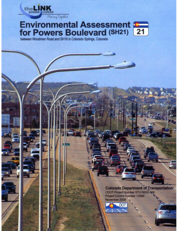
STU R200-109Project Control No. 13589POWERS BOULEVARD (SH21)BETWEEN WOODMEN ROAD AND STATE HIGHWAY 16IN COLORADO SPRINGS, COLORADOENVIRONMENTAL ASSESSMENTSubmitted Pursuant to:42 USC 4332 (2)(C)By theUS Department of TransportationFederal Highway Administrationand theColorado Department of TransportationSubmitted by:Timothy J. Harris, PERegion 2 Transportation DirectorColorado Department of TransportationDateConcurred by:Pamela A. Hutton, PEChief EngineerColorado Department of TransportationDateApproved by:Karla S. Petty, PEDivision Administrator, Colorado DivisionFederal Highway AdministrationDate
A Federal agency may publish a notice in the Federal Register, pursuant to 23 USC139(l), indicating that one or more Federal agencies have taken final actions on permits,licenses, or approvals of a transportation project. If such notice is published, claimsseeking judicial review of those Federal agency actions will be barred unless such claimsare filed within 180 days after the notice, or within such shorter time period as isspecified in the Federal laws pursuant to which judicial review of the Federal agencyaction is allowed. If no notice is published, then the periods of time that otherwise areprovided by the Federal laws governing such claims will apply.
TABLE OF CONTENTSChapter 11.11.21.31.4Introduction & Project Purpose and Need .1-1Introduction.1-1Project Purpose.1-2Need for Action.1-2Addressing This Need .1-7Chapter 22.12.22.32.42.52.62.7Corridor Context.2-1Introduction.2-1Historical Development of the Corridor.2-1Current and Future Development Patterns.2-3Current Role of Powers Boulevard .2-5Mix of Local and Regional Trips .2-8Environmental Context .2-8Shaping Transportation Solutions Based on This Context .2-11Chapter 1How the Proposed Action Was Developed.3-1Description of the Proposed Action .3-12Description of the No-Action Alternative.3-17Other Planned Projects in the Area .3-17Building the Project .3-18Chapter 44.14.24.34.44.54.64.74.84.94.104.11Affected Environment, Impacts, and Mitigation .4-1Introduction.4-1Traffic Congestion and Access.4-3Social, Economic and Land Use Considerations.4-9Community Quality of Life .4-15Construction Impacts.4-32Water Resources.4-38Ecological Resources .4-45Cultural Resources .4-54Other Resources and Issues .4-58Cumulative Effects .4-66Summary of Impacts and Mitigation .4-86Chapter 55.15.25.35.4Public and Agency Involvement .5-1Overview .5-2Key Issues and Actions Taken .5-3Specialized Outreach to Minority and Low-Income Persons .5-8Future Public and Agency Involvement .5-10Chapter 6Native American Consultation .6-1Chapter 77.17.2Section 4(f) De Minimis Impact Documentation .7-1Project Effects .7-1Findings of De Minimis Impacts.7-6i
LIST OF APPENDICESAppendices are contained on a compact disc included at the back of the EA document.Appendix AAgency CorrespondenceAppendix BTraffic Analysis ReportAppendix CMode Feasibility StudyAppendix DAlternatives Screening ReportAppendix EContext Sensitive Solutions ReportAppendix FEnvironmental Justice Technical ReportAppendix GRight-of-Way Technical ReportAppendix HNoise Technical ReportAppendix IAir Quality Technical ReportAppendix JVisual Resources Technical ReportAppendix KEcological Resources Technical ReportAppendix LWetland FindingAppendix MFloodplains Technical ReportAppendix NWater Quality Technical ReportAppendix OCultural Resources Technical ReportAppendix PPaleontological Technical ReportAppendix QPublic Involvement ReportLIST OF EXHIBITS1-11-21-31-41-51-62-12-22-32-4Study Area .1-1Projected Changes Associated with Powers Boulevard Corridor Congestion,Baseline and 2035 Conditions .1-3Powers Boulevard Traffic Volumes, Baseline and 2035 .1-4Traffic Levels of Service at a Signalized Intersection.1-5Congestion Severity by Intersection.1-6Travel Time Needed to Drive the Powers Boulevard Corridor during PeakPeriod, in Minutes .1-7Map of Ranch Ownership and Roads East of Colorado Springs, 1939 .2-2Historical Expansion and Improvement of Powers Boulevard.2-3Summary of Land Uses along the Powers Boulevard Corridor.2-42005 and 2035 Projected Population and Employment by Corridor Subarea.2-5ii
LIST OF EXHIBITS (continued)2-52-62-72-82-9Military Base Access from Powers Boulevard.2-6Two New Hospitals along Powers Boulevard.2-7Intense Retail Development Adjacent to a Powers Boulevard Intersection .2-7Sand Creek, Dry and Running, Downstream from Powers Boulevard.2-8View of Former Rock Island Railroad Location at Powers Boulevard,South of Constitution -133-14Key Steps in the Alternatives Development Process .3-1Planned Future Transit Service in Eastern Colorado Springs.3-3Results of Transportation Mode Analysis.3-4Major North-South Roads Existing or Planned in Eastern Colorado Springs.3-5Results of Corridor Analysis .3-6Results of Roadway Type Analysis .3-9Relationship of Number of Actions to Amount of Detail .3-10Lane Configuration for 6-Lane Freeway North of Milton E. Proby Parkway.3-12Lane Configuration for 4-Lane Freeway South of Milton E. Proby Parkway .3-12Summary of the Proposed Action and the No-Action Alternative.3-13Number of Lanes and Interchange Configurations for Proposed Action .3-14Ordinary Interchange and Interchange with Texas Turnaround Ramp .3-15Typical Cross Section of Powers Boulevard Existing 6-Lane Expressway .3-16Potential Construction Segments and Costs for the Proposed Action .3-124-14-24-3Topics Addressed and Summarized Impacts of the Proposed Action .4-1Baseline and Projected Traffic Volumes on Powers Boulevard .4-5Baseline and Future Congestion Severity by Intersection, and Corridor TravelTime in Minutes.4-6Proposed Changes Affecting Direct Access to Powers Boulevard .4-7Proposed Access Modifications Affecting Nearby Streets .4-82035 Market Area within 15 Minutes’ Drive from Powers/South CarefreeCommercial Area .4-11Residential and Business Relocations Needed for Right-of-Way Acquisition .4-12Example of Duplex Residence on Gunshot Pass Drive .4-14Example of CDOT Noise Wall in Colorado Springs .4-16Locations that Would Experience Noise Impacts with the No-Action Alternative.4-17Locations where Noise Mitigation Was Considered .4-19Recommended Noise Wall Locations and Approximate Dimensions .4-20Air Quality Issues Addressed in This EA.4-22Existing and Planned Parks, Trails and Recreation Facilities .4-26View to and from the High Chaparral Open Spaceacross Powers Boulevard .4-30Views Southward from Barnes Road and Northward from Platte Avenue .4-30View Eastward across Powers Boulevard at Constitution AvenueFor Existing Conditions and the Proposed Action.4-31Potential Construction Segments .4-33Example of Roadside Drainage Ditch along Powers Boulevard 64-174-184-19iii
LIST OF EXHIBITS -424-434-445-15-25-35-45-5Drainages in the Powers Boulevard Corridor .4-39Baseline Runoff and Pollutant Loads from Powers Boulevard andAdjacent Land Uses .4-39Runoff and Pollutant Loads, Baseline and No-Action Alternative .4-41Runoff and Pollutant Loads, Baseline and Proposed Action.4-42Conceptual Locations for Water Quality Detention Features .4-43Ecological Resources in the Powers Boulevard Corridor.4-45Aerial Photos, 1967 and 2007, of the Site of the Former Powers Dairy.4-46Ecological Resources South of Milton E. Proby Parkway .4-48Sensitive Species Potentially Present in the Powers Boulevard Corridor .4-49Noxious Weeds Present in the Powers Boulevard Corridor.4-50East Fork Sand Creek.4-52Location of the Former Rock Island Railroad .4-55Sites with Known or Potential Contamination by Hazardous Materials.4-59Ammonite Fossil Found along the Powers Boulevard Corridor.4-62Excess Commuter Fuel Consumption Due to Traffic Congestion inColorado Springs, 1967 to 2007 .4-63No-Action Travel and Fuel Use for Study Area on a Typical Weekday.4-64Proposed-Action Travel and Fuel Use for Study Area on a Typical Weekday .4-65Past, Present and Reasonably Foreseeable Actions Affecting Landscape Patterns .4-68Past, Present and Reasonably Foreseeable Actions Affecting WaterQuality and Quantity.4-70Past, Present and Reasonably Foreseeable Actions Affecting Air Quality .4-73Past, Present and Reasonably Foreseeable Actions AffectingTransportation Patterns.4-76Past, Present and Reasonably Foreseeable Actions Affecting Noise.4-78Past, Present and Reasonably Foreseeable Actions Affecting Visual Resources .4-80Project-Level and Statewide CO2 Emissions .4-84Summary of Impacts and Mitigation.4-865-75-8Continuous Public Involvement Was a Central Focus throughout EA Development .5-1Public Outreach Tools.5-2Citizens Ask Questions at a Public Open House Meeting.5-2Milton E. Proby Parkway Interchange Expansionl .5-4Aerial View of Rio Vista Drive between South Carefree Circle andConstitution Avenue .5-5Location of Proposed Rock island trail and Sand Creek Trail Crossingsof Powers Boulevard .5-6Original Concept and Alternative Alignment for the Proposed Powers Trail .5-2Pronghorn Antelope at the Bluestem Prairie Open Space .5-67-17-27-3Location of Section 4(f) Resources Affected by the Proposed Action.7-1Aerial View of Rock Island Railroad Impact Location.7-2View Westward of the Former Rock Island Railroad Grade.7-35-6iv
7-47-57-67-77-8Aerial View of the Cherokee Ridge Par 3 Golf Course .7-4View Eastward of Land Needed from the Cherokee Ridge Golf Course.7-4Aerial View of the Skyview Sports Complex .7-5View Southward of Land Needed near the Corner of Softball Field #7.7-5View Northward of Land Needed from the Southern End of the SkyviewSports Complex.7-6v
24CHAPTER 1 – INTRODUCTION &PROJECT PURPOSE AND NEEDExhibit 1-1. Study AreaThe purpose of this project is to 6reduce current and future traffic8congestion on the PowersBoulevard expressway (State10Highway 21) between WoodmenRoad and State Highway 16.1214161820221.1 INTRODUCTION24262830323436384042This Environmental Assessment (EA) wasprepared by the Federal HighwayAdministration and the Colorado Departmentof Transportation to address the problem ofcurrent and future traffic congestion onPowers Boulevard, the second busiest northsouth roadway in the State’s second largestmetropolitan area. This existing expresswayserves rapidly growing eastern ColoradoSprings and unincorporated El Paso County.4446485052In 2007 it was added to the State HighwaySystem as State Highway 21 (SH 21).Powers Boulevard is also part of the NationalHighway System and is locally designated asa truck route.545658606264666870The focus of this EA is the “central” portion ofPowers Boulevard, between Woodmen Roadon the north and State Highway 16 (SH 16)on the south, a distance of approximately 17miles. In the future, Powers Boulevard isplanned to be about 33 miles long,connecting to Interstate 25 (I-25) north andsouth of Colorado Springs, as shown inExhibit 1-1.1-1
123456About seven miles of Powers Boulevard are congested today. By the year 2035, extremelycongested conditions are predicted on the 11 miles between Woodmen Road and Milton E.Proby Parkway. The portion of Powers Boulevard between Milton E. Proby Parkway and SH16, which will not be congested by 2035, was included in the study area in order to identifypotential future improvements, as well as to examine alternative modes and routes at anappropriate scale.7891011121314151617This central portion of the Powers Boulevard expressway varies from four to six through-lanes.North of Woodmen Road, Powers Boulevard continues as SH 21 and is a four-lane expressway.To the south, where Powers Boulevard meets SH 16, the four-lane expressway continueswestward as SH 16 to connect with I-25. These connections are discussed 404142434445At the southern end of existing Powers Boulevard, the expressway continues westward as SH16, also known as Mesa Ridge Parkway, and connects to I-25 near the Fort Carson militarybase. The westernmost mile of SH 16 has long been a congested traffic bottleneck at a keyentrance into Fort Carson, the region’s largest employer. In 2007, CDOT and FHWA completedan EA that examined the potential impacts of widening SH 16 to four lanes. The widening of SH16 began in early 2008 and will continue through at least 2010.Powers Boulevard currently extends northward from Woodmen Road to SH 83, and is plannedto extend westward to meet I-25 south of the existing North Gate interchange. An EA wascompleted in 1997 for the entire “North Powers” extension from Woodmen Road to I-25. ThePikes Peak Area Council of Governments (PPACG) Moving Forward: 2035 RegionalTransportation Plan adopted in 2008 indicates that Powers Boulevard will be connectedbetween SH 83 and I-25 as an expressway, or possibly a tollway, in the 2010-2015 timeframe.PPACG’s Moving Forward identifies the need for a “South Powers” extension from SH 16approximately nine miles to I-25 in the long-term future, but funding for this extension is notincluded in the plan. When warranted, this extension may be the subject of a future environmentalstudy. For the foreseeable future, however, SH 16 will serve as the southern connection betweenPowers Boulevard and I-25.Moving Forward uses 2005 socioeconomic and traffic data as a baseline and 2035 as the futureplanning horizon year. To be consistent with the regional planning effort documented in MovingForward, this EA reflects the baseline and future conditions used in that plan. It should berecognized, however, that the 2005 baseline traffic is likely to be less throughout most of theregion than what exists today due to continued regional growth and development. PowersBoulevard is a good example of one major road which has experienced recent growth in traffic.As studies for this EA progressed, the regional transportation planning process by PPACG wascontinuously being updated. As new plans were adopted, the data used in this EA wasevaluated and PPACG concurred that it was consistent with the latest transportation planningdata and assumptions. Additional information about relevant plan updates and the processesused to assure consistency with them can be found in Appendix B, Traffic Analysis Report.1-2
11.2 PROJECT PURPOSE23456The purpose of this project is to reduce current and future traffic congestion on PowersBoulevard between Woodmen Road and SH 16, while accommodating the amount of traveldemand that is foreseen through 2035 in Moving Forward, the adopted regional transportationplan.7891011121315171.3 NEED FOR ACTIONToday, Powers Boulevard is congested for about seven miles, between Barnes Road andAirport Road. With continued development along the corridor, 11 miles of Powers Boulevardwill be extremely congested, between Woodmen Road and Milton E. Proby Parkway. Theparagraphs below provide a better understanding of why this will occur and what it will mean,based on the four projected corridor changes illustrated in Exhibit 1-2.Exhibit 1-2. Projected Changes Associatedwith Powers Boulevard Congestion, Baselineand 2035 Conditions19212325272930313233343536373839Corridor PopulationRapid urban development has occurred, is continuing to occur, and will likely continue ineastern Colorado Springs and El Paso County. Powers Boulevard is the primary north-southroadway serving the growth that has occurred near it. The Colorado Springs metropolitan areasince 1960 has grown by approximately 100,000 residents each decade, a rate that is nowprojected to increase between the years 2005 and 2035. The 2000 Census recorded apopulation of approximately 517,000 for El Paso County, and the Colorado StateDemographer’s Office estimates that this increased to 565,000 by 2005. PPACG, the region’smetropolitan planning organization, predicts that by 2035, the conty’s population will beapproximately 936,000, reflecting a 30-year increase of about 370,000 new residents.40414243Due to growth constraints to the west of Colorado Springs, including Pikes Peak, the PikesPeak National Forest, and military bases (e.g., Fort Carson and the U.S. Air Force Academy),the city has been growing eastward. Residential development surrounded Powers Boulevardbetween 1985 and 2005, and intense retail development has occurred since the late 1990s.1-3
12345678910111213New businesses are under construction and remaining parcels have all been zoned and/orplatted for development.The population along central Powers Boulevard (i.e., between Academy Boulevard andMarksheffel Road, from Woodmen Road to SH 16) was approximately 172,000 in 2005, and isprojected by PPACG to grow by 90,000 residents to 263,000 by 2035, an increase of 53%.Increased Traffic VolumeIn the baseline conditions (traffic counts taken in 2004-2005) volumes on Powers Boulevardranged from less than 10,000 vehicles per day at the south end of the corridor, betweenFontaine Boulevard and Mesa Ridge Parkway, to more than 60,000 vehicles per day in thenorth central portion of the corridor between Constitution Avenue and Palmer Park Boulevard.Exhibit 1-3 indicates average weekday traffic volumes for the baseline conditions and year 2035between major cross-streets for each section of the corridor.Exhibit 1-3. Powers Boulevard Traffic Volumes, Baseline and 20351415161718192021222324252627Future traffic volumes were projected using the PPACG Regional Travel Model, with theassumption that no capacity improvements would be made on Powers Boulevard. Traffic growthwill vary by location, increasing everywhere by a minimum of 40% and more than doubling nearthe northern and southern ends of the corridor. As a corridor-wide average, traffic volumes areexpected to increase approximately 88% by 2035. In the most heavily used portions of thecorridor, volumes will increase by about 50,000 vehicles per day.The highest projected volume, 107,000 vehicles per day, would occur between North CarefreeCircle and South Carefree Circle. This volume is comparable to the amount of traffic onInterstate 25 in the vicinity of downtown Colorado Springs.1-4
12345678910Congested IntersectionsAs an expressway -- with existing at-grade signalized intersections spaced typically one mileapart and in some cases more closely -- Powers Boulevard does not have the capacity tohandle the projected year 2035 volumes that are identified above. Some portions of Powers arealready nearing or over capacity during peak commuter periods. Increased traffic demand by2035 will cause major deterioration in the traffic level of service during peak periods, and likelythrough additional hours of the average weekday.121416182022242628303234363840Traffic engineers use the amount ofdelay at intersections to categorize thelevel of service that motorists receive,using a grading system from Level ofService A (least congested) to Level ofService F (most congested). Forsimplicity, the six Levels of Servicecan be grouped into three categoriesas shown in the text box at right.Exhibit 1-4 below illustrates thevarious Levels of Service for asignalized intersection.4142Source: CDOT. Woodmen Road Environmental Assessment.Delays for mainline traffic on an expressway occur due to signalized intersections, wherethrough-traffic sits idle as left-turns are made or when cross-street traffic has the green light.LEVELS OF INTERSECTION CONGESTIONNOT CONGESTED – Includes Level of Service A(less than 10 seconds delay per traffic signal cycle),Level of Service B (10 to 20 seconds delay), andLevel of Service C (20 to 35 seconds delay)ALMOST CONGESTED – Level of Service D (35 to55 seconds of delay per traffic signal cycle)CONGESTED – Includes Level of Service E (55 to 80seconds delay per traffic signal cycle) and Level ofService F (more than 80 seconds delay)Exhibit 1-4. Traffic Levels ofService at a Signalized Intersection1-5
1234567Exhibit 1-5 illustrates the baseline and future severity of congestion by intersection. Out of 15existing signalized intersections, one was congested (Airport Road – entrance to Peterson AirForce Base) in the baseline year. Of the existing 15 signalized intersections, 12 will becongested by 2035. Thus, the percentage of these intersections that are congested will haveincreased from 7% to 80%, a difference of 73%. Additionally, three currently unsignalizedintersections south of Milton E. Proby Parkway are likely to be signalized in the future but wouldnot be congested.Exhibit 1-5. Congestion Severity by Intersection81-6
1234567Increased Travel TimeDelays at intersections due to congestion increase travel times. With no delays, driving the17-mile central Powers Boulevard corridor at 50 miles per hour would take just over 20 minutes.Instead, the trip takes about 24 minutes, because there are delays at traffic signals. By 2035,assuming no capacity improvements are made on Powers Boulevard, the same trip will take atleast 43 minutes, or about 19 minutes longer, an increase of 79%. Exhibit 1-6 depicts thesetravel times.Exhibit 1-6. Travel Time Needed to Drive the Powers Boulevard CorridorDuring Peak Period, in 03132Additional traffic demand due to future regional growth will greatly increase the amount of traveldelay routinely experienced on Powers Boulevard.1.4 ADDRESSING THIS NEEDToday, portions of Powers Boulevard are nearing their traffic-carrying capacity during peakhours. In the future, if nothing is done to accommodate the near doubling of traffic, congestionwill be worse and more widespread. Alleviating this congestion could be achieved by shiftingabout half of the total future traffic to another corridor or mode of transportation, or by providingadditional capacity to carry the increased traffic on Powers Boulevard. In any case, atransportation solution would need to accommodate not only current traffic but also the 50,000additional vehicles per day expected on Powers Boulevard by 2035.In the chapters that follow, information is presented regarding potential transportation solutionsto meet this purpose and need, a proposed solution, and its impacts on the environment. Thenext chapter describes the setting for Powers Boulevard, including its development history,surrounding land uses and existing conditions. Chapter 3 then examines potential solutions forexisting and future congestion within this context. Chapter 4 describes the impacts of theProposed Action and identifies mitigation actions associated with it. Chapter 5 documents thepublic and agency involvement that co
10 between CDOT and the City of Colorado Springs, especially in the area south of Platte 11 Avenue near the Colorado Springs Airport. 12 13 Social and Economic Impacts with the No-Action Alternative 14 The City of Colorado Springs Comprehensive Plan, consistent with the PPACG 2035 RTP, 15 reflects Powers Boulevard as a freeway. In the .

