Transcription
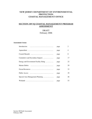
NEW JERSEY DEPARTMENT OF ENVIRONMENTALPROTECTIONCOASTAL MANAGEMENT OFFICESECTION 309 NJ COASTAL MANAGEMENT PROGRAMASSESSMENTDRAFTFebruary 2006Assessment Areas:Introduction page2Aquaculture . page4Coastal Hazards . . page8Cumulative and Secondary Impacts page17Energy and Government Facility Siting .page22Marine Debris . page29Ocean Resources .page33Public Access . page39Special Area Management Planning .page48Wetlands . .page53Section 309 Draft AssessmentFebruary 2006
INTRODUCTIONThe federal Coastal Zone Management Act was enacted in 1972 to deal with the increasingstresses on the nation's coastal areas. The statute creates a voluntary partnership between federaland state government to reduce conflicts between land and water uses in the coastal zone andconserve coastal resources. The goal is to provide for both responsible development in coastalareas and conservation of coastal resources. The New Jersey Coastal Management Program Planreceived final approval from the National Oceanic and Atmospheric Administration (NOAA) in1980. Subsequent amendments to the Act established a program to encourage states andterritories to develop changes that would enhance their Coastal Management Programs. Theamendments established nine areas for coastal zone enhancement: wetlands, public access,coastal hazards, cumulative and secondary impacts, energy and government facility siting, marinedebris, ocean resources, special area management plans, and aquaculture. States participating inthis program must evaluate their Coastal Management Program in these nine issue areas everyfive years, through a process known as a Section 309 Assessment.NOAA provides coastal states with guidance for the Section 309 Assessment. The programmaticobjectives of each enhancement area and the specific series of questions found in this Assessmentwere provided by NOAA, after consultation with states and territories. The last Section 309Assessment was completed in 2001. The current Assessment focuses on updates andimprovements made within each enhancement area since that period. In addition to updating itsAssessment, each state must develop a five year strategy, to begin October 1, 2006, to implementchanges in the enhancement areas identified with a high or medium ranking of importance. to beeligible for section 309 funding.The guidance provided by NOAA suggested the assessment for this period "build" on the 2001Assessment including: Identifying changes that have taken place within each of the nine enhancement areas,including problems that have arisen, and changes in the status of the resources;Describing the nature of problems, changes in the status of resources, or new issues,including the extent to which they are being addressed and their relative importance;Providing the basis for determining the priority needs for improvement of state and territorialcoastal management programs;Considering endangered and threatened species issues and opportunities to improve andconserve endangered and threatened species' habitats;Considering opportunities to enhance protection and management of marine and other specialland and water coastal area in the context of Marine Protected Areas; andProviding the public with an opportunity to learn more about accomplishments under section309 and to comment on the state's identification and justification of current priority needs, aswell as the possible means that the state is considering to address the identified needs.While developing the Assessment, states are requested to review the priorities identified in theprevious Assessment and consider the objectives for each of the nine enhancement areas. Thepriorities should reflect the suitability of Section 309 of the Coastal Zone Management Act, withits emphasis on program changes, for addressing the underlying issues. Program changes arechanges to coastal management programs as opposed to changes in the manner programs areimplemented. In addition, new emphasis has been placed on developing a strategy that includes2
performance measures to gauge the success of the strategy and to evaluate enhancements to theresource. Program changes include:1. New or revised authorities, including enforceable policies, regulations and memorandaof agreement;2. Changes to coastal zone boundaries;3. New or revised coastal land acquisition, management and restoration programs;4. New or revised special area management plans or plans for areas of particular concern;5. New or revised local coastal programs and implementing ordinances; and6. New or revised guidelines, procedures and policy documents, formally adopted, toprovide specific interpretations of enforceable coastal management program policies.The final determination of New Jersey's priority needs will be made in full consultation betweenNOAA and the state with due consideration of public comment. The priority rankings listed inthis document are preliminary and intended as suggestions. Upon review of all comments, theNew Jersey Department of Environmental Protection will prepare a Final Assessment and submitit to NOAA, accompanied by a draft strategy to address the priorities identified.3
AquacultureSection 309 Programmatic ObjectiveI. Enhance existing procedures and long range planning processes for considering the siting ofpublic and private marine aquaculture facilities in the coastal zone.II. Improve program policies and standards which affect aquaculture activities and uses so as tofacilitate siting while ensuring the protection of coastal resources and waters.Resource Characterization1. Briefly describe the state’s aquaculture activities (e.g., existing procedures, plans, programpolicies and standards).Almost all aquaculture in New Jersey’s waters consists of hard clams (Mercenaria mercenaria)and oysters (Crassostrea virginica). Approximately 2500 acres of bottom are leased along theAtlantic Coast estuaries (excluding the Delaware Bay) of which less than 600 acres are used forhard clam aquaculture activities. Oyster aquaculture activities dominate in the Delaware Bay.However, of the approximately 35,000 acres leased, fewer that 10% are actively used fortraditional aquaculture activities such as shell planting and seed transplanting. In addition,Rutgers University has initiated a few pilot scale research operations extending over a few acresin the vicinity of the Rutgers University Cape Shore Oyster Hatchery in Middle Township, CapeMay County. These relatively new operations primarily utilize hatchery seed grown on intertidalrack and bag systems. Both the historical success in rearing these species and the existence ofstatutes and regulations that deal primarily with on-bottom culture of shellfish species have led tothe focus of aquaculture interest on the two species.Nevertheless, finfish aquaculture activities are also occurring in New Jersey though the number ofwater acres dedicated to these activities remain small. Currently, 12-15 aquatic farmers areengaged in raising several species including trout, talapia, koi, large mouth bass, hybrid stripedbass, and blue gill. Approximately 64 pond acres are developed for bass aquaculture and about 18acres for the farming of koi.Rutgers University is building a 5 million commercial-scale Multispecies AquacultureDemonstration Facility in Cape May with financing from the NOAA, Public Service Electric andGas, and the State Commission on Science and Technology. This facility will be operational bythe end of 2006 and will contain a fully equipped hatchery building and nursery for shellfish andfinfish. As part of the operation, Rutgers has leased grounds in Delaware Bay and along theeastern New Jersey coast for shellfish growout. Activities will be coordinated with the hatcheryprogram at Cape Shore and the research program at the Rutgers University Haskin ShellfishResearch Laboratory in Bivalve. The hatchery is a demonstration project designed to encourageprivate companies to pursue additional aquaculture activities. (New York Times, Jun. 12, 2005and Rutgers Haskin web page)2. Briefly describe environmental concerns (e.g., water quality, protected areas, impacts onnative stock and shellfish resources). Also, describe any use conflicts (e.g., navigational,aesthetic, incompatible uses, public access, recreation, and future threats (e.g., shoreline defenseworks, introduced species).4
One of the biggest threats to both naturally grown oysters as well as those produced viaaquaculture activities is the virulent parasite, known as Dermo. According to scientists at theRutgers University Haskin Shellfish Research Laboratory, in the spring of 2005 the number ofyoung oysters in the Delaware Bay appeared to be at an all-time low following five years ofabnormally high adult mortality,. The causes of this decreased recruitment are unknown but mayinclude Dermo infestation in adults, as well as erratic changes in water temperature, fluctuationsin salinity, pollution, new predators or disease.A number of organizations and municipalities have approached the New Jersey Department ofEnvironmental Protection (DEP) with proposals to develop shellfish aquaculture activities inrestricted waters. The objectives of these programs range from raising community awareness andencouraging public stewardship to achieving water quality improvements by increasing thenumber of filter feeding oysters that remove impurities from the water column. Although theproposals emphasize that the oysters will not be harvested or consumed, DEP is concerned aboutpossible illegal harvesting and the consequential impacts to human health. DEP is concentratingon implementing management programs to improve coastal water quality and reduce the numberof water areas that are classified as restricted for shellfish harvest. This will, in turn, increase theoverall area where aquaculture activities can occur in the future. Better water quality will alsoserve to protect native shellfish stocks, a priority for DEP.The aquaculture industry faces use conflicts with recreational fishermen and development alongthe shoreline that limits pier space for commercial fishing and aquaculture activities. Someaquaculture techniques require specialized equipment that can interfere with navigation, createsnags for recreational fishing gear, and obstruct migratory fish patterns. In some instances,successful aquaculture activities require prohibitions to be placed on other uses and activities inproximity to the aquaculture site. In New Jersey, where user competition for space along theshore and in coastal waters is particularly keen, any sound aquaculture management andenhancement strategy must thorougly address potential conflicts.Management Characterization1. Identification of significant changes in the state’s ability to address the planning for andsiting of aquaculture facilities.Characterization of the scope of changeDescription of recent trendsIdentification of impediments to addressing the changeSuccessesTwo significant changes have occurred recently in New Jersey's ability to address the planningfor and siting of aquaculture facilities. These are changes regarding the New Jersey AquacultureDevelopment Act and changes involving permitting as it pertains to aquaculture. These arediscussed below.Updates and Changes Regarding the New Jersey Aquaculture Development ActIn 1997, the New Jersey Legislature adopted Title 4, Chapter 27 “The New Jersey AquacultureDevelopment Act.” In July 2004, the New Jersey Department of Agriculture (DOA) adopted newrules (N.J.A.C. 2:89) as directed by the Aquaculture Development Act. These rules: Provide the licensing requirements for the Aquatic Farmers License Program (see below); Provide filing and application requirements and exemptions from licensing; Set forth the requirements for effluent treatment; Establish the identification and certification requirements of the Aquatic Farmer License;5
Set forth an Aquatic Organism Health Management plan and incorporate by reference theindustry standards set forth by the “International Aquatic Animal Health Code” as identifiedby the Office des International Epizooties (OIE). The OIE lists the diseases of finfishmollusks and crustaceans, the consequences, spread and diagnoses of same, as well as setsforth the criteria for urgent notification of aquatic animal diseases;Establish an aquatic organism import protocol;Set forth the parameters for compliance and monitoring; andEstablish violations and enforcement actions.Under N.J.A.C. 2:89, Subchapter 2, the DOA administers the Aquatic Farmer License Program.An Aquatic Farmer License is required for all commercial aquatic farms in NJ that produce morethan 2500 per year in aquaculture products. The Aquatic Farmer License Program provides thefollowing benefits to the NJ aquaculture industry: Demonstrates definitive ownership of the organism being raised Prevents the introduction of aquatic pests that may be detrimental to wild stocks and otheraquaculture operations Reduces the regulatory burden Establishes a production history for the aquatic farm Makes farmers eligible for other DOA and USDA programs and for marketing assistancefrom the DOASince the Program was established in July 2004, 173 licenses have been issued with morepending. Of the issued licenses, 154 were for shellfish operations, 15 for finfish, 2 for aquaticplants, and 2 for combined finfish and aquatic plant production. A license is effective for fiveyears and is renewable.The Aquaculture Development Act mandated expansion of the State’s aquaculture leasingprogram. DEP actively worked with stakeholders to examine locations for new aquaculturedevelopment zones (ADZs). Individuals wishing to explore innovative aquaculture practices wereencouraged to do so within the ADZs. Criteria for identifying potentially acceptable locationsincluded the suitability of the site for specific types of aquaculture practices; absence ofsubmerged aquatic vegetation; presence of natural shellfish stocks; and absence of user conflictssuch as issues related to navigation, boat traffic, and existing commercial and recreational fishing.Out of approximately twenty sites that were considered in the Delaware Bay and along theAtlantic coastal area, DEP proposed 4 ADZs in the Delaware Bay (interest in Atlantic coastalsites diminished as the process progressed). The proposed ADZs encompass 1285 acres and arelocated in near-shore areas off of Maurice River Township, Cumberland County and Dennis andMiddle Townships, Cape May County. Although the specific criteria and guidelines for activitiesand structures in the ADZs are being developed, the most likely aquaculture systems that wouldoccur are the rack and bag system and the long-line system. DEP's Division of Fish and Wildlifehas received provisional permits for the proposed ADZs from the US Army Corps of Engineersand DEP's Division of Land Use Regulation.A potential barrier to the establishment of one of the sites in Middle Township, (ADZ number 4)is an established Clam Line, a theoretical line defined by N.J.S.A. Title 50, extending from theshore into Delaware Bay, south of which areas cannot be leased for aquaculture developmentactivities. Some members of the Aquaculture Advisory Council with the endorsement of manyorganizations, groups, businesses, and agencies have drafted changes to Title 50 includinglanguage allowing leases for aquaculture activities below the Clam Line. Only if this and otherchanges are approved by the state legislature can the lands in this ADZ be leased for aquaculture6
development. The process of reaching consensus regarding the many additions and deletions tothe current law has been lengthy and is as yet, incomplete. At present the process is stalled andthere are no plans or a timeline for moving toward the legislative stages.Updates and Changes Regarding PermittingRecently, the DOA and the DEP have been meeting to discuss the development of GeneralPermits for shellfish aquaculture activities and community-based shellfish restoration projects.Several organizations including Rutgers Cooperative Research & Extension and the NewYork/New Jersey Baykeeper have made progress toward implementing volunteer-based oystergardening programs. The NY/NJ Baykeeper is working in three locations- Liberty Flats, theRaritan Bay in Keyport, and the Navesink River near Oyster Point in Red Bank. A partnership,which includes the Rutgers Cooperative Research & Extension, the Barnegat Bay NationalEstuary Program, DEP's Bureau of Shellfisheries and others, has just initiated a program focusedon the Barnegat Bay region. The goals of these programs are to educate the community aboutestuary and bay ecosystems, to promote environmental stewardship, and to contribute to the reestablishment of oyster populations.The DOA and the DEP recognize the benefits of these programs. DEP is working to develop ageneral permit for them in order to facilitate their successful implementation. The general permitwould address activities and structures associated with these community-based restorationprograms, as well as for commercial aquaculture activities. In addition, both Departments areworking to identify the best locations for these projects to avoid placing growing and/or matureoysters and clams in waters that are not approved for harvest or where conflicts with other usergroups might occur. Creating a zone or area within approved waters but closed to harvest has alsobeen considered. Additional research and discussions will determine the feasibility of theseregulatory changes.Conclusion1. Identify priority needs or major gaps in addressing the programmatic objectives for thisenhancement area that could be addressed through a 309 Strategy.2. What priority was this area previously and what priority is it now for developing a 309Strategy and designating 309 funding and why?The successful implementation of aquaculture in New Jersey requires the efforts of many groupswith varying interests and responsibilities. Active participation of and communication betweeneach group is needed to discuss problems that arise and their possible solutions. Additionally,scientific research must continue to be a priority. Without a more complete understanding of thecurrent observed decline in oyster populations or environmental threats to existing oysters, goodmanagement is unobtainable. This management must also address use conflicts and must find thebalance between resource use, habitat restoration, and the protection of human health.Modifications to existing rules and regulations are necessary in order for New Jerseyaquaculturists and those working to restore shellfish populations to take the fullest advantage ofpotential shellfish areas and new and innovative techniques. DEP has made significant progress inthis program area and has paved the way for the implementation of additional measures toaddress the programmatic objectives of enhancing procedures and planning and improvingpolicies to protect coastal resources and waters.Last AssessmentHighMedium XLowThis AssessmentHighMedium XLow7
Coastal HazardsSection 309 Programmatic ObjectivesI.Direct future public and private development and redevelopment away from hazardousareas, including the high hazard areas delineated as FEMA V zones and areasvulnerable to inundation from sea and Great Lakes level rise.II.Preserve and restore the protective functions of natural shoreline features such asbeaches, dunes, and wetlands.III.Prevent or minimize threats to existing populations and property from both episodic andchronic coastal hazards.Coastal Hazards Characterization1. Characterize the general level of risk in your state from the following coastal hazards:HazardHurricane/TyphoonStorm SurgeFloodingShoreline Erosion(episodic or chronic)Sea Level RiseSubsidenceGeological Hazards(includingearthquakes andtsunamis)Other (specify)Extratropical stormsHigh RiskMedium RiskXLow RiskXXXXXXX2. If the level of risk or state of knowledge about any of these hazards has changed since the lastassessment, please explain. Also, identify any ongoing or planned efforts to developquantitative measures for this issue area.The general levels of risk for each of the coastal hazards in the Section 309 assessment areunchanged from the previous assessment. However, the New Jersey Coastal ManagementProgram (NJCMP) carefully considered elevating the risk of the Hurricane/Typhoon hazard toHigh. The special consideration of this hazard stemmed primarily from the credible predictions ofthe National Weather Service and others that the current interval of more numerous and moresevere Atlantic tropical cyclones will continue for at least another decade. These predictions arebased on the long-term cyclical pattern of tropical cyclone frequency and intensity.Notwithstanding ever-increasing research focused on determining the ramifications of globalwarming on this historical pattern, the effects remain a matter of debate. With more researchmore robust climatological and oceanographic models should be available for the next five-yearSection 309 Assessment and Strategy. For now, the historical cyclical pattern was sufficientreason to examine the risk level associated with Atlantic cyclones.The decision to continue to rank the Hurricane/Typhoon hazard as medium is primarily a matterof geography. New Jersey is at a sufficiently northern latitude that both the frequency andintensity of hurricanes making landfall in New Jersey is appreciably less than is the case in the8
southern portion of the U.S. Only two hurricanes, both Category 1 storms, have made landfall inNew Jersey since 1950. Warm ocean surface water temperatures fuel hurricanes. The waters offthe New Jersey coast are cooler than ocean waters to the south and the configuration of theeastern seaboard serves to shelter the state from the landfall of hurricanes. However, ranking is arelative measure and the Medium risk category adequately reflects the certainty that the seriouseffects of the landfall of a hurricane on the densely developed New Jersey coast will occur.On-going data collection, research, and modeling continue to refine our knowledge concerningthe effects of global warming on the expression of phenomena that are regarded as coastalhazards. The U.S. Geological Survey conducted an assessment of the vulnerability of the U.S.east and west coasts to the effects of sea level rise. The results of the investigation, which tookinto consideration six variables, tidal range, wave height, coastal slope, shoreline erosion rates,geomorphology, and historical rates of relative sea level rise, are presented in the report, NationalAssessment of Coastal Vulnerability to Sea-level Rise. The USGS study indicates that most ofNew Jersey's coast is highly susceptible to the effects of sea level rise.While the precise rate of sea level rise is uncertain, current models indicate that global warmingwill cause the rate to increase. Recent projections forecast that relative sea level rise at the NewJersey coast will be between 0.31 m and 1.10 m by 2100. The approximate central value of thisrange, 0.71 m, is more than twice the rise that occurred during the last century. This increasewould result in the threat of more sustained extreme storm surges, increased coastal erosion,escalating inundation of coastal wetlands and saline intrusion. (Results of a study by Roper andBraithwaite, "Low sea level rise projections from mountain glaciers and icecaps under globalwarming", published in the 1/19/06 issue of the journal Nature, concludes that current projectionsof global warming generated sea level rise may over-estimate the contribution of meltingmountain glaciers and icecaps to sea level rise, and thus the projections may have to be reviseddownward.)New Jersey's Beach Profile Network continues to conduct semi-annual surveys to monitor thecondition of beaches and dunes at 120 stations along the coast. These stations extend fromAberdeen on Raritan Bay, south to Cape May Point and along the Delaware Bay to Reeds Beach.Cross-section measurements are made of specific beach and dune profiles and the data is used tomake volumetric comparisons through time. In this way, the data generated by the survey is usedto identify areas subject to coastal hazards and assess changes in risk posed by coastal hazards topeople and property.The Stevens Institute of Technology continues to provide quantitative data relevant for theassessment of coastal hazards through the Coastal Monitoring Network. Stevens maintainsautomated stations at three locations along the New Jersey oceanfront that collect and disseminatereal time oceanographic and meteorological information including wave height and period, meanwater level, water temperature, wind speed and direction, barometric pressure, air temperature,and digital imagery of the beach.3. Summarize the risks from inappropriate development in the state, e.g., life and property at risk,publicly funded infrastructure at risk, resources at risk.Many parts of New Jersey's densely populated coastal area are highly susceptible to the effects ofthe following coastal hazards: flooding, storm surge, episodic erosion, chronic erosion, sea levelrise, and extra-tropical storms. Reconstruction of residential development and the conversion ofsingle family dwellings into multi-unit dwellings continues in hazardous areas. Althoughapplication of more stringent construction standards and techniques results in more storm-9
resistant structures in the hazard areas, the value of property at risk is increasing significantly.With anticipated accelerating sea level rise and increasing storm frequency and intensity,vulnerability to the risks of coastal hazards will not abate; it will only become more costly.Another aspect of inappropriate development in New Jersey relates to the impact of sea level riseon coastal wetlands. Generally, coastal wetlands will respond to sea level rise in one or more ofthree general ways. The wetlands can be lost to inundation, they can accrete vertically, or theycan migrate inland. In order to survive, wetlands must maintain their elevation relative to thetidal range. Vertical accretion results from the accumulation of subsurface organic plant matter orfrom the deposition of sediment on the wetlands. Only wetlands exposed to a sufficient source ofsediment can adapt vertically in that manner. Additionally, given the projected rate of sea levelrise, organic plant matter is not likely to accumulate in sufficient quantities to prevent wetlandinundation and loss. The most likely prevailing adaptation involves inland migration of coastalwetlands as the hydrology of the inland area becomes suitable for wetland species. This processwould continue as sea level rises until the migrating wetlands encounter either natural ormanmade obstacles. Development in areas suited to the inland migration of coastal wetlandsserves to preclude this adaptation and the wetlands will either diminish in extent or will be lost toinundation.Management Characterization:2. In the table below, indicate significant changes to the State's hazards protection programssince the last assessment.MechanismBuilding setbacks/restrictionsMethodologies for determining setbacksRepair/rebuilding restrictionsRestriction of hard shoreline protection structuresPromotion of alternative shoreline stabilizationmethodologiesRenovation of shoreline protection structuresBeach/dune protectionPermit complianceInlet management plansSpecial Area Management Plans (SAMP's)Local hazard mitigation planningLocal post-disaster redevelopment plansReal estate sales disclosure requirementsMethodologies for determining setbacksRestrictions on publicly funded infrastructurePublic education and outreachMapping/GIS/tracking of hazard areasChanges Since Last teModerate3. For categories with changes:a. summarize the changeb. specify whether it was a 309 or other CZM driven change and specify the funding sourcec. Characterize the effect of the changes in terms of both program outputs and outcomes.Building setbacks/restrictions: Moderate Change. In 2004, the New Jersey Department ofEnvironmental Protection (DEP) adopted revised Stormwater Management regulations. These10
regulations contain general principles for the development of stormwater management plans andstormwater control ordinances designed to reduce flood damage, including damage to life andproperty. They also provide minimum design and performance standards to address postconstruction stormwater runoff quality impacts of major development and establish minimumdesign and performance standards to control erosion, and encourage and control stormwaterinfiltration and groundwater recharge.Furthermore, the revised regulations provide special protection for Category One waters.Category One waters are special waters requiring particular protection from measurable changesin water quality because of their exceptional ecological, recreational, water supply and fisheriessignificance, as well as other distinguishing characteristics. The regulations require a 300-footspecial water resource protection area adjacent to these waters. In addition to the benefitsattendant to the reduction of flood damage, the 300-foot special water resource protection areawill serve to preserve areas suitable for the horizontal landward migration of certain coastalwetlands in response to sea level rise.The DEP's Coastal Zone Management (CZM) rules were amended to encourage dedication ofdeveloped and undeveloped flood hazard areas to use as public open space. Additionally, therules were changed to clarify the types of development that can occur in undeveloped floodhazard areas. Allowable exceptions or preservation of flood hazard corrid
debris, ocean resources, special area management plans, and aquaculture. States participating in this program must evaluate their Coastal Management Program in these nine issue areas every five years, through a process known as a Section 309 Assessment. NOAA provides coastal states with guidance for the Section 309 Assessment. The programmatic


