Transcription
SUBSEA TECHNOLOGYRANGER 2 USBLUNDERWATERTRACKING NITORINGIMAGING
RANGER 2 USBL3000m6000mTRACKEVERYTHING,IN ANY DEPTH,FROM ANYVESSEL.TRACK A TOWFISH, POSITION AN ROV, DP YOUR VESSEL, SEARCHTHE SEABED OR NAVIGATE AN AUV. WHEN YOU NEED TO INVEST INULTRA-SHORT BASELINE (USBL) ACOUSTIC TECHNOLOGY TOSUPPORT YOUR UNDERWATER OPERATIONS, RANGER 2 HAS THEPERFORMANCE YOU NEED, AT THE INVESTMENT LEVEL YOU CANAFFORD TO GET THE PROJECT COMPLETED FASTER AND MOREEFFICIENTLY THAN ANY OTHER SYSTEM ON THE MARKET.ENGINEERED LIKE NO OTHERAll USBL systems calculate position by measuring the range and bearing from avessel-mounted transceiver to an acoustic transponder fitted to a moving targetor placed on the seabed. But not all USBL systems do it with the accuracy andprecision offered by Ranger 2.We’ve taken everything that made our original Ranger system so effective andadvanced it to the next level. That next level is our award-winning 6G (sixthgeneration) acoustic hardware platform and Sonardyne Wideband 2 digitalsignal architecture which work seamlessly together to deliver the best possibleUSBL positioning performance and operator experience.Vessel and vehicle hardware is easy to install and configure. It can track yourequipment to beyond 7,000 metres and update its position every second. It’sengineered for shallow water, deep water, high elevation and multi-user operatingscenarios. And if your vessel’s fitted with a DP system – regardless of what makeit is – Ranger 2 can interface with it.THE ONLY USBL YOU’LL NEEDEvery survey, ocean science, DP and seismic exploration project is different;different water depths, different vessels and different targets to position. But thatshouldn’t mean you need a different USBL system for each one.Ranger 2 comes with an impressive list of standard features. As your needs growand become more complex, so too can the capabilities of Ranger 2 thanks tosoftware feature packs available in three versions; Survey, Dynamic Positioningand Professional – all of which can be remotely activated* in the field.*Subject to having the appropriate hardware available on boardWHY IT’S GOOD FOR YOUR OPERATIONS Simple, intuitive software Tracks an unlimited number of targets;ROVs, towfish, AUVs. Operating range beyond 7,000 metres Better than 0.1% system accuracy whenoptimised Up to 1 second position updates Compatible with all makes of DP system Automated setup reduces vessel delays Application packs available bringing extrafeatures specific to your operations User training available worldwide Multi-user capable Track record of success on all types of vessel Support available globally 24/7
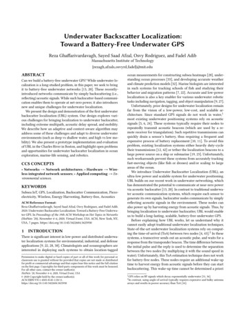
NS 7528.61m2000 m1000 mOdyssey Explorer6000m5000 m3000m0mDeep Tow
RANGER 2 USBL FORSURVEYWHETHER YOU ARE CONDUCTING A HYDROGRAPHIC SURVEY WITHA TOWFISH, MONITORING THE TOUCHDOWN POSITION OF A PIPELINEOR LOWERING AND LANDING STRUCTURES ONTO THE SEABED, RANGER2 HAS ALL THE CAPABILITY YOU NEED IN ONE APPLICATION. THEOPTIONAL SURVEY PACK UNLOCKS A HOST OF ADDITIONAL FEATURESTO FURTHER OPTIMISE THE PERFORMANCE OF YOUR RANGER 2 SYSTEMFOR THE MAJORITY OF OFFSHORE CONSTRUCTION AND SURVEY TASKS.RANGER 2 SURVEY PACKThe Ranger 2 Survey pack uses theintuitive and simple layout as thestandard software but allows accessto more complex areas such as thesetup and tracking of ROVs, AUVsand structures. These objects can beconfigured with multiple transpondersattached to them and fixed offsets canthen be computed to points such asa structure’s CRP or an ROV’s bumperbar which can be both displayedon-screen with their position output.Being able to work in this mannerdirectly in the USBL software benefitsyour surveys as any sensor latencyinduced errors are minimised, and therisk of systematic errors from the useof incorrect offsets is reduced. AutoCADbackdrops and configurable seabedgeodesy allow Ranger 2 Survey to beused for tracking and guidance. Complexdoesn’t have to be complicated.WHY IT’S GOOD FOR SURVEY Up to 0.07% slat range trackingperformance using GyroUSBL Supports complex tracking scenariossuch as structures and vehicles withmultiple transponders and multipleremote offsets Importable AutoCAD DXF fieldbackdrops Built-in seabed geodesy package Configurable UI to suit multipleproject tasks Tools to configure stinger-mountedGyroUSBL transceivers System can be shared with DP
RANGER 2 USBL FORDYNAMICPOSITIONINGOUT OF THE BOX, RANGER 2 IS A HIGHLY CAPABLE ACOUSTICPOSITION REFERENCE SYSTEM THAT YOU CAN INTERFACE WITHANY DP SYSTEM INCLUDING GE, KONGSBERG, MT, NAVIS,ROLLS-ROYCE AND WÄRTSILÄ. BUT IF YOUR VESSEL UNDERTAKESCRITICAL STATION KEEPING ACTIVITIES IN ULTRA-DEEP WATERS,THE RANGER 2 DP PACK OFFERS ENHANCED LEVELS OF POSITIONINGINTEGRITY. DEVELOPED TO MEET THE REQUIREMENTS OF CLASS 2AND 3 RULES, IT’S PERFECT FOR HEAVY CONSTRUCTION, WELLINTERVENTION, SALVAGE AND PRODUCTION VESSELS.RANGER 2 DP PACKThe DP pack’s stand-out feature is its ability to support Long and Ultra-ShortBaseLine (LUSBL) and inertial navigation (DP-INS) configurations.LUSBL exploits the greater precision and acoustic range redundancy offeredby Long BaseLine (LBL) seabed transponder arrays where accuracy is virtuallyindependent of water depth. And because Ranger 2 is built around our exclusiveWideband 2 signal architecture, you have the freedom to deploy your owntransponder array without interrupting others, or share one that is alreadydeployed in the field, saving vessel time and lowering your costs.Tightly integrated acoustic and inertial positioning benefits your DP system byimproving the accuracy, update rate and reliability of the position. The inertialnavigation system can be aided by a single USBL transponder or multipletransponders – but far fewer than a conventional LBL array. Transponders canalso be set to a slower update rate, extending their battery life saving deploymentand calibration time and extending service intervals.DPO FRIENDLYDPOs quickly feel comfortable using Ranger 2’s easy and intuitive software.Automatic discovery of Sonardyne transponders and array planning tools areincluded as standard whilst real-time quality indicators, noise analysis and signaltravel time displays are just some of the extra tools available to help themoptimise performance.WHY IT’S GOOD FOR DP High integrity positioning for criticaldeep water operations Fully compatible with all makes ofDP system Cost effective for owners andshipyards Less wiring, fewer components andsmaller gate-valve than comparablesystems Easy to learn, easy to use DP-INS for added reliability andoperational savings Dual transceivers for added accuracy
RANGER 2 USBL FOREXPLORATIONWITH ITS ABILITY TO SIMULTANEOUSLY TRACK MULTIPLE SUBSEATARGETS, RANGER 2 IS IDEAL FOR MARINE SEISMIC OPERATIONSWHERE VERY LARGE AREAS OF THE SEABED ARE COVERED WITHNODES AND THEIR PRECISE LOCATIONS CONFIRMED BEFOREACQUISITION CAN BEGIN. BUT RANGER 2 DOES MORE THAN SIMPLYPOSITIONING. THE HIGH-SPEED ACOUSTIC COMMUNICATIONSBUILT INTO EACH NODE-MOUNTED 6G TRANSPONDER MEANS THATDURING A SURVEY, DATA CAN BE UPLOADED TO THE SURFACE TOLET YOU KNOW EACH NODE’S STATUS.FROM SHALLOW TO DEEPSeismic surveys using Ocean Bottom Nodes (OBNs) are a popular method ofacquiring high resolution reservoir imagery. Ranger 2 USBL is used to determinethe locations of thousands of marine seismic nodes – or the ROVs that deploythem – when operating in the transition zone all the way to very deep water.When ROVs are used, Ranger 2 integrates seamlessly with our SPRINT INS andSyrinx DVL products to maximise ROV positioning performance. This minimisesthe number of observations required to achieve your project’s specification.THIRD PARTY SOFTWARE INTERFACESNode deployment operations are typically conducted under the control of thirdparty navigation packages such as HydroPos and Gator II so Ranger 2 comes witha remote control interface provided as standard.Once your survey is complete, the precision offered by Ranger 2 allows an ROVpilot to navigate directly to each node to recover it. This saves time and ensuresno hardware is left behind on the seabed. Alternatively, the transponders attachedto each node can be acoustically commanded to release anchor weights so thatthe entire instrument floats up to the surface.WHY IT’S GOOD FOREXPLORATION Thousands of unique transponderaddresses permit large node arrayswithout identity repetition. Compatible with Sonardyne ROVbased INS and DVL products forseamless operation. High update rate maximisesdeployment speed. Quick to install on vessels ofopportunity using pre-calibratedtransceivers Remote control interface to standardseismic navigation systems such asHydroPos and Gator II.
RANGER 2 USBL FOROCEAN SCIENCECHOSEN FOR ITS ABILITY TO TRACK A WIDE VARIETY OF SCIENTIFICPACKAGES AT RANGES UP TO 10,000 METRES, RANGER 2 IS THEPREFERRED USBL SOLUTION FOR MANY OF THE WORLD’S LEADINGOCEAN RESEARCH INSTITUTES. IT IS A KEY ENABLER FOR THEIRVESSELS AND HAS THE FLEXIBILITY TO MEET THE PRECISE IN-WATERAND NEAR-BOTTOM SUSTAINED OBSERVATION NEEDS OF SCIENCEUSERS WORKING NEARSHORE, COASTAL AND DEEP OCEAN.MAXIMISING SCIENCE TIME, MINIMISING DOWNTIMEScience users rarely have the luxury of remaining on site for long, so Ranger 2’sability to position instruments such as corers, camera platforms and geologicaldrills without having to first deploy a seabed array of transponders, helps youmaximise precious ship time. It can even be used to activate compatible acousticrelease transponders, allowing you to release and track your moorings all theway to the surface for immediate recovery on board.If your research involves using a vessel of opportunity, then the benefits of usingRanger 2 begin before you’ve left port. Our pre-calibrated, all-in-one GyroUSBLtransceiver is perfect for installation on a temporary over-the-side mountingarrangement yet delivers the same precision as a permanent installation.ULTRA-DEEP TOWRanger 2’s unique Inverted USBL (iUSBL) mode, a feature of the Survey pack,is perfect for deep tow, extreme layback towfish tracking. Rather than mountingthe USBL transceiver on the vessel in the traditional manner, with iUSBL, thetransceiver is installed on the towed body itself. Because towfish are typicallyquiet, the signal-to-noise ratio is significantly improved which provides longerranges and greater precision.AUV OPERATIONSWhen paired with Av-Trak 6, Ranger 2enhances AUV operations, combiningtelemetry and positioning. The 6GSonardyne Messaging Service supportsthe transfer of vehicle mission updatesand USBL reference positions to theAUV, as well as status messages fromit, and AUV-to-AUV telemetry.SEABED GEODESYRanger 2’s flexibility allows you torecover data from our AutonomousMonitoring Transponders, which areincreasingly being used for the longterm measurement (up to 10 years)of seabed tectonic deformation. Withboth MF and LMF options available tosupport this capability, Ranger 2 HPTscan also be supplied as stand-alonemodems for over-the-side wiredeployment on ships not fitted witha Ranger 2 system.WHY IT’S GOOD FOR OCEANSCIENCE Tracks AUVs, ROVs and otherequipment to full ocean depth Maintains performance in noisy,shallow water environments Built-in fast data telemetry capability Supports MF and long range LMFoperating bands Easy to install on vessels ofopportunity Inverted USBL mode for tracking overlong laybacks Software is simple and intuitive Compatible with all DP systems
Image: SOI
RANGER 2 USBL FORUNRIVALLEDCAPABILITYBE PREPARED FOR ANY VESSEL AND SUBSEA POSITIONING SCENARIOBY CHOOSING THE HIGHEST SPECIFICATION RANGER 2 PACKAVAILABLE – PROFESSIONAL. WITH THIS FEATURE PACK INSTALLED,YOU AND YOUR VESSEL HAVE GOT THE UNRIVALLED ABILITY TOSELECT WHICHEVER FEATURE YOU WANT, WHEN YOU WANT ITRANGER 2 PROFESSIONAL PACKWhether it’s to provide an acousticallyaided reference telegram to a DP deskwhilst simultaneously tracking a complexstructure with multiple transpondersattached, or tracking an ROV overlaid ona geodetic backdrop whilst outputtingan LUSBL DP telegram, Ranger 2 USBLProfessional can do all this and more.SURVEY AND DPRanger 2 Professional directly benefitsmulti-purpose vessels by enabling youto take advantage of the powerfulposition reference features found withinthe DP pack along with all the trackingfeatures found within the Survey pack.This enables vessels to operate usinga single USBL system for both DP andconstruction survey tasks which makesownership and operation much simpler.Professional retains the same easy touse UI of the standard version enablingyou to make the switch with theminimum of extra training required.And, like the Survey pack, the UI candisplay exactly what you want to see.WHY I’TS GOOD FOR ANYOPERATION Up to 0.07% slant range trackingperformance Full support for aided INS and LUSBLvessel DP references Capability to track structures andvehicles with multiple transpondersand multiple remote offsets Can operate in Standard andOptimised tracking modes Easy to install on vessels ofopportunity Support for all Sonardyne 6G USBLtransceivers, transponders andresponders Configurable UI to suit multipleproject tasks
SHIP FIT EQUIPMENTBRIDGE & INSTRUMENTROOMEASIER, FASTER AND NOW MORE CONFIGURABLE. THE LATEST VERSION OF RANGER 2 OPERATINGSOFTWARE IS UNLIKE ANY OTHER ACOUSTIC POSITIONING SOFTWARE PACKAGE AND BRINGS TOGETHERALL THE FEATURES SURVEYORS, SCIENTISTS AND DPOS TOLD US THEY WANTED TO SEE. IF YOU’VE NEVERUSED A USBL SYSTEM, YOU’LL QUICKLY FEEL COMFORTABLE USING RANGER 2 AND IN NO TIME, BE READYTO CONFIGURE YOUR FIRST UNDERWATER TRACKING OPERATION. IT’S ALSO DESIGNED SPECIFICALLYTO TAKE ADVANTAGE OF THE POWERFUL FEATURES CONTAINED WITHIN EVERY 6G TRANSPONDER ANDTRANSCEIVER.ALL THE TOOLS YOU NEEDRanger 2 benefits from a completely revised main UI,a centralised transponder management table, an arrayplanning tool for DP operations, configurable displays, andintegrated support for iWand, our go-anywhere back decktest and configuration device for 6G transponders. Andwhen you need them, remote infield upgrades unlockextra features – ensuring you only pay for what you need. Highly configurablenavigation chart withlayers Importable DXFbackdrops Remote control andoutput telegrams Built-in performanceverification andoptimisation tools Automatic detectionof previously deployedtransponders includingconfigured address
NAVIGATION PC (NAVPC)NAVIGATION SENSOR HUB (NSH)The NavPC and NSH are designed to meet the completeon-board requirements of any Ranger 2 positioningoperation. Featuring an Intel Core i7 processor, the NavPCis purpose built to run the family of Ranger 2 softwareapplications and is proven to withstand the ruggedenvironmental conditions associated with marine operations.It measures just 2U high so is ideally suited for mounting inan instrument rack, portable case for temporary installationsor within a DP desk.The NSH is the interface between the in-water acousticinstruments, sensors and the NavPC which runs theRanger 2 positioning software. In addition to accuratelytime-stamping incoming data from external devices suchas gyros, VRUs and GNSS, the NSH also provides powerand communications for ship-borne acoustic transceivers. Designed to industrialPC standards Internal security dongle Shock-mounted hard drive Dual screen(VGA, DVI or HDMI) Ethernet or Serialinterface to NSH Configurable forstand-alone or dualindependent modes Up to 16 Ethernet orserial interfaces 6 transceiver serialports providing 24/48 VDC power Sub-microsecond timestamping on all Tx/Rx data
SHIP FIT EQUIPMENTTRANSCEIVERSWHEN IT COMES TO USBL TRANSCEIVERS, ONE MODEL DOES NOT FIT ALL SITUATIONS AND VESSELS.THAT’S WHY OUR HIGH PERFORMANCE TRANSCEIVER (HPT) IS AVAILABLE WITH DIFFERENT ARRAYDESIGNS RANGING FROM FULL HEMISPHERICAL COVERAGE TO DIRECTIONAL DESIGNS FOR ULTRADEEP WATER AND HIGH VESSEL NOISE OPERATING ENVIRONMENTS. HPT TRANSCEIVERS CAN ALSOBE USED AS WIRELESS MODEMS FOR AUTONOMOUS MONITORING TRANSPONDER SETUP AND DATARETRIEVAL AS WELL AS SUPPORTING LBL OPERATIONS.TOWFISH MOUNTEDLMF HPTHPT 13000iUSBL/GYROiUSBLA subsea vehicle basedtransceiver that turnsconventional USBL tracking onits head. Designed for projectsusing deep tow, long laybacksurvey platforms requiring highprecision.A specialist USBL transceiveravailable to support trackingprojects in the deepest water.The large array and advancedmulti-element signal processingenables transponders to betracked with ultimate precision.A Low Medium Frequency(14-18kHz) transceiver to ensuremaximum data telemetry rate andpositioning range whilst providingsimultaneous multi-user operationwith systems in other bands ofoperation. Identical functionalityto that of Medium Frequencyband HPT instruments.
HPT 5000Enables subsea targets to betracked with precision andrepeatability over a wide rangeof water depths and elevations.Supports high speed 6G datatelemetry mode.HPT 7000GYROUSBL 5000/7000Lodestar subsea AHRS sensorand HPT transceiver in one unit.GyroUSBL can be pre-calibratedfor rapid and cost-effectivedeployment on vessels ofopportunity. Available withstandard and deep wateroptimised arrays.A USBL and LUSBL transceiveroptimised for noisy dynamicallypositioned drilling andconstruction vessels operatingin deep water. Vessel andthruster noise is rejected.
SHIP FIT EQUIPMENTOPTIONSOPTIMISED USBLThe positioning accuracy obtainable from Ranger 2 can be further improvedby co-locating Lodestar, our premium quality Attitude and Heading Referencesystem (AHRS), with your vessel’s 6G acoustic transceiver.Known as Optimised USBL, the advantage of this configuration is that raw USBLrange and bearing data is simultaneously processed with the Lodestar’s attitudedata. This achieves a tightly compensated solution that enables a system accuracyof 0.1% of slant range to be achieved. Available with standard Ranger 2 systems,or those enabled with Survey, DP and Professional feature packs.TIP If you don’t need the extra performanceoffered by Optimised USBL, the bridge-installedversion of Lodestar is a cost effective replacementfor your ship’s gyro and VRU.DP-INSFor tightly integrated acoustically-aided inertial DP operations ,you will need toinstall our DP-INS sensor to work alongside your Ranger 2 system.GyroUSBL transceivers have this sensor built-in, its capability simply needs to beenabled. Alternatively, we offer a stand-alone unit for installing on your bridge ordeployment machine. Both units incorporate three Ring Laser Gyroscopes andthree accelerometers selected for use for their performance, high mean timebetween failure (MTBF) and ease of export (non ITAR). These sensors have highlystable error characteristics and are compensated for temperature variation.TIP Did you know we use RLGs and inertialsensors with a 400,000hrs MTBF, provenover 15 years of use in almost everycommercial airliner?VIEWPOINT REMOTE WORKSTATIONIf you want to share and visualise positioning data from your Ranger 2system with other teams on board, then you will need a Viewpoint remotedisplay workstation.It enables you to transform co-ordinates of surface vessels, subsea vehiclesand structures into geographical information overlaid on easy-to-useguidance displays. When changes to Ranger 2 are made, such as adding anew tracked target, they automatically appear on ViewPoint workstations.And because it is serially interfaced with Ranger 2, Viewpoint is totallysecure; there is no way to affect live survey and DP operations.
TRANSCEIVER DEPLOYMENT – PERMANENTUSBL system performance is seriously degraded by poor transceiver mountingand deployment so we’ve developed a family of highly engineered deploymentmachines suitable for any situation. Validated on hundreds of vessels, ourthrough-hull hydraulic deployment machine is ideal for permanent installationsand features a stiff, corrosion-resistant pole, high integrity bearing and sealingdesign and reliable hydraulic actuation with safety interlocks, sea chest foraccess, and
Wideband 2 signal architecture, you have the freedom to deploy your own transponder array without interrupting others, or share one that is already deployed in the field, saving vessel time and lowering your costs. . Ranger 2 integrates seamlessly with our SPRINT INS and Syrinx DVL products to maximise ROV positioning performance. This minimises